With a renewed enthusiasm for photography and local history, I set out this blog as a record of my experiences with images and narratives. It is my hope that you find something of interest on this site. Please feel free to contact me for more information on any of the posts. You can see a comprehensive list of my blogs at my website :- http://www.davidnurse.co.uk

Showing posts with label Coast Wales Seascape. Show all posts

Burry Port Lighthouse


Burry Port is a small coastal town in the South of Wales.

The harbour was built in the early 1830s and was the main port for exporting coal from the surrounding areas.

The Harbour initially was named the Pembrey New Harbour and was a larger upgrade
 to the smaller harbour just along the coast.

The harbour's name was changed by an act of parliament in 1835 to Burry Port Harbour
 and thus gave the name to the Town of Burry Port.


Visit Date August 2020


Burry Port Lighthouse


Today the harbour has been developed into the local Marina and also houses the lifeboat station.


Burry Port Lighthouse


The lighthouse was built in 1842 and was restored in the mid 1990's by Llanelli Borough Training, with the support of the Burry Port Yacht Club with Trinity House*** supplying the lantern for the structure which was officially reopened on 9th February 1996 by the Mayor of Llanelli.


Burry Port Lighthouse


The lighthouse is quite small with its walls being just 24ft high with the gallery and lantern on top.


Burry Port Lighthouse


The lantern light is visible for 15 miles and is an important landmark for the marina.


Burry Port Lighthouse


***Trinity House is a charity dedicated to safeguarding shipping and seafarers, providing education, support and welfare to the seafaring community with a statutory duty as a General Lighthouse Authority to deliver a reliable, efficient and cost-effective aids to navigation service for the benefit and safety of all mariners.


Burry Port


Burry Port harbour was the landing place for the first crossing of the Atlantic by a woman please see my post:-


Footer:Visit Information: -

Google Reference: -
51.677500723894276, -4.2512000337731735


Google search term:
Burry Port Lighthouse

What Three Words reference: -
///kilt.origins.dynamics

OS Details: -
SN 44449 00034

Additional information.

Visiting Burry Port is very easy.
There is lots of parking here, with the closest being the harbour car park (51.680651095461656, -4.2513750336966005).


There are lots of shops toilets and other amenities close by.


A full list of blogs can be found at my website


Read More

Coetan Arthur


___________________________________________________________________________________


C o e t a n  A r t h u r


Coetan Arthur (also known as Arthurs Quoit).
 A dolmen on the southwest coast of Wales 
on the St. Davids's head peninsular, 
in county of Pembrokeshire, Wales.
This impressive megalithic tomb dates from 
between 4000 to 3000 BC.
The dolmen, which is formed by two vertical 
megaliths erected to support a flat capstone,
is partially collapsed, but still impressive nonetheless.


Visit Date August 2022


_____________________________________________________________________________________


Coetan Arthur, St Davids, Pembrokshire.


There are many ancient burial sites around the southwest of Wales
These burial sites are often marked with three or more uprights and a large capstone. Often this is all that is left of the site which would originally be covered with earth. This upright/capstone structure has been called a Dolmens or often also referred to here in Wales as a Cromlech, but my understanding is that Cromlech can also refer to a circular stone structure.


Coetan Arthur, St Davids, Pembrokshire.


This structure should not be confused with Carreg Coeten Arthur which is also in Pembroke, and which will be covered in another blog soon.


Coetan Arthur, St Davids, Pembrokshire.


The St Davids headland is full of ancient remains including signs of ancient field patterns, Neolithic enclosures, and defensive banks and ditches.


Coetan Arthur, St Davids, Pembrokshire.


Perhaps the most impressive part of the burial chamber is the massive capstone, which is roughly 6m long and 2.5m wide. The upright stone supporting it (known as an orthostat) is about 1.5m high.


Coetan Arthur, St Davids, Pembrokshire.


The site here overlooks Whitesands Bay at St. Davids and has a good view but is far enough from the main cliff not to be to battered by any storms that hit the coast.


Coetan Arthur, St Davids, Pembrokshire.


It has been reported many visitors to the site that they found the site hard to find. I suspect that if you were only casually walking the coast path that this could be true but I found that the site could be seen from quite a distance when walking east to west which seems to be the most natural direction to be walking.


These ancient sites often have a legend attached to them and this one is no exception. The legend for Coetan Arthur states King Arthur himself chucked the stones from nearby Carn Llidi.


Note: The terms Dolmen, Cromlech and Quoit are often used to describe this sort of neolithic site.


Footer:
Visit Information: -

Google Reference: -
51.90450867492426, -5.308083153876568

What Three Words reference: -
///snowstorm.finely.deck

OS Details: -
SM 72527 28056 Altitude: 162 ft

Additional information.
Visiting is easy, head to Whitesands bay car park (51.897174093111616, -5.2940221280185105) this is a caravan and camping park and is easy to get to.
There is good facilities for the park, there is a charge for parking.

The walk is around 1mile from the car park but is not flat it is undulating.
Before you descend to the path to Pothmelgan beach (there is a small crossing) you can see the site to the northwest. You can then either take the steep path directly to the site of take the coastal path around the head and then on to the site.


Read More

Culver Hole


___________________________________________________________________________________


C u l v e r   H o l e

Legends and tales of smugglers and pirates.


The rugged coast of South Wales has seen many shipwrecks and is well was well known for its rough and dangerous coastlines. What better place than these unwelcoming bays to try and bring booty and contraband ashore away from the H. M Customs men? This well-hidden man-made structure is surrounded by the mystery and legends of ancient pirates and smugglers that came ashore on the South Wales coast.


Visit Date August 2022


___________________________________________________________________________________


Culver Hole


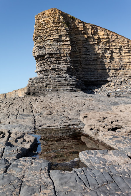
"Culver Hole" is well hidden and difficult to access so it is understandable that it is easy to pass by and not notice it from the cliffs above.

It is accessible by the low tide and it is quite a distance down the cliff to get to it. Or perhaps possible along the beach from the small port of "Port Eynon", easier, of course, if you are on a small boat.

Given its location, it is perhaps unsurprising that so many tales and legends of smugglers are related to it.


Culver Hole


The structure of the site settled in its small cove which is only around 4 meters wide consists of a 16m high wall which is 3.6meters thick at the base.

One such legend states that it was used by a powerful local brigand, John Lucas who used it as a storehouse for his ill-gotten gains. There is also a tale that there was a tunnel, big enough to ride a horse through, for over a quarter of a mile to a local "Salthouse" (more on that in another blog).

While it might be true that "Culver Hole" was used in the 17th Century by these dangerous and ruthless men the original use of the structure is more mundane.


Culver Hole


The structure, built in the 13th or 14th century is listed as a Dovecot on Coflein (a catalogue of archaeology sites, buildings and monuments in Wales) and that is most likely what this structure is.

Internally it has around 30 tiers of nesting boxes cut into the walls and a narrow stairwell.

It might seem very strange for a dovecot to be placed here and so it is but in the times when this was built doves, pigeons, and their eggs were an important source of food.

The name also would support this as the name Culver derives from the old English word Culfre which means pigeon.

Even given all this, there are still some oddities about this structure. Firstly it seems strange that the holes are so big. Normally you would have a door on a dovecote but the windows are very large for a dovecote, also the location of a beach seems strange. 

There are some historical mentions of the site.

There is some thought that it may have been attached to a castle at some time and there are records of "The Castle of Port Eynon" being mentioned in a lawsuit in 1396.  but there is no evidence of a castle on this site. 
There is a minister's account dated 1429 of a dovecote in the clyve at Penard,
Also, the aforementioned John Lucas is found in a document that states he is said to have repaired a stronghold called Kulvered Hall.


View of coast at Culver Hole


Whatever the uses of the "Culver Hole" it must have seemed a very bleak place in a winter storm, however, there can be no denying that its location on a good day is breathtaking.


View of coast at Culver Hole


Thank you for visiting this blog.


Footer:

Visit Information:-

Google Reference
51.5392344199753, -4.214123775586852

What Three Words reference : ///comments.youths.months


Culver Hole can be visited but must be done so with great care and at low tide.
About a quarter of a mile from here there is a large public car park (51.54431040120058, -4.2118757381346805) which is adjacent to a caravan and camping holiday site. There is also public toilets and a cafĂ©, shop and take away.
You can walk from the car park alongside the camp site until you reach the Youth Hostal. The path then takes you right and up the side of the hill but a better course is to walk on to the "Salt House". From here you can look up to the hill and see the marker stone in the last image. If you take the footpath up to this and then go along the cliff for a few hundred yards until you see a stone coast path marker. The path is just opposite this but is narrow and steep. The last few yards are difficult as you will be climbing down the rocks at the bottom. It is passable with care.


Read More

Monknash Rocket House

Visit Date: April 2022.


Monknash Rocket House


For today's blog, I am visiting another South Wales coastal bay at Monknash in the Vale of Glamorgan.


Monknash bay or beach is at the coastal end of a small valley called Cwm Nash.


Monknash Rocket House


The reason I have visited here this time is not for the breathtaking coast and cliff but for this small building high on the cliffs.

This is a Coastguard Rocket Station.


Monknash Rocket House


This is an early example of this type of building specifically built to house life-saving apparatus used when conditions prevented the lifeboat from deploying.


View from Monknash Rocket House


These locations would have had rocket apparatus which could fire a rope out from the land to any ship that ran aground on the rocks. The rope would allow the ship's crew to pull in the attached breeches buoy. The breeches buoy was a pulley system that could winch a sling out to the ship and then winch it back with a person in the sling.


View from Monknash Rocket House


Rocket Houses became a vital part of seafaring rescues and his one dates from the late 1870s and is on an OS map dated 1877. This would seem to be correct as many of these Rocket Houses" were built along the coast at this time.


OS benchmark


On the front wall of the rocket house, I found this mark.

Someone I met at the site thought it might be a mark to state that the building was owned or looked after by the government or forces however, I believe it is an ordinance survey benchmark.

***(From Wikipeadia)

The term benchmark, bench mark, or survey benchmark originates from the chiselled horizontal marks that surveyors made in stone structures, into which an angle-iron could be placed to form a "bench" for a leveling rod, thus ensuring that a levelling rod could be accurately repositioned in the same place in the future. These marks were usually indicated with a chiselled arrow below the horizontal line.

The term is generally applied to any item used to mark a point as an elevation reference. ***.

.


Monknash


As you can see this is a beautiful part of the coast here which gets battered frequently by the sea.
There have been many wrecks on this part of the coast one of which I have mentioned in an earlier
blog regarding the wreck of the The Wreck of the Altmark


Monknash


A little while ago some human bones (at least six) were found protruding from the rock face here and it is thought that they are either an early unofficial burial ground or this may have been a burial of some sailors whose vessel was wrecked here.


Monknash


The remains of people recovered from the site previously have been found to date from the 16th Century.

The earliest burial licence in the parish of Monknash - the area where the remains have been found - was granted in 1609.

And previous radiocarbon dating of remains found at the site showed they were from the late 16th Century or the early 17th Century, according to details published by Cardiff University.


- - - - - - - - - - - - - - - - - - - - - - - - - - - -


There is one other ruin of interest in Cwm Nash. As you walk up the footpath you come to this old ruin.

It is the ruin of an old corn mill that would have been powered by the river.


Monknash Corn Mill


The northerly gable wall, against which was the waterwheel, stands to its full height, but the other walls are ruined more or less to ground level. The leat is visible and terminates at the mill at eaves level; the stone base of the wheelpit is clear and its floor is just above the stream level, both features together suggesting an overshot wheel about 3.6-4.2m (12-14 feet) in diameter by about a metre (just over three feet) wide.


Monknash Corn Mill


The Mill also appears on the old Ordinance survey map of 1877.


Monknash Corn Mill


Footer:
Visit Information:-
Google Reference
51.41942070629259, -3.576461563665641

What Three Words reference:-
///adjust.gagging.inventors

Additional information.
Visiting is relatively easy and is a good walk from the car park (51.41891777077914, -3.5647860982640633) which is a farm field and there is an honesty box for payment on the entry post to the carpark (£3 currently).
 You can then follow the path, some tarmacked, and some over cobbles. This will take you past the corn mill down to the beach (20 minutes or so). I think the corn mill is wrongly positioned on google maps I think it is nearer (51.42097552443006, -3.570768612493772) or  (///farmland.exhale.different) but you can't miss it on the way to the beach.

The Station as you can see is up on the cliff and part of the official Wales coastal path but it does take some climbing.


Thank you for visiting this blog.
If you would like more information on this location please feel free to contact me.


Read More

Nash Point Lighthouse

 Visit Date: September 2019


Nash Point Lighthouse


Nash Point Lighthouse is to be found on the South Wales Coast. It's an iconic and historic building that has now been given Grade 2 listed status.


Nash Point Lighthouse


The lighthouse was built between 1831 -1832. And was first turned on On September 1st 1832.


Nash Point Lighthouse


This lighthouse was constructed after the loss of "The Frolic" a shipwrecked here in 1831 with the loss of 78 lives.


There are two towers. The tall lighthouse and a smaller tower. Both initially gave out light..


Nash Point lighthouse Lower Tower


The lower tower was decommissioned in the 1920s and the main tower ceased to be manned in August 1998


Nash Point Cliffs.


The lighthouse is made of local "Blue Lias" Stone and was quarried from the cliffs that it stands on.


The Blue Lias stone cliffs at Nash Point.


Footer:


Visit Information:-


Google Reference
51.40094650459908, -3.552126744084211


What Three Words reference : ///bloodshot.clotting.handicaps


Additional information


Visiting this site is very easy and there is a car park with a small shop/café where you will need to pay a small charge (51.403908670782236, -3.5590157508222844).


The B4265 which spans between Cardiff and Bridgend would be the main link. From this road head for the village of Macross and then onto Nash Point.
Read More

A view worth remembering

Visit Date: September 2019


This day I visited a part of the South Wales coast that I have not been to for many years, Langland Bay in the Mumbles area of Swansea. It is a beautiful part of the country. I walked along the coastal path until I saw a breath-taking vision of the coast. I stopped for a little while here and rested at this headland on a public bench that had the dedication on the bench that is in the photograph below.

It was a very poignant moment, the message gripped me and I took the image of the coast with the public bench in the shot. It is easy to understand why this view kept the mentioned POW Keith Bailey thinking of home in those very difficult times.

The mentioned Austin Bailey Foundation was established on 1st of February 1984 by the late Keith Bailey who, despite being a prisoner of war with the Japanese from 1942 to 1945, was acutely conscious of his own good fortune in life.

As a result, he was always keen to help those less fortunate who are in need or have adversity.

Canon Don Lewis, then Vicar of Swansea, assisted in setting up the trust and remained a Trustee, good friend and staunch supporter of its aims until his death.

The trustees of the Austin Bailey Foundation normally meet in May and December. Donations are made in the following categories;
  • Local Charities in Swansea and district; - approximately 50% of unrestricted income is used for local charities and local branches of national charities who help children and families, those who are disabled, infirm, aged or in need.
  • Local Churches in the City and County of Swansea; - approximately 25% of unrestricted income is donated to local churches for the furtherance of the Christian faith.
  • Overseas Charities; - approximately 25% of unrestricted income is given to relief agencies for the relief of poverty and ill-health, and the fostering of opportunities for young people in the developing world.

Please note I have no connection with the Austin Bailey Foundation.


Footer:

Visit Information:-

Google Reference
51.564505682553225, -4.0146685687908805

Google Search reference: Snaple Point View Point

What Three Words reference : ///paces.irrigated.flies

Additional information
Visiting: There is a good size car park ( 51.568155694635536, -4.013917844838723 ) at Langland Bay which is a little over 5 miles from Swansea. There is also an easy coastal walk of just over a mile from Langland Bay west to Caswell Bay.


Read More

Search This Blog

About Me

Bridgend, United Kingdom
A renewed interest in photography and local history.

Contact Me

Name

Email *

Message *

Followers