With a renewed enthusiasm for photography and local history, I set out this blog as a record of my experiences with images and narratives. It is my hope that you find something of interest on this site. Please feel free to contact me for more information on any of the posts. You can see a comprehensive list of my blogs at my website :- http://www.davidnurse.co.uk

Showing posts with label History Sculpture Wales. Show all posts

Cenarth Falls


Cenarth is a small village on the border of Pembrokeshire, Ceredigion and Carmarthenshire. 
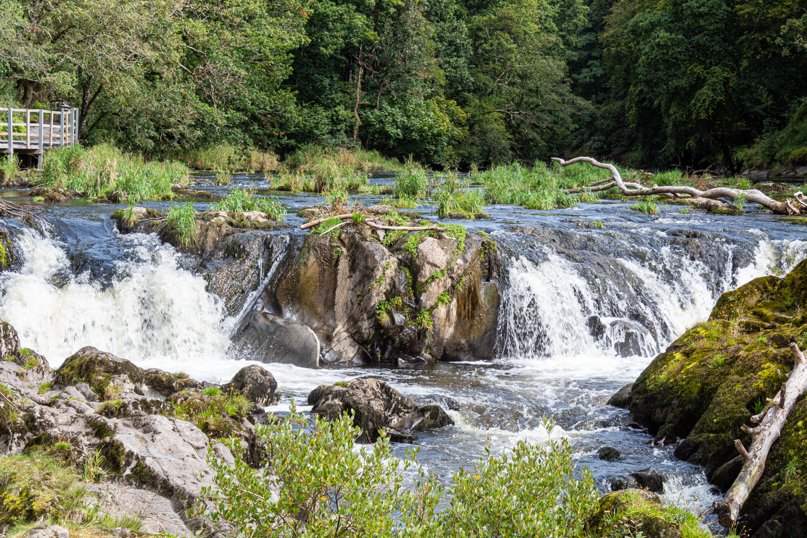
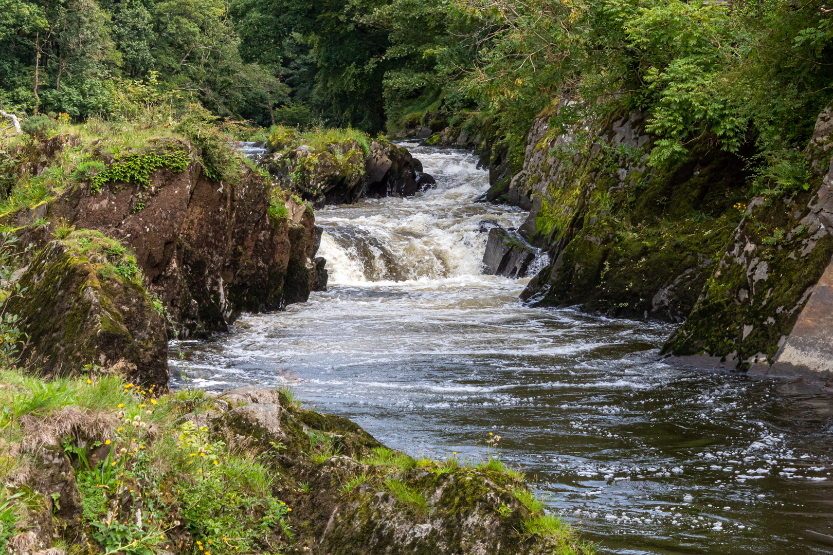
The focus of the village is Cenarth Falls, a series of small waterfalls and pools
 on the river Teifi known as The Salmon Leaps.


Visit Date September 2023


Cenarth Falls


The waterfalls are one of the first real barriers to salmon and seatrout on their way up the Teifi from the sea to spawn.


Cenarth Falls


There has been a mill on the south bank of the river at Cenarth since the 13th century when Cenarth Mill came into the possession of Edward I when he became Lord of the Manor of Cenarth.


Cenarth Falls, showing the mill.


The mill holds a secret in its base. There is a trap door in the floor and it is said that the miller would open the door and catch the salmon that were leaping there. The catching of salmon here was illegal but despite this, there was a lot of poaching of the fish, especially at night.

Light round boats, called coracles here in Wales, would often be seen on the river in the autumn nights with their occupants poaching the fish.


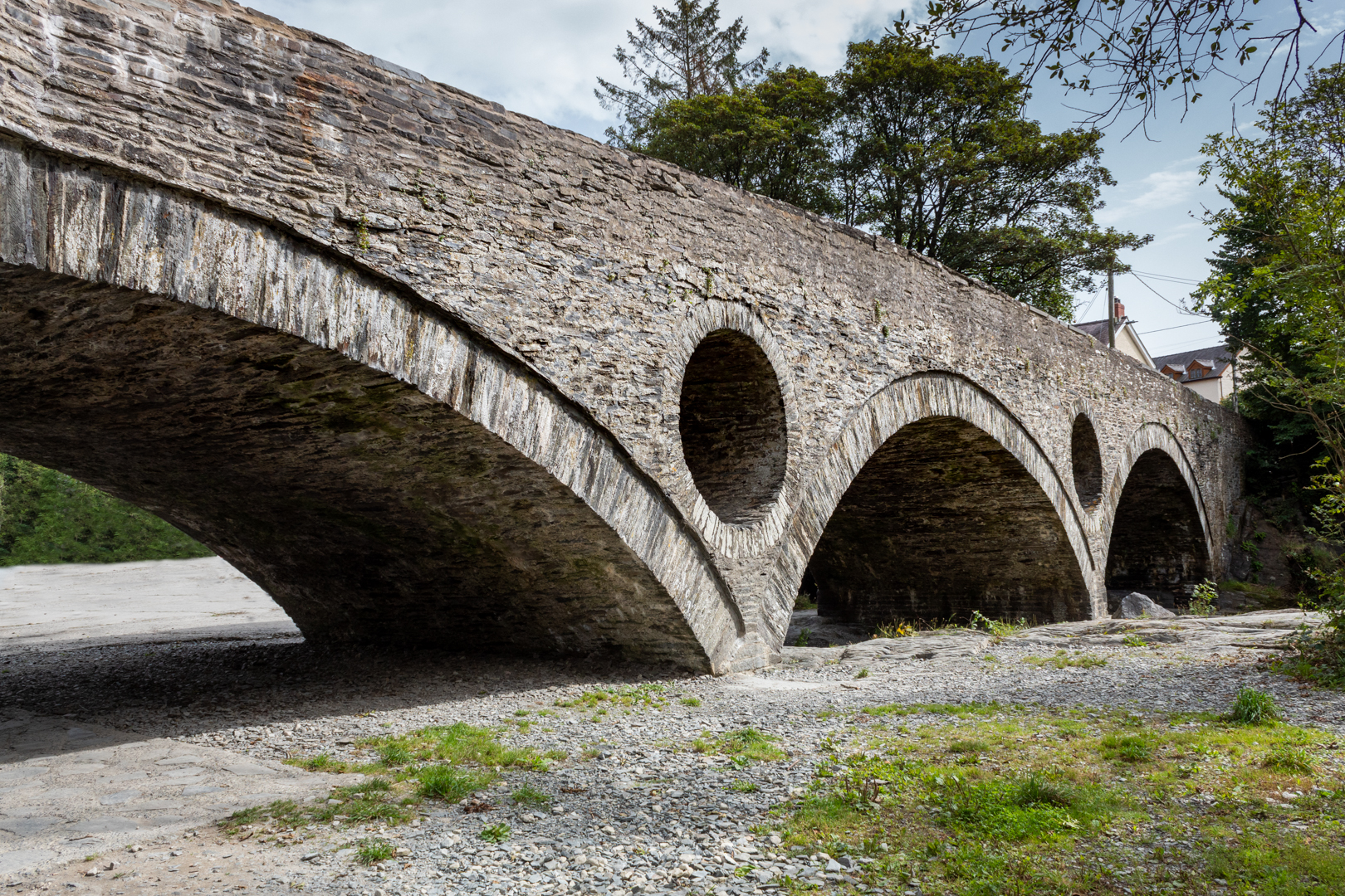
Cenarth Bridge


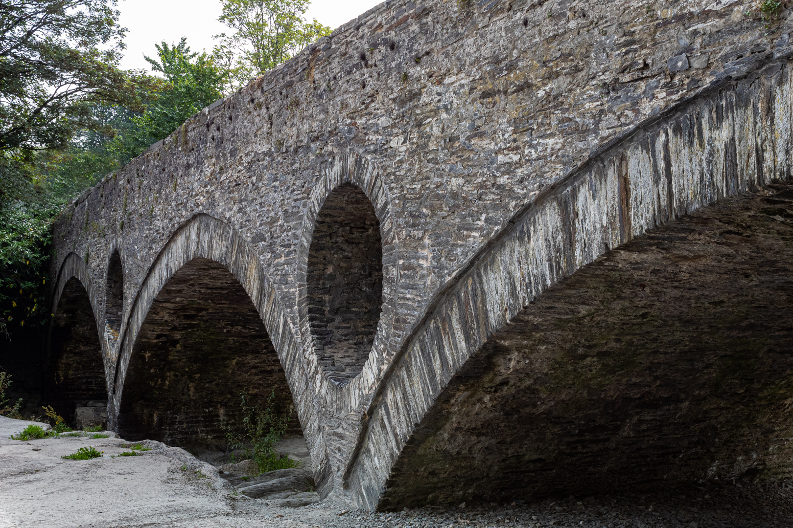
As well as the falls at Cenarth the other main feature of this small town is the bridge over the River Teifi at Cenarth that joins two counties, Carmarthenshire and Ceredigion and has existed at least since 1188 when it was mentioned in the writings of Gerald of Wales.(a royal clerk to the king and two archbishops, he travelled widely and wrote extensively).


Cenarth Bridge


The design includes two cylindrical holes 6 ft (1.8 m) in diameter, one on either side of the central span. The holes were included in the design while reducing the overall weight of the structure they also allow floodwaters to pass through them, instead of going over the top of the bridge: In these images, the water appears to flow under the southern arch only however, when in full flood the Teifi flows through all three arches.
This feature was used by Edwards's father William, who used six holes in the Old Bridge at Pontypridd to reduce the weight and pressure on the centre section.


Footer:Visit Information: -

Google Reference: -
52.04573152490105, -4.524292938371246


Google search term:
Cenarth Falls

What Three Words reference: -
///shows.riper.correctly

OS Details: -
SN 27008 41592 Altitude:40 ft

Additional information.

Visiting Cenarth falls and bridge is very easy.
There is lots of parking here right on the river bank. (52.04578729006762, -4.525187301082359).


There are shops toilets and a very nice cafe adjacent to the car park other also other amenities close by.


A full list of blogs can be found at my website


Read More

Grove Colliery


In 1849, after the establishing iron furnaces at Kilgetty 
the Pembrokeshire Iron and Coal Company 
considered the possiblity of sinking a new pit at Grove
 to mine the Kilgetty anthracite vein and provide
 anthracite to the ironworks.


Visit Date October 2023


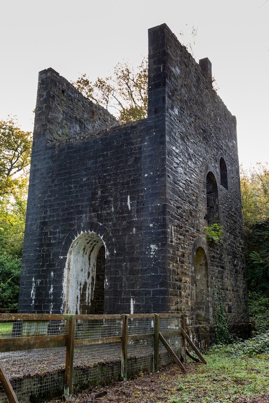
Grove Colliery Pithead
The Pithead and Shaft


The pit would have to be sunk to a depth of 182 metres to reach the vein.

The final decision was taken around 1852 and the new pit was started and opened some time later. When the pit finally started producing coal the Ironworks was in one of its production phases.


Grove Colliery Pithead
The Pithead and Shaft


The pit, being very close to the ironworks was to be linked underground to the workings of the older Kilgetty Colliery, which it drained. It had a tramway link directly to the Ironworks and was also connected to the Saundersfoot Railway.
The shaft was described in 1859 as the largest in Wales.
Coal from Grove was not exclusively used in the ironworks but was also taken by the Saundersfoot Railway to be sold for use elsewhere.


Grove Colliery Pithead
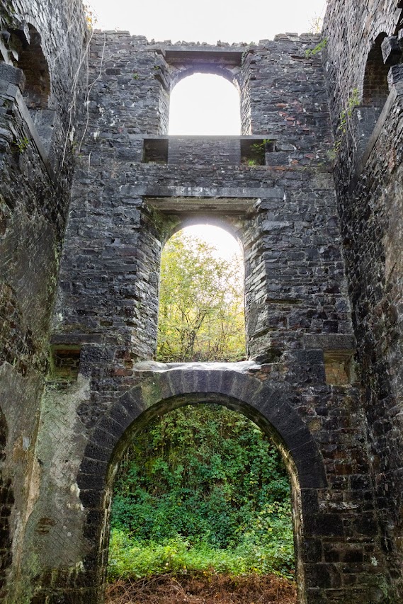
Inside view of Pithead


The Grove Colliery was later finally connected to Kilgetty Colliery via an underground tunnel.

Grove Colliery had its' own Smithy, Carpenters' shop and Stables which housed the pit ponies.


Grove Colliery Pithead


The associated ironworks finally ceased production in 1877 and a few years later coal extraction had ceased at Grove but the 274-horsepower Cornish Beam Pumping Engine was retained for pumping water until its' final abandonment in 1900."


Grove Colliery Cornish engine house
The Cornish Engine House


It is reported that there remains a fully equipped stable at the foot of the shaft.


Footer:
Visit Information: -

Google Reference: -
51.731820524163666, -4.696051707193539

What Three Words reference: -
///jets.demanding.losing

OS Details: -
SN 13918 07112 WAltitude:58 m

Additional information.

There is parking here for a a dozen cars or so and the place is easy to visit.
The site is now alongside a Holiday Park

Off the A477 the turning marked for Stepaside, Wisemans bridge and Amroth. Then follow the brown heritage signs for the ironworks.
Then look for direction to the pit.

There are no facilities at the site.


A full list of blogs can be found at my website


Read More

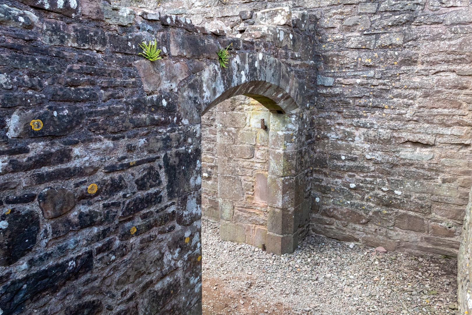
Skenfrith Castle


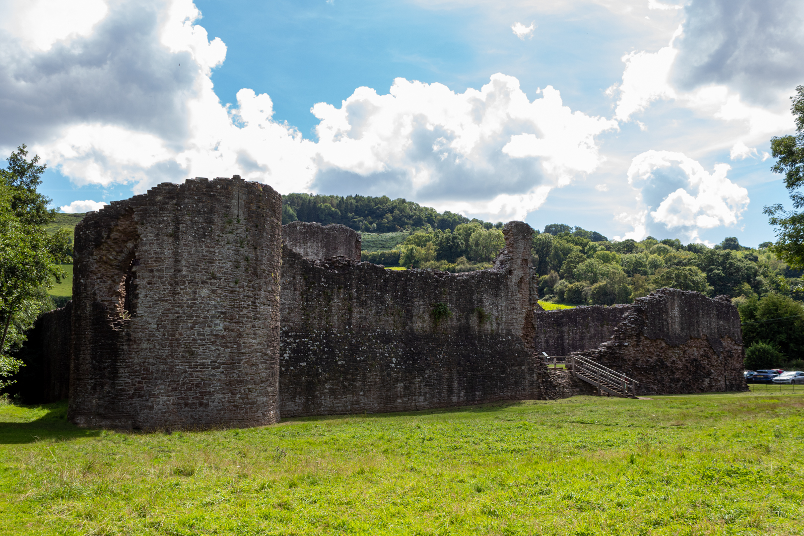
Skenfrith Castle (Welsh: Castell Ynysgynwraidd) is an 
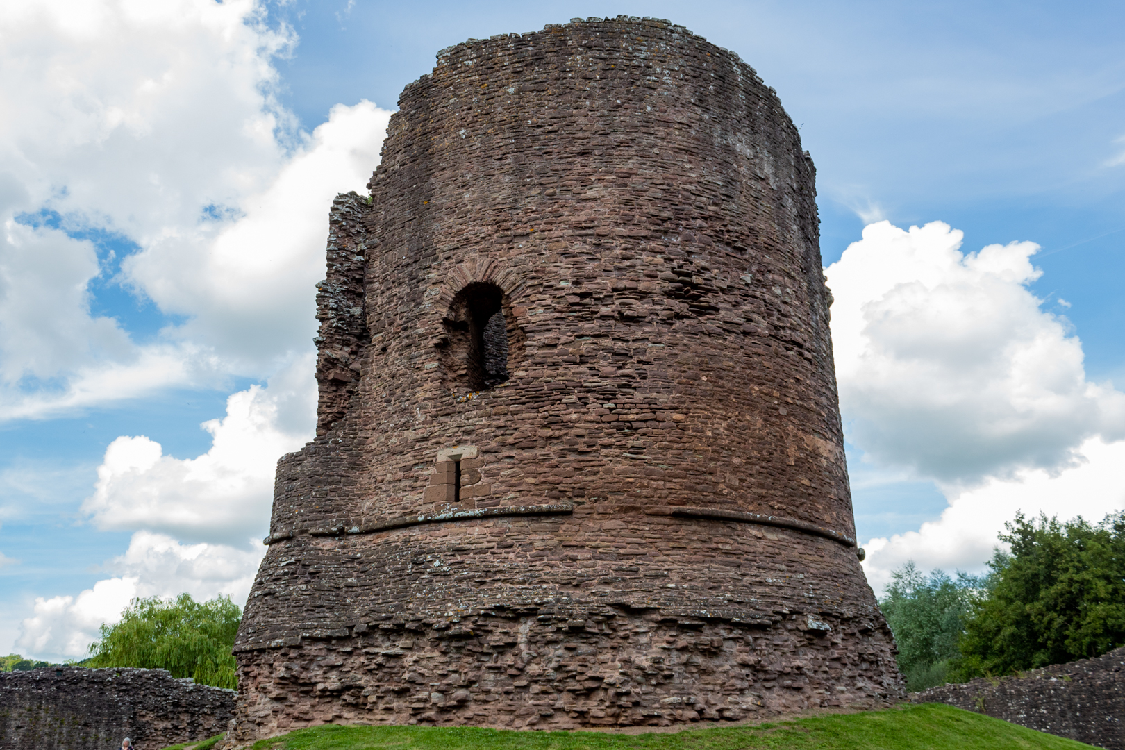
ancient medieval fortress with a substantial central tower.


Visit Date August 2023


Skenfrith Castle


Commissioned by William Fitz Osbern, the Earl of Hereford, in the early 12th century the castle comprised earthworks with timber defences.

What is left of the remains is the later constructed fortress by Hubert de Burge in the 13th century.


Skenfrith Castle


Built on an earthen mound this structure was one of the ‘Three Castles of Gwent’ (along with Grosmont and White Castle)


Skenfrith Castle


Controlling a large area of Gwent the three castles guarded the border country between The river Wye and the Black Mountains with Skenfrith Castle overlooking one of the main routes between England and Wales on the banks of the river Monnow.


Skenfrith Castle


In 1135, a major Welsh revolt took place and in response, King Stephen brought together Skenfrith Castle and its sister fortifications of Grosmont and White Castle to form a lordship known as the "Three Castles", which continued to play a role in defending the region from Welsh attack for several centuries.


Skenfrith was rebuilt in stone. In 1201, King John gave the castle to a powerful royal official, Hubert de Burgh (Earl of Kent) who destroyed the old castle and rebuilt the rectangular outer walls with the round keep and towers we can see today.


Skenfrith Castle


Hubert fell from power in 1232 and was stripped of the castles, which were placed under the command of Walerund Teutonicus

Walerund built a new chapel at the castle in 1244 and repaired the keep's roof


Skenfrith Castle


In 1267 the Castle along with the other two castles were granted to Edmund, the Earl of Lancaster


Skenfrith Castle


King Edward I' (20 November 1272 – 7 July 1307). In his conquest of Wales in 1282 removed much of the castle's military utility and saw the demise of the importance of the castle and by 1538, it had fallen into disuse and ruin.

In 1825, the Three Castles were sold off to Henry Somerset, the Duke of Beaufort. Skenfrith was eventually acquired by the lawyer Harold Sands, who carried out some conservation of the site; he went on to give the castle to the National Trust. Skenfrith was placed into the care of the state in 1936,


Skenfrith Castle


Skenfirth Castle is managed by Cadw
(Cadw is the historic environment service of the Welsh Government and part of the Tourism and Culture group. Cadw works to protect historic buildings and structures, landscapes and heritage sites) 


A visit to the castle would be enhanced by seeking out a disused mill on the south-eastern side of the castle. Much later than the castle of course dated 1867 at the 1st-floor level of the SW side; the mill continued to function until 1990 although by that time the mill had been converted to electric power.


Skenfrith Corn Mill

Skenfrith Corn Mill


Footer:
Visit Information: -

Google Reference: -
51.878293893054106, -2.790379413287163

Google Search term:
Skenfrith Castle

What Three Words reference: -
///parked.sporting.help

OS Details: -
SO 45697 20264 : Altitude:141 ft

Additional information.

There is parking here (51.87809680428079, -2.790591909573205) for a a dozen cars or so and the place is easy to visit.

Off the B4347 from Monmouth and on to the B4521 takes you to Skenfrith.

There are no facilities at the site.

The site is popular in the summer months with locals sunbathing and swimming in the river.


A full list of blogs can be found at my website


Read More

A Portrait Bench. . .


A Portrait Bench


The Richard Burton Trail is a short walk around
the forest park near the Welsh Village of Cwmavon.

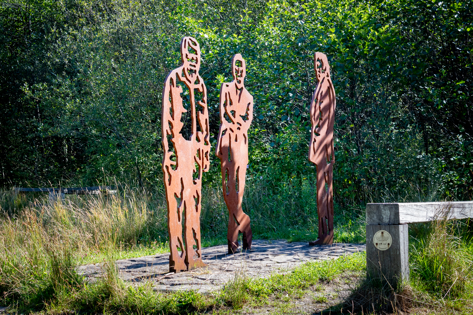
Along the trail is a tribute or "portrait bench" installed 
as a tribute to those who have hailed from the area


Visit Date April 2022


The Portrait Bench in Cwmavon


The walk is a reminder of Port Talbot’s most famous son, Oscar winner Richard Burton CBE. Richard Burton was born in the village of Pontrhydyfen on 10th November 1925, he was a Welsh miner’s son who never forgot his roots. Born Richard Walter Jenkins, he lived in Pontrhydyfen until just under the age of 2, when, following the death of his mother, he moved to Taibach in Port Talbot.


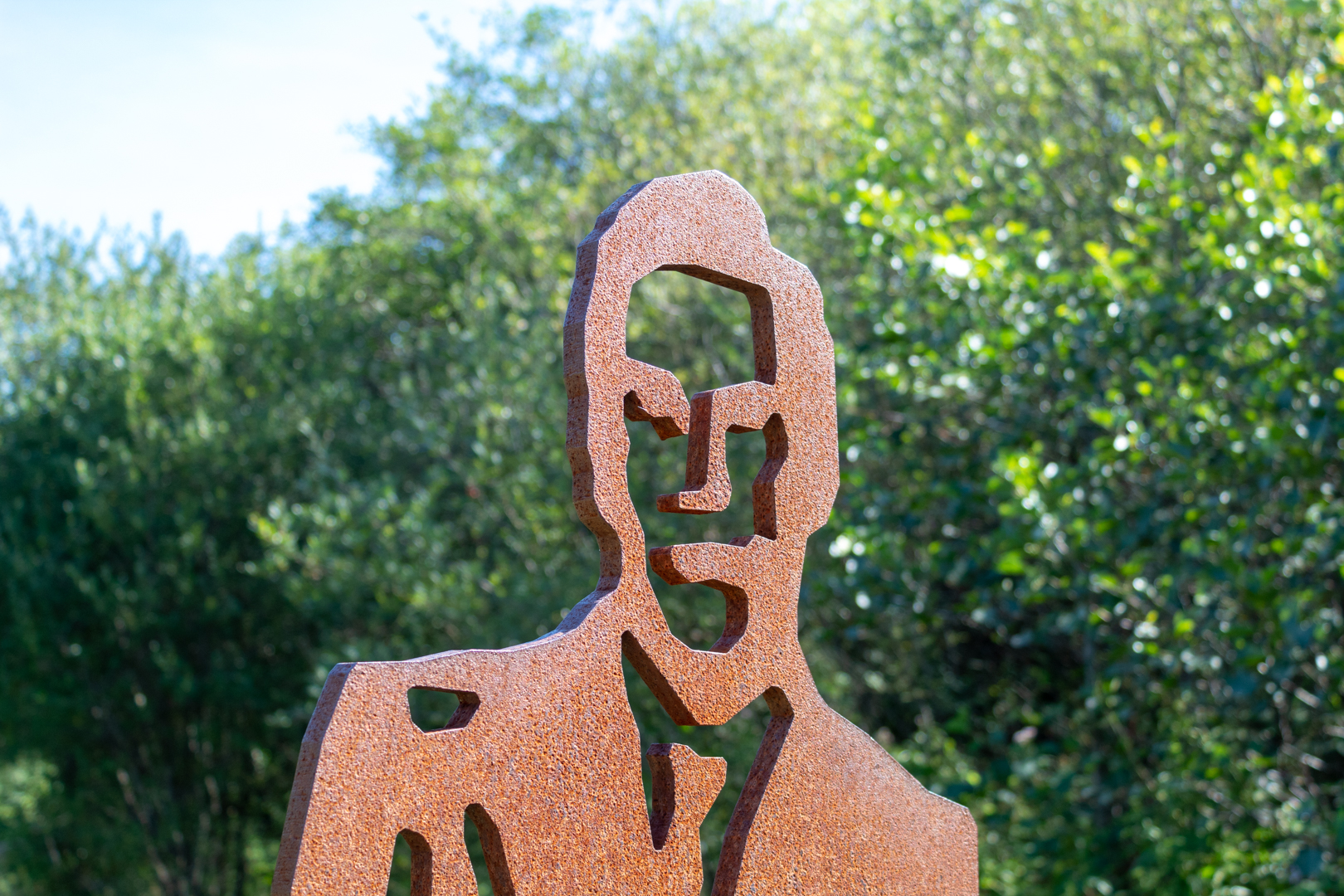
Richard Burton


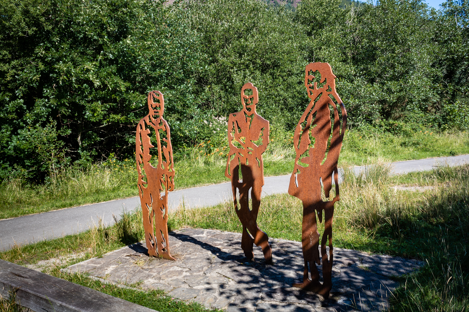
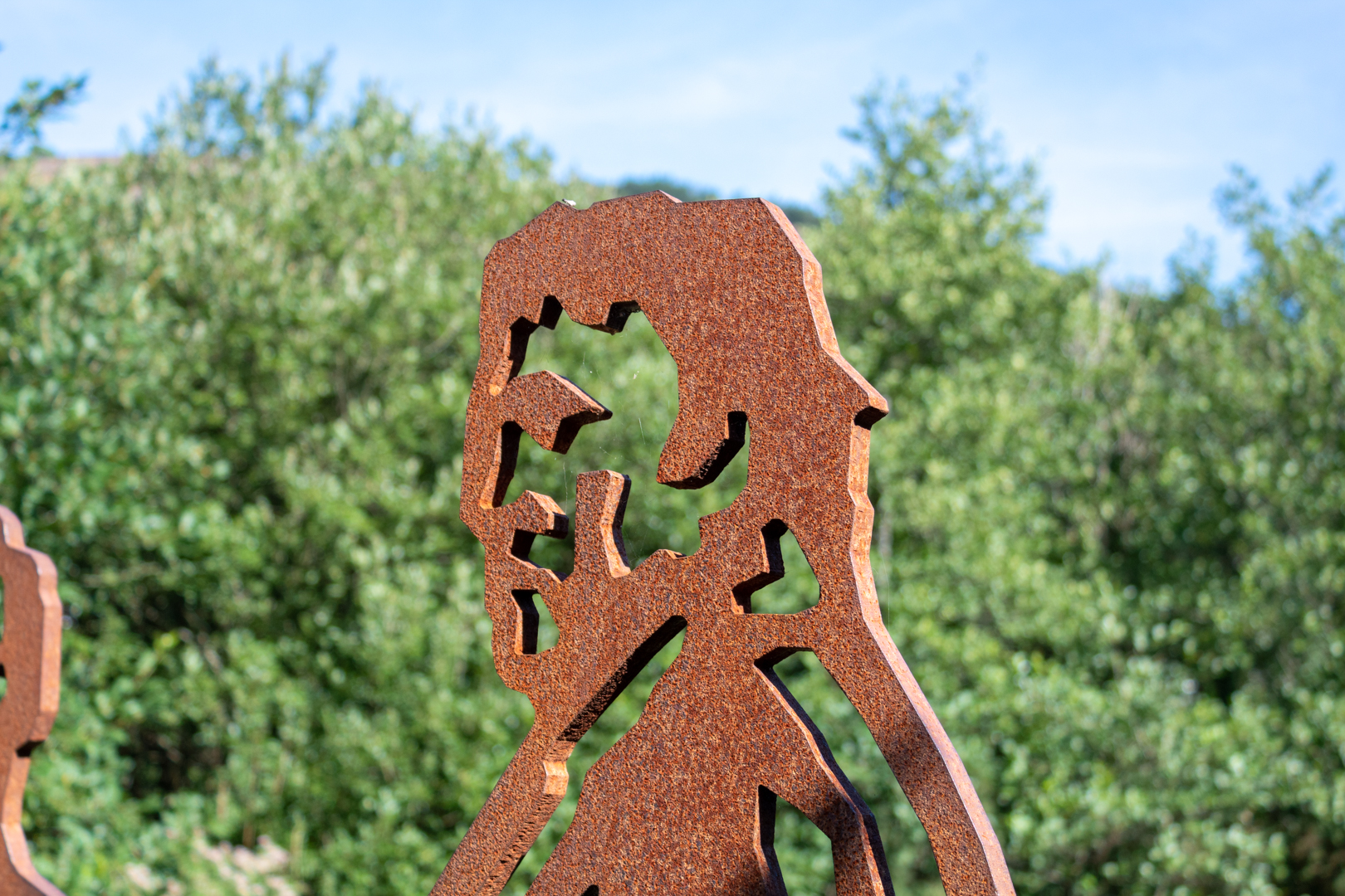
On the walk, you will see the STEEL statuettes of Richard along with the welsh comic and actor Rob Brydon that have been placed on the route in their home town of Port Talbot as part of an art project by sustainable transport charity Sustrans.
The new art installations have been placed in the Afan Forest Park above the steel town and also feature the park’s head ranger, Dick Wagstaff.


Rob Brydon


The three figures were chosen by the local community to be immortalised in a Portrait Bench – one of 80 benches to be installed across the UK.


Richard (Dick) Wagstaff.


Each comprises a wooden bench with three life-size steel effigies of local icons alongside and is unique to the local area in which it is placed.

Each bench is being placed along a newly created route for pedestrians and cyclists – in this case along a new route connecting Port Talbot to the Afan Valley community of Cwmavon and the Afan Forest Park.


The Portrait Bench Cwmavon


Members of the families of Richard Burton and Rob Brydon, along with Dick Wagstaff, were in the forest park on May 1 2013 to see the bench officially opened to the public.


Along the pathway from the sculptures, there is another moving tribute to a lesser-known local heroine.


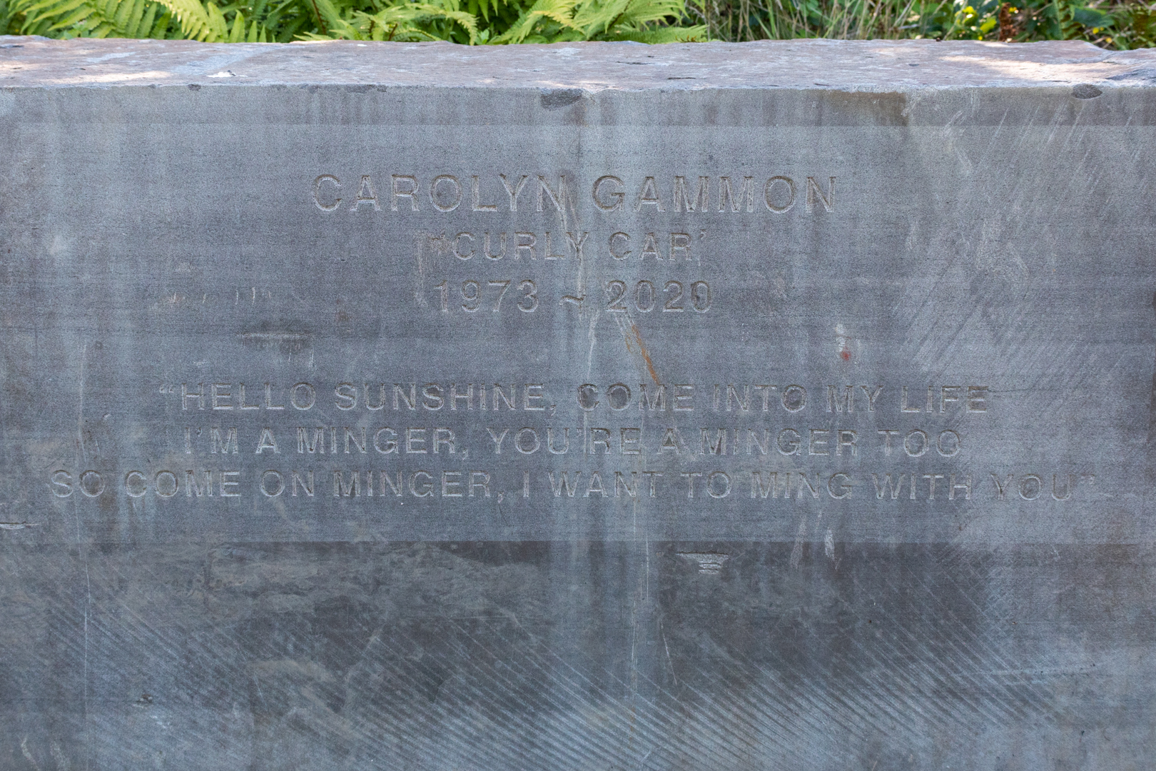
Carolyn Gammon Memorial


I have to say I didn't know anything about this until I returned home and did some research. This tribute is known as Carolyns Rock and is a memorial of a local woman, Carolyn Gammon known as Curly Car.
She was diagnosed with breast cancer during her pregnancy.
She raised lots of money for breast cancer charities.


Carolyn Gammon Memorial


It seems that Rachel Wigley arranged this beautiful memorial to Carolyn (following her EXACT instructions ).


Footer:
Visit Information: -

Google Reference: -
51.61895331276028, -3.749284085203686
Google Keyword: The Portrait Bench

What Three Words reference: -
///spooned.conspired.weeded

OS Details: -
SS 78990 92575 : Altitude:171 ft

Additional information.
This is an easy walk to get to through a forest park.
There is parking in the village (51.617043334820664, -3.7548627356550908) and from there there is a short walk to the bridge crossing the river which leads naturally to the path. Take a left after the bridge and you will pass the portrait bench approximately 500 metres further on.


Read More

Captain Cat.

 ___________________________________________________________________________________


C a p t a i n   C a t 

A sculpture in Swansea


Here we see a sculpture which seems to encompass two elements of the Welsh history and culture of this area.
The statue erected in the heart of Swansea's maritime quarter is of a sailor looking out and ringing a bell.
The statue is named Captain Cat sculpted by theWelsh sculptor Robert Thomas .
Commissioned by Swansea City Council on 1st March 1990.


Visit Date August 2019


_____________________________________________________________________________________


Captain Cat . A statue in Swansea maritime quarter


The sculpture does at first glance seem just to refer back to the maritime past of Swansea, but the character here has more significance.

Captain Cat is one of the main characters from possibly the best-known piece of literature to come out of Wales, "Under Milk Wood" by Dylan Thomas. Under Milk Wood was written as a radio drama and was broadcast in 1954.

Subsequently, in the 1972, the story made it to the silver screen being made into a movie starring one of the all-time greatest actors to come out of Wales Richard Burton.

An additional version and then was remade in 2015.

Captain Cat although old and blind is one of the play's most important characters, He observes and comments on the goings-on in the village from his window as he can recognize the different characters by the sound of their footsteps.


CAPTAIN CAT

"The sleepers are rung out of sleep

with his loud get-out-of-bed bell"

from

Under Milk Wood

by

Dylan Thomas


Footer:
Visit Information: -

Google Reference: -
51.6164323229727, -3.935963108023244

What Three Words reference: -
///bliss.case.cans

OS Details: -
SS 66059 92618 Altitude: 8 ft

Additional information.


his statue is in the maritime quarter of Swansea. 
There is lots of parking and the closest is the marina car park (51.61679855131115, -3.936364737297523)which is just a 2 minute walk from the site.


Read More

Swansea Jack.

Visit Date 05-2022. .

Today's blog was inspired after my walk took me along the seafront at Swansea when I came upon a monument to one of Swansea's greatest lifesavers and perhaps a story not known to many.

I suspect that if you were to ask anybody in Wales to name the most famous dog (Movies excluded) I suspect they would answer Gelert.

The reason for this is that the story is of a dog that is buried and remembered in the village named after him, Beddgelert.

The inscription on the grave in both Welsh and then in English reads: -

IN THE 13TH CENTURY, LLYWELYN, PRINCE OF NORTH WALES, HAD A PALACE AT BEDDGELERT. ONE DAY HE WENT HUNTING WITHOUTGELERT "THE FAITHFUL HOUND" WHO WAS UNACCOUNTABLY ABSENT. ON LLYWELYN'S RETURN, THE TRUANT STAINED AND SMEARED WITH BLOOD, JOYFULLY SPRANG TO MEET HIS MASTER. THE PRINCE ALARMED HASTENED TO FIND HIS SON, AND SAW THE INFANT'S COT EMPTY, THE BEDCLOTHES AND FLOOR COVERED WITH BLOOD. THE FRANTIC FATHER PLUNGED THE SWORD INTO THE HOUND'S SIDE THINKING IT HAD KILLED HIS HEIR. THE DOG'S DYING YELL WAS ANSWERED BY A CHILD'S CRY. LLYWELYN SEARCHED AND DISCOVERED HIS BOY UNHARMED BUT NEAR BY LAY THE BODY OF A MIGHTY WOLF WHICH GELERT HAD SLAIN, THE PRINCE FILLED WITH REMORSE IS SAID NEVER TO HAVE SMILED AGAIN. HE BURIED GELERT HERE. THE SPOT IS CALLED BEDDGELERT.

Unfortunately this is just a myth. History and myth appear to have become a little confused when in 1793, a man called David Pritchard came to live in Beddgelert. He was the landlord of the Royal Goat Inn and knew the story of the brave dog and adapted it to fit the village, and so benefit his trade at the inn.

However, in Wales, we really do have a true story of a historic dog.

Swansea Jack


Swansea Jack was a black retriever born in 1930. He lived in the North Dock / River Tawe area of Swansea with his master, William Thomas.
Jack would always respond to cries for help from the water, diving into the water and pulling whoever was in difficulty to safety at the dockside.
His first rescue, in June 1931, when he saved a 12 year old boy, went unreported. But a few weeks later, this time in front of a crowd, Jack rescued a swimmer from the docks. His photograph appeared in the local paper and the local council awarded him a silver collar. In 1936,

Later he had the prestigious 'Bravest Dog of the Year' awarded to him and in 2000, Swansea Jack was named 'Dog of the Century' by NewFound Friends of Bristol who train domestic dogs in aquatic rescue techniques

Legend has it that in his lifetime he saved 27 people from the Docks / River Tawe. Sadly, in October 1937, Swansea Jack died after eating rat poison. His burial monument, paid for by public subscription, is located on the Promenade in Swansea.


Footer:
Visit Information:-
Google Reference
51.611550048497776, -3.966347713215829

What Three Words reference:-
///spill.urban.dark (this is an approximate)

Additional information.
On the main promenade in Swansea.


Thank you for visiting this blog.
If you would like more information on this location please feel free to contact me.


Read More

Monknash Rocket House

Visit Date: April 2022.


Monknash Rocket House


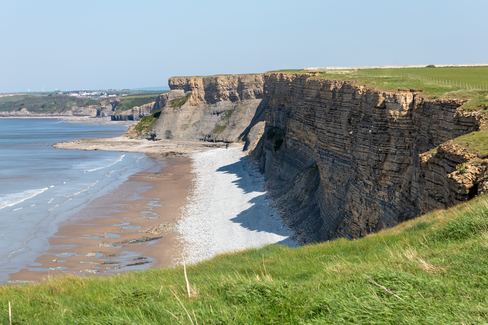
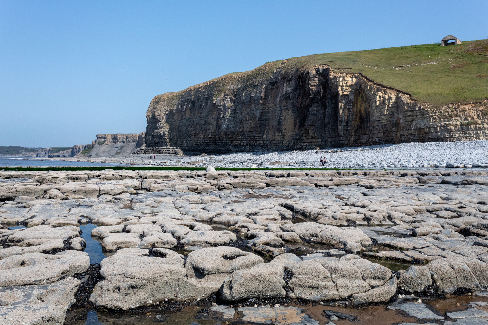
For today's blog, I am visiting another South Wales coastal bay at Monknash in the Vale of Glamorgan.


Monknash bay or beach is at the coastal end of a small valley called Cwm Nash.


Monknash Rocket House


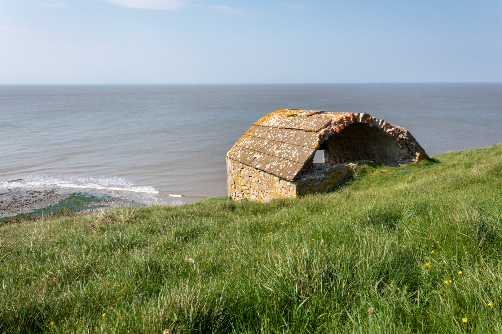
The reason I have visited here this time is not for the breathtaking coast and cliff but for this small building high on the cliffs.

This is a Coastguard Rocket Station.


Monknash Rocket House


This is an early example of this type of building specifically built to house life-saving apparatus used when conditions prevented the lifeboat from deploying.


View from Monknash Rocket House


These locations would have had rocket apparatus which could fire a rope out from the land to any ship that ran aground on the rocks. The rope would allow the ship's crew to pull in the attached breeches buoy. The breeches buoy was a pulley system that could winch a sling out to the ship and then winch it back with a person in the sling.


View from Monknash Rocket House


Rocket Houses became a vital part of seafaring rescues and his one dates from the late 1870s and is on an OS map dated 1877. This would seem to be correct as many of these Rocket Houses" were built along the coast at this time.


OS benchmark


On the front wall of the rocket house, I found this mark.

Someone I met at the site thought it might be a mark to state that the building was owned or looked after by the government or forces however, I believe it is an ordinance survey benchmark.

***(From Wikipeadia)

The term benchmark, bench mark, or survey benchmark originates from the chiselled horizontal marks that surveyors made in stone structures, into which an angle-iron could be placed to form a "bench" for a leveling rod, thus ensuring that a levelling rod could be accurately repositioned in the same place in the future. These marks were usually indicated with a chiselled arrow below the horizontal line.

The term is generally applied to any item used to mark a point as an elevation reference. ***.

.


Monknash


As you can see this is a beautiful part of the coast here which gets battered frequently by the sea.
There have been many wrecks on this part of the coast one of which I have mentioned in an earlier
blog regarding the wreck of the The Wreck of the Altmark


Monknash


A little while ago some human bones (at least six) were found protruding from the rock face here and it is thought that they are either an early unofficial burial ground or this may have been a burial of some sailors whose vessel was wrecked here.


Monknash


The remains of people recovered from the site previously have been found to date from the 16th Century.

The earliest burial licence in the parish of Monknash - the area where the remains have been found - was granted in 1609.

And previous radiocarbon dating of remains found at the site showed they were from the late 16th Century or the early 17th Century, according to details published by Cardiff University.


- - - - - - - - - - - - - - - - - - - - - - - - - - - -


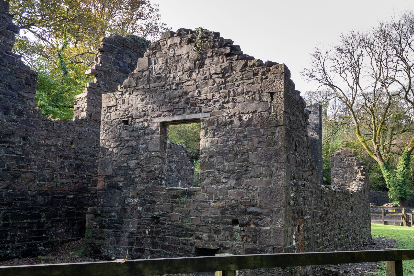
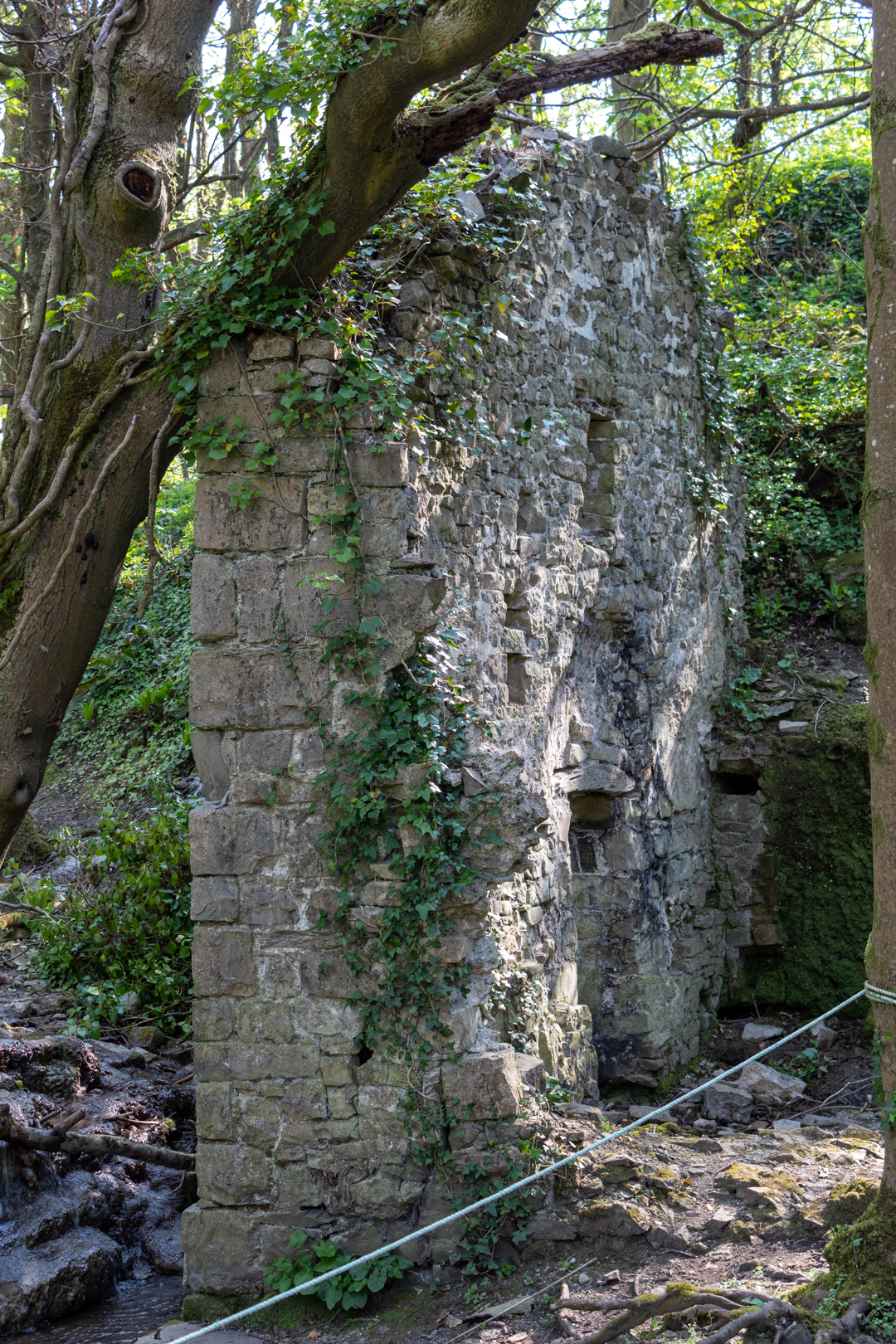
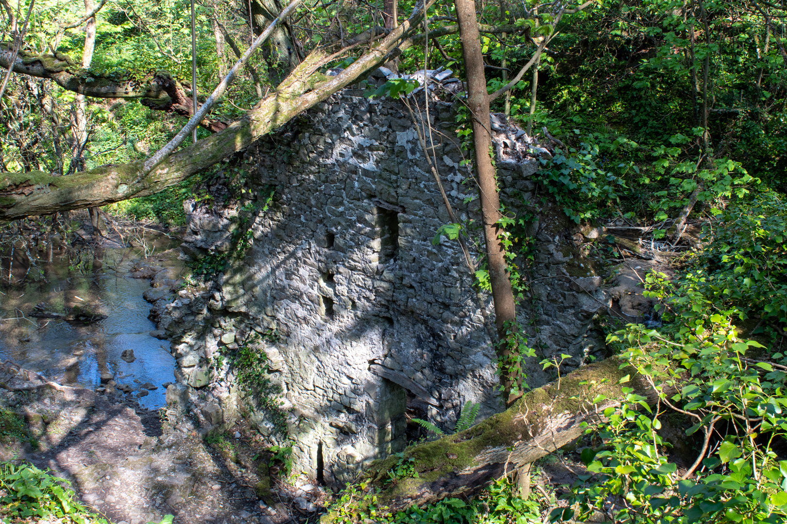
There is one other ruin of interest in Cwm Nash. As you walk up the footpath you come to this old ruin.

It is the ruin of an old corn mill that would have been powered by the river.


Monknash Corn Mill


The northerly gable wall, against which was the waterwheel, stands to its full height, but the other walls are ruined more or less to ground level. The leat is visible and terminates at the mill at eaves level; the stone base of the wheelpit is clear and its floor is just above the stream level, both features together suggesting an overshot wheel about 3.6-4.2m (12-14 feet) in diameter by about a metre (just over three feet) wide.


Monknash Corn Mill


The Mill also appears on the old Ordinance survey map of 1877.


Monknash Corn Mill


Footer:
Visit Information:-
Google Reference
51.41942070629259, -3.576461563665641

What Three Words reference:-
///adjust.gagging.inventors

Additional information.
Visiting is relatively easy and is a good walk from the car park (51.41891777077914, -3.5647860982640633) which is a farm field and there is an honesty box for payment on the entry post to the carpark (£3 currently).
 You can then follow the path, some tarmacked, and some over cobbles. This will take you past the corn mill down to the beach (20 minutes or so). I think the corn mill is wrongly positioned on google maps I think it is nearer (51.42097552443006, -3.570768612493772) or  (///farmland.exhale.different) but you can't miss it on the way to the beach.

The Station as you can see is up on the cliff and part of the official Wales coastal path but it does take some climbing.


Thank you for visiting this blog.
If you would like more information on this location please feel free to contact me.


Read More

Margam Radar Station.

 Visit Date 04-2022. .

Margam Radar Station


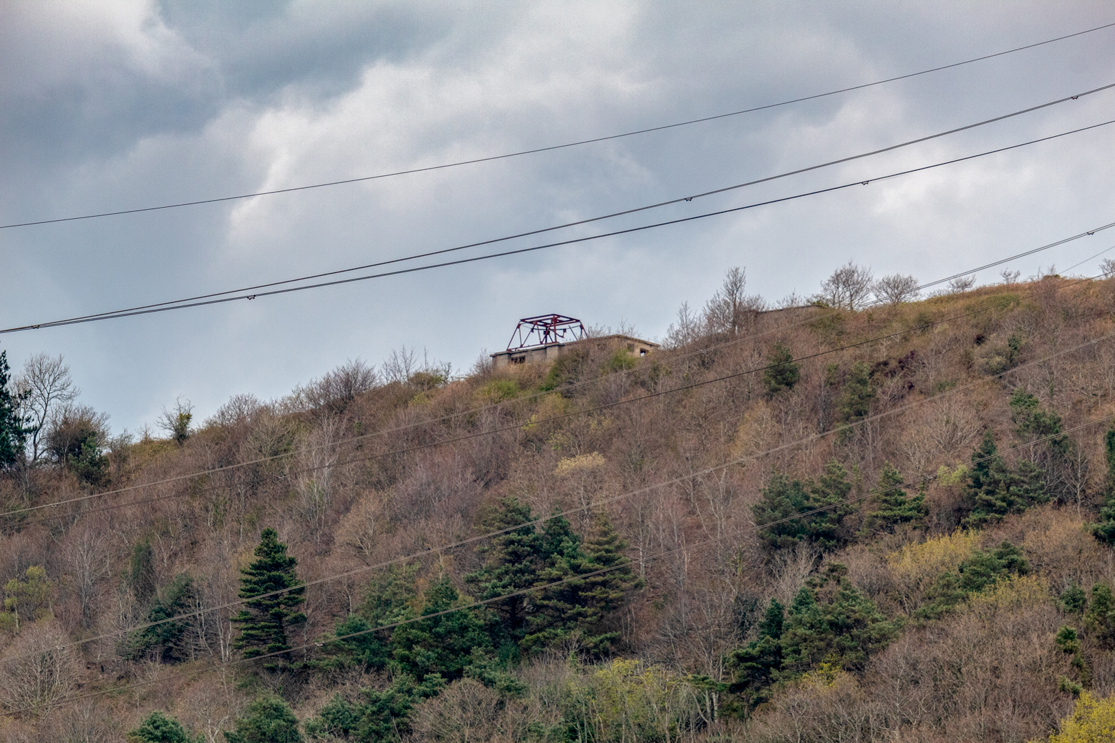
Overlooking the Bristol Channel from high above Port Talbot, I visited the remains of the Margam Radar Station.


Margam Radar Station.


The station is a Chain Home Low Radar Station. The original Chain Home Radar system was developed to detect enemy aircraft, but whilst it was extremely effective at identifying aeroplanes at a distance and flying at high altitudes, it could not see them when they flew low.


Margam Radar Station.


The  Chain Home Low could reliably detect aircraft flying as low as 500 feet (150 m).
It's design also allows the coast to be guarded against enemy surface craft and submarines in the Bristol Channel, 


Margam Radar Station.


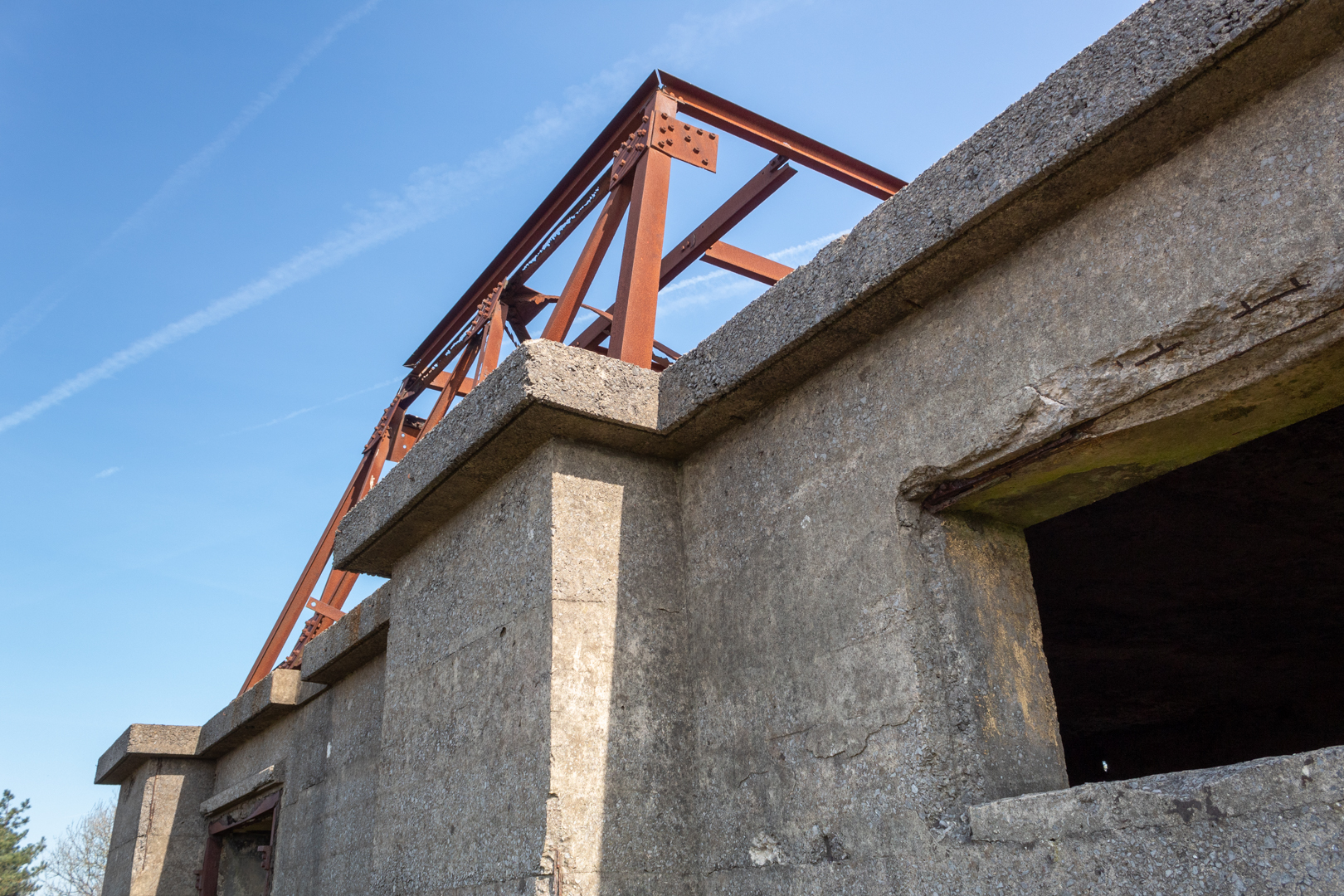
This station consists of three squarish concrete buildings with flat roofs.

This building retains the framework of a steel gantry, the base for a rectangular radar transmitter/receiver array, known as a 'bedstead array' from its wires and framework.


Margam Radar Station.


Next to it stands the generator house that supplied the necessary power.

There is a third building that is thought to be a back generator.


Margam Radar Station.


Situated high on the hill over Margam, Port Talbot and most importantly the Bristol Channel it had great views of the coast.


Margam Radar Station.


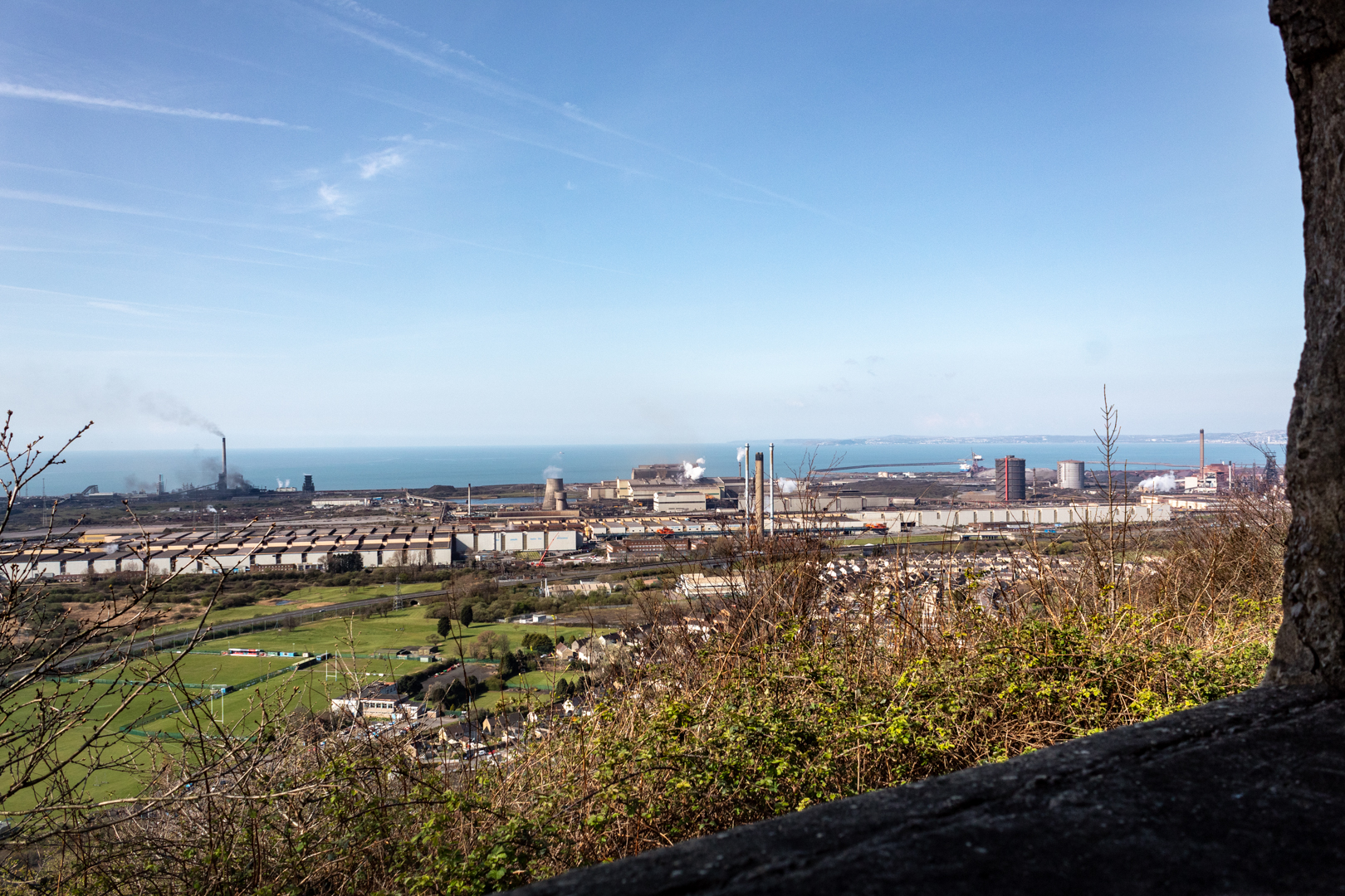
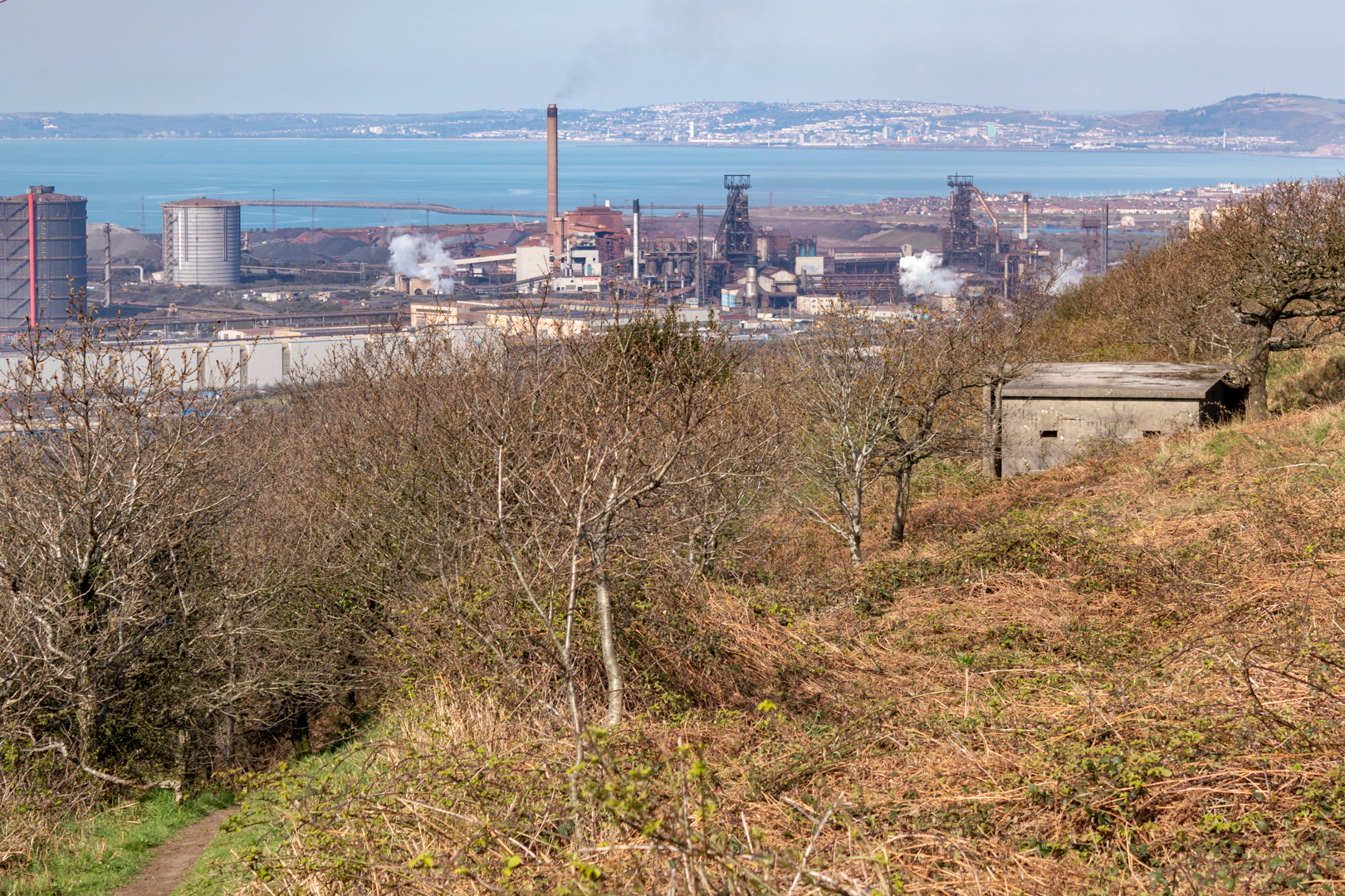
It now overlooks the mighty Port Talbot Steel Works. The works covers a large area of land which dominates the south of the town. Its two blast furnaces and steel production plant buildings are major landmarks visible from both the M4 motorway and the South Wales Main Line when passing through the town.


Margam Radar Station.


This Radar Station is believed to be a unique survivor within the British Isles.


The Margam Radar Station.


Footer:
Visit Information:-
Google Reference
51.569833872704216, -3.742837925791009

What Three Words reference:-
///otherwise.paying.price

Additional information.
Visiting is relatively easy but is mostly uphill as the site is on the South Wales Coastal Walk. I visited by parking close by and there is a car park near the start of the walk (51.56361379905241, -3.7338320577891753) and there is also roadside parking. You leave the M4 at junction 38 head for Margam Park but turn in at the sign which reads "Margam Abby" Walk up the hill on the road until you see the path marked "COLD CADW WOODLAND" then follow this path up to the station. The walk is almost all uphill but the paths are quite good.

Additional Information.
On the road part of the walk you will pass both "The Monks Bath" and "
 Capel Mair as y Bryn" both of which have been also blogged.


Read More

Search This Blog

About Me

Bridgend, United Kingdom
A renewed interest in photography and local history.

Contact Me

Name

Email *

Message *

Followers