With a renewed enthusiasm for photography and local history, I set out this blog as a record of my experiences with images and narratives. It is my hope that you find something of interest on this site. Please feel free to contact me for more information on any of the posts. You can see a comprehensive list of my blogs at my website :- http://www.davidnurse.co.uk

Showing posts with label Wales. Show all posts

Harold's Stones 


Harold's Stones

In the village of Trellech, three megaliths stand. The village likely got its name from these stones, translating to either 'village of stones' or 'three stones.' The name derives from 'tri' (Welsh for three) and 'llech' (meaning flat stone).


Visit Date January 2025


Harold's Stones : Trellech


These three large standing stones in a 12-metre alignment, all three are leaning at angles but it is unlikely that this is deliberate.


Harold's Stones : Trellech


Although a relatively small village in modern times, Trellech in Monmouthshire was one of the largest towns in Wales in the 13th century.

Harold's stones are in a 12-metre alignment with a possible fourth stone being robbed away or destroyed in the late 18th century. The stones are of a conglomerate rock that's known as pudding stone. All the stones lean at different angles with the tallest being over 4 metres in height. 


Harold's Stones : Trellech


A font in the local church has a carving of the stones with the stones numbered 8, 10 and 14 which is thought to be the height of each stone at that time.


Harold's Stones : Trellech


The precise reason for the erection of the stones is unknown however, they may have been for ritual, though an astronomical use is not out of the question.
The stones create an approximate line running between the north-east and south-west at an azimuth of about 229°, likely indicating the midwinter sunset, although the possibility of the midsummer sunrise cannot be dismissed due to the imprecise alignment today due to the movement.


Harold's Stones : Trellech


The central stone of the three has been dressed to smooth its surface and bears two large cup marks on its face.


Harold's Stones : Trellech


There is much folklore associated with the stones.

The origin of the name "Harold's Stones" remains a mystery. Local legend suggests that these stones were erected to commemorate the victory of the Saxon king Harold over the Britons. However, this theory is unlikely, as the stones date back at least 2,000 years before Harold's time. Another legend claims that they mark the location where three British chieftains fell in battle against Harold. Despite being associated with Harold's victory over the Britons, the stones are much older than that.


Harold's Stones : Trellech
Click on any image for a larger version


As another story goes, Jack o'Kent, a giant, quarrelled with the Devil on Trellech Beacon, which is the hill located directly east of Trellech. The Devil challenged Jack to a throwing match. Jack threw first, but the Devil managed to throw his object a bit farther. However, Jack, probably with his eyes closed and one hand behind his back, threw just a bit farther than the Devil. In frustration, the Devil ran off.

The location of this event varies depending on who tells the story. Some versions claim that the competition took place on Sugar Loaf Mountain, while a third version cites Skirrid Fawr, also known as Holy Mountain, as the site of the contest.


Footer:Visit Information: -
Google Reference: -
51.74277538693781, -2.7265470451085365

What Three Words reference: -
///jeep.pylon.streetcar

OS Details: -
OS Grid Ref: 
SO 49927 05145 Elevation: 206 m 

Additional information.

Visiting is easy and there is a public car park close to the site (
51.74405088914131, -2.7246217913570847) There is just a short walk along the road to the site however, this has no pavement so care will be needed. The site is marked with a monument sign.


There are no facilities at the site but there is a pub in the village and also you may be lucky enough to have tea in the village hall!


A full list of blogs can be found at my website


Read More

The Church of the Holy Cross, Mwnt.

The Church of the Holy Cross (Welsh: Eglwys y Grog)
 in Mwnt, Ceredigion, Wales. 
A parish church and a Grade I listed building, 
likely dating from the 13th century.


Visit Date March 2025


The Church of the Holy Cross, Mwnt.


The Church of the Holy Cross is an example of a medieval sailors' chapel of ease, allowing sailors to attend church without traveling all the way to the village of Mwnt.


The Church of the Holy Cross, Mwnt.
Click on any image to see a larger version


The site is said to have been used since the Age of the Saints (about 410-700 AD).


Mwnt.
The coast at Mwnt


The dedication to the Holy Cross likely references a stone cross that once stood atop Foel y Mwnt, the conical hill directly behind the church.
The cross would also have been visible for many miles out to sea,  attracting pilgrims who drew their boats up on the sandy beach at the base of the cliffs.


The Church of the Holy Cross, Mwnt.
A pilgrims way wall hanging


Mwnt gained a reputation among early Christians as a stopover for the bodies of saints being transported to Bardsey Island for burial. Its location also made it a convenient resting place for pilgrims traveling to St. David's, further down the coast.


The Church of the Holy Cross, Mwnt.
North wall showing blocked lancet


On the north wall, there is a small blocked lancet window that may have permitted lepers—who were not allowed inside churches—to view the high altar during services.


The Church of the Holy Cross, Mwnt.


On the north wall, remnants of a medieval rood stair can be found, and timbers from the 15th-century rood loft, embellished with rose carvings, are set into the wall.


The Church of the Holy Cross, Mwnt.
Click on any image to see a larger version


The interior consists of a single chamber featuring deep-set windows and a unusually designed roof.


The Church of the Holy Cross, Mwnt.
The font


It has an example of a 12th- or 13th-century font made of Preseli stone.


The Church of the Holy Cross, Mwnt.
The coast at Mwnt


In 1155, a group of Flemish soldiers landed at Mwnt but were repelled by the local Welsh after fierce fighting. A nearby stream still bears the name Nant y Fflymon, meaning the Flemings' Brook.


The Church of the Holy Cross, Mwnt.


Over the centuries, many human bones have been unearthed. It is believed that the bodies from the battle were buried in the farmer’s field.


The Church of the Holy Cross, Mwnt.


The victory achieved by the local Welsh inhabitants in the area was commemorated, at least in the 18th century when the events were recorded, through secular games held on the first Sunday in January. These games were referred to as “Coch y Mwnt,” which translates to "the Bloody Sunday of Mount."


The Church of the Holy Cross, Mwnt.


The nearby farm features a well named Ffynnon Grog, known as the well of the cross, along with Nant y Flymon, which translates to Fleming’s brook. 


The Church of the Holy Cross, Mwnt.


Mwnt was a civil parish for several centuries. However, before the 17th century, it served as a detached chapelry of the parish of Llangoedmor. Since 1934, Mwnt has been part of the parish of Y Ferwig, which consists of a parish church and a few houses. This community includes the villages of Penparc, Felinwynt, Tremain, Mwnt, and Gwbert, as well as Cardigan Island and the National Trust area of Mwnt.


Footer:Visit Information: -
Google Reference: -
52.13694896383402, -4.638645221098706

What Three Words reference: -
///echo.dwarf.mission

OS Details: -
OS Grid Ref: SN 19504 52017 

Additional information.

Visiting is easy and there is a car park close to the site (
52.135662647388045, -4.638483304444649) This is run by the national trust and is free for members but charges do apply for non-members.

There were no facilities when I visited in March however there is a cafe (Caban Mwnt) a short walk from the car park  (52.1347209027339, -4.639436590459322).

The roads to the site are well maintained single track country roads with passing points. 

I believe this site can become very busy in the summer with visitors to the beach and surrounding areas. 
.


A full list of blogs can be found at my website


Read More

Aberthaw Limeworks


On December the 22nd 1888  
'The Aberthaw Pebble Limestone Company'
 opened the lime works at Aberthaw near the coast of South Wales. 
The owner David Owen was also the  owner of the
  local newspaper 'Western Mail' which still exists today.


Visit Date August 2023


Aberthaw Limeworks
Aberthaw Limeworks


The works were primarily built to utilise the huge number of Limestone Pebbles that had previously been taken inland and were readily available.


The lime produced at Aberthaw was well known before the opening of the lime works and subsequent cement works. Experiments in 1756-7 were undertaken by John Smeaton to test the setting qualities of lime in seawater preparatory to designing and building the Eddystone lighthouse. Although Aberthaw lime was not used in the final construction of this lighthouse the fame it got from its inclusion of testing of materials to be used in the construction and its use in the actual construction of other docks, piers, harbours, ports and other lighthouses naturally led to increased demand which could not be fully met until this major new works was built.


Aberthaw Limeworks
Aberthaw Limeworks


Aberthaw Lime mixed with Pozzolana and fired produced a remarkably hard lime mortar whose quality of setting under water proved invaluable and may have been the forerunner to Portland Cement.


Aberthaw Limeworks
Click any image for a larger view


Aberthaw Lime Works ran until its closure in 1926 and is now a derelict structure.


Aberthaw Limeworks
Click any image for a larger view


The local limestone and brick structure is still largely intact however there has been some work done to preserve what is left and the structure is now a grade II listed building.


Aberthaw Limeworks
Internal image of the building


What we see today are 2 large vertical pot draw kilns that would have held up to 300 tons each and produced 40 tons of lime per day.

A tramway leading to the top of the kilns serviced the lime and coal for the kilns but this has now disappeared.

These wagons with the material would then have been winched to the kiln top by cables via a winding house which also has disappeared.

The lime would have been withdrawn from the bottom of the kilns again by trams and some of the track still exists and can be seen at the base of the kiln.


Aberthaw Limeworks - Base of kiln
Base of the kiln showing rail tracks


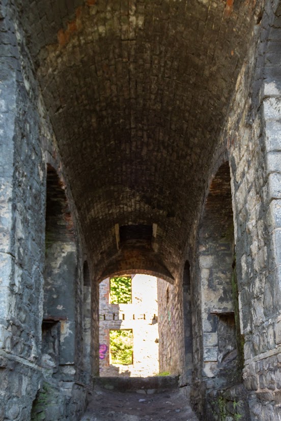
The surviving remains include roofless stone buildings which would have housed the crushing plant and boilers. 


Aberthaw Limeworks
One of the main buildings


Aberthaw Limeworks
Internal view of one of the main remaining buildings


The square brick chimney can still be seen and is perhaps the most iconic part seen from a distance, alongside this would have been the engine house sadly this has been demolished.

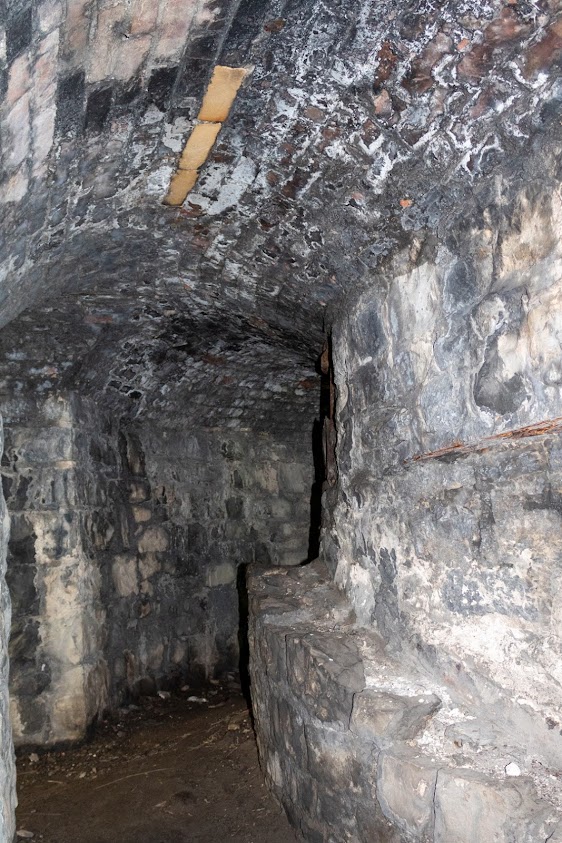
The interior of the kilns is lined with firebrick and iron doors. 
The carefully constructed stone-lined draught tunnels under the kilns can still be seen. 


Aberthaw Limeworks
Interior of kiln

Aberthaw Limeworks
Draft tunnel of kiln


Although this works closed in 1926 cement is still produced in this area about 1km north of the site, at a factory founded in 1914. It receives limestone from an adjoining quarry.

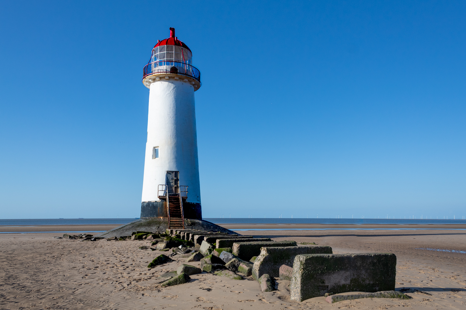
Constructed near the south Wales coast, and despite being surrounded by trees it is still quite a landmark that can be seen from the coast if one walks along the Wales coastal path.

Its location is just east of the now decommissioned Aberthaw power station, whose tall chimney in the distance can still be seen dwarfing the lime works chimney.


Looking out to sea further the cold water inlet from the power station, which looks like something from a Star Wars movie, can be seen just off the coast close by.


Footer:Visit Information: -

Google Reference: -
51.38587662515887, -3.383564003219934


What Three Words reference: -
///faced.denser.booms

OS Details: -
ST 03813 66115 Altitude:38 ft

Additional information.

Visiting is very easy but parking close is not.

The best place for this is to park in the Fontygary holiday park car park (51.38526429361768, -3.365962684286137) This park is open to visitors daily throughout the summer. It also has good facilities including a good restaurant and cafe.
From the car park you can walk down to the beach and then head west along the coast until you see the works and then join the coastal path. This would be a reasonably easy 1.6 km. WARNING: This path way is on the beach so watch for the tide times.

Alternatively go north from the car park to the top road of the park and head west. You then leave the park onto a path and then this leads down to the beach, this can by quite a climb however there are quite steep steps down to the beach but if you are mobile you can achieve this. Follow the coastal path then from the beach. This path is only on the beach for a short distance so the tides do not matter. This is slightly shorter at 1.3 km

On both these walks you will leave the beach at (51.385594477460046, -3.3807672028986824) and cross the concrete wall via the gate.


A full list of blogs can be found at my website


Read More

St. Dogmaels Abby and St Thomas' Church.


Founded in 1120 on the site of an earlier pre-Norman church, St. Dogmael’s status as a religious centre can be seen in extensive ruins which span four centuries of monastic life. Elements of the church and cloister are 12th century in origin, while the tall west and north walls of the nave are 13th century.


Visit Date September 2023


St Dogmaels Abbey - Infirmary


St Dogmaels story starts long before the abbey was built.

The Abbey was constructed and inhabited by The Monks of Tiron.


St Dogmaels Abbey - Infirmary


The Tironensian Order or the Order of Tiron was a medieval monastic order named after the location of the mother abbey (Tiron Abbey, French: Abbaye de la Sainte-Trinité de Tiron, established in 1109)


St Dogmaels Abbey - Infirmary


The foundation of Tiron Abbey by Bernard of Abbeville was part of wider movements of monastic reform in Europe in the eleventh and twelfth centuries. Bernard intended to restore the asceticism and strict observance of the Rule of St. Benedict in monastic life, insisting on manual labour.


St Dogmaels Abbey - The Nave & West Wing


Tiron was the first of the new religious orders to spread internationally. Within less than five years of its creation, the Order of Tiron owned 117 priories and abbeys in France, Britain and Ireland.


St Dogmaels Abbey - The Nave & West Wing


Tiron's influence in Britain was limited. St Dogmaels was the only Tironian abbey to be established in Wales or England, although the house also had daughter priories in Wales and Ireland. A few Tironian abbeys were established in Scotland, but they soon formed their own independent order.


St Dogmaels Abbey - The infirmary


And so in in 1120 on the site of an earlier pre-Norman church, St Dogmael’s status as a religious centre was created.


The Chancel with a Crypt


The monastic vows laid great stress on poverty, chastity and obedience, and these ideals were characteristic of the monastic life, especially in the early years. The abbey would have taken in any pilgrims and travelers requiring hospitality.


St Dogmaels Abbey - The Refectory with the Cloister and Nave in the background
The Refectory with the Cloister and Nave in the background


Not all aspects of the monastic life at St Dogmaels continued to flourish, and in later centuries the abbey suffered from a decline in standards as well as in its financial position. In 1402, for instance, at the time of the visitation by the bishop of St David’s, it appears that only 4 monks were left in the abbey and they were of disrepute, it having been noted, "They were gluttonous and one of them named as Howel Lange had been found drunk and because of this and his "evil deeds" he was banned from drinking any alcohol for a year".


St Dogmaels Abbey -The Refectory
The Refectory


After this visit for some time, the abbey saw an improvement in its monastic life but despite this, St. Dogmaels was never raised to the levels seen years before and its life as a monastery was declining again and was ended during the reign of King Henry VIII when in 1536 it took its place with many other places with an income of less than £200 a year.


St Dogmaels Abbey - The North Transept
The North Transept


The assessed annual value of the monastery at the dissolution was £87 8s.6d


St Dogmaels Abbey - The North Transept


Much of the abbey's possessions, including Caldey and Fishguard were leased to John Bradshaw of Presteigne, in Radnorshire. A few years later, in 1543, Bradshaw was able to purchase the properties which he already had on lease. He built a mansion for himself, almost certainly within the abbey grounds, and possibly took stone from the abbey buildings for its construction. It is thought that none of the remains of these buildings can be seen today.


St Dogmaels Abbey - The North Transept


It was reported that by the start of the 17th century, the site was in a ruinous state.

In 1646 the site was bought by David Parry of Neuadd-Trefawr, near Cardigan but he never lived there.


St Dogmaels Abbey - The North Transept, Nave and Guest House
The North Transept, Nave and Guest House


Early in the eighteenth century, a new parish church was erected alongside the old abbey church. A century later, in 1847, this was replaced by St Thomas' Church which now stands on the site.


St. Thomas' Church
St. Thomas' Church


The original plans were made in 1847 for a church to cost £600, but the final cost was £1,500. A tower was proposed but funds were insufficient. Daniel Evans of Cardigan superintended the building, and John Davies and John Thomas of Llechryd were the contractors.


St. Thomas' Church
St. Thomas' Church

St. Thomas' Church
St. Thomas' Church

St. Thomas' Church
St. Thomas' Church


1866, a vicarage and its coach house were added with materials from the old abbey buildings.


St. Thomas' Church
St. Thomas' Church


In 1934 the remains of the abbey were placed in State guardianship by the Representative Body of the Church in Wales. The site was cleared and the masonry consolidated between 1947 and 1968 and the ruins are now maintained by Cadw: Welsh Historic Monuments.


St Dogmael
St Dogmael


Finally, Saint Dogmael was a 6th-century Welsh monk and preacher who is considered a saint. His feast day is 14 June.
Saint Dogmael seems to have concentrated his preaching in Pembrokeshire, where there are several churches dedicated to him.


Footer:Visit Information: -

Google Reference: -
52.080568145326666, -4.680455205913844

Google search term:
St Dogmaels Abbey

What Three Words reference: -
///rescuer.conspire.same

OS Details: -
SN 16401 45858 Altitude:62 ft

Additional information.

Visiting is very easy.
A487 and then B4546 to the Abbey
There is limited parking at the site. (
52.08084819413824, -4.679396371342211) and this is not always available especially on Tuesdays when it is the venue for the local market. but a better bet is at the town parking (52.08178485298606, -4.677090769613847) and it is just a short  200 m walk to the Abbey.
There is a great cafe and also museum an the site.


A full list of blogs can be found at my website


Read More

Search This Blog

About Me

Bridgend, United Kingdom
A renewed interest in photography and local history.

Contact Me

Name

Email *

Message *

Followers