With a renewed enthusiasm for photography and local history, I set out this blog as a record of my experiences with images and narratives. It is my hope that you find something of interest on this site. Please feel free to contact me for more information on any of the posts. You can see a comprehensive list of my blogs at my website :- http://www.davidnurse.co.uk

Monknash Rocket House

Visit Date: April 2022.


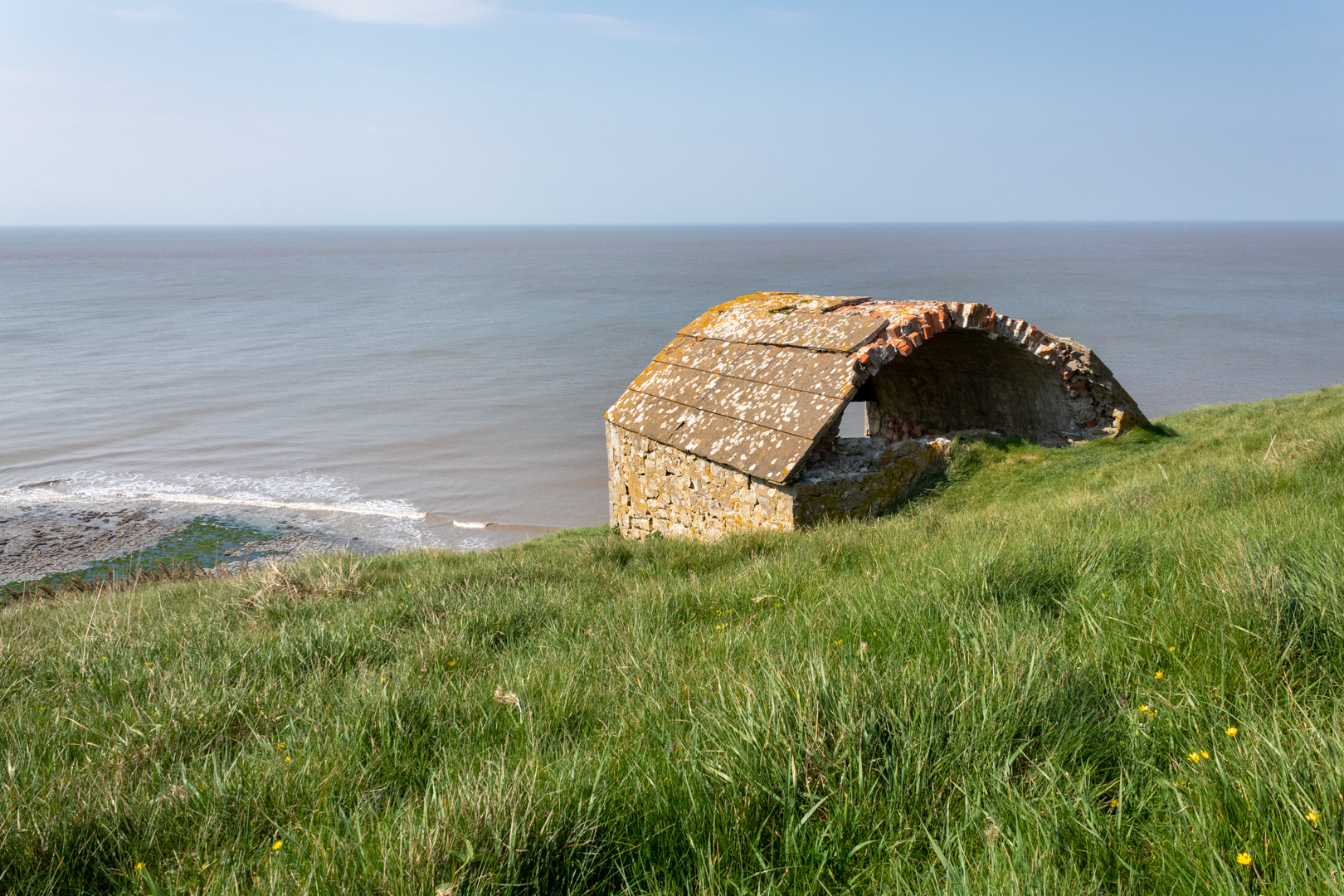
Monknash Rocket House


For today's blog, I am visiting another South Wales coastal bay at Monknash in the Vale of Glamorgan.


Monknash bay or beach is at the coastal end of a small valley called Cwm Nash.


Monknash Rocket House


The reason I have visited here this time is not for the breathtaking coast and cliff but for this small building high on the cliffs.

This is a Coastguard Rocket Station.


Monknash Rocket House


This is an early example of this type of building specifically built to house life-saving apparatus used when conditions prevented the lifeboat from deploying.


View from Monknash Rocket House


These locations would have had rocket apparatus which could fire a rope out from the land to any ship that ran aground on the rocks. The rope would allow the ship's crew to pull in the attached breeches buoy. The breeches buoy was a pulley system that could winch a sling out to the ship and then winch it back with a person in the sling.


View from Monknash Rocket House


Rocket Houses became a vital part of seafaring rescues and his one dates from the late 1870s and is on an OS map dated 1877. This would seem to be correct as many of these Rocket Houses" were built along the coast at this time.


OS benchmark


On the front wall of the rocket house, I found this mark.

Someone I met at the site thought it might be a mark to state that the building was owned or looked after by the government or forces however, I believe it is an ordinance survey benchmark.

***(From Wikipeadia)

The term benchmark, bench mark, or survey benchmark originates from the chiselled horizontal marks that surveyors made in stone structures, into which an angle-iron could be placed to form a "bench" for a leveling rod, thus ensuring that a levelling rod could be accurately repositioned in the same place in the future. These marks were usually indicated with a chiselled arrow below the horizontal line.

The term is generally applied to any item used to mark a point as an elevation reference. ***.

.


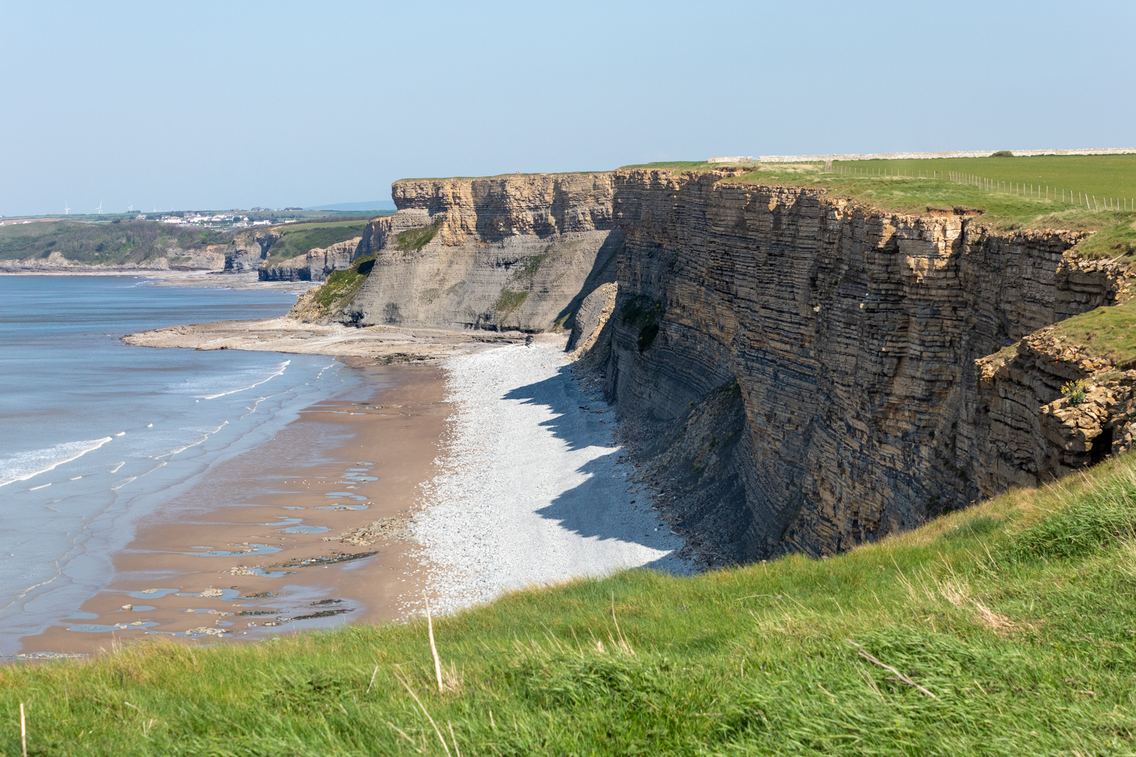
Monknash


As you can see this is a beautiful part of the coast here which gets battered frequently by the sea.
There have been many wrecks on this part of the coast one of which I have mentioned in an earlier
blog regarding the wreck of the The Wreck of the Altmark


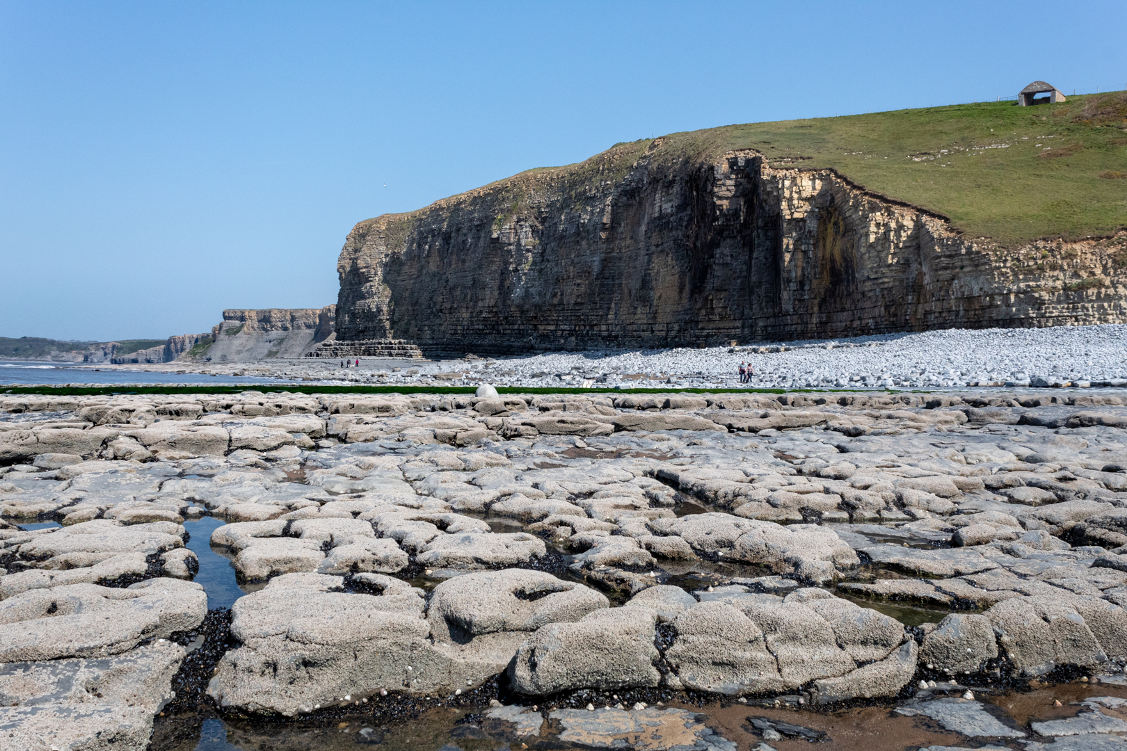
Monknash


A little while ago some human bones (at least six) were found protruding from the rock face here and it is thought that they are either an early unofficial burial ground or this may have been a burial of some sailors whose vessel was wrecked here.


Monknash


The remains of people recovered from the site previously have been found to date from the 16th Century.

The earliest burial licence in the parish of Monknash - the area where the remains have been found - was granted in 1609.

And previous radiocarbon dating of remains found at the site showed they were from the late 16th Century or the early 17th Century, according to details published by Cardiff University.


- - - - - - - - - - - - - - - - - - - - - - - - - - - -


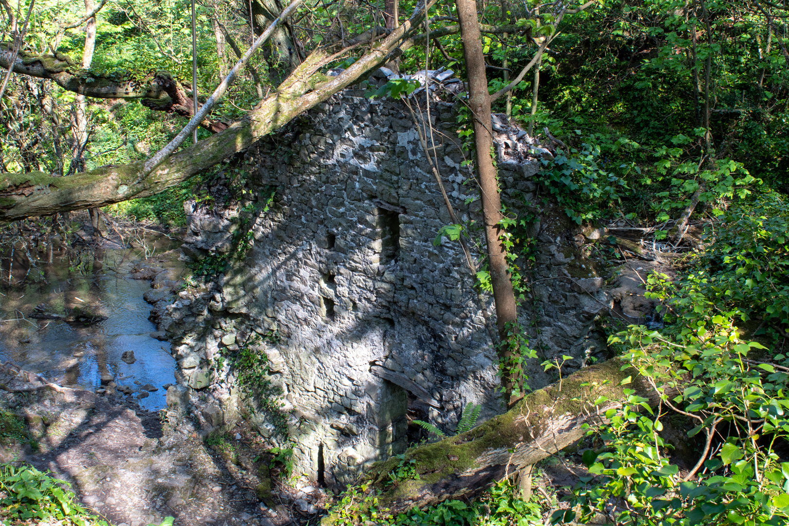
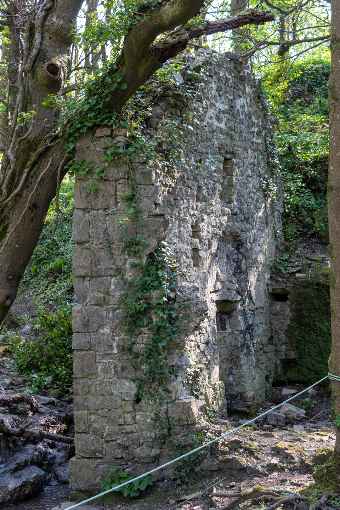
There is one other ruin of interest in Cwm Nash. As you walk up the footpath you come to this old ruin.

It is the ruin of an old corn mill that would have been powered by the river.


Monknash Corn Mill


The northerly gable wall, against which was the waterwheel, stands to its full height, but the other walls are ruined more or less to ground level. The leat is visible and terminates at the mill at eaves level; the stone base of the wheelpit is clear and its floor is just above the stream level, both features together suggesting an overshot wheel about 3.6-4.2m (12-14 feet) in diameter by about a metre (just over three feet) wide.


Monknash Corn Mill


The Mill also appears on the old Ordinance survey map of 1877.


Monknash Corn Mill


Footer:
Visit Information:-
Google Reference
51.41942070629259, -3.576461563665641

What Three Words reference:-
///adjust.gagging.inventors

Additional information.
Visiting is relatively easy and is a good walk from the car park (51.41891777077914, -3.5647860982640633) which is a farm field and there is an honesty box for payment on the entry post to the carpark (£3 currently).
 You can then follow the path, some tarmacked, and some over cobbles. This will take you past the corn mill down to the beach (20 minutes or so). I think the corn mill is wrongly positioned on google maps I think it is nearer (51.42097552443006, -3.570768612493772) or  (///farmland.exhale.different) but you can't miss it on the way to the beach.

The Station as you can see is up on the cliff and part of the official Wales coastal path but it does take some climbing.


Thank you for visiting this blog.
If you would like more information on this location please feel free to contact me.


Read More

The Monks Bath (Ffynnon Gyffyr)

 Visit Date September 2020. 


The Monks Bath


Todays post it the final part of three linked posts from the area of Margam is South Wales.
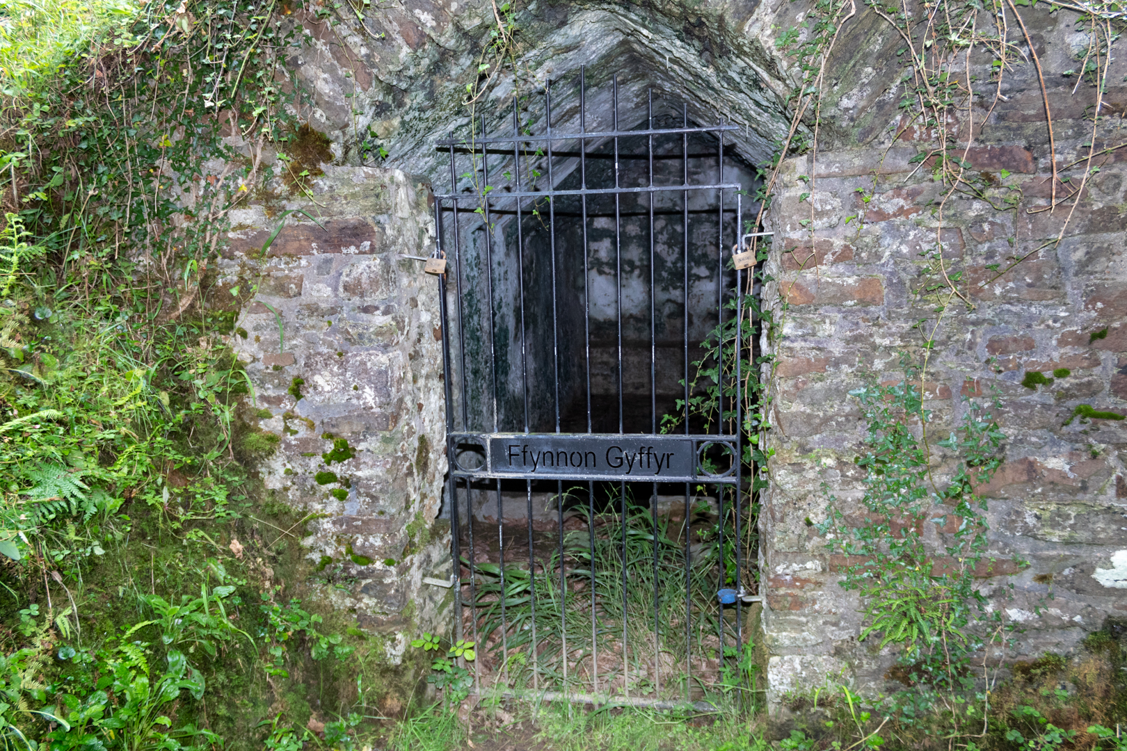
Known locally as "The Monks Bath" this ancient building has the name Ffynnon Gyffyr which seems a little vague. It is also known as the Spring well or the Medicinal Well.


The Monks Bath


The date of construction is thought to stretch back to the 12 or 13th century.
It is very close to the Abbey of Margam, dedicated to St Mary the Virgin, at Margam which was founded in 1147.


The structure is where the monks of the abbey bathed.


The interior contains an L-shaped pool, about 1m deep with well-built stone walls. Although the pool is fed by a water inlet at the Northern end, it is evident that water enters the pool at a lower level through the stonework.


The building is now Listed grade II as an unusual and complete survival of a medieval baptistry and holy well.


It is on the pathway from Margam country park to Capel Mair ar y Bryn ('The chapel of St Mary on the hill') a small ruined chapel overlooking the borough and the beautiful Margam Country Park. 


A view of Margam Abbey


Footer:
Visit Information:-
Google Reference
51.568208528035434, -3.7281904102333994

What Three Words reference:-
///televise.curve.admires

Additional information.
Visiting is relatively easy but is mostly uphill. I visited by parking close by and there is a car park near the start of the walk (51.56361379905241, -3.7338320577891753) and there is also roadside parking. Go get to the car park you leave the M4 at junction 38 head for Margam Park but turn in at the sign which reads "Margam Abby". Once parked walk up the hill on the road until you see a small marker and a steel barrier on the left hand side. Carry of for a 100 yards and you will see the path on the right hand side . It is a very short distance on from here. 

Two blogs in this area:-
Margam Radar Station and Capel Mair ar y Bryn


Read More

Capel Mair ar y Bryn

 Visit Date: September and November 2020 . 


Capel Mair ar y Bryn


Capel Mair ar y Bryn (The chapel of St Mary on the hill) has been known by many other names over the years such as the Cryke Chaple, Hen Egwlys and just plain Capel Mair, the place of worship, established circa 1470 was built by the monks of Margam and dedicated to St Mary, for the benefit of local peasants who did not have the right to worship in Margam Abbey.


Capel Mair ar y Bryn


In the later Middle Ages there was a famous statue of the Virgin Mary here and pilgrims came to see it.


Capel Mair ar y Bryn . West and North Walls


After the Reformation, the chapel was used by local Catholics, who worshipped here in secret.


View through the west gate/window to the larger East Window


The chapel is on a stone ridge and is a circular enclosure, suggesting that it may have been built on the site of an older church.


Capel Mair ar y Bryn


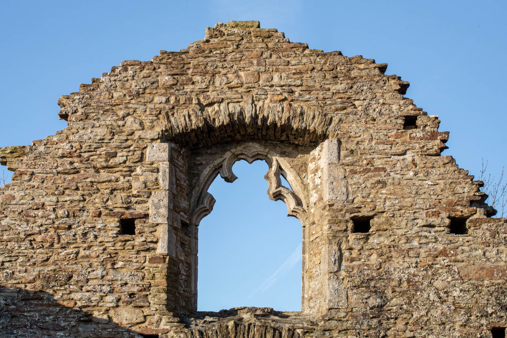
The west side of the chapel has a door with a window above. There has been some discussion about this window as it's style does not fit in with the rest of the chapel and it is thought to be earlier.

One explanation for this is that the window was brought here from the Abbey to be added when the chapel was built.


Capel Mair ar y Bryn


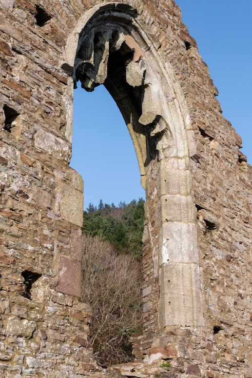
The east window seen here, however, is very much of the style of the time and in undoubtedly original and in keeping with the time.


The East Window, Capel Mair ar y Bryn


The Large East window must have been very impressive for the time.


The North Wall, Capel Mair ar y Bryn


The north wall has not survived well and there is little in the way of detail.


The South Wall, Capel Mair ar y Bryn


The south wall has windows but some may have been added at a later date.


Capel Mair ar y Bryn


The chapel stands on an imposing knoll and can be seen from the road and also Margam Country Park.


Footer:
Visit Information:-
Google Reference
51.56480536863176, -3.730925337099626


What Three Words reference:-
///florists.treatable.exits


Additional information.
Visiting is relatively easy but is mostly uphill. I visited by parking close by and there is a car park near the start of the walk (51.56361379905241, -3.7338320577891753) and there is also roadside parking. Go get to the car park you leave the M4 at junction 38 head for Margam Park but turn in at the sign which reads "Margam Abby". Once parked you can walk up the pathed steps up but this is very steep. A easier way is to walk up the hill on the road until you see a small marker and a steel barrier on the left hand side. Go through the barrier and you will come to the chapel.


I have made a short "video walk" of my visit here that can be found here:-


Read More

Margam Radar Station.

 Visit Date 04-2022. .

Margam Radar Station


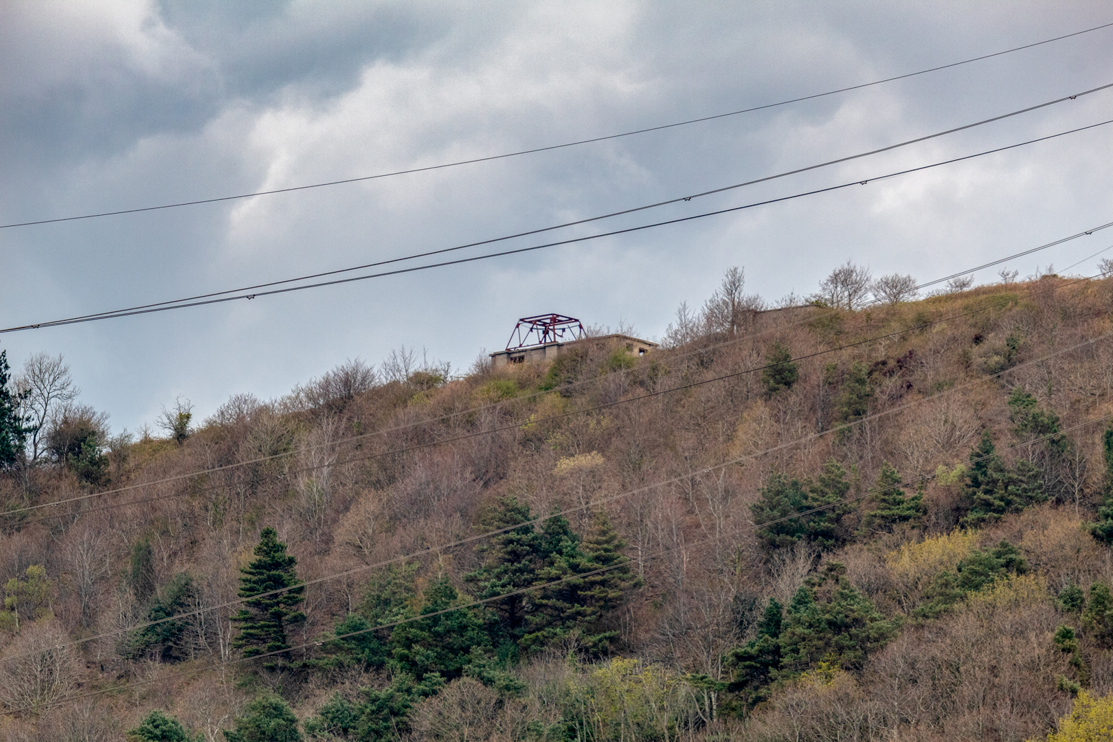
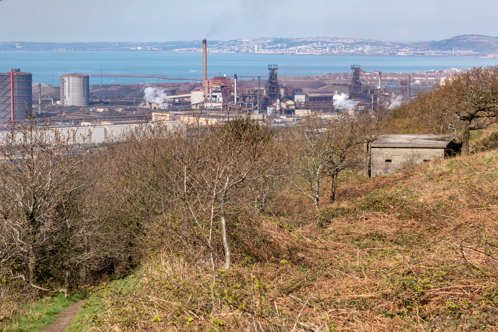
Overlooking the Bristol Channel from high above Port Talbot, I visited the remains of the Margam Radar Station.


Margam Radar Station.


The station is a Chain Home Low Radar Station. The original Chain Home Radar system was developed to detect enemy aircraft, but whilst it was extremely effective at identifying aeroplanes at a distance and flying at high altitudes, it could not see them when they flew low.


Margam Radar Station.


The  Chain Home Low could reliably detect aircraft flying as low as 500 feet (150 m).
It's design also allows the coast to be guarded against enemy surface craft and submarines in the Bristol Channel, 


Margam Radar Station.


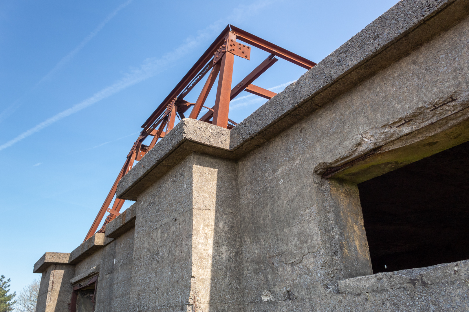
This station consists of three squarish concrete buildings with flat roofs.

This building retains the framework of a steel gantry, the base for a rectangular radar transmitter/receiver array, known as a 'bedstead array' from its wires and framework.


Margam Radar Station.


Next to it stands the generator house that supplied the necessary power.

There is a third building that is thought to be a back generator.


Margam Radar Station.


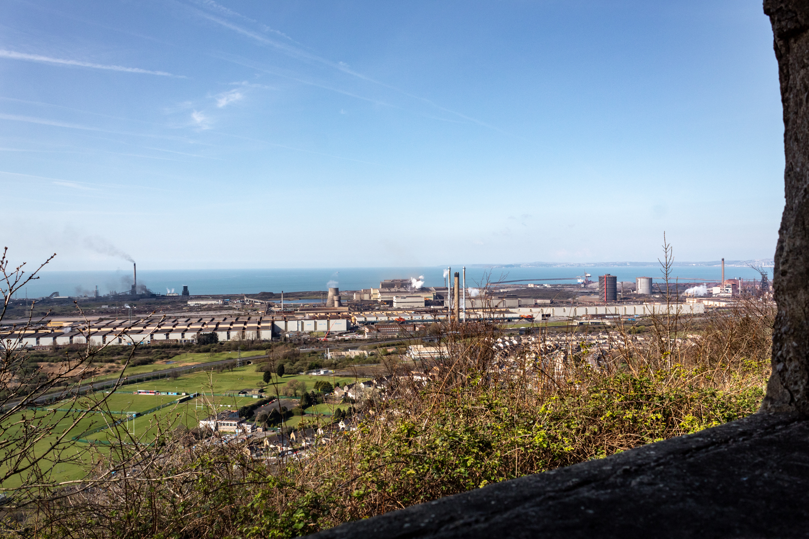
Situated high on the hill over Margam, Port Talbot and most importantly the Bristol Channel it had great views of the coast.


Margam Radar Station.


It now overlooks the mighty Port Talbot Steel Works. The works covers a large area of land which dominates the south of the town. Its two blast furnaces and steel production plant buildings are major landmarks visible from both the M4 motorway and the South Wales Main Line when passing through the town.


Margam Radar Station.


This Radar Station is believed to be a unique survivor within the British Isles.


The Margam Radar Station.


Footer:
Visit Information:-
Google Reference
51.569833872704216, -3.742837925791009

What Three Words reference:-
///otherwise.paying.price

Additional information.
Visiting is relatively easy but is mostly uphill as the site is on the South Wales Coastal Walk. I visited by parking close by and there is a car park near the start of the walk (51.56361379905241, -3.7338320577891753) and there is also roadside parking. You leave the M4 at junction 38 head for Margam Park but turn in at the sign which reads "Margam Abby" Walk up the hill on the road until you see the path marked "COLD CADW WOODLAND" then follow this path up to the station. The walk is almost all uphill but the paths are quite good.

Additional Information.
On the road part of the walk you will pass both "The Monks Bath" and "
 Capel Mair as y Bryn" both of which have been also blogged.


Read More

A Short Visit to Laugharne

 Visit Date: March 2022. . 

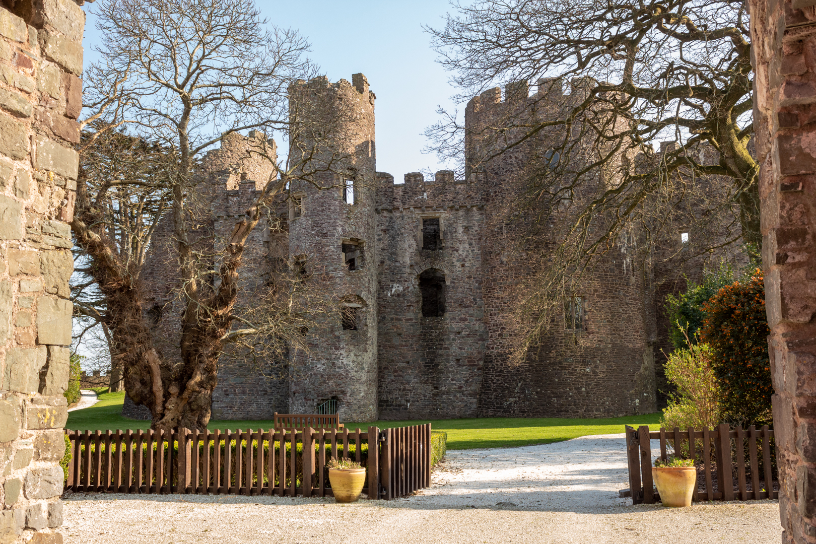
Laugharne Castle


For today's post, I visit the small beautiful coastal village of Laugharne.

The castle, located on the estuary of the River Tâf, was originally established in 1116.


The Estuary at Laugharne.


The River Tâf (Welsh: Afon Tâf) rises in the Preseli Hills, Pembrokeshire, and continues through Carmarthenshire to Laugharne. It is one of the three rivers to enter the sea on the east side of Carmarthen Bay. The other two are the River Gwendraeth and River Tywi,


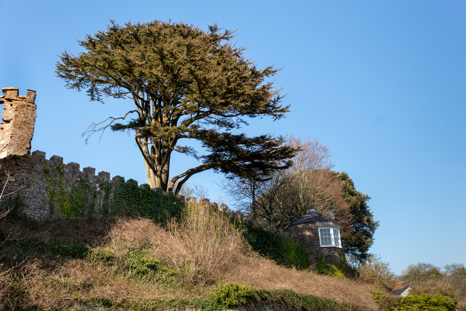
Laugharne


The original castle was established in 1116 as the castle of Robert Courtemain, who is recorded to have entrusted its care to the Welshman Bleddyn ap Cedifor. (The use of "ap" in a name means the son of i.e. Bleddyn son of Cedifor)


Laugharne Castle


The castle burnt down in the late 1190's or early 1200's

It was rebuilt by the Normans, and in 1215 was captured by Llywelyn the Great in his campaign across South Wales.


Laugharne Castle


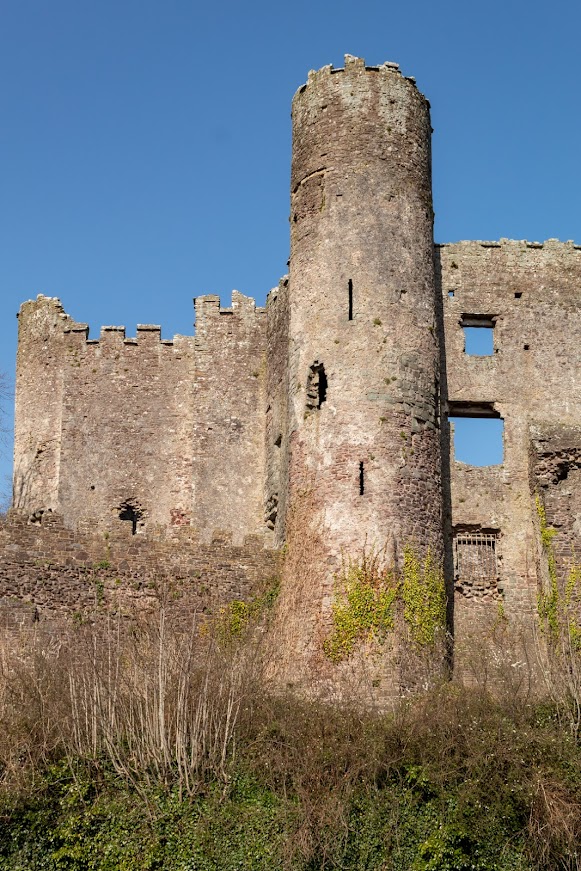
The two robust round towers date from the rebuilding work done in the late thirteenth century.


Laugharne Castle


In 1584, Queen Elizabeth granted Laugharne to Sir John Perrott (rumoured to have been an illegitimate son of Henry VIII) who was responsible for converting the castle from a fortification into a Tudor mansion.


Laugharne Castle


In about 1730 the new Castle House was built close by, the castle itself being left as a romantic ruin.

Although the castle at Laugharne is the largest monument in the village it is not what Laugharne is most famous for that remains to be the Most Famous writer to come out of Wales Dylan Thomas.


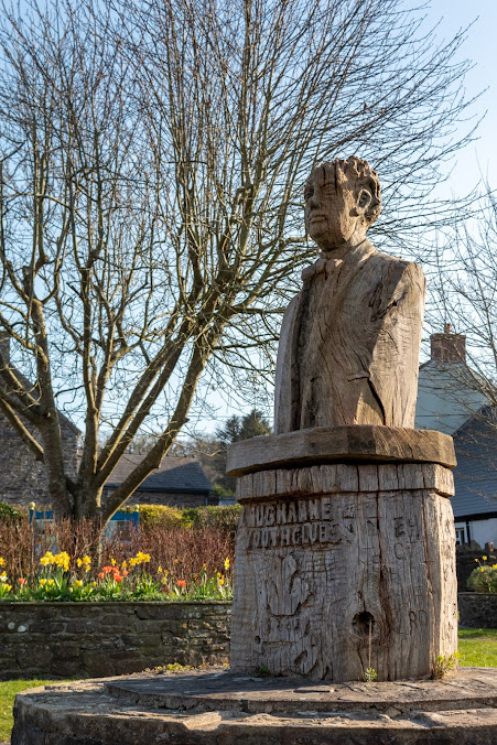
A Local Image of Dylan Thomas


Dylan Marlais Thomas born 27th October 1914 died 9th November 1953 was the most famous Welsh poet and writer whose works include the poems "Do not go gentle into that good night" and "And death shall have no dominion"; the "play for voices" Under Milk Wood.

He became widely popular in his lifetime and acquired a reputation, which he had encouraged, as a "roistering, drunken and doomed poet".

Many of his works appeared in print while he was still a teenager

Thomas met Caitlin Macnamara. They married in 1937 and had three children: Llewelyn, Aeronwy and Colm


The writing shed of Dylan Thomas.


In May 1949, Dylan and his family moved to his final home, the Boat House at Laugharne, purchased for him at a cost of £2,500 in April 1949 by Margaret Taylor. Thomas acquired a garage a hundred yards from the house on a cliff ledge which he turned into his writing shed, and where he wrote several of his most acclaimed poems.

Dylan went to the United States in the 1950s. His readings there brought him a degree of fame, but his erratic behaviour and drinking worsened. He took the trip to America on a few occasions hoping that it would ease his health problems.


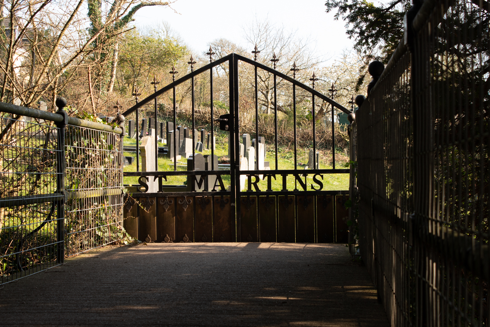
St Martins, Laugharne


During his fourth trip to New York in 1953, Dylan became gravely ill and fell into a coma. He died on 9 November 1953 and his body was returned to Wales.
On 25 November 1953, he was interred at St Martin's churchyard in Laugharne, Carmarthenshire.


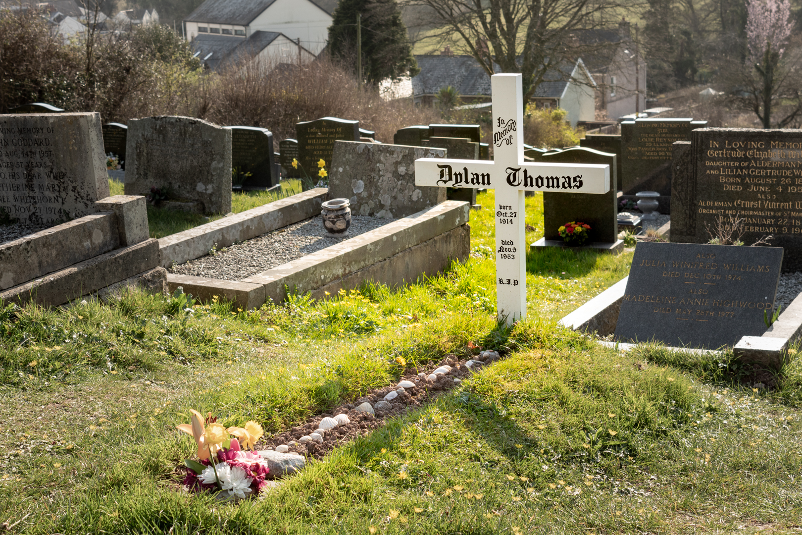
The Grave of Dylan and Caitlin Thomas in Laugharne

The Grave of Dylan and Caitlin Thomas in Laugharne


Thomas's widow, Caitlin, died in 1994 and was buried alongside him and the small white understated cross sees Dylan on one side and Caitlin on the other.

This is only a brief synopsis of Dylan Thomas' life which can be found well documented.


Postscript


Whilst at St Martin's I wandered around the churchyard and this monument reminded me of something well known here in Wales.
Here we see the grave of William Emrys Hughes. As we can see he was known as Emrys the Post. It is common for people to have this type of nickname a part of which is often their profession. So Mr. Hughes was the local postman or perhaps postmaster.


This reminded me of a man who looked after the ponies or horses that had been used in a local coal mine in the valley where I grew up. His name was David Thomas.


In Wales, I should mention David is also a very common name, indeed it is the name of our Patron Saint, but it is often shortened to Dai.
In my local village was one such Dai who illustrates the nicknaming perfectly.
For the first few years, I only knew Mr David Thomas as "Dai Horse" and everyone knew him as "Dai Horse".
A few years later Mr Thomas started to look after the deliveries of the local Evening newspaper (The South Wales Echo). The papers would come from Cardiff (about 25 miles away) by train to Bridgend and then by bus up to the valleys. The conductor of the bus would then throw the papers from the bus at the main bus stop in the village where "Dai" would be waiting. He would then distribute the "Echo's" to houses or local shops where we paperboys would take over and deliver them to the houses.
Of course, this meant that "Dai Horse" soon became known as "Dai Echo".


Footer:
Visit Information:-
Google Reference
51.769533670673184, -4.4621345420282434

What Three Words reference:-
///rams.torch.yelled


Additional information.
Visiting this charming place is very easy. The M4 motorway west to the end then the A60 and finally the A4066 to the village.
There is a car park and the village is well equipped with public toilets, pubs, restaurants and shops.


Other locations:
Dylan Thomas writing shed (51.771868802662844, -4.457087760422741) is a short walk from the castle and also hiss home "The Boathouse" (51.7722589433432, -4.456168366948648) is just a little further on.


On arriving at the village you will pass St Martins church and graveyard (51.775386928948315, -4.463235618400214) it is a 20 minute walk from the carpark, however it also has a small car park of it's own.


Read More

Search This Blog

About Me

Bridgend, United Kingdom
A renewed interest in photography and local history.

Contact Me

Name

Email *

Message *

Followers