With a renewed enthusiasm for photography and local history, I set out this blog as a record of my experiences with images and narratives. It is my hope that you find something of interest on this site. Please feel free to contact me for more information on any of the posts. You can see a comprehensive list of my blogs at my website :- http://www.davidnurse.co.uk

WW2 Pillbox on Kenfig Sands


 Visit Date 05-2022: . 


WW2 Pillbox on Kenfig Sands


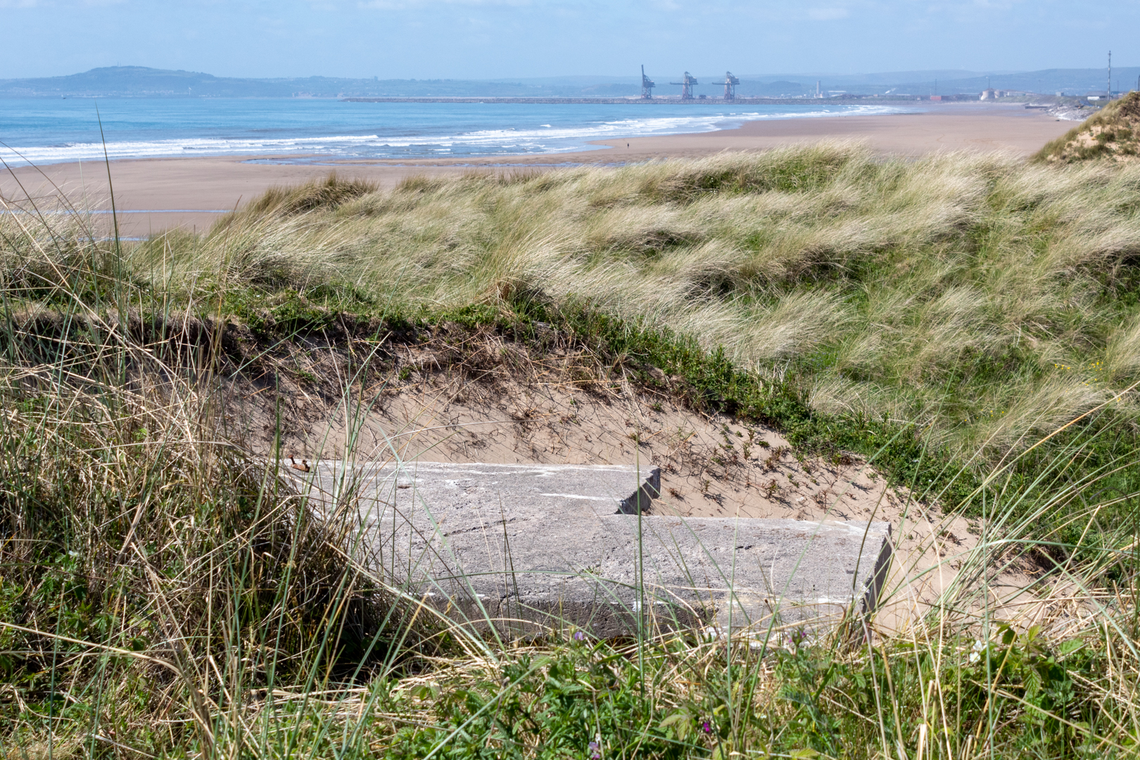
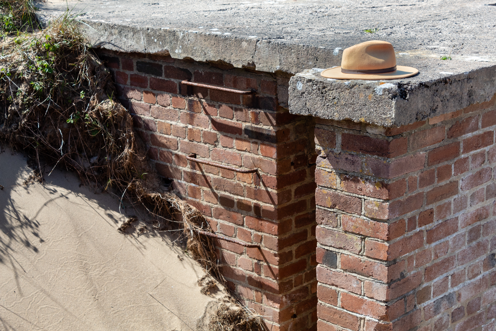
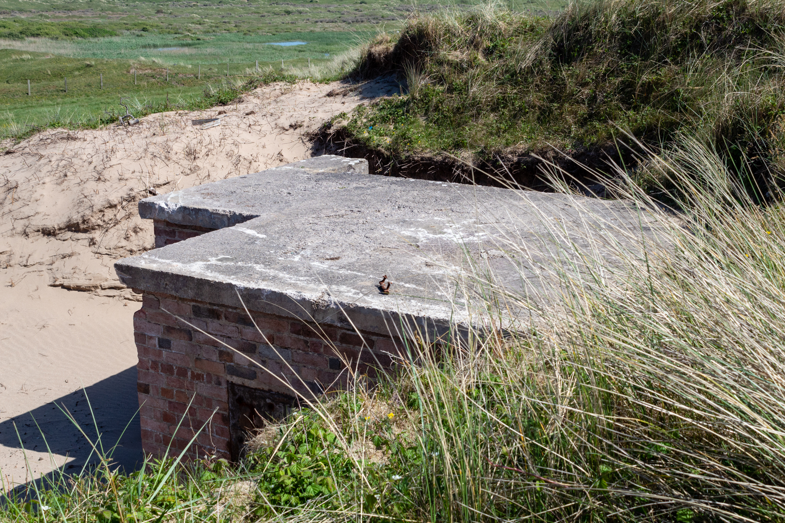
About 28,000 pillboxes and other hardened field fortifications were constructed in Britain in 1940 as part of the British anti-invasion preparations for World War II. About 6,500 of these structures still survive. Along the beach at Kenfig sands is the remains of one of these abandoned structures.


WW2 Pillbox on Kenfig Sands


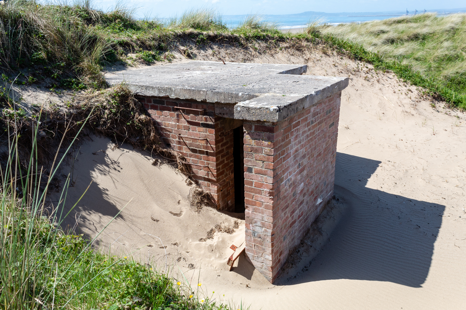
A pillbox is a type of brick, block, or concrete dug-in guard-post, normally equipped with slits of gaps through which defenders can fire weapons. It is in effect a trench firing step, hardened to protect against small-arms fire and grenades, and is usually raised to improve the field of fire.
The modern concrete pillbox originated on the Western Front in the German Army in 1916.


WW2 Pillbox on Kenfig Sands


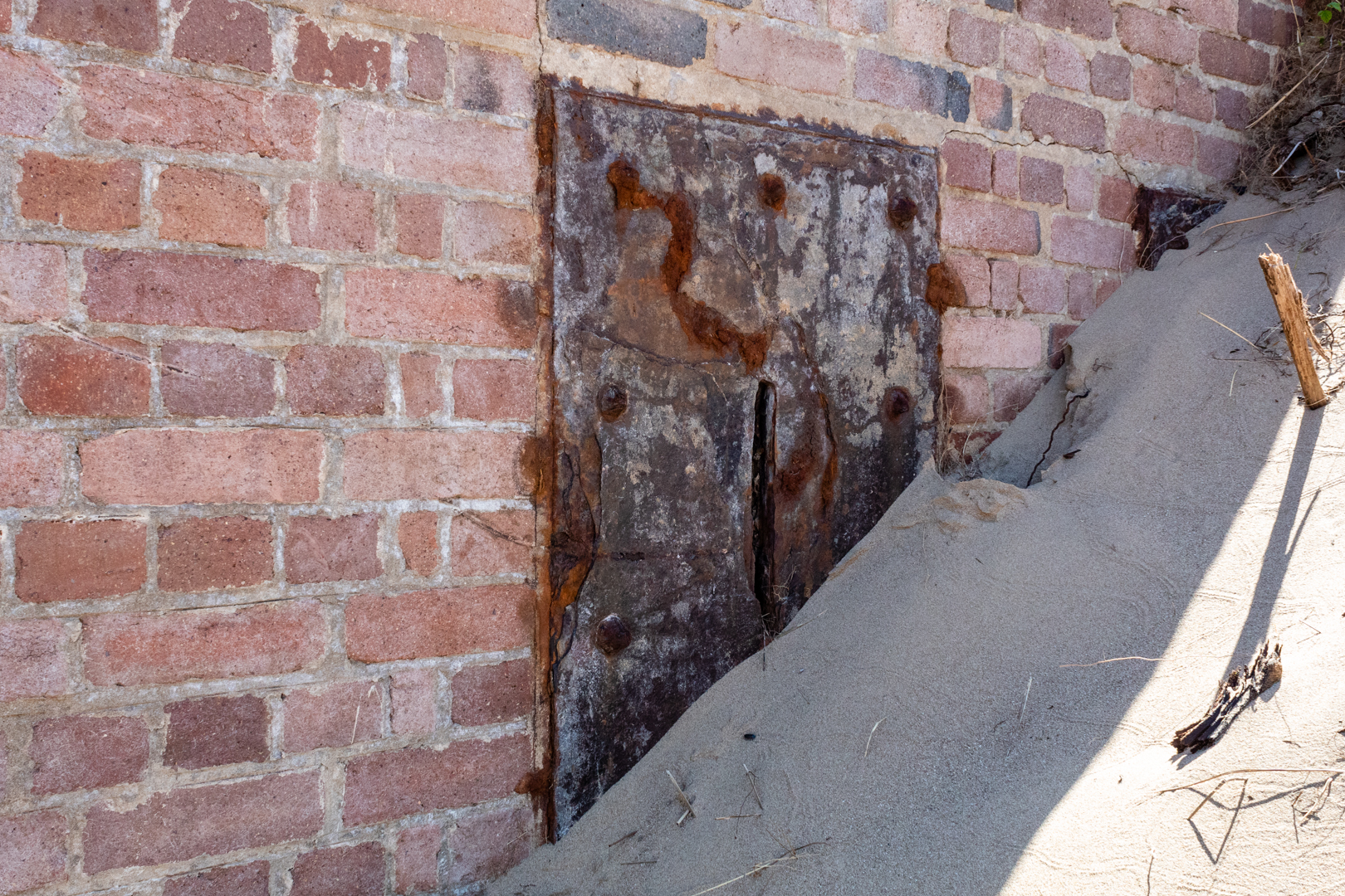
The pillbox on Kenfig sands is built of brick with a concrete roof and was buried in the sands here for many years but is now being exposed once again.
Kenfig is near the sea and has always been at the mercy of the drifting sand dunes in the area. Just a few miles down the coast from here a bronze age settlement grew over the years and a Norman castle was built on the site only for the village to be abandoned when the sand could no longer be held back. The keep of the castle is all that is left to be seen at the site.


A few years ago the UK "Time Team" made a TV episode of their archaeological dig on this area and the report is available and the programme is available for some countries.

https://www.channel4.com/programmes/time-team/articles/series-19/kenfig-dig-report/492

The position of this pillbox is not recorded as far as I can tell but I am now attempting to add it to Google maps.


WW2 Pillbox on Kenfig Sands


There are different thoughts on the origin of the name pillbox he most likely is that with their slots they resemble post pillar boxes, however, it is also thought that as many were round that they resembled actual medicine pill boxes.


WW2 Pillbox on Kenfig Sands


The positioning of this is only 2.5 miles (as the crow flies) away from the radar station above Port Talbot that I mentioned in an earlier blog that you can find here.


WW2 Pillbox on Kenfig Sands


Footer:
Visit Information:-
Google Reference
51.53316706915935, -3.760472908611369

What Three Words reference:-
///crackling.librarian.prospers

OS Grid Ref
SS 77989 83050

Additional information.
Visiting is not so easy as you will need to be able to walk some distance.

The easiest way would be to park in Kenfig Nature reserve (51.51591341284918, -3.7282361412960436) and then walk to the beach and then west on the beach ( 3miles)

Another route would be to park near Maudlam Church (51.52390184618248, -3.722235803836141) and walk across Kenfig Burrows (3.5 miles)

A third option might be to park around Kenfig industrial estate. (51.533298360212996, -3.737641631660293) A much shorter 1.3 miles. But a little more complicated route.


Thank you for visiting this blog.
If you would like more information on this location please feel free to contact me.

Read More

East Usk Lighthouse (and West)

 Visit Date- 04-2022:. 

East Usk Lighthouse


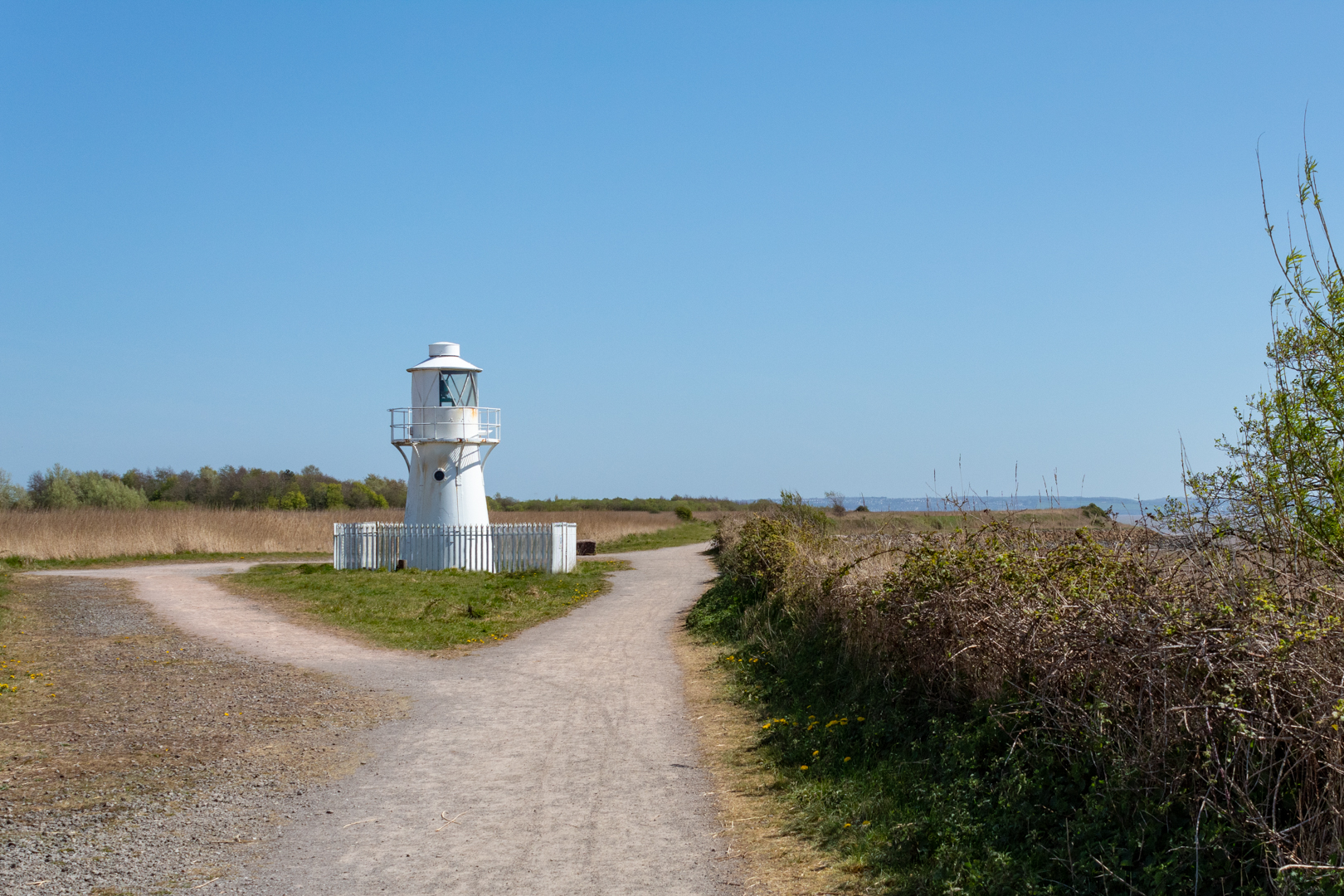
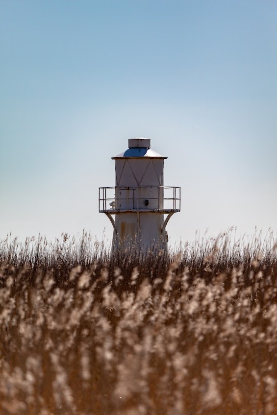
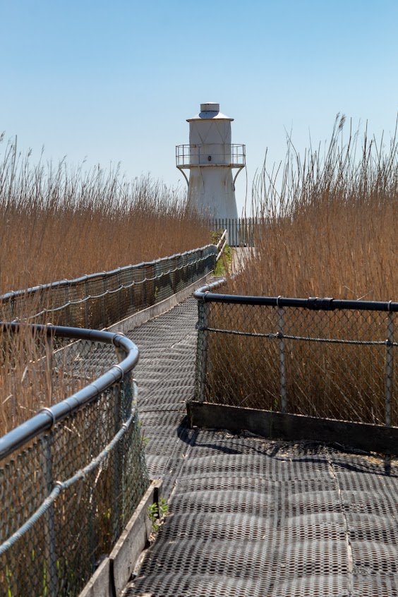
The East Usk Lighthouse was constructed in 1893 by Trinity House. it stands guard at the eastern entrance to the River Usk in the Severn Estuary at Newport in South Wales.
Historically, the tidal reaches of the Usk have been used as a major shipping port for much of the last millennium, mostly because of its wide and deep mouth, and good navigable access from the Severn Estuary and the Bristol Channel and thence access to home waters and further overseas.


East Usk Lighthouse


It exhibits the remaining operational light of the two lighthouses this one on the east bank and the other on the west bank of the river Usk.


East Usk Lighthouse


Originally built on legs, these were eventually covered as the level of the land increased due to the tipping of fly ash from the Uskmouth Power Station.


East Usk Lighthouse


The lighthouse Displays a Port Entry Light consisting of occulting Red, White and Green light sectors that guide shipping into the entrance of the Newport dredged channel.


East Usk Lighthouse


It was the first Trinity House lighthouse in the UK to use the Dalén Sun Valve, an ingenious device for turning an unwatched light on and off using daylight. Combined with the flashing apparatus, the sun valve saved 94% of the gas compared to having the light operating all the time.


East Usk Lighthouse


And across the river:-


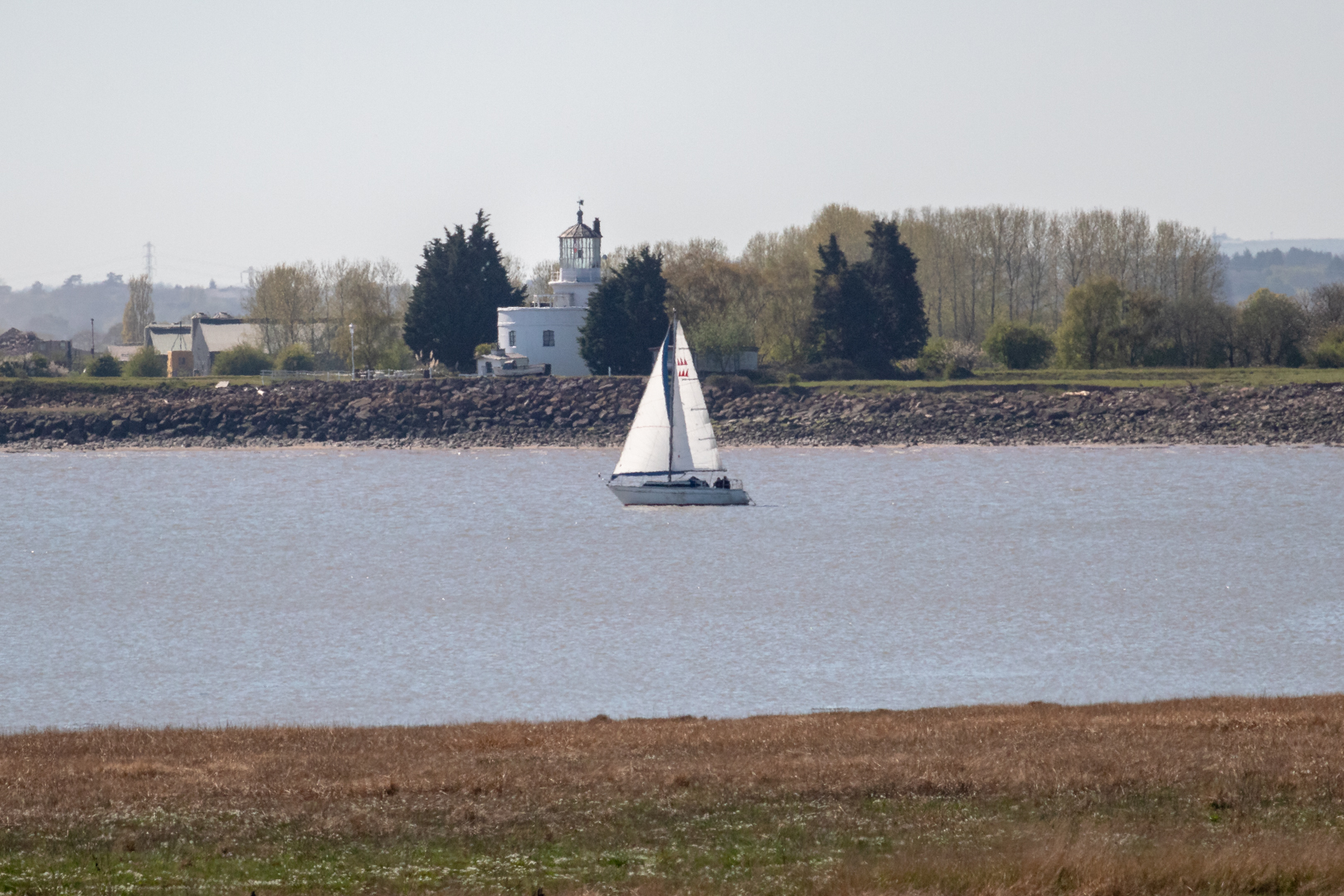
The West Usk Lighthouse, on the opposite side, was decommissioned in the 1920s.


West Usk Lighthouse


The lighthouse was the first to be built by renowned Scottish civil engineer James Walker in 1821. Amongst other projects, Walker went on to build another 21 lighthouses.


West Usk Lighthouse


The West Usk Lighthouse now is a cosy bed & breakfast and small wedding venue.


Footer:
Visit Information:-
Google Reference
51.54000309880295, -2.9669295034881444

What Three Words reference:-
///escaping.polishing.moves

OS Grid Ref
ST 33032 82787

Additional information.
Visiting is really easy as the lighthouse is in Newport Wetlands, a wildlife reserve covering parts of Uskmouth, Nash and Goldcliff, in the south-east of the city of Newport,

There is a car park .(51.546183353252786, -2.96084537665131).

The lighthouse is a 10 minute flat walk from the car park.


Thank you for visiting this blog.
If you would like more information on this location please feel free to contact me.


Read More

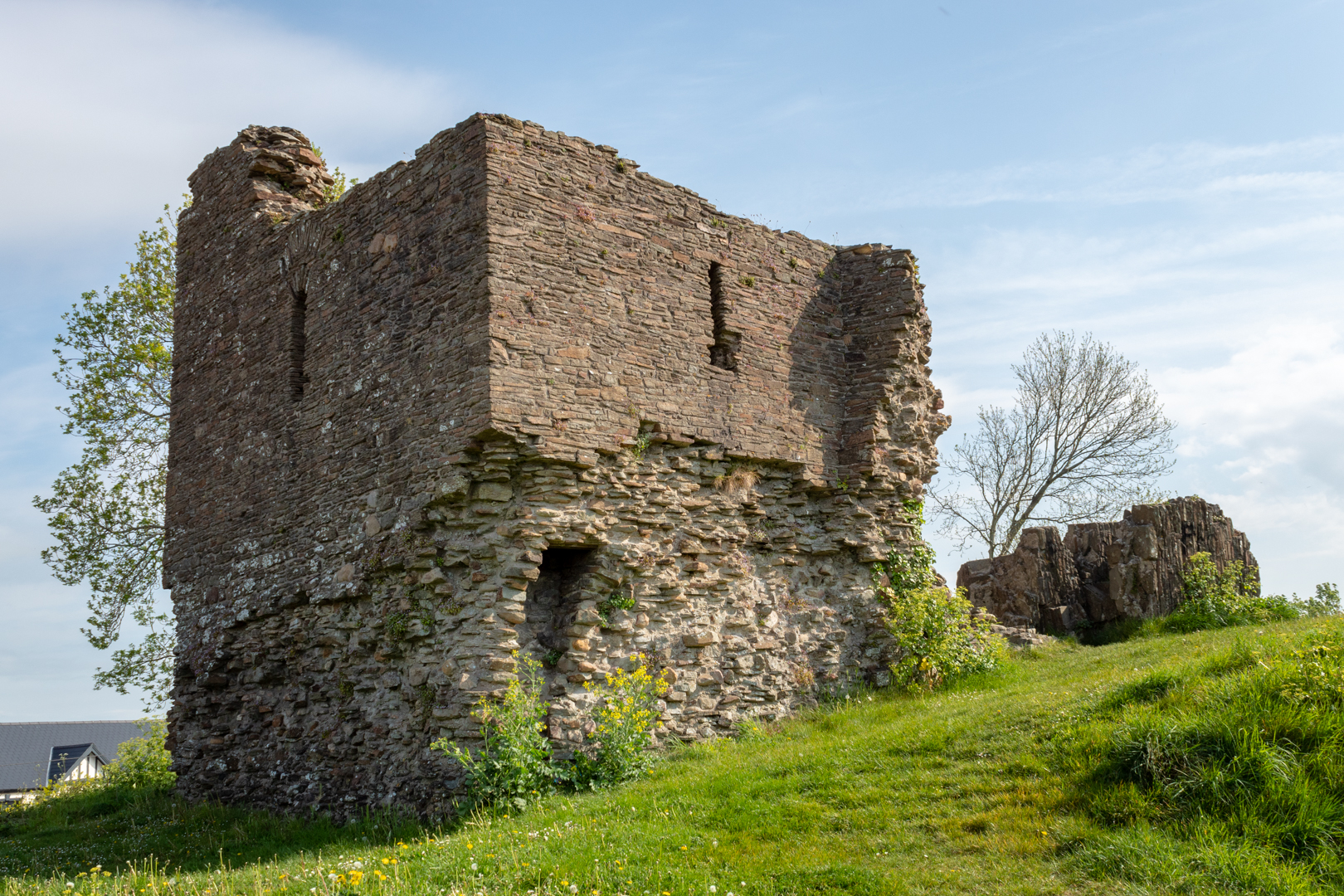
Loughor Castle.

 Visit Date May 2022..

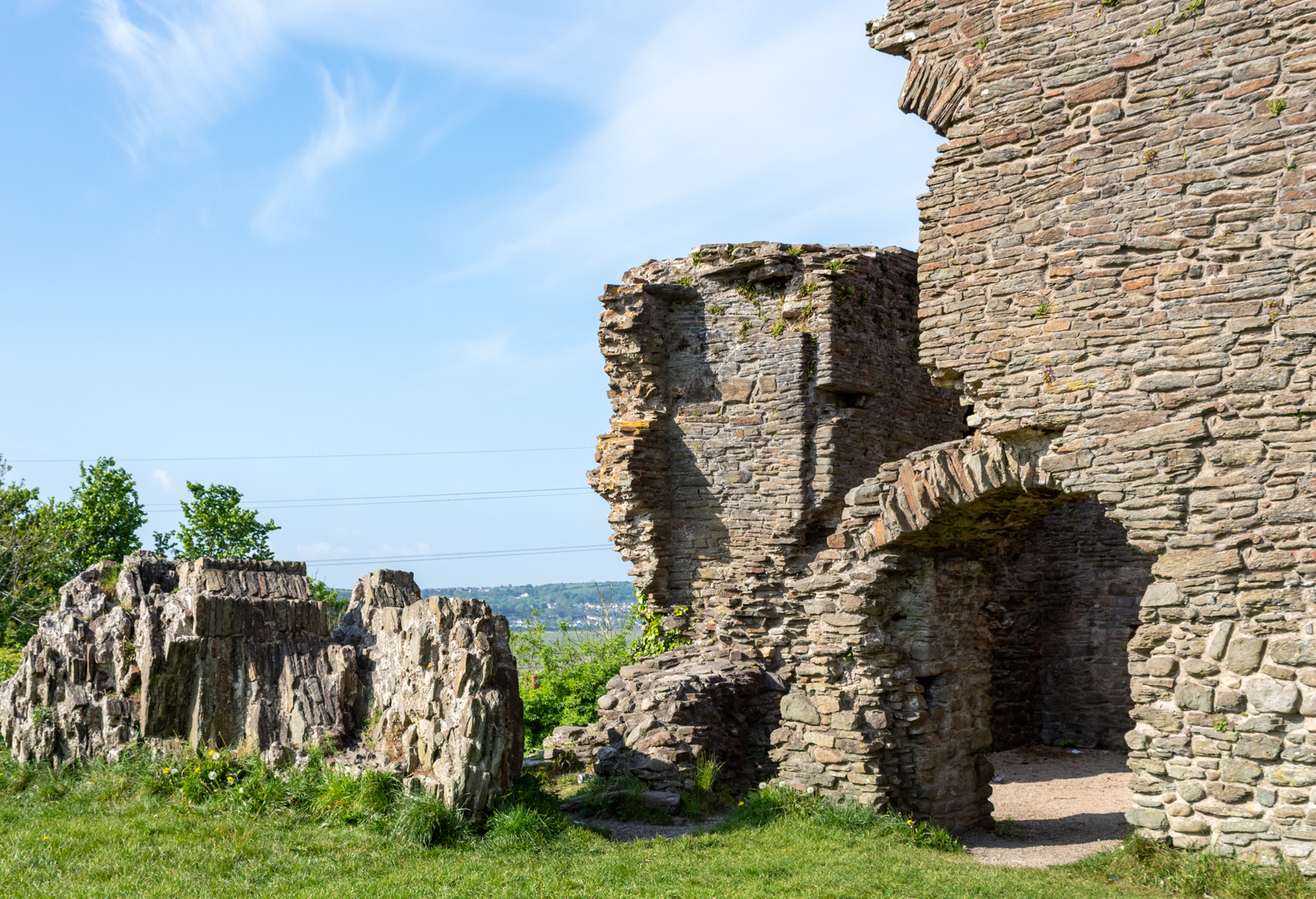
Lougher Castle  on the north of the gower coast


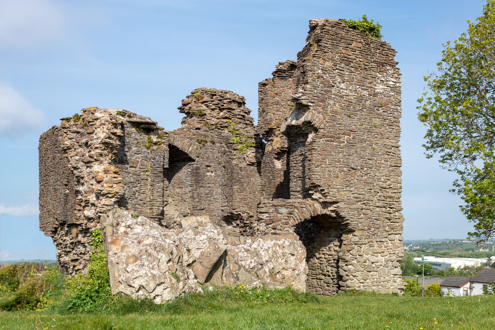
Loughor Castle is situated in a strategic location on the north of the Gower coast and the site has a long history.

Its history starts in around 75 AD when the Romans built a fort on the site then known as Leucarum, which took its name from the Celtic name for the River Loughor (in Welsh, Llwchwr; Leucara, in Latin).


Lougher Castle  on the north of the gower coast


It was used as a military fort intermittently until the 5th century when it was abandoned.

When the invasion of the Normans spread to Wales in the late 1060's they occupied the fort and as in many cases in Wales rebuilt their settlements on the older Roman sites.


Lougher Castle  on the north of the gower coast


Early in the 12th century, the Normans extended their control over southern Wales and the Earl of Warwick, Henry de Beaumont, became the area's overlord after he had been given the Gower Peninsula by Henry the first.

By 1116, an oval ringwork castle existed on top of the earlier fort.
At this time the castle and its defences would have been wooden structures.


Lougher Castle  on the north of the gower coast


In 1151, the Welsh attacked Loughor Castle and burned it. Curiously scorched Norman chess pieces, possibly dating to this event, have been unearthed at the site.


Lougher Castle  on the north of the gower coast


The Normans once again took charge of the castle and the first of the stone structures of the castles were constructed.


In 1203 King John Gave the castle to his ally William de Braose; William was a powerful Marcher Lord.


Lougher Castle  on the north of the gower coast


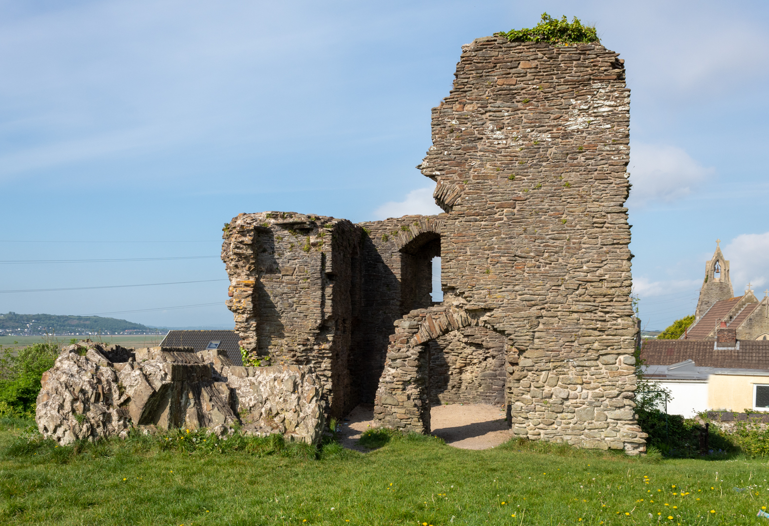
The rectangular stone tower that now dominates the site was constructed.


Lougher Castle  on the north of the gower coast


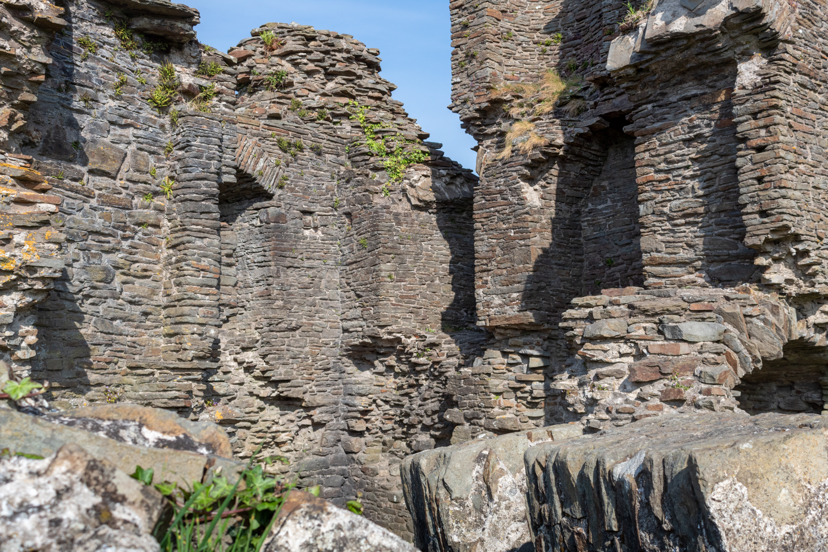
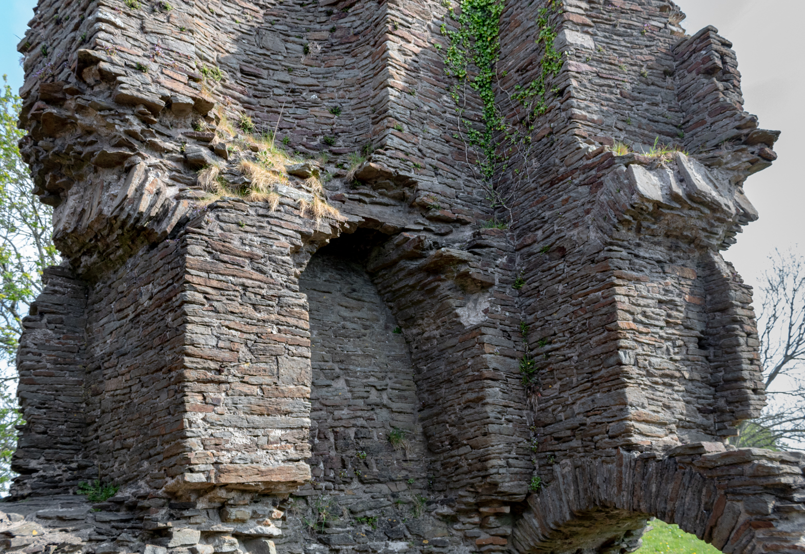
Though greatly ruined, the two-storied tower retains enough of its original structure to give a fairly complete picture of how it was used.


Lougher Castle  on the north of the gower coast


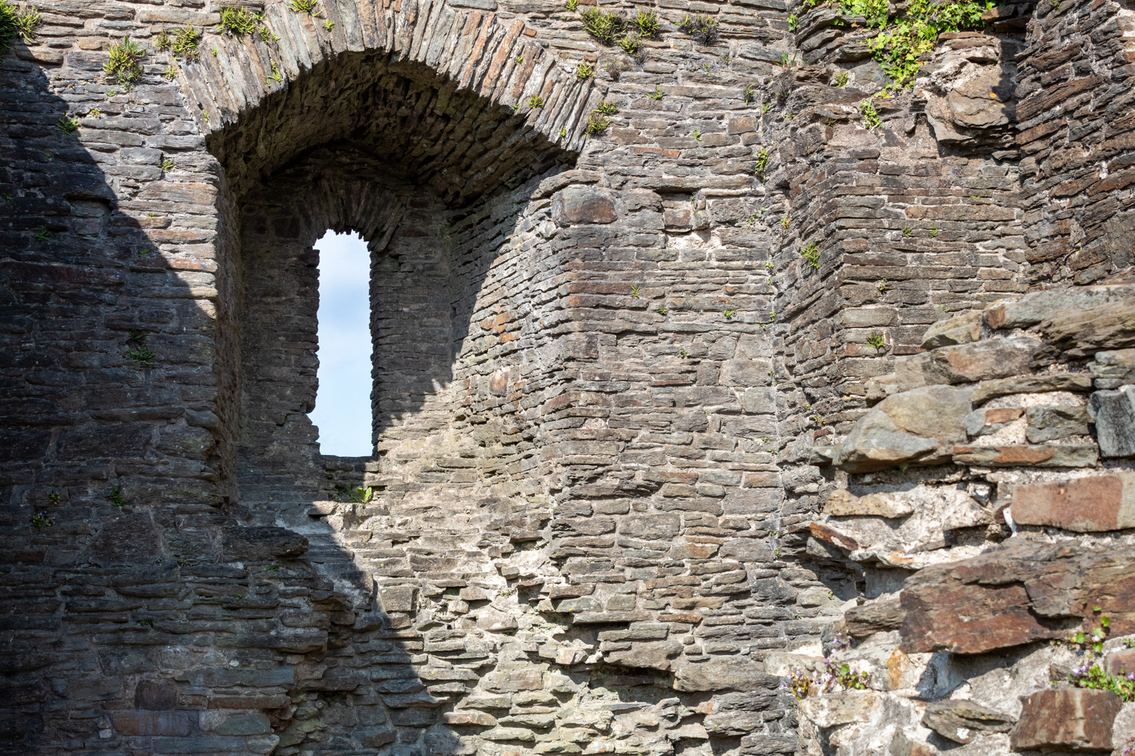
The fireplaces, fine windows, and garderobe (latrine chute) suggest that the tower was residential, perhaps housing the lord of the castle and his household.


Lougher Castle  on the north of the gower coast


William allied himself with the Welsh prince Llywelyn the Great and war broke out. William died in 1211, but his son, Reginald, continued fighting and married Gwladus, Llywelyn's daughter.

In 1215, the castle was captured by Llywelyn's forces and control of Gower was granted to Reginald.
Two years later, however, Reginald made peace with the English Crown and Llywelyn removed him from power, replacing him with the Welsh prince Rhys Gryg.

Llywelyn married another of his daughters, Margaret, to Reginald's nephew, John de Braose, and in 1220 Llywelyn gave him Gower and Loughor Castle,


Lougher Castle  on the north of the gower coast


In 1232 the castle was inherited by John's son, William de Braose, and in turn his son, also called William. In the second half of the century, Wales saw a renewal of fighting, and the castle was attacked again in 1251 which lead to the stone defences being improved once again.

In 1302, William de Braose granted the Loughor estate to his seneschal, John Yweyn, for life in exchange it is said for an annual fee of a greyhound collar.

On John Yweyn's death in 1322 the lands were seized by John de Mowbray, William's son-in-law he was executed later the same year however for taking part in a rebellion.

Edward fell from power in 1327, and the Loughor lands were granted to John de Mowbray's son, John.


Lougher Castle  on the north of the gower coast


This was the last of the importance of the castle and its condition started to deteriorate, For a few hundred years the site continued to fall into ruin then in the 1940's the main tower of the building collapsed and the ruin was left as it can be seen now.


Although not much is left of this historic place there is enough to warrant a short visit to this historic place which is close to the beautiful Loughor Estuary.


Footer:
Visit Information:-
Google Reference
51.66219879408081, -4.077424328580057


Search term
Loughor Castle.

What Three Words reference:-
///declining.fatigued.romance

Additional information.
Visiting is really easy as the castle is located alongside the main A4240 road in the village.
You may be able to park on the road however, there is a small car park (free) close by (51.66332518930001, -4.078047165998971).
It is a short walk 5 mins from here to the castle and you will also be rewarded by great views of the river and the estuary from here.


Thank you for visiting this blog.
If you would like more information on this location please feel free to contact me.






Read More

Swansea Jack.

Visit Date 05-2022. .

Today's blog was inspired after my walk took me along the seafront at Swansea when I came upon a monument to one of Swansea's greatest lifesavers and perhaps a story not known to many.

I suspect that if you were to ask anybody in Wales to name the most famous dog (Movies excluded) I suspect they would answer Gelert.

The reason for this is that the story is of a dog that is buried and remembered in the village named after him, Beddgelert.

The inscription on the grave in both Welsh and then in English reads: -

IN THE 13TH CENTURY, LLYWELYN, PRINCE OF NORTH WALES, HAD A PALACE AT BEDDGELERT. ONE DAY HE WENT HUNTING WITHOUTGELERT "THE FAITHFUL HOUND" WHO WAS UNACCOUNTABLY ABSENT. ON LLYWELYN'S RETURN, THE TRUANT STAINED AND SMEARED WITH BLOOD, JOYFULLY SPRANG TO MEET HIS MASTER. THE PRINCE ALARMED HASTENED TO FIND HIS SON, AND SAW THE INFANT'S COT EMPTY, THE BEDCLOTHES AND FLOOR COVERED WITH BLOOD. THE FRANTIC FATHER PLUNGED THE SWORD INTO THE HOUND'S SIDE THINKING IT HAD KILLED HIS HEIR. THE DOG'S DYING YELL WAS ANSWERED BY A CHILD'S CRY. LLYWELYN SEARCHED AND DISCOVERED HIS BOY UNHARMED BUT NEAR BY LAY THE BODY OF A MIGHTY WOLF WHICH GELERT HAD SLAIN, THE PRINCE FILLED WITH REMORSE IS SAID NEVER TO HAVE SMILED AGAIN. HE BURIED GELERT HERE. THE SPOT IS CALLED BEDDGELERT.

Unfortunately this is just a myth. History and myth appear to have become a little confused when in 1793, a man called David Pritchard came to live in Beddgelert. He was the landlord of the Royal Goat Inn and knew the story of the brave dog and adapted it to fit the village, and so benefit his trade at the inn.

However, in Wales, we really do have a true story of a historic dog.

Swansea Jack


Swansea Jack was a black retriever born in 1930. He lived in the North Dock / River Tawe area of Swansea with his master, William Thomas.
Jack would always respond to cries for help from the water, diving into the water and pulling whoever was in difficulty to safety at the dockside.
His first rescue, in June 1931, when he saved a 12 year old boy, went unreported. But a few weeks later, this time in front of a crowd, Jack rescued a swimmer from the docks. His photograph appeared in the local paper and the local council awarded him a silver collar. In 1936,

Later he had the prestigious 'Bravest Dog of the Year' awarded to him and in 2000, Swansea Jack was named 'Dog of the Century' by NewFound Friends of Bristol who train domestic dogs in aquatic rescue techniques

Legend has it that in his lifetime he saved 27 people from the Docks / River Tawe. Sadly, in October 1937, Swansea Jack died after eating rat poison. His burial monument, paid for by public subscription, is located on the Promenade in Swansea.


Footer:
Visit Information:-
Google Reference
51.611550048497776, -3.966347713215829

What Three Words reference:-
///spill.urban.dark (this is an approximate)

Additional information.
On the main promenade in Swansea.


Thank you for visiting this blog.
If you would like more information on this location please feel free to contact me.


Read More

Monknash Rocket House

Visit Date: April 2022.


Monknash Rocket House


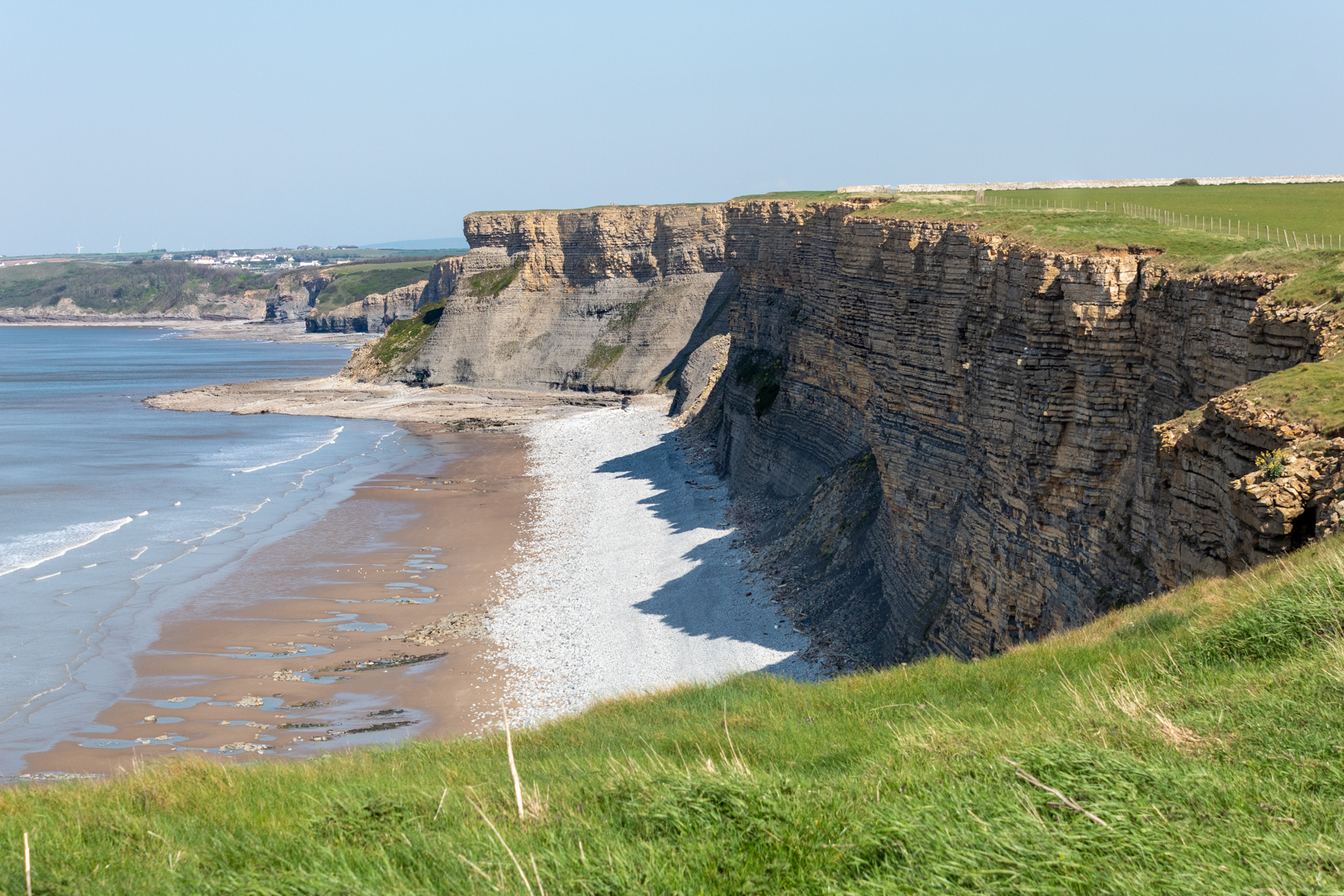
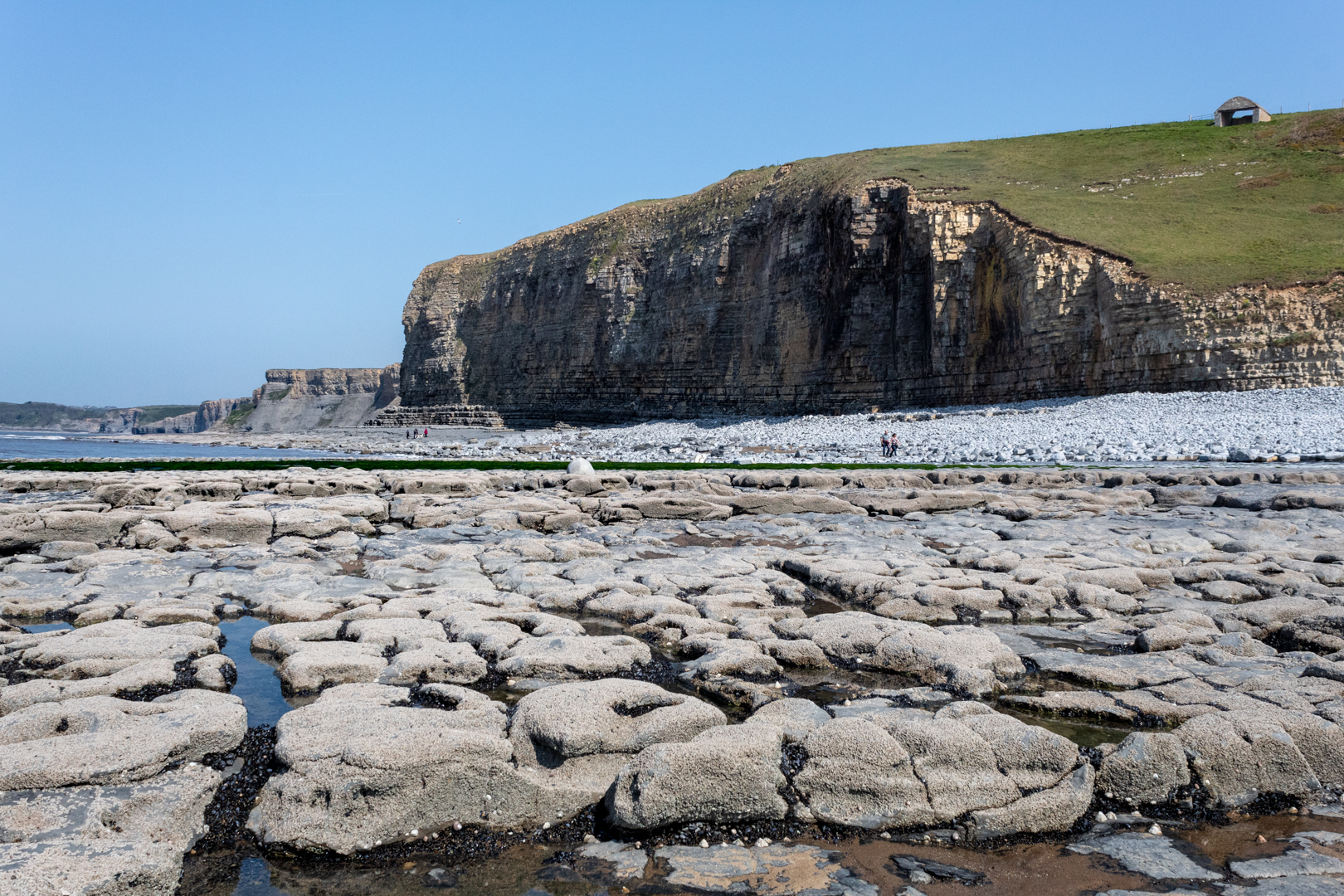
For today's blog, I am visiting another South Wales coastal bay at Monknash in the Vale of Glamorgan.


Monknash bay or beach is at the coastal end of a small valley called Cwm Nash.


Monknash Rocket House


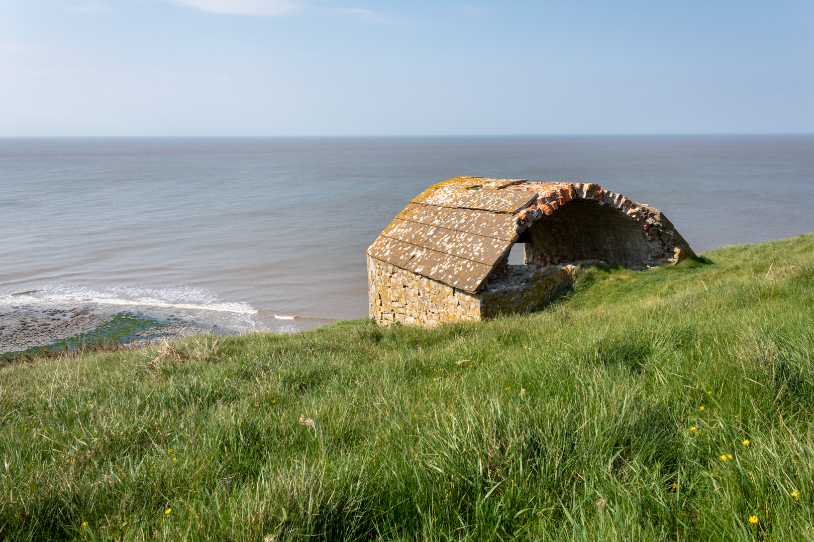
The reason I have visited here this time is not for the breathtaking coast and cliff but for this small building high on the cliffs.

This is a Coastguard Rocket Station.


Monknash Rocket House


This is an early example of this type of building specifically built to house life-saving apparatus used when conditions prevented the lifeboat from deploying.


View from Monknash Rocket House


These locations would have had rocket apparatus which could fire a rope out from the land to any ship that ran aground on the rocks. The rope would allow the ship's crew to pull in the attached breeches buoy. The breeches buoy was a pulley system that could winch a sling out to the ship and then winch it back with a person in the sling.


View from Monknash Rocket House


Rocket Houses became a vital part of seafaring rescues and his one dates from the late 1870s and is on an OS map dated 1877. This would seem to be correct as many of these Rocket Houses" were built along the coast at this time.


OS benchmark


On the front wall of the rocket house, I found this mark.

Someone I met at the site thought it might be a mark to state that the building was owned or looked after by the government or forces however, I believe it is an ordinance survey benchmark.

***(From Wikipeadia)

The term benchmark, bench mark, or survey benchmark originates from the chiselled horizontal marks that surveyors made in stone structures, into which an angle-iron could be placed to form a "bench" for a leveling rod, thus ensuring that a levelling rod could be accurately repositioned in the same place in the future. These marks were usually indicated with a chiselled arrow below the horizontal line.

The term is generally applied to any item used to mark a point as an elevation reference. ***.

.


Monknash


As you can see this is a beautiful part of the coast here which gets battered frequently by the sea.
There have been many wrecks on this part of the coast one of which I have mentioned in an earlier
blog regarding the wreck of the The Wreck of the Altmark


Monknash


A little while ago some human bones (at least six) were found protruding from the rock face here and it is thought that they are either an early unofficial burial ground or this may have been a burial of some sailors whose vessel was wrecked here.


Monknash


The remains of people recovered from the site previously have been found to date from the 16th Century.

The earliest burial licence in the parish of Monknash - the area where the remains have been found - was granted in 1609.

And previous radiocarbon dating of remains found at the site showed they were from the late 16th Century or the early 17th Century, according to details published by Cardiff University.


- - - - - - - - - - - - - - - - - - - - - - - - - - - -


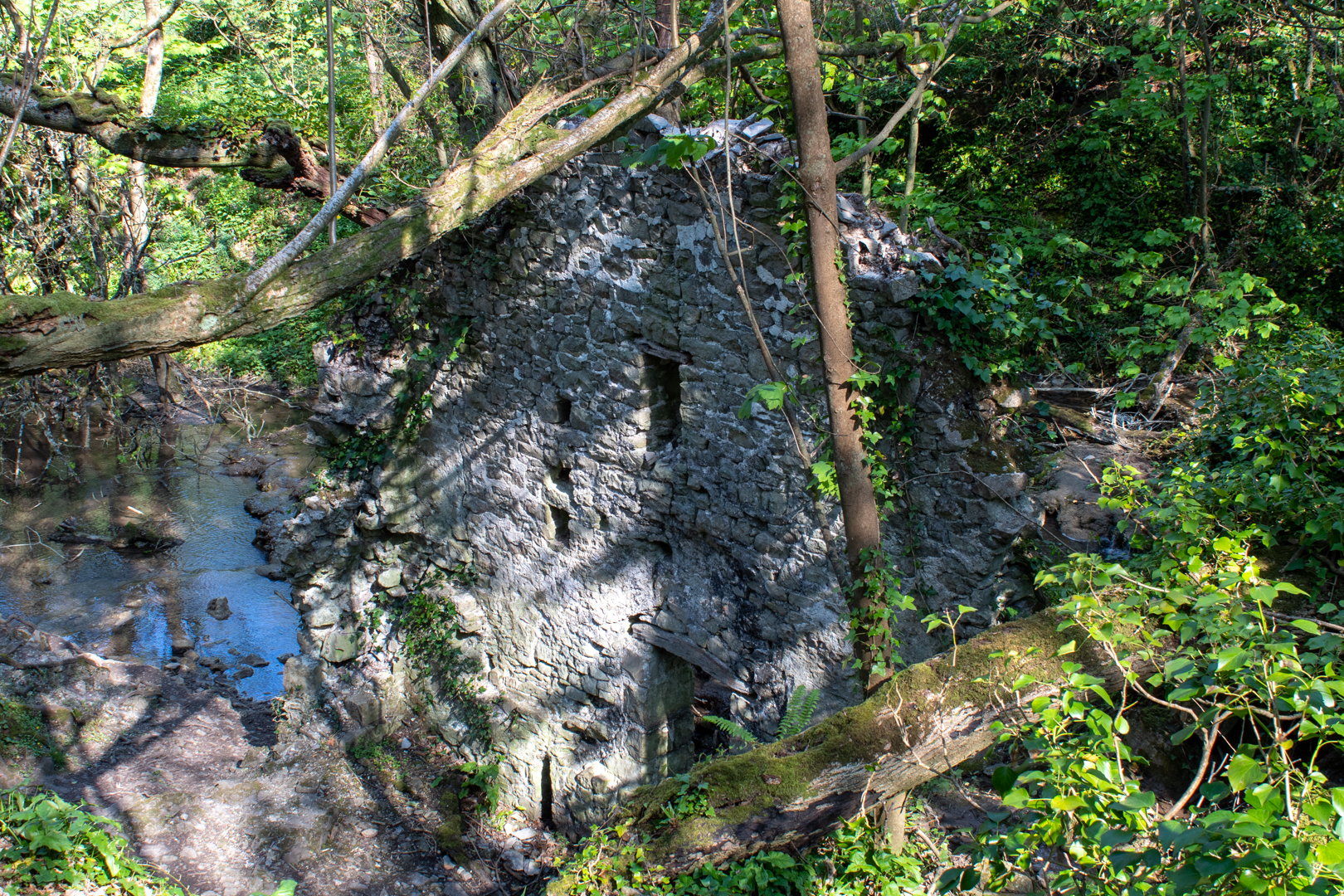
There is one other ruin of interest in Cwm Nash. As you walk up the footpath you come to this old ruin.

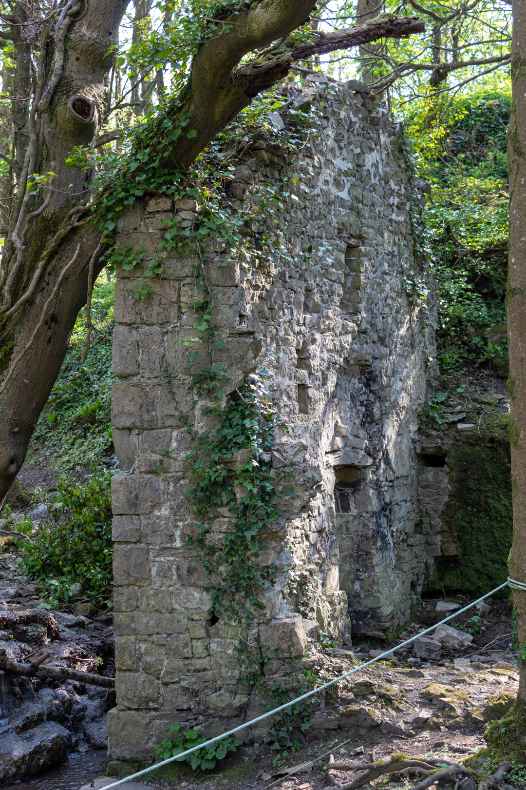
It is the ruin of an old corn mill that would have been powered by the river.


Monknash Corn Mill


The northerly gable wall, against which was the waterwheel, stands to its full height, but the other walls are ruined more or less to ground level. The leat is visible and terminates at the mill at eaves level; the stone base of the wheelpit is clear and its floor is just above the stream level, both features together suggesting an overshot wheel about 3.6-4.2m (12-14 feet) in diameter by about a metre (just over three feet) wide.


Monknash Corn Mill


The Mill also appears on the old Ordinance survey map of 1877.


Monknash Corn Mill


Footer:
Visit Information:-
Google Reference
51.41942070629259, -3.576461563665641

What Three Words reference:-
///adjust.gagging.inventors

Additional information.
Visiting is relatively easy and is a good walk from the car park (51.41891777077914, -3.5647860982640633) which is a farm field and there is an honesty box for payment on the entry post to the carpark (£3 currently).
 You can then follow the path, some tarmacked, and some over cobbles. This will take you past the corn mill down to the beach (20 minutes or so). I think the corn mill is wrongly positioned on google maps I think it is nearer (51.42097552443006, -3.570768612493772) or  (///farmland.exhale.different) but you can't miss it on the way to the beach.

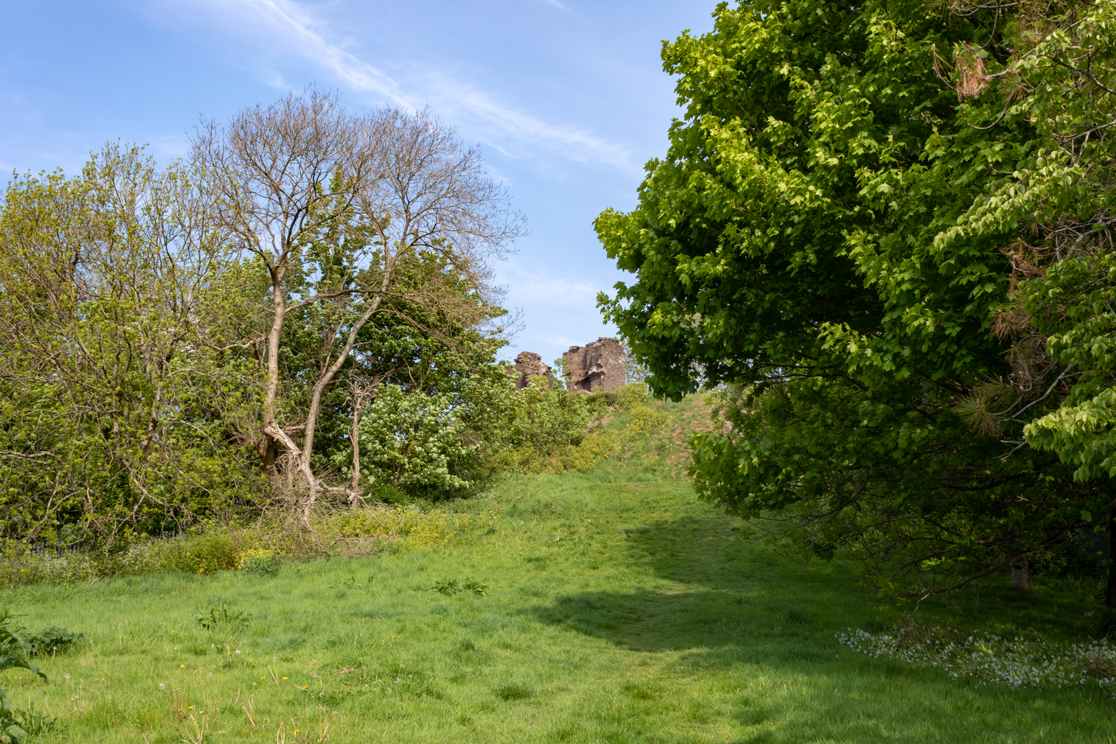
The Station as you can see is up on the cliff and part of the official Wales coastal path but it does take some climbing.


Thank you for visiting this blog.
If you would like more information on this location please feel free to contact me.


Read More

The Monks Bath (Ffynnon Gyffyr)

 Visit Date September 2020. 


The Monks Bath


Todays post it the final part of three linked posts from the area of Margam is South Wales.
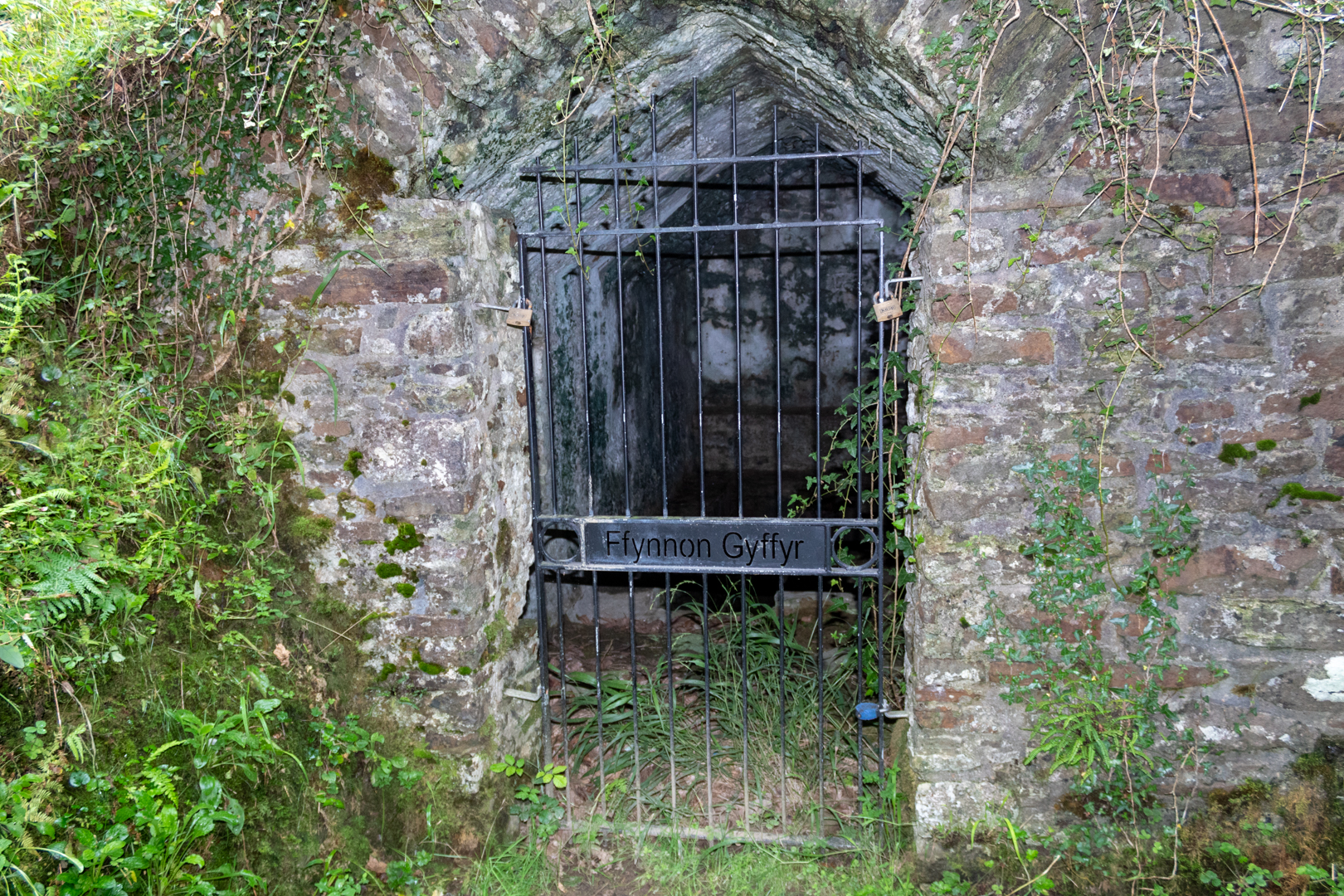
Known locally as "The Monks Bath" this ancient building has the name Ffynnon Gyffyr which seems a little vague. It is also known as the Spring well or the Medicinal Well.


The Monks Bath


The date of construction is thought to stretch back to the 12 or 13th century.
It is very close to the Abbey of Margam, dedicated to St Mary the Virgin, at Margam which was founded in 1147.


The structure is where the monks of the abbey bathed.


The interior contains an L-shaped pool, about 1m deep with well-built stone walls. Although the pool is fed by a water inlet at the Northern end, it is evident that water enters the pool at a lower level through the stonework.


The building is now Listed grade II as an unusual and complete survival of a medieval baptistry and holy well.


It is on the pathway from Margam country park to Capel Mair ar y Bryn ('The chapel of St Mary on the hill') a small ruined chapel overlooking the borough and the beautiful Margam Country Park. 


A view of Margam Abbey


Footer:
Visit Information:-
Google Reference
51.568208528035434, -3.7281904102333994

What Three Words reference:-
///televise.curve.admires

Additional information.
Visiting is relatively easy but is mostly uphill. I visited by parking close by and there is a car park near the start of the walk (51.56361379905241, -3.7338320577891753) and there is also roadside parking. Go get to the car park you leave the M4 at junction 38 head for Margam Park but turn in at the sign which reads "Margam Abby". Once parked walk up the hill on the road until you see a small marker and a steel barrier on the left hand side. Carry of for a 100 yards and you will see the path on the right hand side . It is a very short distance on from here. 

Two blogs in this area:-
Margam Radar Station and Capel Mair ar y Bryn


Read More

Capel Mair ar y Bryn

 Visit Date: September and November 2020 . 


Capel Mair ar y Bryn


Capel Mair ar y Bryn (The chapel of St Mary on the hill) has been known by many other names over the years such as the Cryke Chaple, Hen Egwlys and just plain Capel Mair, the place of worship, established circa 1470 was built by the monks of Margam and dedicated to St Mary, for the benefit of local peasants who did not have the right to worship in Margam Abbey.


Capel Mair ar y Bryn


In the later Middle Ages there was a famous statue of the Virgin Mary here and pilgrims came to see it.


Capel Mair ar y Bryn . West and North Walls


After the Reformation, the chapel was used by local Catholics, who worshipped here in secret.


View through the west gate/window to the larger East Window


The chapel is on a stone ridge and is a circular enclosure, suggesting that it may have been built on the site of an older church.


Capel Mair ar y Bryn


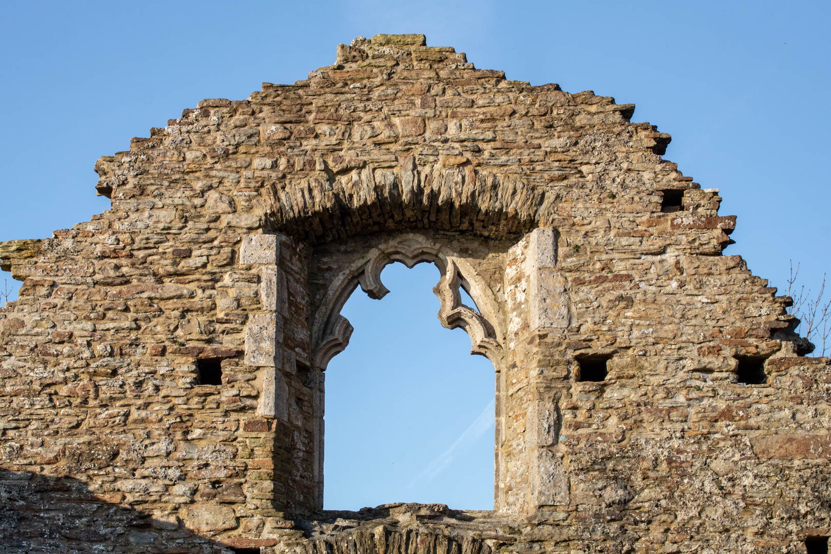
The west side of the chapel has a door with a window above. There has been some discussion about this window as it's style does not fit in with the rest of the chapel and it is thought to be earlier.

One explanation for this is that the window was brought here from the Abbey to be added when the chapel was built.


Capel Mair ar y Bryn


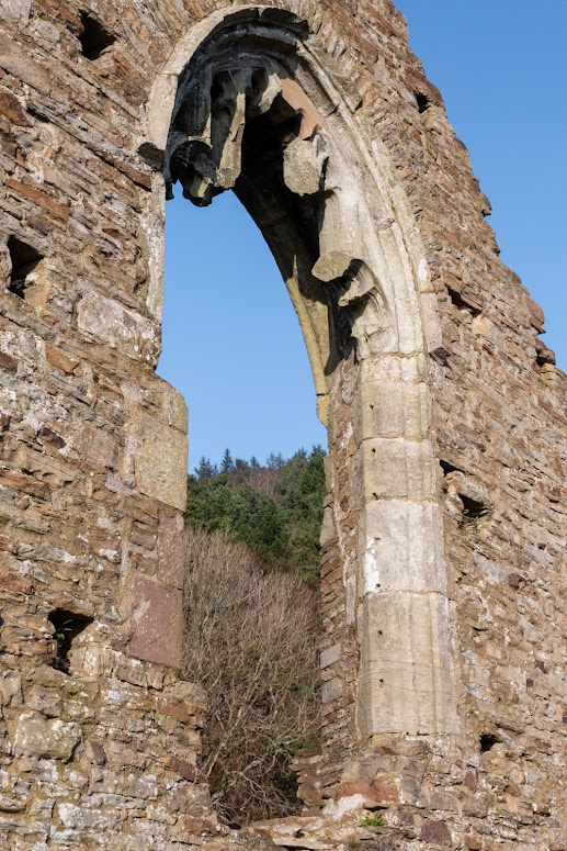
The east window seen here, however, is very much of the style of the time and in undoubtedly original and in keeping with the time.


The East Window, Capel Mair ar y Bryn


The Large East window must have been very impressive for the time.


The North Wall, Capel Mair ar y Bryn


The north wall has not survived well and there is little in the way of detail.


The South Wall, Capel Mair ar y Bryn


The south wall has windows but some may have been added at a later date.


Capel Mair ar y Bryn


The chapel stands on an imposing knoll and can be seen from the road and also Margam Country Park.


Footer:
Visit Information:-
Google Reference
51.56480536863176, -3.730925337099626


What Three Words reference:-
///florists.treatable.exits


Additional information.
Visiting is relatively easy but is mostly uphill. I visited by parking close by and there is a car park near the start of the walk (51.56361379905241, -3.7338320577891753) and there is also roadside parking. Go get to the car park you leave the M4 at junction 38 head for Margam Park but turn in at the sign which reads "Margam Abby". Once parked you can walk up the pathed steps up but this is very steep. A easier way is to walk up the hill on the road until you see a small marker and a steel barrier on the left hand side. Go through the barrier and you will come to the chapel.


I have made a short "video walk" of my visit here that can be found here:-


Read More

Search This Blog

About Me

Bridgend, United Kingdom
A renewed interest in photography and local history.

Contact Me

Name

Email *

Message *

Followers