With a renewed enthusiasm for photography and local history, I set out this blog as a record of my experiences with images and narratives. It is my hope that you find something of interest on this site. Please feel free to contact me for more information on any of the posts. You can see a comprehensive list of my blogs at my website :- http://www.davidnurse.co.uk

Showing posts with label Lighthouse Wales Welsh Coast. Show all posts

Point of Ayr Lighthouse


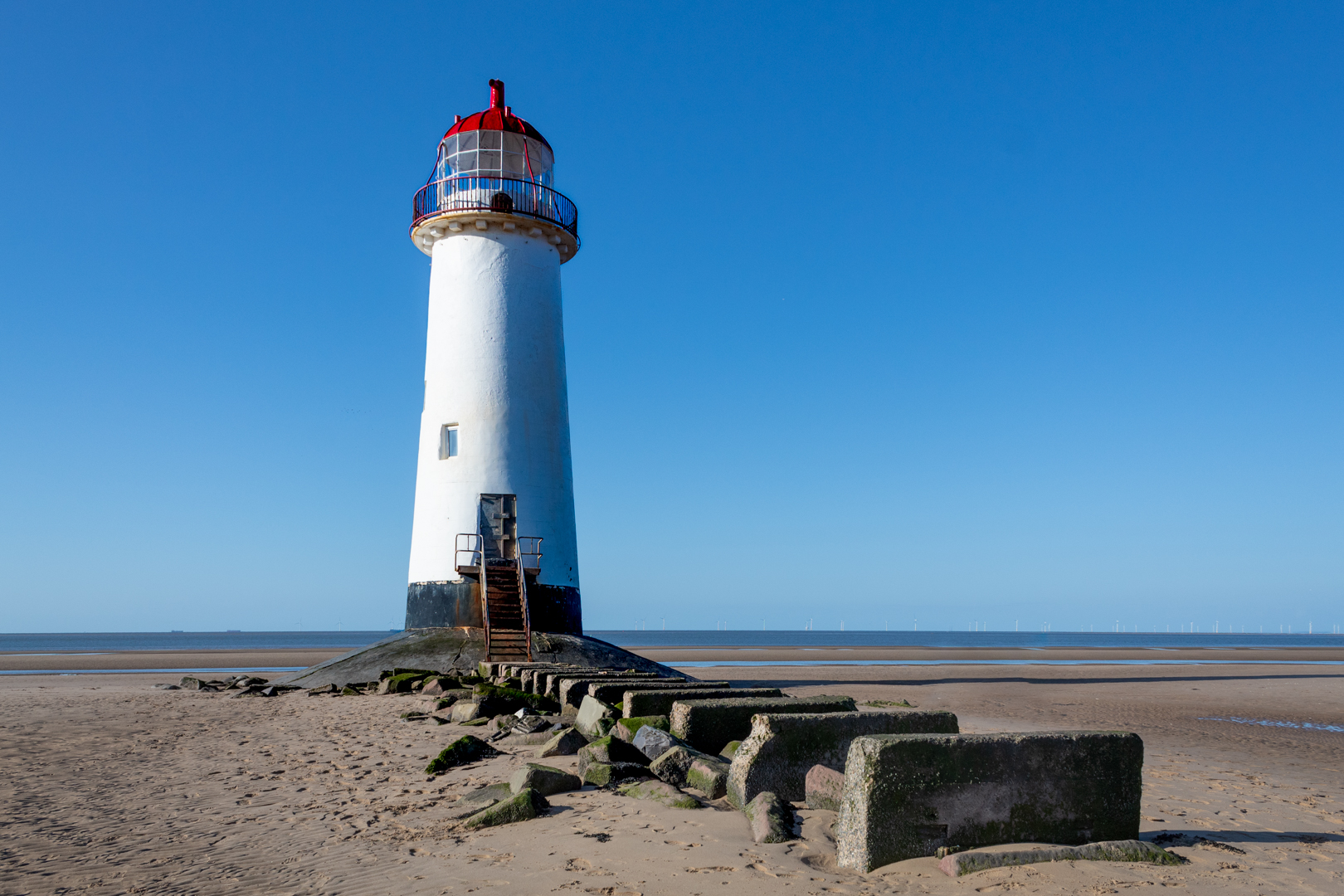
The Point of Ayr Lighthouse, also known as the Talacre Lighthouse, 

has a rich and varied history on the north coast of Wales.


Visit Date: April 2024


The Point of Ayr Lighthouse


The lighthouse was constructed in 1776, serving an essential role in maritime navigation.
Its construction was authorized by the Chester Lighthouse Act of 1776, legislation aimed at improving safety for vessels entering and leaving the River Dee.
A trust comprising the Mayor, Recorder, and Aldermen of Chester oversaw the construction process. This trust was responsible for ensuring the lighthouse met the necessary specifications for both functionality and aesthetic appeal.
The total cost of building the lighthouse was £349 and 8 shillings and a penny, a significant investment at the time, reflecting the community's commitment to enhancing maritime safety and trade in the region.

The primary objective was to provide warning signals to vessels navigating between the Dee and Mersey Estuary, as well as to safeguard maritime operations along the Welsh coastline. This initiative gained particular significance following the catastrophic loss of two Dublin ferries in 1775, which resulted in the tragic demise of over 200 individuals and considerable damage to cargo.

The lighthouse served as a vital navigational aid, functioning as a directional landfall light with its beam illuminating the northern and western approaches to the Dee estuary. This strategic positioning was essential to alert vessels to the potentially hazardous conditions that characterized the entrance. However, it is important to note that the lighthouse does not feature a light specifically designed to assist mariners as they depart from the estuary, which could pose challenges for navigation in that direction.


The Point of Ayr Lighthouse


The tower was designed based on the Liverpool Docks Board light situated at Hoylake. Its base is inscribed with the initials "H.T.," representing Henry Turner, a prominent local architect and builder.

In 1819, Trinity House assumed ownership from the Point of Ayr Lighthouse Trustees. Since then, Trinity House has served as the authoritative body responsible for lighthouses in Wales and England.

In around 1820, significant alterations were made to the lighthouse structure, including the installation of the current lantern. This reconstruction may have been prompted by a partial structural collapse.

The internal stair was rebuilt circa 1840.

Samuel Brooks, a notable early convert to the Church of Jesus Christ of Latter-day Saints (LDS/Mormon Church), served as the lighthouse keeper from 1825 to 1856. During his lengthy tenure, he resided in one of the quaint cottages designated for lighthouse keepers, which offered him a unique vantage point over the turbulent waters. In addition to Brooks, another significant figure in this early community, John Parry Jr., utilized his masonry skills at the lighthouse in 1848, contributing to its architectural integrity and enduring presence along the coastline.


The Point of Ayr Lighthouse


The lighthouse was decommissioned in 1844 and replaced by a "pile light," a similar structure to the Burnham-on-Sea low lighthouse.


The 1844 lighthouse has since vanished.


The original lighthouse was replaced by a lightship moored in the estuary in 1883. This change came after a court allegation in 1882 claimed that the lighthouse was situated too far inland, following an incident where a steamship ran aground. Although the lighthouse was officially decommissioned in 1844, some sources suggest it was actually taken out of service in 1883 or 1884.


The tower is a tapered cylindrical brick structure featuring a balcony and a lantern. It was measured to be 16 meters (52 feet) high in 1776, with a base diameter of 7.8 meters (25.75 feet) and a top diameter of 4.9 meters (16 feet). Some sources indicate that it may actually be 18 meters (59 feet) tall or even 60 feet.

The light is positioned 53 feet above high water and can be seen from 9 miles away in clear weather. It displays a white light from E ¾ W to SE, a red light between SE and W by N ¼ N, and then white light again from N by W. A bell is rung during foggy conditions.

Notably, the lighthouse retains one of the earliest lanterns in Wales. The original structure has a slight lean but has withstood numerous storms. In 2007, it sustained damage from storms, which dislocated the metal steps and created a hole in the base. The cost of repairs was covered by the owners of a nearby caravan park.

The lighthouse was restored in the 1990s.


The Point of Ayr Lighthouse


The lighthouse is now privately owned. It was listed for sale in 2011 for £100,000 and was sold in April 2012 for £90,000 to a private couple.


As a Grade II listed building, it holds the distinction of being the oldest lighthouse in Wales.

The lighthouse is often said to be haunted by a ghost named Raymond, who was the last lighthouse keeper and reportedly died of a fever while on duty. Some visitors claim to have seen a man in old-fashioned clothing standing atop the lighthouse, gazing out to sea during night visits.

In honor of the reported ghost, the then-owner, James McAllister, installed a seven-foot stainless steel sculpture of a 'lighthouse keeper' created by local artist Angela Smith on the balcony between 2009 and 2012. However, the planning permission for the sculpture expired, and it was subsequently relocated.


The Point of Ayr Lighthouse


It is a popular tourist attraction and a dog-friendly destination, particularly known for sunset walks that provide stunning views of the Irish Sea and the Dee Estuary. The surrounding dunes are designated as a Site of Special Scientific Interest and are part of a nature reserve managed by the RSPB.


Footer:Visit Information: -
Google Reference: -
53.357046807776754, -3.32238377723201

What Three Words reference: -
///dignify.conducted.overdrive

OS Details: -
Grid Ref: SJ 12095 85271  Elevation 9 ft


Additional information.
Visiting is easy and there is a car park at the site (53.35321642414517, -3.319730302110794).
Access is easy from here. There are no facilities at this car park but an alternative car park close by (
53.35196453461079, -3.3168028637702056) has facilities.


A full list of blogs can be found at my website


Read More

Burry Port Lighthouse


Burry Port is a small coastal town in the South of Wales.

The harbour was built in the early 1830s and was the main port for exporting coal from the surrounding areas.

The Harbour initially was named the Pembrey New Harbour and was a larger upgrade
 to the smaller harbour just along the coast.

The harbour's name was changed by an act of parliament in 1835 to Burry Port Harbour
 and thus gave the name to the Town of Burry Port.


Visit Date August 2020


Burry Port Lighthouse


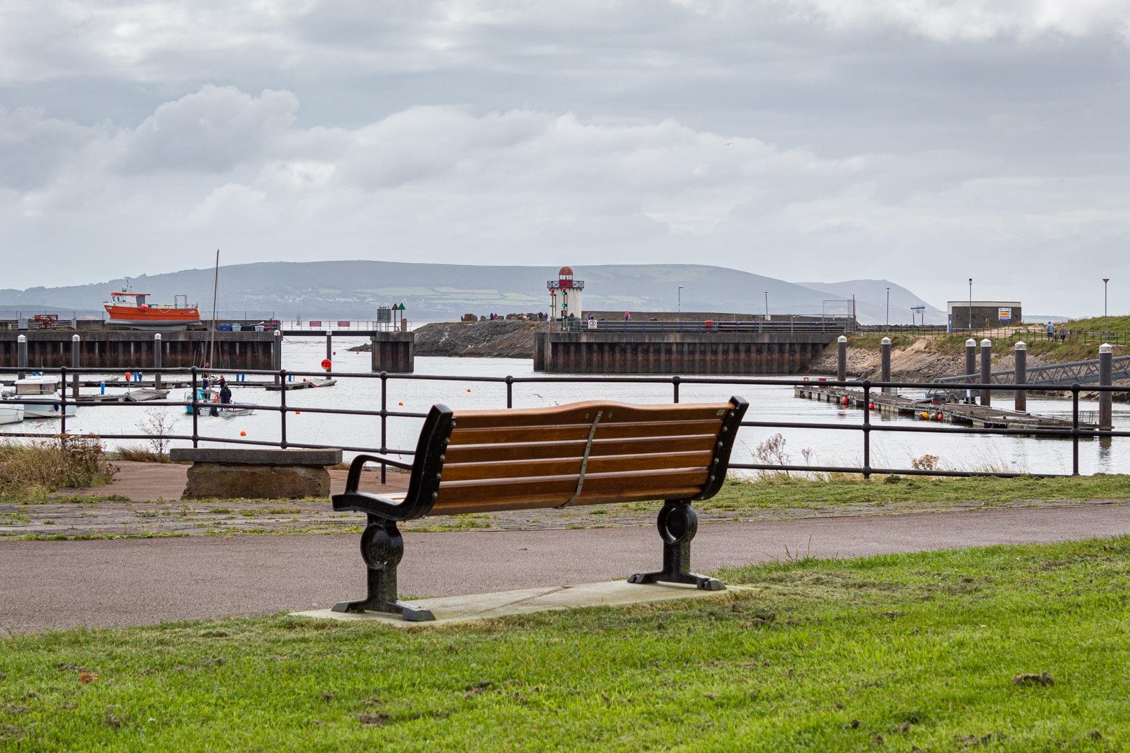
Today the harbour has been developed into the local Marina and also houses the lifeboat station.


Burry Port Lighthouse


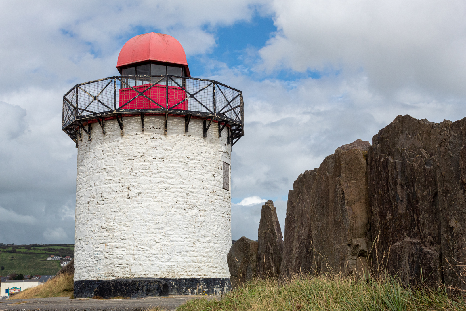
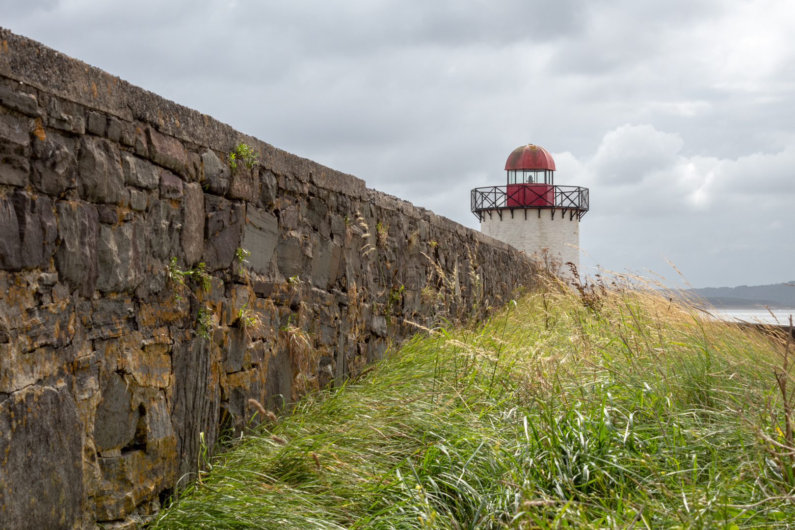
The lighthouse was built in 1842 and was restored in the mid 1990's by Llanelli Borough Training, with the support of the Burry Port Yacht Club with Trinity House*** supplying the lantern for the structure which was officially reopened on 9th February 1996 by the Mayor of Llanelli.


Burry Port Lighthouse


The lighthouse is quite small with its walls being just 24ft high with the gallery and lantern on top.


Burry Port Lighthouse


The lantern light is visible for 15 miles and is an important landmark for the marina.


Burry Port Lighthouse


***Trinity House is a charity dedicated to safeguarding shipping and seafarers, providing education, support and welfare to the seafaring community with a statutory duty as a General Lighthouse Authority to deliver a reliable, efficient and cost-effective aids to navigation service for the benefit and safety of all mariners.


Burry Port


Burry Port harbour was the landing place for the first crossing of the Atlantic by a woman please see my post:-


Footer:Visit Information: -

Google Reference: -
51.677500723894276, -4.2512000337731735


Google search term:
Burry Port Lighthouse

What Three Words reference: -
///kilt.origins.dynamics

OS Details: -
SN 44449 00034

Additional information.

Visiting Burry Port is very easy.
There is lots of parking here, with the closest being the harbour car park (51.680651095461656, -4.2513750336966005).


There are lots of shops toilets and other amenities close by.


A full list of blogs can be found at my website


Read More

Nash Point Lighthouse

 Visit Date: September 2019


Nash Point Lighthouse


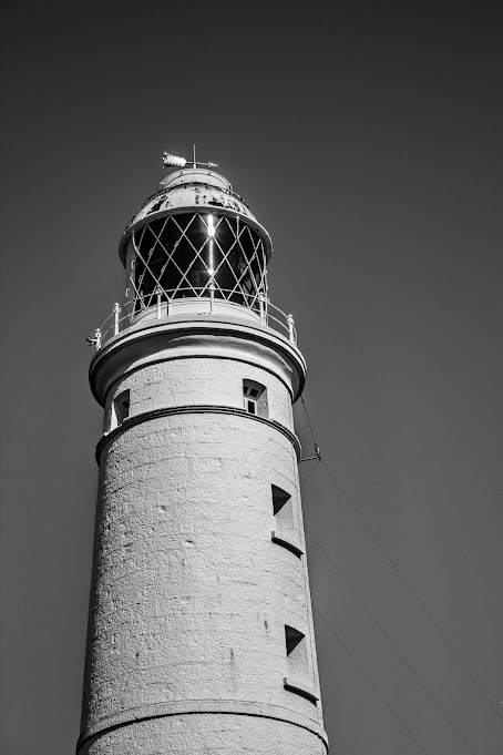
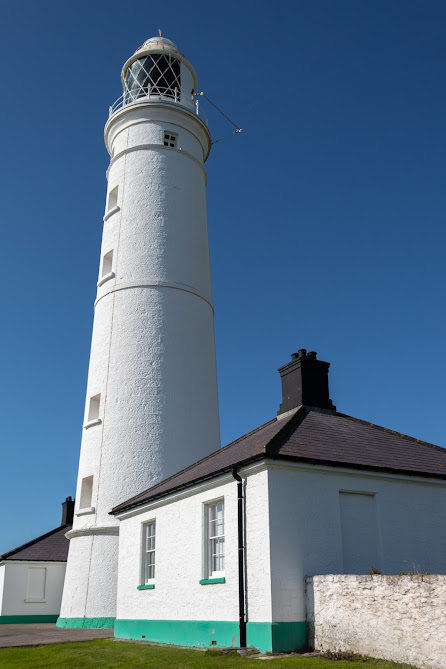
Nash Point Lighthouse is to be found on the South Wales Coast. It's an iconic and historic building that has now been given Grade 2 listed status.


Nash Point Lighthouse


The lighthouse was built between 1831 -1832. And was first turned on On September 1st 1832.


Nash Point Lighthouse


This lighthouse was constructed after the loss of "The Frolic" a shipwrecked here in 1831 with the loss of 78 lives.


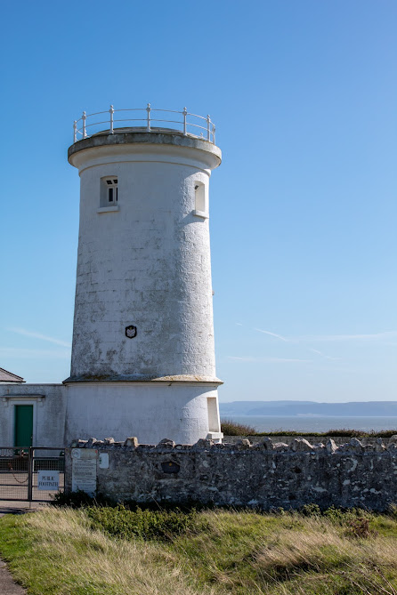
There are two towers. The tall lighthouse and a smaller tower. Both initially gave out light..


Nash Point lighthouse Lower Tower


The lower tower was decommissioned in the 1920s and the main tower ceased to be manned in August 1998


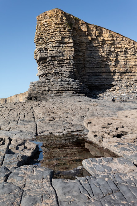
Nash Point Cliffs.


The lighthouse is made of local "Blue Lias" Stone and was quarried from the cliffs that it stands on.


The Blue Lias stone cliffs at Nash Point.


Footer:


Visit Information:-


Google Reference
51.40094650459908, -3.552126744084211


What Three Words reference : ///bloodshot.clotting.handicaps


Additional information


Visiting this site is very easy and there is a car park with a small shop/café where you will need to pay a small charge (51.403908670782236, -3.5590157508222844).


The B4265 which spans between Cardiff and Bridgend would be the main link. From this road head for the village of Macross and then onto Nash Point.
Read More

Mumbles Lighthouse

Visit Date: August 2020:


Mumbles Lighthouse


Mumbles is a small coastal village near the city of Swansea in South Wales.

It sits at the eastern edge of the Gower peninsular much of which forms the first area in the United Kingdom to be designated an Area of Outstanding Natural Beauty.

Mumbles or as we call it "The Mumbles" is a beautiful place to visit and I'm confident that the village will be the subject of a future blog but for now, it is the lighthouse that takes centre stage.

Mumbles Lighthouse


Built-in 1794 the tower is 17 metres high and stands on the outer of the two outlying small islands on Mumbles head between Swansea Bay and Bracelet bay.

It is 35 metres above mean high water and is one of the most photographed buildings in the area.

The Swansea Harbour Trustees were given the power to provide a lighthouse at the outer Mumbles in the Harbour Act of 1791; in July 1792 work began, but while in construction the structure collapsed in October of the same year.

In 1793 the plans of the local architect William Jernegan were accepted and the lighthouse was finally completed and lit in 1794.

Mumbles Lighthouse


Originally lit by two coal fires it was then converted to oil then a further upgrade in 1860, saw the oil-powered light upgraded to a dioptric light.

A flashing mechanism was added in 1905 and this was automated in 1934.

The lamp was electrified in 1969.

By the late 1970s the lantern was corroded and was replaced in 1987.

In 1995, the main light was replaced and an array of solar panels added.

Mumbles Lighthouse


Around the base is a fort or battery which surrounds the southern side of the lighthouse. it was built in 1860 by the War Department. It is one of the many Palmerston Forts built in response to a perceived French invasion.

It mounted five 80 pounder rifled muzzle-loading (RML) guns, two in casemates and three on the roof

In 1940 two 4.7-inch guns were manned by men of the 531st (Glamorgan) Coast Regiment, Royal Artillery. Well before the end of the war, as the German threat decreased, the battery was placed into care and maintenance.


As the lighthouse is accessible at low tide and I intend to visit the island and take more images of this landmark.

Mumbles

Very near to the lighthouse is Mumbles pier the second landmark of Mumbles.

Built and opened on the 10th of May 1898 at a cost of £10,000

During a major renovation in 2012, a new lifeboat station and Royal National Lifeboat institution gift shop was built at the end of the pier and fishing platforms added.

The original Red and cream coloured lifeboat station can be seen alongside the new station.


Footer:
Visit Information:-
Google Reference
51.566795772416825, -3.9708609642798742
Google Search reference: Mumbles Lighthouse
What Three Words reference : ///vertical.televise.junior

Additional information
Visiting Mumbles is very easy. Take the M4 motorway west until you see the first exit for Swansea then keep on the coast road through Swansea to the Mumbles.
Mumbles is a seaside town and has lots of parking along the coast and there is also a good car park on the west side at Bracelet Bay (51.566758645490815, -3.9814065526495392) which is called Limeslade bay Car Park.


Read More

Search This Blog

About Me

Bridgend, United Kingdom
A renewed interest in photography and local history.

Contact Me

Name

Email *

Message *

Followers