With a renewed enthusiasm for photography and local history, I set out this blog as a record of my experiences with images and narratives. It is my hope that you find something of interest on this site. Please feel free to contact me for more information on any of the posts. You can see a comprehensive list of my blogs at my website :- http://www.davidnurse.co.uk

Showing posts with label Chromlech. Show all posts

Llety'r Filliast


The Neolithic Heart of the Great Orme


Llety'r Filiast is an important archaeological, cultural, and historical site, 

prominently recognized as a Neolithic burial chamber located on the Great Orme, near Llandudno.


Visit Date: April 2024


Llety'r Filiast
Llety'r Filiast South View


Llety'r Filiast is classified as a Neolithic chambered cairn, or portal dolmen, which was commonly used during the Neolithic era, approximately between 6,000 and 4,500 years ago.


Llety'r Filiast
Click on any image to enlarge


The chamber itself measures about 2.1 meters long and 1.5 meters high, surrounded by the remains of a cairn that once covered it. Originally, this cairn was believed to be around 30 meters long and 10 meters wide, with a roughly egg-shaped form, though much of the stone has been removed over time. The space under the horizontal capstone likely contained the remains of significant community figures or family members, possibly cremated.


Llety'r Filiast


While it is unclear whether the chamber featured a visible entrance or was entirely enclosed, structures like this are thought to hold deeper symbolic meanings, possibly serving as "portals to another world" or relating to ancient creation myths.


Llety'r Filiast


The construction of elaborate burial chambers like Llety'r Filiast reflects a critical phase in human development—the Neolithic era. During this time, people transitioned from nomadic hunter-gatherers to settled agricultural communities, enabling them to allocate resources to significant projects, such as building burial sites, as they were no longer solely focused on sourcing food.


Llety'r Filiast


A geophysical survey conducted by Jo Jones in 1996 at the "Cromlech Field," where Llety'r Filiast is situated, revealed traces of an outer ring ditch and potential postholes, indicating the presence of a henge monument associated with the site. Nearby finds include Romano-British ceramic material unearthed close to the chamber, suggesting later activities in the area.


Llety'r Filiast
Llety'r Filiast (Viewed from East)


Llety'r Filiast is located near the Great Orme, a limestone headland on the north coast of Wales, northwest of Llandudno. The Great Orme, referred to as Cyngreawdr Fynydd by the 12th-century poet Gwalchmai ap Meilyr, derives its English name from the Old Norse word for "sea serpent."


Llety'r Filiast
Llety'r Filiast (Viewed from the North)


Nearby are the Orme copper mines, discovered in 1987 during landscaping efforts on the Great Orme. These copper mines represent one of the most remarkable archaeological finds in recent history, dating back 4,000 years to the Bronze Age, and they have reshaped our understanding of the ancient people of Britain and their structured societies, well before the Roman invasion. While Llety'r Filiast predates these mines, it is also geographically close to other prehistoric structures, such as Neolithic roundhouses on the Great Orme. Local tradition suggests that a trackway from the mines may have passed by the cromlech, indicating that the dolmen might have served as a "guardian" of the mines' entrance. This site is part of a larger landscape rich in early human activity on the Great Orme, which includes evidence of Mesolithic flint tools and Neolithic implements found in a nearby valley.


Llety'r Filiast
Llety'r Filiast (Viewed from the west)


The name Llety'r Filiast translates to "The Lair of the Greyhound Bitch" or "Lodging of the Greyhound Bitch." This name is shared with other tombs across Wales, although no specific story survives to explain its significance for this particular site. "Filiast" is commonly interpreted as a reference to a female greyhound or grey-colored hound. Some theories connect these sites to the Celtic goddess Cerridwen, whose symbols included a "milast," a form she is believed to have taken during initiation rituals. Another interpretation links "milast" to Camulus (Mars), to whom greyhound bitches and horses were dedicated. Folklore also associates phantom guard dogs with "the bowels of the earth," drawing similarities to Cerberus guarding the underworld or to the "Bar Guest" of the Derbyshire Mines. This connection may provide insight into the name "Lair of the Greyhound Bitch," suggesting that such sites were viewed with a mix of awe and fear, relating to their mystical or protective associations with the underworld.


Footer:

Visit Information: -
Google Reference: -

What Three Words reference: -

OS Details: -
SH 77216 82940 elevation 447

Additional information.
Visiting is easy. There is a small place to park at the side of the field (53.32897301962271, -3.844905483766489) but this is a small country lane really.
The most satisfying way to visit would be to take a ride on the Great Orme Tramway, (53.32727640960437, -3.835464572077922) which is a funicular railway. Get off at the halfway stage and you can walk to the site, however the terrain is quite steep.
There are lots of facilities in the Town.


A full list of blogs can be found at my website

Read More

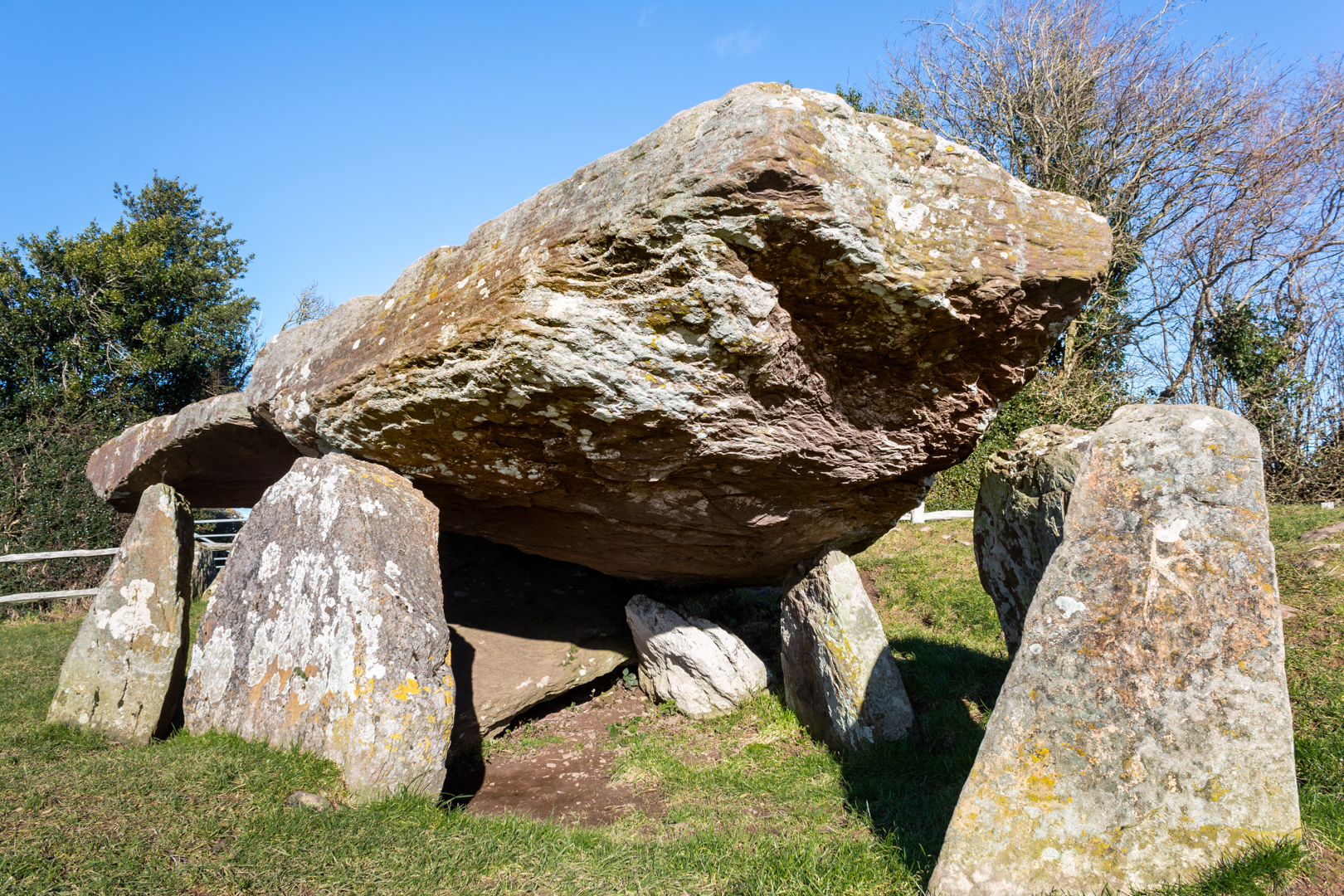
Arthur's Stone

Like many prehistoric monuments in western England and Wales, 

this monument has been linked to King Arthur. 

According to the 13th-century legend, it was here that Arthur slew a giant, 

who left the impression of his elbows on one of the stones as he fell.

Others suggest the indentations were left by Arthur's 

knees or elbows as he knelt there to pray.


Visit Date January 2025


Arthur's Stone, Herefordshire
Arthur's Stone


The tomb dated around 3500 BC is much like many others of this type of structure often referred to as Chromlechs, Quoits or Dolmens and is made up of a large capstone perhaps weighing around 25 tons supported not by the more common 3 or 4 uprights but 9 uprights.


Arthur's Stone, Herefordshire
Click on any image for larger view


The entrance to the tomb is through a curved, 4.6 m (15 ft) long entrance passageway.


Arthur's Stone, Herefordshire
Arthur's Stone


This is not uncommon but seems to deviate from many of these types of tombs which would have a straight entrance-way.


Arthur's Stone, Herefordshire
Click on any image for larger view


The site would have been covered with a great mound of earth which has either been eroded over the centuries or exposed much earlier. Modern investigations had not been carried out on this structure until 2022/2023, when investigations led by the Universities of Manchester and Cardiff were carried out.


Arthur's Stone, Herefordshire
Arthur's Stone


It was found that it is likely the tomb has been altered since the original single burial chamber Dolmen. The original entrance would have been north-facing however it is now thought that the structure was later converted into a long cairn and the entrance to this new structure faced south.
More work may be done to confirm this.


Arthur's Stone, Herefordshire
Arthur's Stone possible original entrance


During these excavations near the long entrance, there was found evidence of a dry stone wall structure. This had been carefully constructed and was thought to have had some symbolic meaning, perhaps the stones were brought as some sort of memorial to the dead.


The curved passageway seems to be part of this later addition.


Arthur's Stone, Herefordshire
Arthur's Stone, Writing


As stated earlier this Neolithic monument known as Arthur’s Stone,  has long been linked to legend and literature however, if King Arthur had been at every location he is associated with he would have to have lived many lives.


Arthur's Stone, Herefordshire
Click on any image for larger view


These Arthurian giant-slaying escapades and the inspiring large Stone capstone or table here at this site is said to have been the inspiration on which the lion Aslan was sacrificed in C S Lewis’ The Chronicles of Narnia. 


The site is now in the care of English Heritage


Footer:Visit Information: -
Google Reference: -
52.08230962757643, -2.9953445186919994

What Three Words reference: -
///bolsters.craters.timer

OS Details: -
OS Grid Ref: SO 31887 43123 

Additional information.

Visiting is easy and is about 11 miles from Hereford along the A438 and B4352 (Pentre lane ) and then 3/4 of a mile along Arther's Stone Lane (this is the only narrow part.
There is parking for 3/4 cars in a lay-by right next to the site. There are no facilities.
I have been told that this site can get busy in the summer months.


A full list of blogs can be found at my website


Read More

Dyffryn Ardudwy Burial Chamber


Neolithic burial sites can be found all over Wales, the UK and across Europe.
I have visited many of these sites and have posted information on them here such as
What makes the site at Duffryn Ardudwy different is that there are two tombs close together.


Visit Date May 2023


Dyffryn Ardudwy Burial Chamber
Click on any image to enlarge.


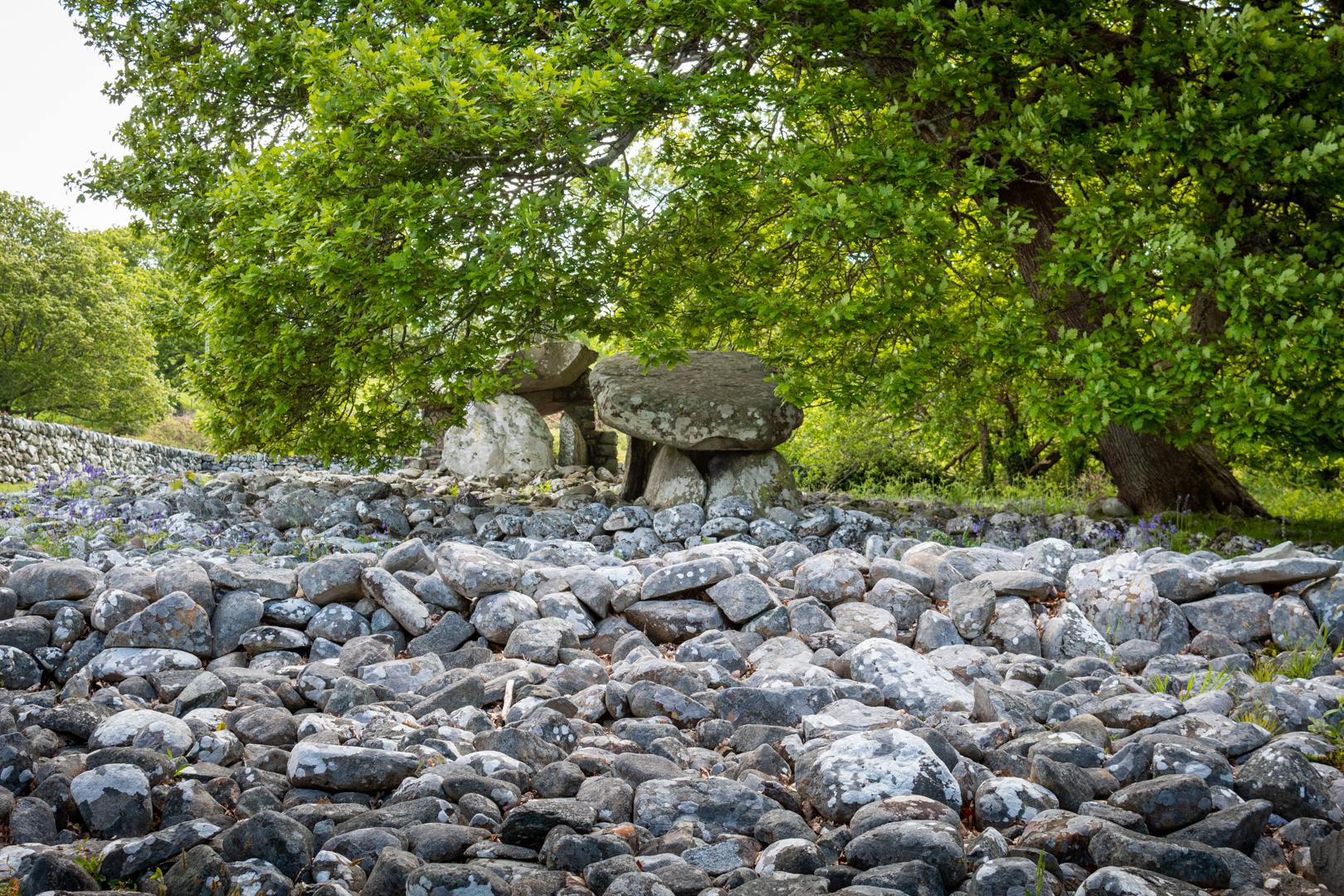
The two dolmens are just 30 feet apart within a much bigger mound.

The chambers were built sometime between 4000-2000 BC, probably as a communal burial site. The entire monument was probably originally covered by a mound of small stones.


Dyffryn Ardudwy Burial Chamber
Click on any image to enlarge


The investigation following the excavation seems to explain that there had been two different periods of construction at the site.


Dyffryn Ardudwy Burial Chamber
The Western Dolmen


First, the smaller, western, dolmen had been put up and surrounded by an oval cairn.


The Eastern Dolmen
The Eastern Dolmen


Sometime later, a larger Eastern tomb was constructed with a trapezial design which was needed to combine both tombs.


Dyffryn Ardudwy Burial Chamber
Click on any image to enlarge


Today the site consists of an elongated oval, running up a slight slope, with one large chamber at the top eastern end of the slope and a smaller chamber beneath the branches of a tree at the lower western end. Beside the upper chamber is a solitary standing stone.


Dyffryn Ardudwy Burial Chamber


The site was excavated in 1961-2 by T.G.E. Powell. Although the tomb had been rifled, at the smaller dolmen a pit containing fragments of five Neolithic pottery vessels was found sealed by the cairn in front of the tomb.
This tomb has a small prehistoric cup-mark carved on one of its portal stones.


Dyffryn Ardudwy Burial Chamber
The Eastern Tomb


The second, larger megalithic tomb was built to the east and was set within a large, rectangular cairn which incorporated the earlier tomb. This later tomb produced both Neolithic and Bronze Age pottery.
Other finds included a fine, broken, stone pendant.


It was found necessary in 1961-62 to provide additional support for the great roofing stone on the eastern dolmen and a buttress was built on either side of the chamber for this purpose.


Dyffryn Ardudwy Burial Chamber
The Western Tomb


There is little doubt that the two tombs were built several generations apart.


Stones from this site have been used in the past as building materials and this is often the case at these sites but there is still a vast amount of stones around the site.


Dyffryn Ardudwy Burial Chamber


In his book, 'Guide to Ancient Britain' Bill Anderton writes that: “As part of an outbreak of light phenomena, columns of light were seen issuing from the ground here in 1905. 


The site stands on the Morchras geological fault.


Footer:Visit Information: -

Google Reference: -
52.78462455046947, -4.094379021652469

Google search term:
Dyffryn Ardudwy Burial Chamber

What Three Words reference: -
///bagpipes.genius.snowmen

OS Details: -
SH 58852 22835L : Altitude:141 ft

Additional information.

Visiting is very easy but parking close is not so.
First there is Station road parking (52.78834904037549, -4.097879713123781) this will be the closest and it is just a 500 metre walk back to the main road and down to the school where the marked path alongside the school takes you to the site.
Alternatively park opposite the community centre (52.78834904037549, -4.097879713123781) and the walk is just an additional 200 metres and you may then visit the friendly café in the community centre. Good coffee and a warm welcome.


A full list of blogs can be found at my website


Read More

TÅ· Newydd Burial Chamber.


TÅ· Newydd burial chamber although ruined, is still a good example of a megalithic dolmen. 
Set on a natural outcrop it would originally have been covered with a mound or cairn 
now marked out by the small bollards that surround it.


Visit Date May 2023


Ty Newydd Burial Chamber (Dolmen)
Click on image for a larger version.


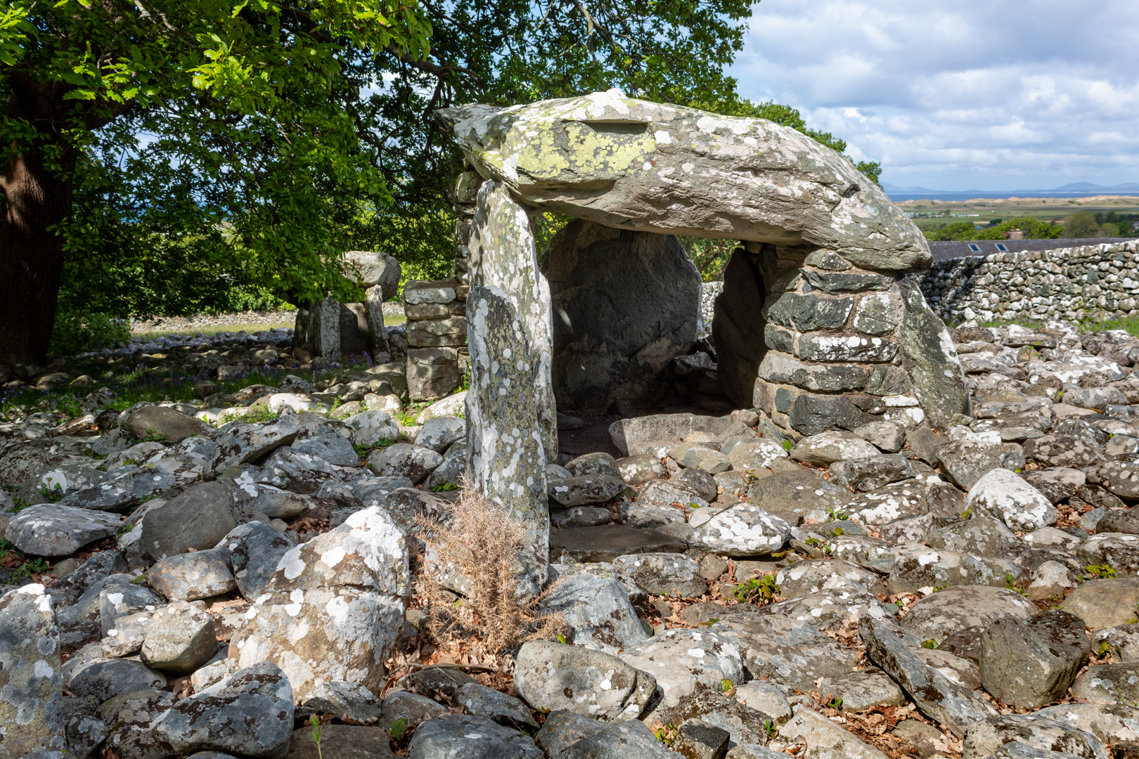
Ty-Newydd has a massive cracked capstone, about 4.0m by 1.8m and up to 1.2m thick, that rests on three of the four remaining uprights. The Capstone is likely to have originally been wider as part of the southern edge has broken off.


Ty Newydd Burial Chamber (Dolmen)


The chamber was originally part of a passage grave. One theory is that the tomb was originally similar to Bryn Celli Ddu (the subject of a later blog), with a second chamber joined to the first by a passage, and the entire tomb was covered by a large earth mound which was later removed.


Ty Newydd Burial Chamber (Dolmen)


Early reports claim that the second larger chamber existed close by, this has long since been broken up and carried away as has any surface evidence of a covering stone cairn so it is impossible to establish the original layout of the site although several small concrete markers around the chamber hint at the possible extent.
It is said to have once been enclosed by a circular wall about 32m in diameter and this may reflect the form of the cairn.


Ty Newydd Burial Chamber (Dolmen)


The huge tilted capstone is split and is now partly supported by brickwork and concrete. This does distract from the natural beauty of this site however one suspects that without this intervention the capstone would now be on the ground.
There is a photo in 'The Ancient Stones of Wales' by Barber and Williams, which purports to show Ty Newydd in 1900, with the capstone resting on 3 uprights, without all the modern brickwork.


Ty Newydd Burial Chamber (Dolmen)


The chamber was excavated in August 1935 by Charles Phillips.
There was a lot of charcoal, suggesting evidence of a large fire that formed this thick layer of charcoal as well as a quantity of quartz.


Ty Newydd Burial Chamber (Dolmen)


There were no human remains found at the site however the finds included five flint flakes, a burnt flint arrowhead, a small chip from a polished flint axe, and some small fragments of pottery. Phillips believed that the pottery fragments were from the Beaker culture, suggesting a Bronze Age reuse of this earlier Neolithic monument.


More recently, prehistoric artwork termed ‘cup marks’ have been detected on the capstone.


Footer:Visit Information: -

Google Reference: -
53.23592779682485, -4.482380635799995

Google search term:
I have had a few problems with google maps trying to locate the exact place by description so please use the google reference above.

What Three Words reference: -
///overgrown.broke.slings

OS Details: -
SH 34422 73862 Altitude:115 ft

Additional information.

Visiting is relatively easy.
There is a turn off to an unnamed road off the A4080
It traveling north the entrance to the field is on the right hand side and is has a ancient monument signpost and information board.
There is a small layby (53.23661829013594, -4.485084849839341).

There are no facilities here.


A full list of blogs can be found at my website


Read More

Coetan Arthur


___________________________________________________________________________________


C o e t a n  A r t h u r


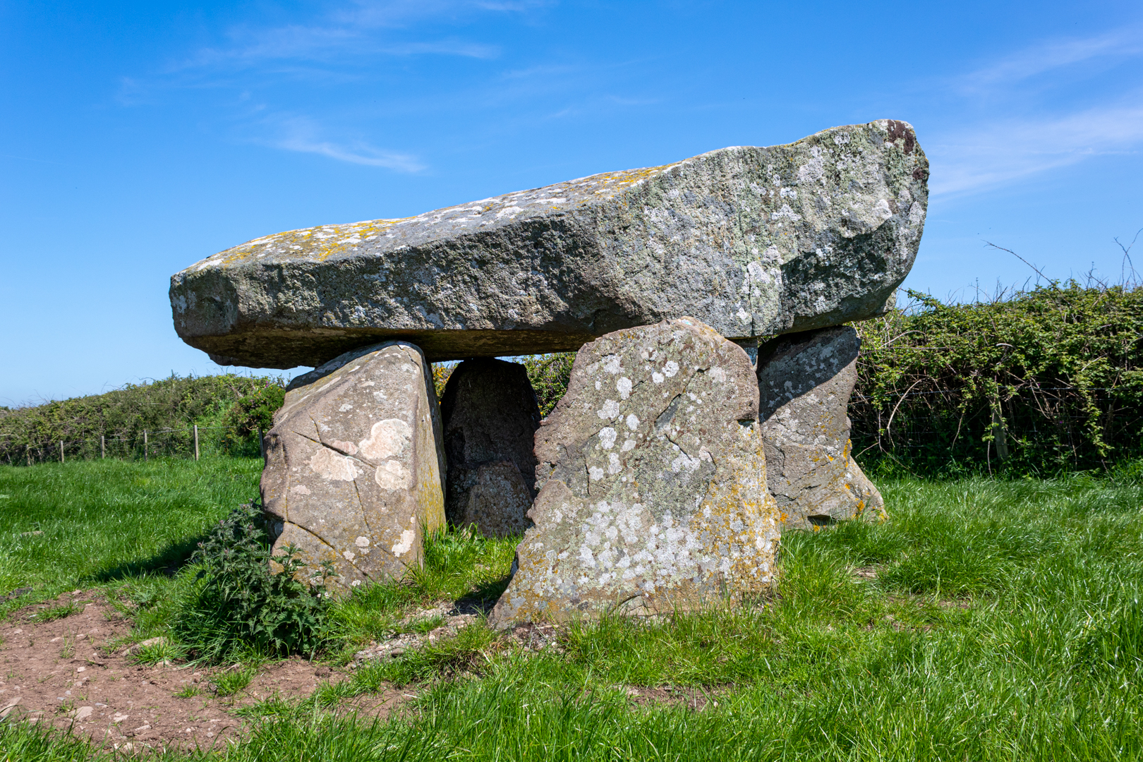
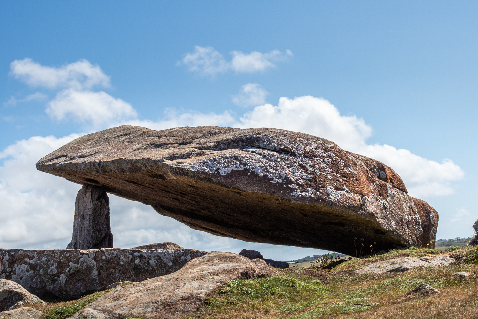
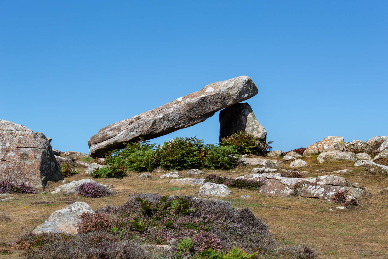
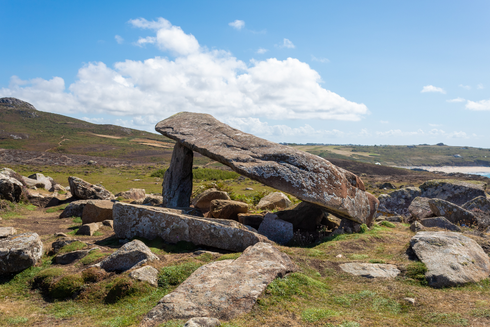
Coetan Arthur (also known as Arthurs Quoit).
 A dolmen on the southwest coast of Wales 
on the St. Davids's head peninsular, 
in county of Pembrokeshire, Wales.
This impressive megalithic tomb dates from 
between 4000 to 3000 BC.
The dolmen, which is formed by two vertical 
megaliths erected to support a flat capstone,
is partially collapsed, but still impressive nonetheless.


Visit Date August 2022


_____________________________________________________________________________________


Coetan Arthur, St Davids, Pembrokshire.


There are many ancient burial sites around the southwest of Wales
These burial sites are often marked with three or more uprights and a large capstone. Often this is all that is left of the site which would originally be covered with earth. This upright/capstone structure has been called a Dolmens or often also referred to here in Wales as a Cromlech, but my understanding is that Cromlech can also refer to a circular stone structure.


Coetan Arthur, St Davids, Pembrokshire.


This structure should not be confused with Carreg Coeten Arthur which is also in Pembroke, and which will be covered in another blog soon.


Coetan Arthur, St Davids, Pembrokshire.


The St Davids headland is full of ancient remains including signs of ancient field patterns, Neolithic enclosures, and defensive banks and ditches.


Coetan Arthur, St Davids, Pembrokshire.


Perhaps the most impressive part of the burial chamber is the massive capstone, which is roughly 6m long and 2.5m wide. The upright stone supporting it (known as an orthostat) is about 1.5m high.


Coetan Arthur, St Davids, Pembrokshire.


The site here overlooks Whitesands Bay at St. Davids and has a good view but is far enough from the main cliff not to be to battered by any storms that hit the coast.


Coetan Arthur, St Davids, Pembrokshire.


It has been reported many visitors to the site that they found the site hard to find. I suspect that if you were only casually walking the coast path that this could be true but I found that the site could be seen from quite a distance when walking east to west which seems to be the most natural direction to be walking.


These ancient sites often have a legend attached to them and this one is no exception. The legend for Coetan Arthur states King Arthur himself chucked the stones from nearby Carn Llidi.


Note: The terms Dolmen, Cromlech and Quoit are often used to describe this sort of neolithic site.


Footer:
Visit Information: -

Google Reference: -
51.90450867492426, -5.308083153876568

What Three Words reference: -
///snowstorm.finely.deck

OS Details: -
SM 72527 28056 Altitude: 162 ft

Additional information.
Visiting is easy, head to Whitesands bay car park (51.897174093111616, -5.2940221280185105) this is a caravan and camping park and is easy to get to.
There is good facilities for the park, there is a charge for parking.

The walk is around 1mile from the car park but is not flat it is undulating.
Before you descend to the path to Pothmelgan beach (there is a small crossing) you can see the site to the northwest. You can then either take the steep path directly to the site of take the coastal path around the head and then on to the site.


Read More

Search This Blog

About Me

Bridgend, United Kingdom
A renewed interest in photography and local history.

Contact Me

Name

Email *

Message *

Followers