With a renewed enthusiasm for photography and local history, I set out this blog as a record of my experiences with images and narratives. It is my hope that you find something of interest on this site. Please feel free to contact me for more information on any of the posts. You can see a comprehensive list of my blogs at my website :- http://www.davidnurse.co.uk

Showing posts with label Seascape Coast. Show all posts

The Burnham-on-Sea Low Lighthouse


The Burnham-on-Sea Low Lighthouse, fondly referred to as 'the Lighthouse on Legs',

 has a rich and dynamic history that has evolved significantly since 

its construction in 1832 and continues to play an operational role today.


Visit Date: April 2025


The Burnham-on-Sea Low Lighthouse


The Low Lighthouse was built in 1832 by Joseph Nelson. It was constructed alongside the High Lighthouse to replace the original Round Tower Lighthouse, which had previously replaced a light maintained in the tower of St. Andrew's Church.

Its primary purpose has been to guide fishing boats and vessels safely into the entrance channel of the River Parrett, where it flows into the Bristol Channel. The Bristol Channel is known for its extensive mudflats and a tidal range that can recede over 1.5 miles (2.4 km), along with constantly shifting sands, all of which pose significant risks to shipping.

The structure is a Grade II listed heritage building. It is a square wooden building standing 9 meters (30 feet) tall on nine wooden stilts or piles, sunk sixteen feet into the sand.


The Burnham-on-Sea Low Lighthouse
Click on any image for a lager view


Initially, the lighthouse was painted white with a black vertical stripe on the seaward side. In 1890, the color of the stripe was changed to red to make the lighthouse more visible during the day. Today, it remains white with a single vertical red stripe on its front face.

The Low Lighthouse originally displayed a narrow fixed beam of white light from its upper floor, visible through a square window. It functioned as a leading light in conjunction with the High Lighthouse, meaning vessels would align the two lights (one above the other) to determine the exact bearing of the deep-water channel into the Parrett estuary.

The Low Light had a range of 12 nautical miles (22 km; 14 mi). Beyond the channel, it also assisted vessels approaching the Bristol Channel from Hurlstone Point and Minehead. Keepers stationed at the High Lighthouse oversaw the operation of the Low Light.


The Burnham-on-Sea Low Lighthouse


By April 1844, the Gore Sand had extended, making the alignment of the lighthouses inaccurate for indicating the deep-water channel. As a result, starting November 1, 1866, an additional red light was installed in the Low Lighthouse to shine towards Gore Sand, and another red light was added to guide departing vessels upriver.

With the arrival of electricity in Burnham in 1927, incandescent light bulbs replaced paraffin vapor burners in both lighthouses, rendering the keepers redundant. A submarine cable connected the two lighthouses, and their light characteristics were synchronized and controlled by a motor-driven machine in the High Lighthouse. Both lights were given an occulting characteristic, with the Low Light occulting every 2.5 seconds. It received a 500-watt bulb with a range of 9 nautical miles (17 km; 10 mi). An automatic lamp changer was also installed as a backup.


The Burnham-on-Sea Low Lighthouse


The Low Lighthouse was deactivated in 1969 due to the installation of a new subsidiary sector light in a lower window of the High Lighthouse, which provided the correct bearing for the deep-water channel, making the Low Lighthouse surplus to requirements. However, on December 31, 1993, the Low Lighthouse was re-established and recommissioned after the High Lighthouse was decommissioned and sold, becoming a private residence and tourist attraction. The High Lighthouse's flashing white light and subsidiary sector light functions were transferred to the Low Lighthouse.


The Burnham-on-Sea Low Lighthouse


The lighthouse has undergone multiple restorations due to rough sea conditions. Its stairway was removed in 1984 due to storm damage, and a metal stairway was later installed in 2010. The building receives a fresh coat of marine-grade paint every six years, with a total of 50 liters of Cuprinol opaque wood finish used for a previous makeover.


The Burnham-on-Sea Low Lighthouse


Somerset Council inspects the building twice a year.


The current significance of the lighthouse is as an active navigation aid. It provides a white flash every 7 to 7.5 seconds and a fixed directional light (white, red, or green depending on direction) at a focal plane of 4 meters (13 ft), while the focal plane for the main light is 7 meters (23 ft).


The Burnham-on-Sea Low Lighthouse


The lighthouse is currently owned and maintained by Somerset Council; it was previously operated by Sedgemoor District Council. Funding for its maintenance has been confirmed as secure by Somerset Council, despite budget concerns.


The Burnham-on-Sea Low Lighthouse


The Low Lighthouse is an iconic structure and a symbol of the town's rich maritime heritage. It is popular with photographers and tourists and is featured in the town's coat of arms, local signage, and literature. The lighthouse is also a subject for local artists. Visitors can walk to its base during low tide, although there is no public access to enter the lighthouse itself. It is a key attraction on Burnham-on-Sea Beach.


The Burnham-on-Sea Low Lighthouse


While the lighthouse is a popular destination, visitors are strongly cautioned about the hazardous mudflats and sinking sand on the beach, which are due to the area's vast tidal range. 


The Burnham-on-Sea Low Lighthouse


Symbolizing the town's rich maritime heritage, the Low Lighthouse is a popular destination for photographers and tourists alike, featuring prominently in local signage and literature. Although visitors can approach its base during low tide, access inside the lighthouse is restricted. The lighthouse is a central attraction on Burnham-on-Sea Beach, but visitors are advised to exercise caution due to hazardous mudflats and sinking sand typical of the area’s extensive tidal range.


Footer:Visit Information: -
Google Reference: -
51.24845147253358, -3.00585011421767

What Three Words reference: -
///wallet.quilting.cunning

OS Details: -
Grid Ref: ST 29892 50396


Additional information.
Visiting is easy as this is on the public beach, the nearest parking would be on Poplar Road
 ( 51.24464740501554, -3.000507843662151) but this is busy. 
There is however plenty of parking on the sea front 
(51.2391062944699, -2.9989930766074693) then there is an easy 1.1 KM walk along the beach. 
There are lots of facilities on the sea front.


A full list of blogs can be found at my website


Read More

Durdle Door


Durdle Door is a notable limestone arch situated on the Jurassic Coast in Dorset, England. 
It boasts a rich geological history, an ancient name, and has inspired various cultural works.


Visit Date June 2025


Durdle Door : Dorset , England
Durdle Door


The formation of Durdle Door is a result of complex geological processes spanning millions of years.

The story of initial sedimentation began approximately 140 to 150 million years ago during the late Jurassic period when the area was covered by a warm, shallow sea. Over time, layers of sediment and debris, primarily composed of clay, silt, sand, and limestone (known as Portland Stone), were gradually deposited.


Durdle Door : Dorset , England
Coastline west of Durdle door indicating a small arch formation in the distance.


Around 70 million years ago, tectonic forces caused the Earth's crust to experience folding and uplifting, forming a dome-like structure known as the Lulworth anticline. This process resulted in the rock layers being tilted, almost standing on end.

Durdle Door was formed on a concordant coastline, where layers of rock run parallel to the shoreline. The arch itself is made of resistant Portland Limestone, which is harder than the surrounding rock layers. Over time, the relentless pounding of waves against the coastline gradually eroded the softer rocks behind this harder limestone. This process of differential erosion initially created a notch at the base of the cliff, which then developed into a cave. Eventually, as the cave eroded completely through the hard stone, it transformed into the distinctive arch we see today.


Durdle Door : Dorset , England
Click on any image for a larger view


Durdle Door is a "process halfway finished." The coastline is dynamic and prone to erosion, leading to occasional rockfalls and landslides. The arch is expected to eventually collapse, creating a sea stack, it is likely to occur during a strong storm, as ongoing erosion weakens the structure.


Durdle Door : Dorset , England
Coastline east of Durdle door showing 'sea stacks'


The name "Durdle Door" is believed to have ancient origins, possibly dating back over a thousand years, although early written records are limited.

The word "Durdle" is derived from the Old English word "thirl," meaning "to pierce," "bore," or "drill". This, in turn, comes from "thyrel," meaning "hole"

The term "Door" in the name likely refers to the arch's unique arched shape. In the late 19th century, it was also known as the "Barn Door" due to its design, which was tall enough for a sailing boat to pass through.

In the late 18th century, it was referred to as the "magnificent arch of Durdle Rock Door." Early 19th-century maps featured variations of the name, such as "Duddledoor," "Durdle," and "Dudde Door." The first Ordnance Survey map, published in 1811, officially named it "Dirdale Door."


Durdle Door appears in Folklore, Myths, and Popular Culture

Arthur Moule, a Dorset-born missionary and friend of Thomas Hardy, wrote about Durdle Door in his 1879 book of poetry, Songs of Heaven and Home, written in a foreign Land.


Durdle Door : Coast Marker
Coastal walk marker at Durdle Door.


Durdle Door has been featured in several films, including *Wilde* (1997) with Stephen Fry, *Nanny McPhee* with Emma Thompson, the 1967 *Far From The Madding Crowd*, and the Bollywood film *Housefull*. Most recently, it appeared in the 2022 *Doctor Who* episode "The Power of the Doctor," where the Thirteenth Doctor regenerated.

Parts of music videos for Tears for Fears' "Shout," Billy Ocean's "Loverboy," Cliff Richard's "Saviour's Day," and Bruce Dickinson's "Tears of the Dragon" were filmed at Durdle Door.


Footer:Visit Information: -
Google Reference: -
50.62127062504596, -2.2762703993436575

What Three Words reference: -
///crabmeat.inversely.chat

OS Details: -

Grid Ref: SY 80524 80195 Elevation: 74 ft 


Additional information.

Visiting is easy and there is a public car park at the site (
50.62416344362244, -2.269425401934578).
Access is well signposted off the B3070 near Burngate and onto Church Road. On this road it feels like you are entering a holiday park but continue to follow the signs and you will eventually come to the car park. Access then is along the coastal path down to the site and beach. There is a steep climb down to the viewing area and if you wish to get to the beach it is a further climb down many steps. This is difficult if you have poor mobility.
At the car park there is refreshments and toilet services. This place gets very busy, especially in the summer months.
The car park is not free and there is a number plate recognition system in use and payment is made by card on leaving.


A full list of blogs can be found at my website


Read More

The Church of the Holy Cross, Mwnt.

The Church of the Holy Cross (Welsh: Eglwys y Grog)
 in Mwnt, Ceredigion, Wales. 
A parish church and a Grade I listed building, 
likely dating from the 13th century.


Visit Date March 2025


The Church of the Holy Cross, Mwnt.


The Church of the Holy Cross is an example of a medieval sailors' chapel of ease, allowing sailors to attend church without traveling all the way to the village of Mwnt.


The Church of the Holy Cross, Mwnt.
Click on any image to see a larger version


The site is said to have been used since the Age of the Saints (about 410-700 AD).


Mwnt.
The coast at Mwnt


The dedication to the Holy Cross likely references a stone cross that once stood atop Foel y Mwnt, the conical hill directly behind the church.
The cross would also have been visible for many miles out to sea,  attracting pilgrims who drew their boats up on the sandy beach at the base of the cliffs.


The Church of the Holy Cross, Mwnt.
A pilgrims way wall hanging


Mwnt gained a reputation among early Christians as a stopover for the bodies of saints being transported to Bardsey Island for burial. Its location also made it a convenient resting place for pilgrims traveling to St. David's, further down the coast.


The Church of the Holy Cross, Mwnt.
North wall showing blocked lancet


On the north wall, there is a small blocked lancet window that may have permitted lepers—who were not allowed inside churches—to view the high altar during services.


The Church of the Holy Cross, Mwnt.


On the north wall, remnants of a medieval rood stair can be found, and timbers from the 15th-century rood loft, embellished with rose carvings, are set into the wall.


The Church of the Holy Cross, Mwnt.
Click on any image to see a larger version


The interior consists of a single chamber featuring deep-set windows and a unusually designed roof.


The Church of the Holy Cross, Mwnt.
The font


It has an example of a 12th- or 13th-century font made of Preseli stone.


The Church of the Holy Cross, Mwnt.
The coast at Mwnt


In 1155, a group of Flemish soldiers landed at Mwnt but were repelled by the local Welsh after fierce fighting. A nearby stream still bears the name Nant y Fflymon, meaning the Flemings' Brook.


The Church of the Holy Cross, Mwnt.


Over the centuries, many human bones have been unearthed. It is believed that the bodies from the battle were buried in the farmer’s field.


The Church of the Holy Cross, Mwnt.


The victory achieved by the local Welsh inhabitants in the area was commemorated, at least in the 18th century when the events were recorded, through secular games held on the first Sunday in January. These games were referred to as “Coch y Mwnt,” which translates to "the Bloody Sunday of Mount."


The Church of the Holy Cross, Mwnt.


The nearby farm features a well named Ffynnon Grog, known as the well of the cross, along with Nant y Flymon, which translates to Fleming’s brook. 


The Church of the Holy Cross, Mwnt.


Mwnt was a civil parish for several centuries. However, before the 17th century, it served as a detached chapelry of the parish of Llangoedmor. Since 1934, Mwnt has been part of the parish of Y Ferwig, which consists of a parish church and a few houses. This community includes the villages of Penparc, Felinwynt, Tremain, Mwnt, and Gwbert, as well as Cardigan Island and the National Trust area of Mwnt.


Footer:Visit Information: -
Google Reference: -
52.13694896383402, -4.638645221098706

What Three Words reference: -
///echo.dwarf.mission

OS Details: -
OS Grid Ref: SN 19504 52017 

Additional information.

Visiting is easy and there is a car park close to the site (
52.135662647388045, -4.638483304444649) This is run by the national trust and is free for members but charges do apply for non-members.

There were no facilities when I visited in March however there is a cafe (Caban Mwnt) a short walk from the car park  (52.1347209027339, -4.639436590459322).

The roads to the site are well maintained single track country roads with passing points. 

I believe this site can become very busy in the summer with visitors to the beach and surrounding areas. 
.


A full list of blogs can be found at my website


Read More

Pendeen Lighthouse


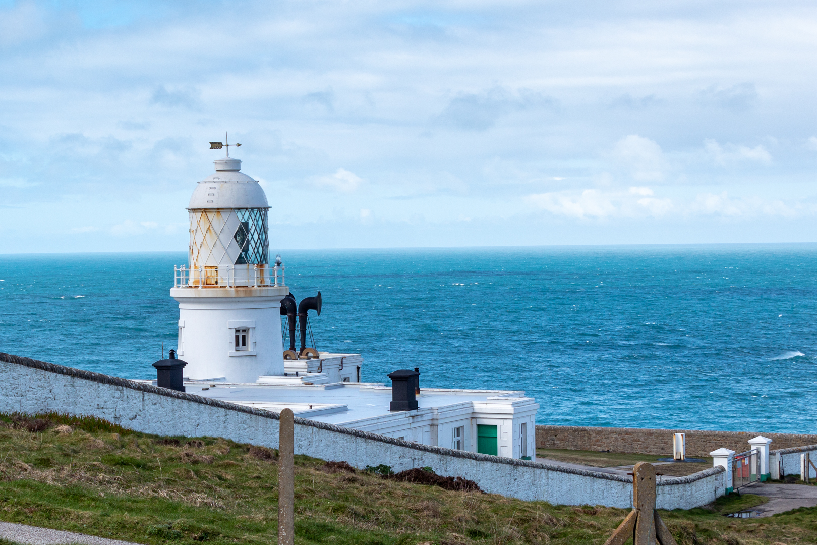
Pendeen Lighthouse

Pendeen Lighthouse, also known as Pendeen Watch
 is an active aid to navigation and is sited north of the 
village of Pendeen in west Cornwall, England, 
United Kingdom.


Visit Date March 2023


Pendeen Lighthouse
Click on any image for larger view


Pendeen Lighthouse lies Only six miles north of Land's End and is close to the small and very pretty village of St Just, which thrived during the Tin and Copper mining era in the 1900s.

The construction of the lighthouse started in the 1890s and was designed by Sir Thomas Mathews for Trinity House (Trinity House is a charity dedicated to safeguarding shipping and seafarers) and constructed by Arthur Carkeek from Redruth.

The headland needed to be flattened to accommodate the 17-metre tower and associated buildings.

The light was first lit on 3 October 1900


Pendeen Lighthouse


A foghorn is also sighted here with twin 5-inch sirens driven initially by compressed air from an oil engine.

A five–wick Argand lamp provided the initial power for the lighthouse but the lamp was soon replaced with a 3-50mm dia. mantle lamp


Pendeen Lighthouse


The lens system was a large (first-order) rotating optic made up of two sets of four panels, which displayed a group of four flashes every fifteen seconds, it had a range of 20 nautical miles and is still in use.


The Cornish coast at Pendeen Lighthouse
Click on any image for a larger view


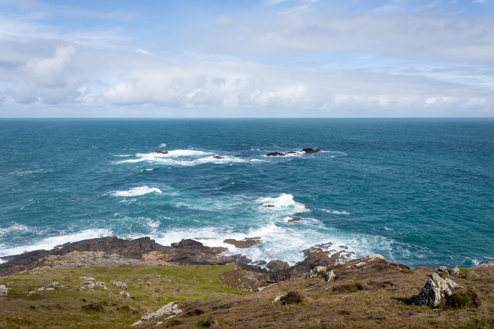
The coast of this area is treacherous to shipping. Along the coast, the remnants of the once thriving mining in the area can be seen. 

In the 1990s it was decided that the lighthouse would become automated and the last of the lightkeepers left the lighthouse on May 3rd 1995.


The Cornish coast at Pendeen Lighthouse


The lighthouse, together with the attached keepers' cottages, are Grade II listed,

Built within the North Cornwall Coast within a Site of Special Scientific Interest and an Area of Outstanding Natural Beauty, it is sited on one of the many granite headlands bird watching is popular here as is seal and dolphin spotting. Being north-west facing is a perfect location to watch the sun setting over the Atlantic.


Footer:
Visit Information: -

Google Reference: -
50.16498077682171, -5.671545986771646

What Three Words reference: -
///cheeses.cabs.zooms

OS Details: -
SW 37890 35891 : Altitude:52 m

Additional information.

There is parking here (50.164339321872106, -5.670764521122517) for a half a dozen cars or so and the place is easy to visit.
Off the B3306 the lighthouse is signposted from the road.
There are no facilities at the site.


A full list of blogs can be found at my website


Read More

Search This Blog

About Me

Bridgend, United Kingdom
A renewed interest in photography and local history.

Contact Me

Name

Email *

Message *

Followers