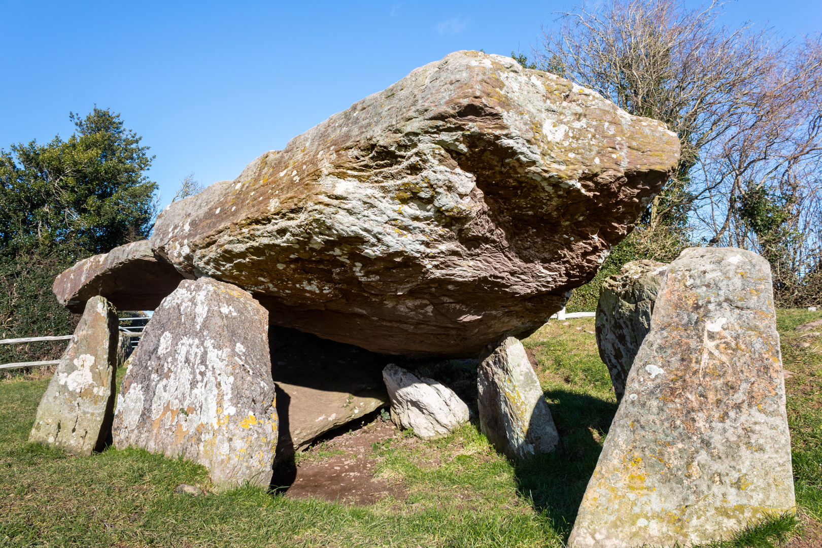
With a renewed enthusiasm for photography and local history, I set out this blog as a record of my experiences with images and narratives. It is my hope that you find something of interest on this site. Please feel free to contact me for more information on any of the posts. You can see a comprehensive list of my blogs at my website :- http://www.davidnurse.co.uk

Showing posts with label Ancient Structures. Show all posts

Trethevy Quoit


Known locally as "the giant's house".

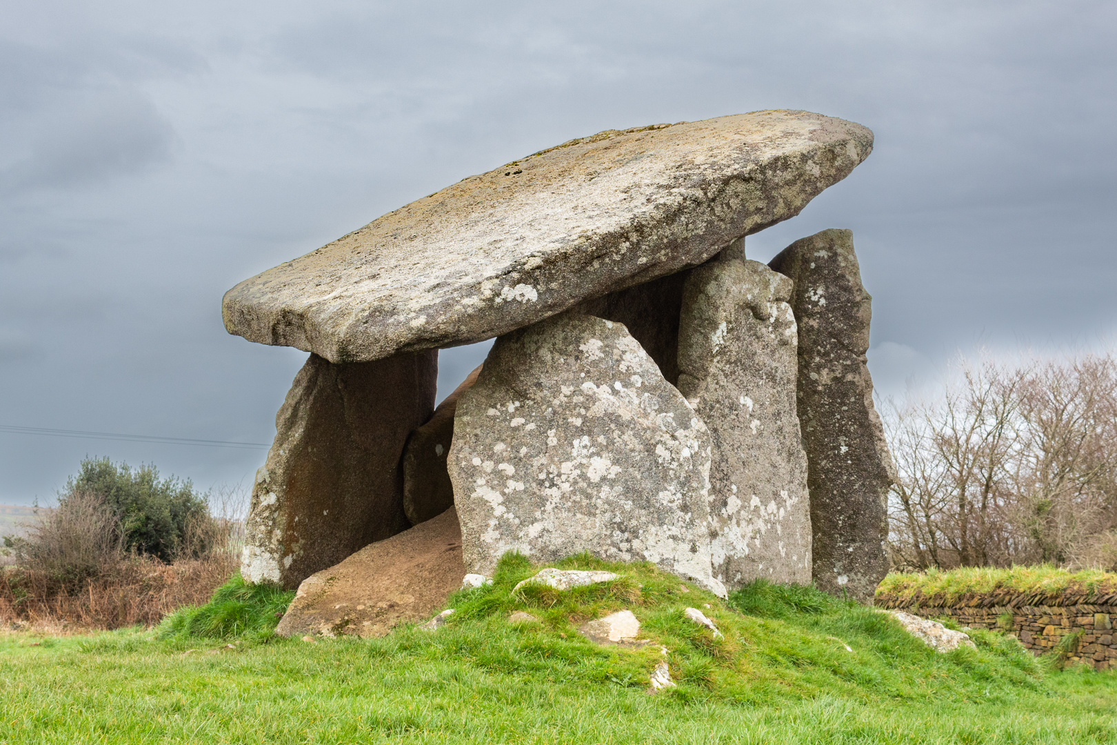
Standing 9 feet (2.7 m) high, this magnificent 5000-year-old

ancient structure consists of Six standing stones capped by a large slab.


Visit Date March 2024


Trethevy Quoit
Trethevy Quoit


Walking up to this structure, it is in a field close to some modern houses you do not get a feel of the size of this structure but as you approach the magnificence of this site overwhelms you.


Trethevy Quoit
Click on any image to enlarge


There are many of these burial sites in the UK and Cornwall has a large number of them.

Like many other portal structures, Trethevy Quoit would have been originally covered by a mound.

In the 19th century, William Copeland Borlase studied the site and made drawings of it.
A later investigation of the remnants suggests a mound diameter of almost 6.5 metres.

It is impossible to tell if stones have been removed from the site but the remaining seven stones a and an estimated 10.5-ton cover slab were inside the mound.


Trethevy Quoit
Trethevy Quoit


There are some unusual aspects of Trethevy Quoit, not only does it have 6 supporting stones forming its internal chamber, but it also has an antechamber at the 'front'. The only other Cornish quoit to boast two chambers is Lanyon Quoit.


Particularly interesting is the circular hole cut in the highermost corner of the capstone. Speculation has informed us that the hole could have been used for astronomy. The movement and settling over the millennia that have passed means it is impossible to prove, but it is peculiar and thought to be unique to this megalithic site.


Trethevy Quoit
Click on any image to enlarge


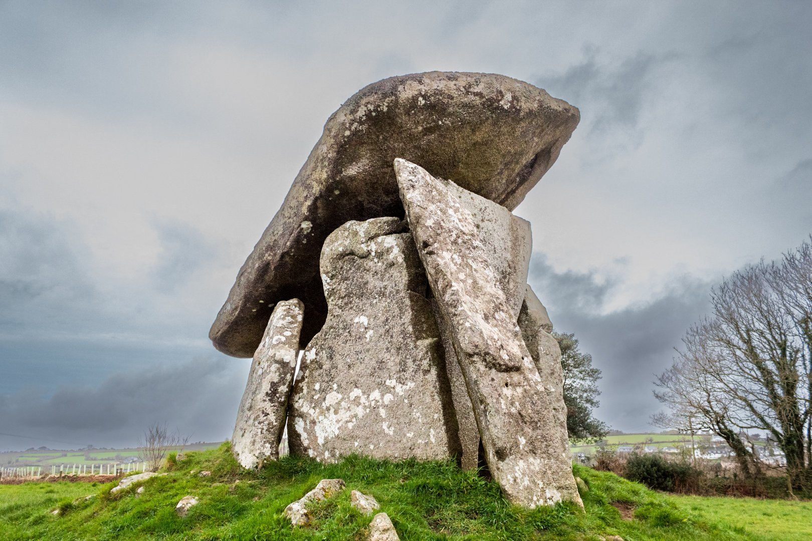
The massive capstone sits at a steep angle, and this is unlikely if this was the capstone's original position. At the lower side of the capstone, five small hollows can be found.

The entrance stone at the front in most portal structures can't be moved. however, Trevethy Quoit is a rare exception here, because a small rectangular stone moving at the bottom right of the front allows access to the chamber.

There is a rectangular cut-out at the side of the upright stone that forms the front of the main chamber it is unclear if this is a later modification of if it was used and an entrance this is not seen on any other Cornish sites.


Trethevy Quoit
Trethevy Quoit


Trethevy Quoit was first mentioned in 1584 by John Norden, in a topographical and historical account of Britain.

He described it as “A little howse raised of mightie stones, standing on a little hill within a fielde”.


Trethevy Quoit
Trethevy Quoit


In Cornish mythology, the monument is known as the Giant’s House and was believed to have been created by this fabled race.
It also like many other structures in Cornwall and indeed Wales it has links with King Arthur legend and is believed to have been magically built by Merlin.


Additional information:-
A Cromlech or Dolmen is an ancient underground tomb typically built with several large upright stones and a capstone on top. In its day, the whole thing would have been covered by a mound of earth. In some parts of the UK especially in Cornwall these structures are called Quoits.
Most date from the Late Neolithic period (4000–2000 BC)


Footer:Visit Information: -
Google Reference: -
50.493185727515105, -4.455456201119047

What Three Words reference: -
///countries.extent.nibbles

OS Details: -
SX 25936 68813 : Altitude:725 ft

Additional information.

Visiting is fairly easy although the roads become just lanes for some of the way and parking is a small car park for about three cars (50.493164985542144, -4.454975466726607) and a short walk into the adjacent field.
The approach is via the B3254 and turn off towards the village of Darite. On this road you will see the turn off for the quoit.


A full list of blogs can be found at my website


Read More

Dyffryn Ardudwy Burial Chamber


Neolithic burial sites can be found all over Wales, the UK and across Europe.
I have visited many of these sites and have posted information on them here such as
What makes the site at Duffryn Ardudwy different is that there are two tombs close together.


Visit Date May 2023


Dyffryn Ardudwy Burial Chamber
Click on any image to enlarge.


The two dolmens are just 30 feet apart within a much bigger mound.

The chambers were built sometime between 4000-2000 BC, probably as a communal burial site. The entire monument was probably originally covered by a mound of small stones.


Dyffryn Ardudwy Burial Chamber
Click on any image to enlarge


The investigation following the excavation seems to explain that there had been two different periods of construction at the site.


Dyffryn Ardudwy Burial Chamber
The Western Dolmen


First, the smaller, western, dolmen had been put up and surrounded by an oval cairn.


The Eastern Dolmen
The Eastern Dolmen


Sometime later, a larger Eastern tomb was constructed with a trapezial design which was needed to combine both tombs.


Dyffryn Ardudwy Burial Chamber
Click on any image to enlarge


Today the site consists of an elongated oval, running up a slight slope, with one large chamber at the top eastern end of the slope and a smaller chamber beneath the branches of a tree at the lower western end. Beside the upper chamber is a solitary standing stone.


Dyffryn Ardudwy Burial Chamber


The site was excavated in 1961-2 by T.G.E. Powell. Although the tomb had been rifled, at the smaller dolmen a pit containing fragments of five Neolithic pottery vessels was found sealed by the cairn in front of the tomb.
This tomb has a small prehistoric cup-mark carved on one of its portal stones.


Dyffryn Ardudwy Burial Chamber
The Eastern Tomb


The second, larger megalithic tomb was built to the east and was set within a large, rectangular cairn which incorporated the earlier tomb. This later tomb produced both Neolithic and Bronze Age pottery.
Other finds included a fine, broken, stone pendant.


It was found necessary in 1961-62 to provide additional support for the great roofing stone on the eastern dolmen and a buttress was built on either side of the chamber for this purpose.


Dyffryn Ardudwy Burial Chamber
The Western Tomb


There is little doubt that the two tombs were built several generations apart.


Stones from this site have been used in the past as building materials and this is often the case at these sites but there is still a vast amount of stones around the site.


Dyffryn Ardudwy Burial Chamber


In his book, 'Guide to Ancient Britain' Bill Anderton writes that: “As part of an outbreak of light phenomena, columns of light were seen issuing from the ground here in 1905. 


The site stands on the Morchras geological fault.


Footer:Visit Information: -

Google Reference: -
52.78462455046947, -4.094379021652469

Google search term:
Dyffryn Ardudwy Burial Chamber

What Three Words reference: -
///bagpipes.genius.snowmen

OS Details: -
SH 58852 22835L : Altitude:141 ft

Additional information.

Visiting is very easy but parking close is not so.
First there is Station road parking (52.78834904037549, -4.097879713123781) this will be the closest and it is just a 500 metre walk back to the main road and down to the school where the marked path alongside the school takes you to the site.
Alternatively park opposite the community centre (52.78834904037549, -4.097879713123781) and the walk is just an additional 200 metres and you may then visit the friendly café in the community centre. Good coffee and a warm welcome.


A full list of blogs can be found at my website


Read More

St. Dogmaels Abby and St Thomas' Church.


Founded in 1120 on the site of an earlier pre-Norman church, St. Dogmael’s status as a religious centre can be seen in extensive ruins which span four centuries of monastic life. Elements of the church and cloister are 12th century in origin, while the tall west and north walls of the nave are 13th century.


Visit Date September 2023


St Dogmaels Abbey - Infirmary


St Dogmaels story starts long before the abbey was built.

The Abbey was constructed and inhabited by The Monks of Tiron.


St Dogmaels Abbey - Infirmary


The Tironensian Order or the Order of Tiron was a medieval monastic order named after the location of the mother abbey (Tiron Abbey, French: Abbaye de la Sainte-Trinité de Tiron, established in 1109)


St Dogmaels Abbey - Infirmary


The foundation of Tiron Abbey by Bernard of Abbeville was part of wider movements of monastic reform in Europe in the eleventh and twelfth centuries. Bernard intended to restore the asceticism and strict observance of the Rule of St. Benedict in monastic life, insisting on manual labour.


St Dogmaels Abbey - The Nave & West Wing


Tiron was the first of the new religious orders to spread internationally. Within less than five years of its creation, the Order of Tiron owned 117 priories and abbeys in France, Britain and Ireland.


St Dogmaels Abbey - The Nave & West Wing


Tiron's influence in Britain was limited. St Dogmaels was the only Tironian abbey to be established in Wales or England, although the house also had daughter priories in Wales and Ireland. A few Tironian abbeys were established in Scotland, but they soon formed their own independent order.


St Dogmaels Abbey - The infirmary


And so in in 1120 on the site of an earlier pre-Norman church, St Dogmael’s status as a religious centre was created.


The Chancel with a Crypt


The monastic vows laid great stress on poverty, chastity and obedience, and these ideals were characteristic of the monastic life, especially in the early years. The abbey would have taken in any pilgrims and travelers requiring hospitality.


St Dogmaels Abbey - The Refectory with the Cloister and Nave in the background
The Refectory with the Cloister and Nave in the background


Not all aspects of the monastic life at St Dogmaels continued to flourish, and in later centuries the abbey suffered from a decline in standards as well as in its financial position. In 1402, for instance, at the time of the visitation by the bishop of St David’s, it appears that only 4 monks were left in the abbey and they were of disrepute, it having been noted, "They were gluttonous and one of them named as Howel Lange had been found drunk and because of this and his "evil deeds" he was banned from drinking any alcohol for a year".


St Dogmaels Abbey -The Refectory
The Refectory


After this visit for some time, the abbey saw an improvement in its monastic life but despite this, St. Dogmaels was never raised to the levels seen years before and its life as a monastery was declining again and was ended during the reign of King Henry VIII when in 1536 it took its place with many other places with an income of less than £200 a year.


St Dogmaels Abbey - The North Transept
The North Transept


The assessed annual value of the monastery at the dissolution was £87 8s.6d


St Dogmaels Abbey - The North Transept


Much of the abbey's possessions, including Caldey and Fishguard were leased to John Bradshaw of Presteigne, in Radnorshire. A few years later, in 1543, Bradshaw was able to purchase the properties which he already had on lease. He built a mansion for himself, almost certainly within the abbey grounds, and possibly took stone from the abbey buildings for its construction. It is thought that none of the remains of these buildings can be seen today.


St Dogmaels Abbey - The North Transept


It was reported that by the start of the 17th century, the site was in a ruinous state.

In 1646 the site was bought by David Parry of Neuadd-Trefawr, near Cardigan but he never lived there.


St Dogmaels Abbey - The North Transept, Nave and Guest House
The North Transept, Nave and Guest House


Early in the eighteenth century, a new parish church was erected alongside the old abbey church. A century later, in 1847, this was replaced by St Thomas' Church which now stands on the site.


St. Thomas' Church
St. Thomas' Church


The original plans were made in 1847 for a church to cost £600, but the final cost was £1,500. A tower was proposed but funds were insufficient. Daniel Evans of Cardigan superintended the building, and John Davies and John Thomas of Llechryd were the contractors.


St. Thomas' Church
St. Thomas' Church

St. Thomas' Church
St. Thomas' Church

St. Thomas' Church
St. Thomas' Church


1866, a vicarage and its coach house were added with materials from the old abbey buildings.


St. Thomas' Church
St. Thomas' Church


In 1934 the remains of the abbey were placed in State guardianship by the Representative Body of the Church in Wales. The site was cleared and the masonry consolidated between 1947 and 1968 and the ruins are now maintained by Cadw: Welsh Historic Monuments.


St Dogmael
St Dogmael


Finally, Saint Dogmael was a 6th-century Welsh monk and preacher who is considered a saint. His feast day is 14 June.
Saint Dogmael seems to have concentrated his preaching in Pembrokeshire, where there are several churches dedicated to him.


Footer:Visit Information: -

Google Reference: -
52.080568145326666, -4.680455205913844

Google search term:
St Dogmaels Abbey

What Three Words reference: -
///rescuer.conspire.same

OS Details: -
SN 16401 45858 Altitude:62 ft

Additional information.

Visiting is very easy.
A487 and then B4546 to the Abbey
There is limited parking at the site. (
52.08084819413824, -4.679396371342211) and this is not always available especially on Tuesdays when it is the venue for the local market. but a better bet is at the town parking (52.08178485298606, -4.677090769613847) and it is just a short  200 m walk to the Abbey.
There is a great cafe and also museum an the site.


A full list of blogs can be found at my website


Read More

Ynyscedwyn Ironworks


The site of the Ynyscedwyn Ironworks is a remnant 
of the past and is one of the most iconic sights
in the village of Ystradgynlais near Swansea.


Visit Date March 2023


Ynyscedwyn Ironworks
Click on the any image for a larger view


Ynyscedwyn Ironworks' long history has been traced. Thanks to a find of pig iron it has been able to date iron production here back to 1612.

As you would expect the site has gone through many changes over the centuries.


Ynyscedwyn Ironworks


What we see today is dated from a stone in the base of the wall of the chimney dated 1872 and is what is left of a mill that was constructed then possibly for Steel production. This was never completed and the site shortly after this housed a tinplate works.


Ynyscedwyn Ironworks
Click on the any image for a larger view


By 1837 three blast furnaces were running at the site which increased to 6 by 1853.

by 1854 the Inyscedwyn Ironworks were the largest producer in the country.

However, the glory days of the works were soon in decline after this date and by 1869-70 the works were closed.


Ynyscedwyn Ironworks
Click on the any image for a larger view


It was then that the rolling mill project was started, the remains of which we see today. But they were never completed and work was started converting the site to a tin works.

The tin works consisted of three operating mills from the periods 1889-1903 and 1905-41 before they also went the way of the ironworks.


Ynyscedwyn Ironworks


The site then lay in disrepair until the site was cleared and landscaped in the late 20th century only leaving what we see today primarily the 1872 chimney and the massive arches on either side.


Ynyscedwyn Ironworks
Click on the any image for a larger view


Also on the site, a few pieces of the works are left. A dram or coal cart, the remains of a winding mechanism and the remains of a miner's cage.


Ynyscedwyn Ironworks
Click on the any image for a larger view


The site of the ironworks is open to the public and a housing estate is close by and also a children's playground is now alongside the historical site.


Footer:Visit Information: -

Google Reference: -
51.7682972861281, -3.7642929522232205

Google search term:
Ynyscedwyn Iron Works

What Three Words reference: -
///glassware.clips.demanding

OS Details: -
SN 78346 09208 : Altitude:230 ft

Additional information.

Visiting is very easy.
From the M4 junction 45 take the A4067 north then the B4559 the site is Situated on grassed site bounded by Glan-Rhyd Road and Pont Aur, just N of Ystradgynlais Hospital.
There is a parking at the site. (51.76851605993839, -3.7649497331170707).


A full list of blogs can be found at my website

Read More

Cenarth Falls


Cenarth is a small village on the border of Pembrokeshire, Ceredigion and Carmarthenshire. 
The focus of the village is Cenarth Falls, a series of small waterfalls and pools
 on the river Teifi known as The Salmon Leaps.


Visit Date September 2023


Cenarth Falls


The waterfalls are one of the first real barriers to salmon and seatrout on their way up the Teifi from the sea to spawn.


Cenarth Falls


There has been a mill on the south bank of the river at Cenarth since the 13th century when Cenarth Mill came into the possession of Edward I when he became Lord of the Manor of Cenarth.


Cenarth Falls, showing the mill.


The mill holds a secret in its base. There is a trap door in the floor and it is said that the miller would open the door and catch the salmon that were leaping there. The catching of salmon here was illegal but despite this, there was a lot of poaching of the fish, especially at night.

Light round boats, called coracles here in Wales, would often be seen on the river in the autumn nights with their occupants poaching the fish.


Cenarth Bridge


As well as the falls at Cenarth the other main feature of this small town is the bridge over the River Teifi at Cenarth that joins two counties, Carmarthenshire and Ceredigion and has existed at least since 1188 when it was mentioned in the writings of Gerald of Wales.(a royal clerk to the king and two archbishops, he travelled widely and wrote extensively).


Cenarth Bridge


The design includes two cylindrical holes 6 ft (1.8 m) in diameter, one on either side of the central span. The holes were included in the design while reducing the overall weight of the structure they also allow floodwaters to pass through them, instead of going over the top of the bridge: In these images, the water appears to flow under the southern arch only however, when in full flood the Teifi flows through all three arches.
This feature was used by Edwards's father William, who used six holes in the Old Bridge at Pontypridd to reduce the weight and pressure on the centre section.


Footer:Visit Information: -

Google Reference: -
52.04573152490105, -4.524292938371246


Google search term:
Cenarth Falls

What Three Words reference: -
///shows.riper.correctly

OS Details: -
SN 27008 41592 Altitude:40 ft

Additional information.

Visiting Cenarth falls and bridge is very easy.
There is lots of parking here right on the river bank. (52.04578729006762, -4.525187301082359).


There are shops toilets and a very nice cafe adjacent to the car park other also other amenities close by.


A full list of blogs can be found at my website


Read More

Search This Blog

About Me

Bridgend, United Kingdom
A renewed interest in photography and local history.

Contact Me

Name

Email *

Message *

Followers