With a renewed enthusiasm for photography and local history, I set out this blog as a record of my experiences with images and narratives. It is my hope that you find something of interest on this site. Please feel free to contact me for more information on any of the posts. You can see a comprehensive list of my blogs at my website :- http://www.davidnurse.co.uk

1940's Bridgend

 Event Date: June 2019.  .


Bridgend


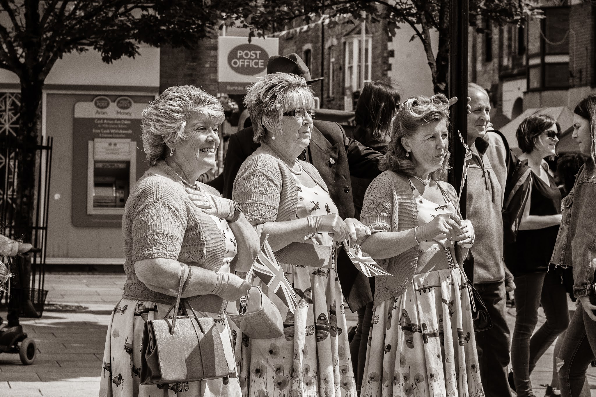
In the summer of 2019 my local town held a festival and the theme was "1940's"

The re-enactment day saw the town centre transported back to the 1940s, with shop and pub staff dressing up in clothes from the era and even taping up their windows as they would have done during wartime to prevent flying glass from bomb blasts.

This has been done in the past and there were hopes that it would continue, sadly due to the pandemic, not this year!

A good-humoured enjoyable weekend was had by all concerned.


Bridgend
Click on images for full screen view.
Bridgend

Bridgend


Bridgend

Bridgend


Footer:

I hope you enjoyed the images.
I also made a short YouTube video of these images and some extras not on here:-


Read More

A view worth remembering

Visit Date: September 2019


This day I visited a part of the South Wales coast that I have not been to for many years, Langland Bay in the Mumbles area of Swansea. It is a beautiful part of the country. I walked along the coastal path until I saw a breath-taking vision of the coast. I stopped for a little while here and rested at this headland on a public bench that had the dedication on the bench that is in the photograph below.

It was a very poignant moment, the message gripped me and I took the image of the coast with the public bench in the shot. It is easy to understand why this view kept the mentioned POW Keith Bailey thinking of home in those very difficult times.

The mentioned Austin Bailey Foundation was established on 1st of February 1984 by the late Keith Bailey who, despite being a prisoner of war with the Japanese from 1942 to 1945, was acutely conscious of his own good fortune in life.

As a result, he was always keen to help those less fortunate who are in need or have adversity.

Canon Don Lewis, then Vicar of Swansea, assisted in setting up the trust and remained a Trustee, good friend and staunch supporter of its aims until his death.

The trustees of the Austin Bailey Foundation normally meet in May and December. Donations are made in the following categories;
  • Local Charities in Swansea and district; - approximately 50% of unrestricted income is used for local charities and local branches of national charities who help children and families, those who are disabled, infirm, aged or in need.
  • Local Churches in the City and County of Swansea; - approximately 25% of unrestricted income is donated to local churches for the furtherance of the Christian faith.
  • Overseas Charities; - approximately 25% of unrestricted income is given to relief agencies for the relief of poverty and ill-health, and the fostering of opportunities for young people in the developing world.

Please note I have no connection with the Austin Bailey Foundation.


Footer:

Visit Information:-

Google Reference
51.564505682553225, -4.0146685687908805

Google Search reference: Snaple Point View Point

What Three Words reference : ///paces.irrigated.flies

Additional information
Visiting: There is a good size car park ( 51.568155694635536, -4.013917844838723 ) at Langland Bay which is a little over 5 miles from Swansea. There is also an easy coastal walk of just over a mile from Langland Bay west to Caswell Bay.


Read More

Carreg Samson

 Date of visit August 2019

Carreg Samson

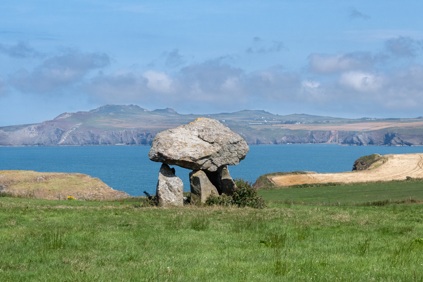
Carreg Samson is another Dolmen in Wales.
As with others of this type the structure would originally have been covered with earth.
It is one of the most beautiful spots overlooking the sea, near the picturesque port of Abercastle.
This is a typical example of this type of neolithic chambered tomb.
The Capstone is 4.5 metres long, 1 metre thick, 2.7 metres wide and between 1 and 2 metres high.
When excavated, it was found that a pit of almost a metre deep lay underneath. The was pit covered by clay stones. A small quantity of bone, flint and pottery was unearthed at the site and included a vessel containing cremated ashes.
Carreg Samson is also known locally as The Longhouse Cromlech
It is also known as Samsons Stone. The connection with the name Samson is regarding St. Samson of Dol, and the legend goes that he placed the capstone onto the structure using his little finger.
St. Samson was the son of Amon of Demetia and Anna Of Gwent, Anna was the daughter of Meurig ap Tewdrig the King of Gwent.

Beautiful spot to rest

This is a great place to visit if you like Dolmens or Cromlechs.
This is a typically beautiful example of this type of Neolithic chambered tomb.
Even if you just like to get outdoors the view from here over the bay of Abercastle.

(Location information below)


Footer:

Visit Information:-

Google Reference
51.95833371460036, -5.132992069771207

Google Search reference: Carreg Samson

What Three Words reference : ///crumble.able.shuttling

Additional information

Visiting: If you drive to Abercastle port (51.95990618212159, -5.12670170227685) there is limited parking for around a dozen cars. You can then walk up and along the coast path until you reach the site, this is a lovely walk.
On the day I visited the car park was jammed full and there is no other parking in this small village. I was disappointed however a local man told me that I could also visit from longhouse farm (51.95689526973494, -5.1342374861494315) which owns the field.
I drove the few minutes there and asked at the farmhouse if I could park and visit the Dolmen, the lady of the house was very welcoming, and let me park there. The access from here is very easy if you have any mobility problems.


Read More

The Pit Pony Memorial and the memories of "Dai"

Visit Date: September 2021


Parc Slip Memorial


I visited my local nature reserve again which was prompted by a notice in the local paper of a memorial service that is held every year at 8.20 am on the 26th of August on the anniversary of the time and day when 146 men and boys died when there was an explosion in the coal mine.

I was happy to see that the area has had a facelift and a new memorial bench has been placed in the area.

Parc Slip Memorial

The carving is of a miner and his "Pit Pony".

Parc Slip Memorial


It was shining in the warm late summer sunshine and it got me thinking of the area where I grew up not 10 miles from here.

I Digress:-

The area was very much a mining valley and back in the late 60's, it was common to see men in the street with "Blue Scars" where coal dust had gone in beneath their skin and cause scars that looked like tattoos permanently on their face and arms.

But the Pit Pony sculpture reminded me of the stables that were behind the row of our houses and that still housed a number of Ponies and I was told that they were Pit Ponies that I assumed now were there in their retirement. No open field for these old boys, I believe they spent their last years in these stables, as I never saw them outside on a single occasion.

I am not sure when the last ponies would have been used here underground but I would guess, these ponies would have been quite young when retired.

This led me to think of the man who looked after the ponies or horses. His name was David Thomas.

In Wales David is a very common name and anyone called David would be known as "Dai" also it was very common to have this as the first part of your nickname and your job or some other "theme" as the second part, One chap in my street was called "Dai Bad Back", yup you've guessed it for years he could not work because of a bad back (I still can't recall his real surname). We also had an "Alan Potcher" who could turn his hand to any odd job and fix it up or "potch it up". Now I think of it there did seem to be many "Dai's" who had something attached to their name (Or maybe I can recall them easier as I was called "Dai" for the first 25 years of my life)!

For the first few years, I knew him I only knew Mr. David Thomas as "Dai Horse" and everyone knew "Dai Horse".

A few years later Mr Thomas started to look after the deliveries of the local Evening newspaper (The South Wales Echo). The papers would come from Cardiff (about 25 miles away) by train to Bridgend and then by bus up to the valleys. The conductor of the bus would then throw the papers from the bus at the main but stop in the village where "Dai" would be waiting. He would then distribute the papers to houses or local shops where we paperboys would take over and deliver them to the houses.

Of course, this meant that "Dai Horse" soon became known as "Dai Echo"

I remember fondly many people having this type of nickname back then but the strangest one I think I heard was the David who bought the biggest house at the head of the valley which at one time would have been the mine managers house. His nickname? Well "Dai Big House" of course.

Footer:

Visit Information:-

Google Reference
51.539548735113236, -3.618187109403901

Google Search reference: Parc Slip Memorial

What Three Words reference : ///ranks.fixed.rally

The site is easy to find just 15 minutes from M4 motorway at junction 46

The car park //////joystick.plod.painting
Google Maps (51.54538490015156, -3.6143532913911733) is free and there are toilets and a café nearby.


Read More

" A column of water that lifts a hundred tons" Brunel Docks Briton Ferry.

Visit Date : August 2021


Brunel Dock


Isn't it strange and interesting that sometimes you take a more detailed look at something familiar that a whole host of history is revealed?

This happened to me recently as I passed over the Briton Ferry Bridge on the motorway from Port Talbot to Swansea.

I have passed this way what must have been hundreds of times without giving the view before a second thought but a recent article on the TV whetted my appetite to get a closer look, and I was not disappointed.

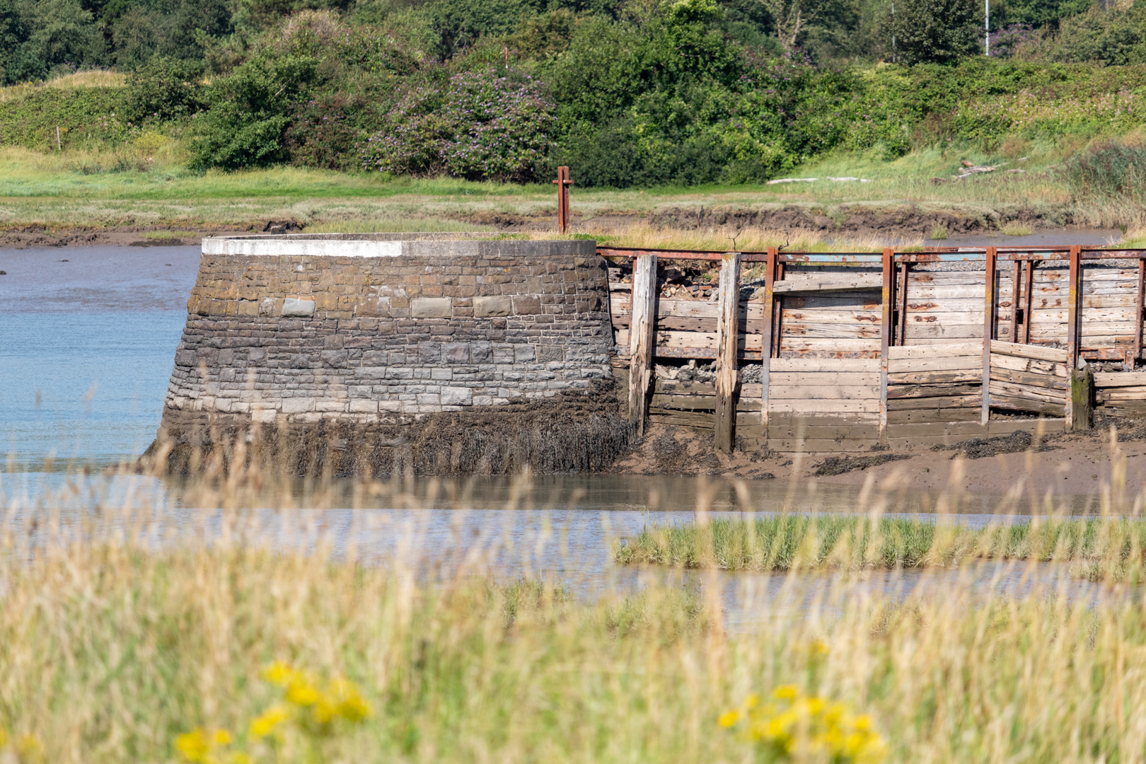
This is Briton Ferry docks, built in the 1850s.

Brunel Dock

This area was close to Ironworks and massive coal production so docks were built in lots of places around this coast. So what was special about this one well the first thing to catch my attention was that this was designed and built by Isambard Kingdom Brunel ***( an English civil engineer who is considered "one of the most ingenious and prolific figures in engineering history, one of the 19th-century engineering giants, and "one of the greatest figures of the Industrial Revolution, who changed the face of the English landscape with his groundbreaking designs and ingenious constructions. Brunel built dockyards, the Great Western Railway (GWR), a series of steamships including the first propeller-driven transatlantic steamship, and numerous important bridges and tunnels. His designs revolutionised public transport and modern engineering.*** (thanks to Wikipedia))

Brunel Dock

The dock was completed by Brunel's chief assistant, Robert Pearson Brereton in 1861 two years after Brunel's death in 1859.

Brunel Dock

The dock was originally called the Briton Ferry Floating dock but has been renamed as The Brunel Dock.

Brunel Dock

Some of the design for the dock was remarkable as it marked his experimental work on buoyant lock gates, and the move from wooden gates to Iron and this is thought to be the only surviving example of this work.

hydraulic accumulator

The power for this was housed in Brunel's tower which contains the hydraulic accumulator which powered the lock gates and cranes of the unique Briton Ferry floating dock.

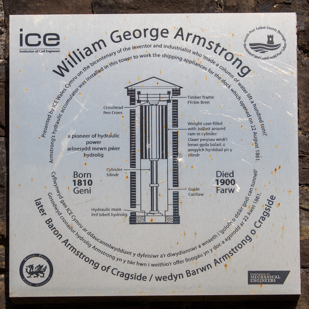
The tower housed this accumulator, supplied by Sir William Armstrong. Inside, a weight pushed down on the water in a cylinder. The high-pressure water then operated the lock gate, cranes and other machinery. The weight gradually descended as the water was used. It was moved back up the tower by power from a stationary steam engine nearby.

hydraulic accumulator


The engineering savvy amongst you may well understand how this was done but for us normal folk the plaque on the tower states:-

" A column of water that lifts a hundred tons".

Footer:

Visit Information:-

Google Reference
51.626406, -3.828599
Google Search reference: Brunel Docks Briton Ferry

What Three Words reference : //////alien.comet.decreased

The site is easy to find leave M4 motorway at junction 41 Follow signs to Briton Ferry then A48 to the "McDonalds roundabout then left onto Brunel Way.

The car park ///eating.tester.shark (51.626114, -3.826099) is free but with only 4 places


Read More

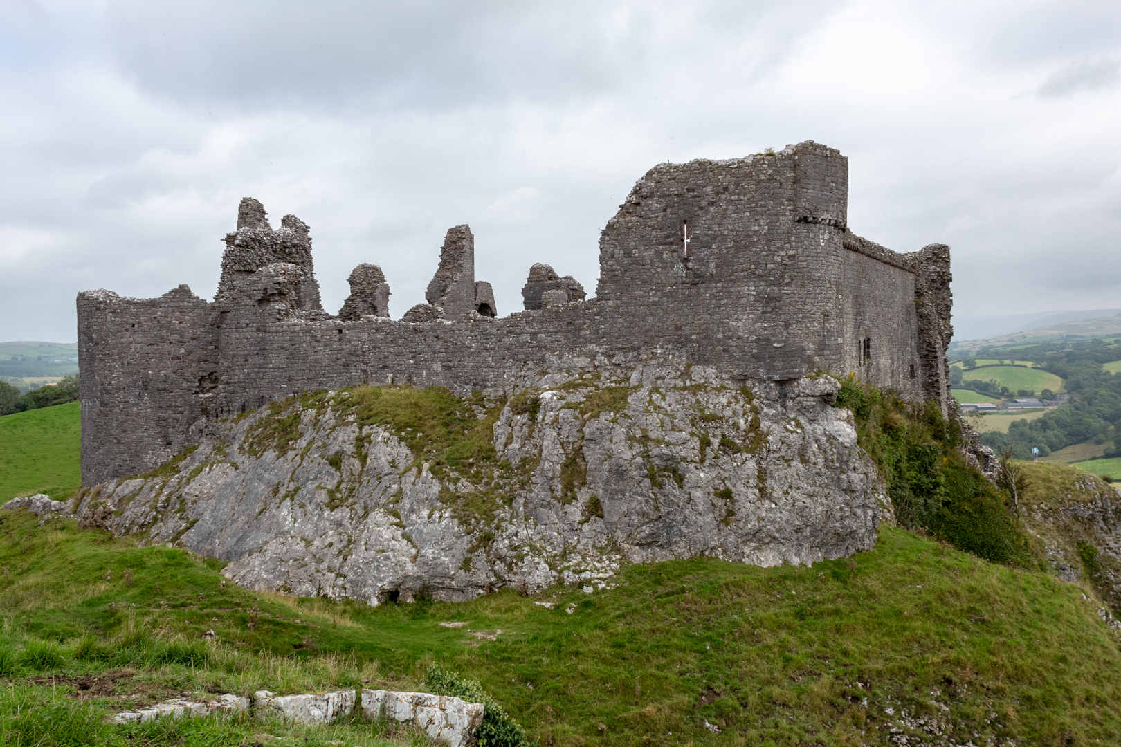
Carreg Cennen Castle

Visit Date : August 2021


Carreg Cennen Castle

WELSH: Castell Carreg Cennen meaning castle (on the) rock (above the) Cennen) is well named as this fortress is well above the outlying land high upon a limestone cliff.

Castell Carreg Cennen


The site has a long history and may well have also been the site of an Iron Age hillfort.

There is also some Roman history as Roman coins have been found in the area, although it is unlikely the Romans occupied this site on a permanent basis.

Castell Carreg Cennen

Legends of the original fortress goes back to the Dark Ages, held by Urien Rheged, Lord of Iskennen, and his son Owain, knights during the reign of King Arthur.

Stories claim that there is a warrior (perhaps one of the knights, or Arthur himself?) asleep beneath the castle, awaiting a call from the Welsh.

Castell Carreg Cennen

As with many Welsh castles, they will have been built, rebuilt and altered through the ages.

The first "castle" on the site was probably built by the Welsh Lord Rhys, Prince of Deheubarth, in the late 12th century, but was taken in 1277 by King Edward I.
Castell Carreg Cennen

The castle we see today replaced the demolished previous structure in the late 13th century by John Giffard and his son.

Castell Carreg Cennen


It was involved in many battles and was besieged during the rebellion of Owain Glyndwr in about 1403 and was considerably damaged.

Around 1461, the castle was deemed too much of a threat to the monarchy and was destroyed the following spring and is basically in the same state today.

Castell Carreg Cennen

Despite being in a ruinous state in the 18th century it started to attract artists (Turner sketched the castle in 1798).

Castell Carreg Cennen

In the 1960s Carreg Cennen Castle was acquired by the Morris family of Castell Farm, when Lord Cawdor's legal team made a mistake in the wording of the deeds and included the castle as part of the farm.

Castell Carreg Cennen

Castell Carreg Cennen

Castell Carreg Cennen

Castell Carreg Cennen

Castell Carreg Cennen

Castell Carreg Cennen

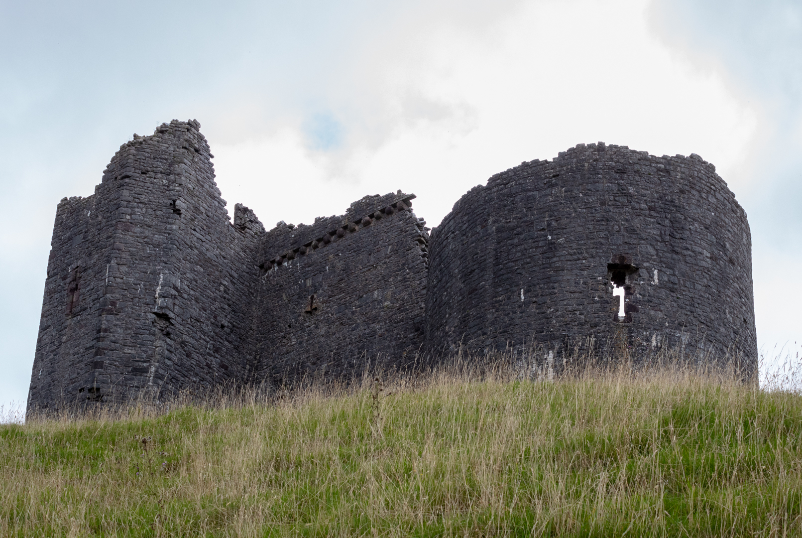
The image below is an interesting feature (at least to me) was this tower with the hole at the bottom. It was the outlet for the latrine.

Castell Carreg Cennen

Although today the Castle is maintained by CADW: (Welsh Historic Monuments) the castle is still privately owned and managed along with the farm and tea rooms by Margaret & Bernard Llewellyn and their Daughters.

Castell Carreg Cennen


Footer:

Visit Information:-

Google Reference 51.854408996393424, -3.935643592179748

Google Search reference: Carreg Cennen Castle

What Three Words reference : ///reason.winners.routs

The site is easy to find Leave north from Ammanford and turn left onto Ffordd Wern Ddu it is signposted from here.

The car park (51.85656999860168, -3.9376914809885473) is free with many spaces and overflow spaces. There are toilets and a "must visit" tea room and gift shop.


Read More

Maen Llia

Visit Date: December 2019


This is a post from a visit I made to this site in 2019.


Maen Llia Standing Stone on The Brecon Beacons


This standing stone is situated in Brecon.

As you approach Maen Llia, the megalith is in a large area of scrub and does not look so large but gets more and more overwhelming as you get closer and close up is it very impressive. The stone is actually 12 foot high and 9ft wide.

The stone is made of Calcreate which is a form of old red sandstone which is found some distance away.

Maen Llia Standing Stone on The Brecon Beacons


The stone is likely to have been brought to this location by a glacier many thousands of years ago and then placed upright in its exact position during the Bronze Age.

The myth associated with this stone is that on mid-summers eve the Maen Llia walks to the river to drink.

It is said that this myth stems perhaps from the shadow getting longer as the sun goes down and stretches down to the river before sunset.

Maen Llia Standing Stone on The Brecon Beacons

Maen Llia Standing Stone on The Brecon Beacons


Footer:

Visit Information:-

Google Reference 51.860873062740495, -3.5636886724985617

Google Search reference: Maen Llia

What Three Words reference : ///compress.maple.display

The site is easy to find on Sarn Helen, in the Brecon Beacons.

Head north from Glynneath briefly on the A4019 and then the B4242 and Maen Llia is right next to the road, well marked and easily visible from the road.


Read More

CARN LLECHART RING CAIRN

Visit Date:- August 2021

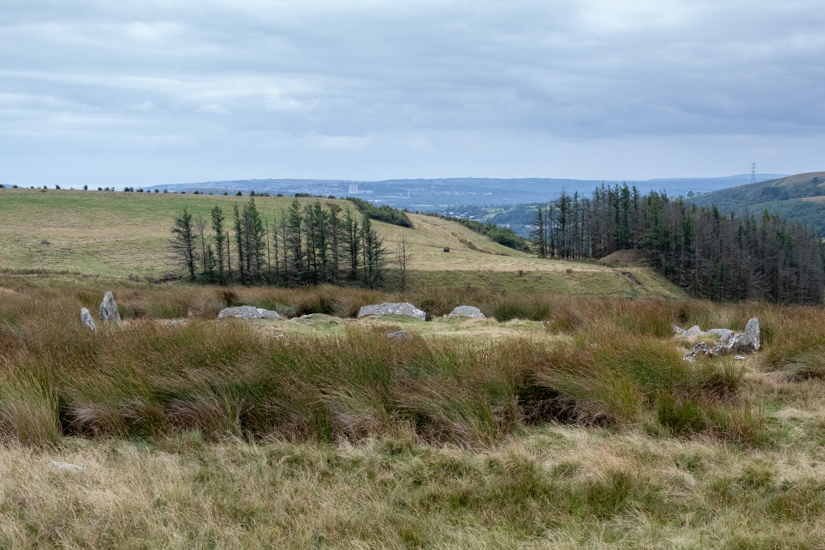
Today my short outing was to visit the small stone circle called Carn Llechart.
This is within the Brecon Beacons National park and is high on the hills overlooking the village of Rhyd Y Fro.


Carn Llechart Ring Cairn
Click on images for larger view


The site comprises the remains of a burial cairn probably dating to the Bronze Age (c. 2300 - 800 BC).

CARN LLECHART RING CAIRN
Click on images for larger view


On observation, the ring is not really that impressive as other circles with the stones being not more than a few feet high and the ring not nearly as large as many others.

The reason for this is likely to be that the circle is not of the same sort of group ceremonial use that we see from the larger circle sites but is more likely that this circle is just the border of a burial site. But it does have significance in the history of this site.

CARN LLECHART RING CAIRN
Click on images for larger view

An important ring cairn, It measures 13 metres in internal diameter

with its unusual circle of contiguous slabs, about 25 in number, around a large rectangular cist (A cist is a small stone-built coffin-like box or ossuary used to hold the bodies of the dead. Examples can be found across Europe and in the Middle East),

This site is important as it has the distinction of being mentioned in one of Britain's earliest antiquarian books, William Camden's 'Britannia' (1695 edition).

CARN LLECHART RING CAIRN

The twenty-five stone slabs leaning outwards slightly create a 'crown of thorns' effect. The circle is very slightly above the surrounding ground level. At the centre is the robbed-out rectangular cist measuring 2 metres by 1 metre Approx.

CARN LLECHART RING CAIRN


The cist was originally topped by a large stone slab, but this has been lost. Although I did read that it had been "moved" to a site 100 yards away.

I wish I had realised that the circle was so close to the ground as I would have taken a light ladder to get above the site to show it better, especially as the site was overgrown today at the height of summer, Maybe a return winter visit is on the cards?

CARN LLECHART RING CAIRN


There have been some interesting visit mentions for this site.

One of the visits was recorded by a couple who said "I have never seen anything like it. Claire was bodily thrown from the centre of the circle by some kind of force. I felt it too. It was like being punched in the stomach."

"Since our visit we suffered severe headaches, stomach problems, lethargy and general illness. It was almost as if our energy was completely sapped by whatever was in the centre of those stones."

By contrast, another reads:-

" I visit this place regularly and have found no ill effects when visiting, in fact, quite the contrary... I find the energy there is very warm and welcoming, not at all malicious, I leave with a renewed sense of wellbeing.

======================================================

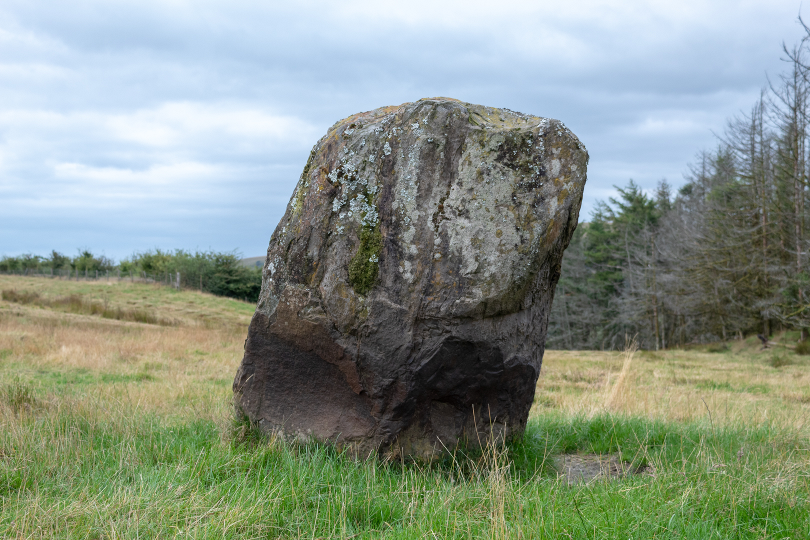
In an adjoining farm field to the southwest of the circle, you will see another stone circle with much larger stones. A more impressive site this has often been in reports mistaken for the actual site. The stones are much larger and set out not in a proper circle so you have to be more open to the circle description.

CARN LLECHART RING CAIRN
Click on images for larger view


This is almost certainly more recent, however, it is likely that these large stones did mark something in the distant past but have been moved considerably.

CARN LLECHART RING CAIRN

One local resident stated that this was constructed by the gas board to stop the farmers cows from rubbing against the machinery that was stored there. This was going to be the use for the large flat stone. Although this may have been the recent use it is difficult to believe that these stones would have been brought here when the field with its dry-stone walls could have been secured more easily.

CARN LLECHART RING CAIRN

Another report was of a farmer building a stone circle in a field south of Carn Llechart ring cairn in 1985. Either way, I think these may have been of importance before being repurposed and the original position and purpose has now sadly long gone.

That said they are impressive to look at. Oh yes, the views are also great from up here but the light was very flat and not good for the long landscape shots.

--- Footer ---

Visit Information:-
Google Reference 51.73995923556227, -3.8880360662304243
Google Search reference: Carn Llechart Stone Circle & Cairn
What Three Words reference : ///fight.lucky.geek

To visit the site is quite easy, but it took me quite a time to find it but this should make it easier for you.

When entering the village of Rhyd Y Fro with the "Traveller's Well" pub on your right-hand side, take the turning left just past the pub. Go up the hill on the small farm track until you pass over a cattle grid. A little way after this is a sharp hairpin bend to the left, take this up the hill further.

Next, there is a right-hand hairpin turn with a larger tuning space. Here you can park or just a little way further up the hill there is an entrance to the hill with a yellow grit box on the right-hand side, you could park here also.

Take a walk through this entrance by the grit box with the wall on your left and then follow the wall 90 degrees around to the left. When you reach the second metal gate with the "walkway markings" and style stop.

You will see the false circle and stone in the field if you wish to visit but Carn Llechart is not in this direction.

With this gate at your back look opposite and slightly to the right and the Circle is just a few hundred yards away up the hill slightly. I visited in summer and could hardly see the stones of the circle from the gate as they were overgrown but in winter you may possibly see them.

The google map reference is very good and I found it from that.


Read More

Search This Blog

About Me

Bridgend, United Kingdom
A renewed interest in photography and local history.

Contact Me

Name

Email *

Message *

Followers