With a renewed enthusiasm for photography and local history, I set out this blog as a record of my experiences with images and narratives. It is my hope that you find something of interest on this site. Please feel free to contact me for more information on any of the posts. You can see a comprehensive list of my blogs at my website :- http://www.davidnurse.co.uk

A Portrait Bench. . .


A Portrait Bench


The Richard Burton Trail is a short walk around
the forest park near the Welsh Village of Cwmavon.

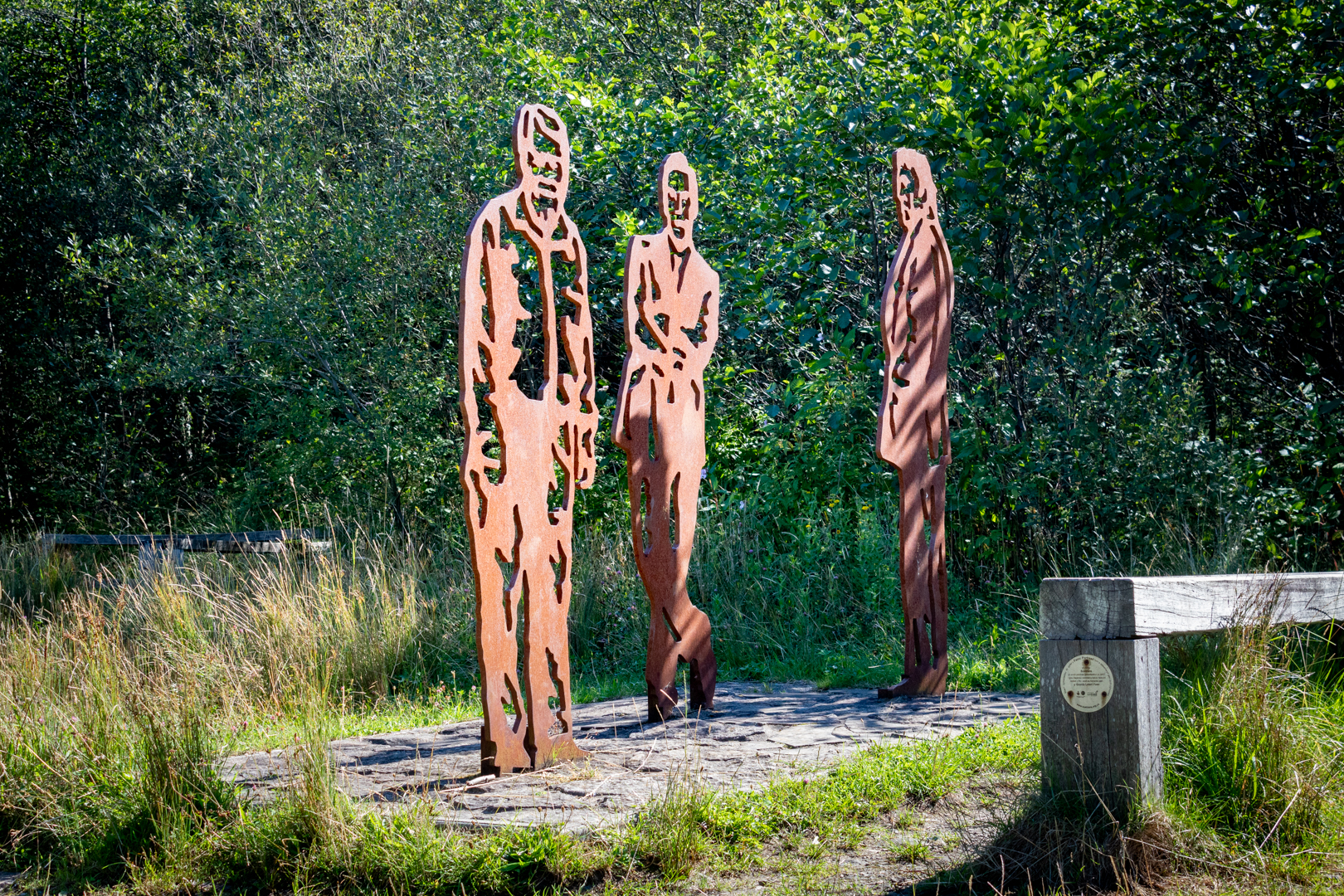
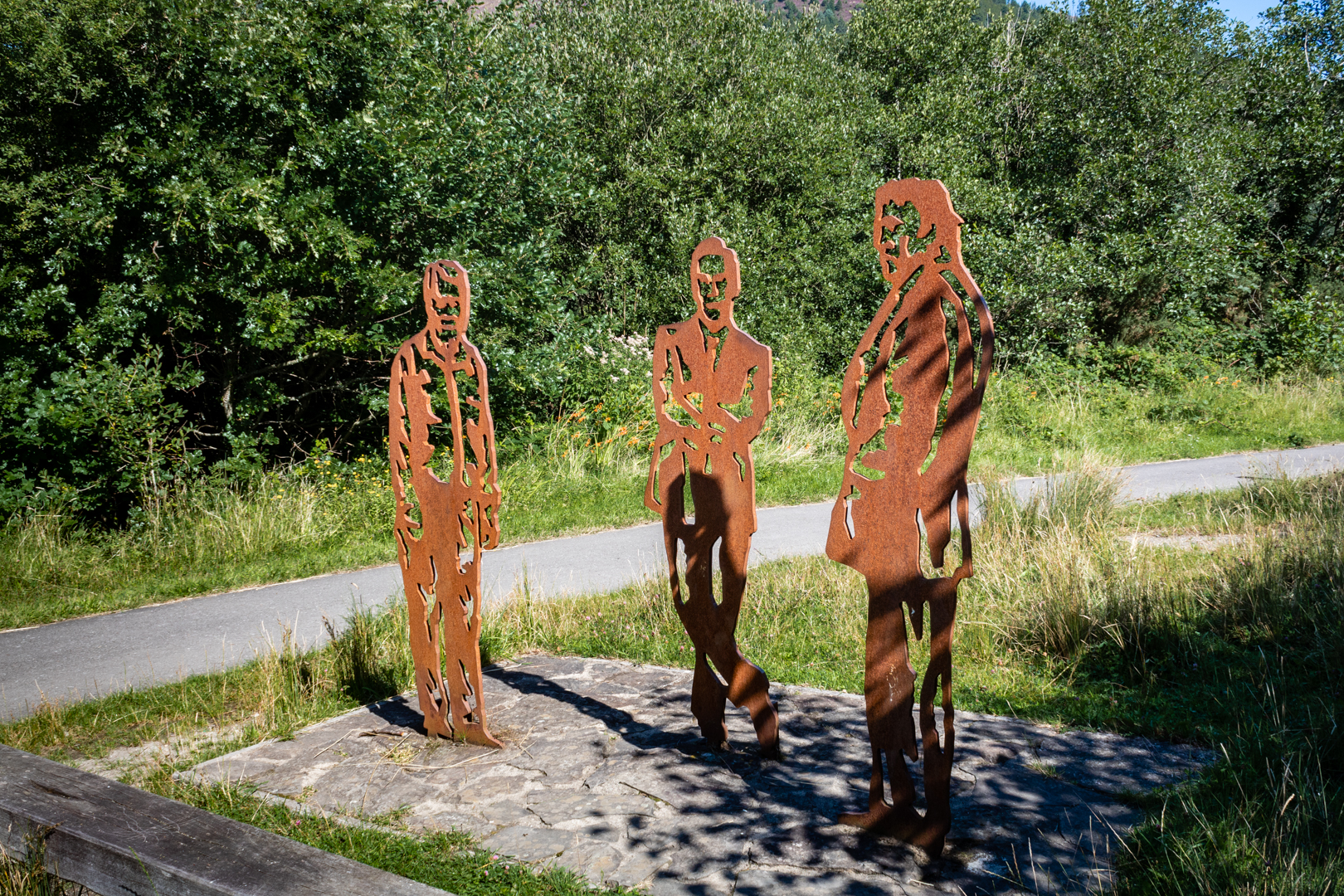
Along the trail is a tribute or "portrait bench" installed 
as a tribute to those who have hailed from the area


Visit Date April 2022


The Portrait Bench in Cwmavon


The walk is a reminder of Port Talbot’s most famous son, Oscar winner Richard Burton CBE. Richard Burton was born in the village of Pontrhydyfen on 10th November 1925, he was a Welsh miner’s son who never forgot his roots. Born Richard Walter Jenkins, he lived in Pontrhydyfen until just under the age of 2, when, following the death of his mother, he moved to Taibach in Port Talbot.


Richard Burton


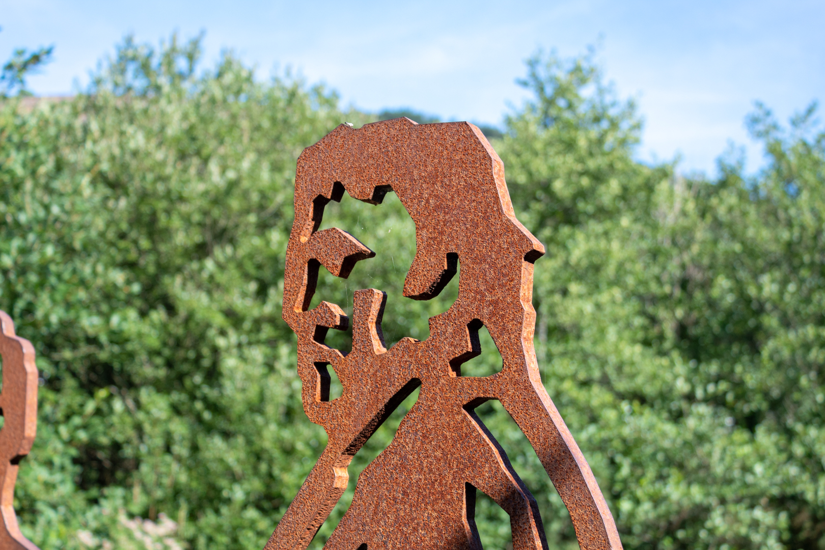
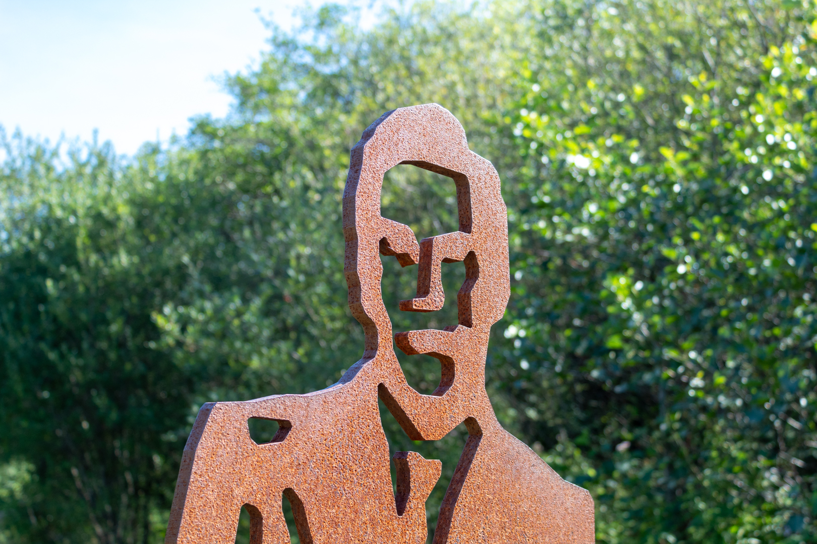
On the walk, you will see the STEEL statuettes of Richard along with the welsh comic and actor Rob Brydon that have been placed on the route in their home town of Port Talbot as part of an art project by sustainable transport charity Sustrans.
The new art installations have been placed in the Afan Forest Park above the steel town and also feature the park’s head ranger, Dick Wagstaff.


Rob Brydon


The three figures were chosen by the local community to be immortalised in a Portrait Bench – one of 80 benches to be installed across the UK.


Richard (Dick) Wagstaff.


Each comprises a wooden bench with three life-size steel effigies of local icons alongside and is unique to the local area in which it is placed.

Each bench is being placed along a newly created route for pedestrians and cyclists – in this case along a new route connecting Port Talbot to the Afan Valley community of Cwmavon and the Afan Forest Park.


The Portrait Bench Cwmavon


Members of the families of Richard Burton and Rob Brydon, along with Dick Wagstaff, were in the forest park on May 1 2013 to see the bench officially opened to the public.


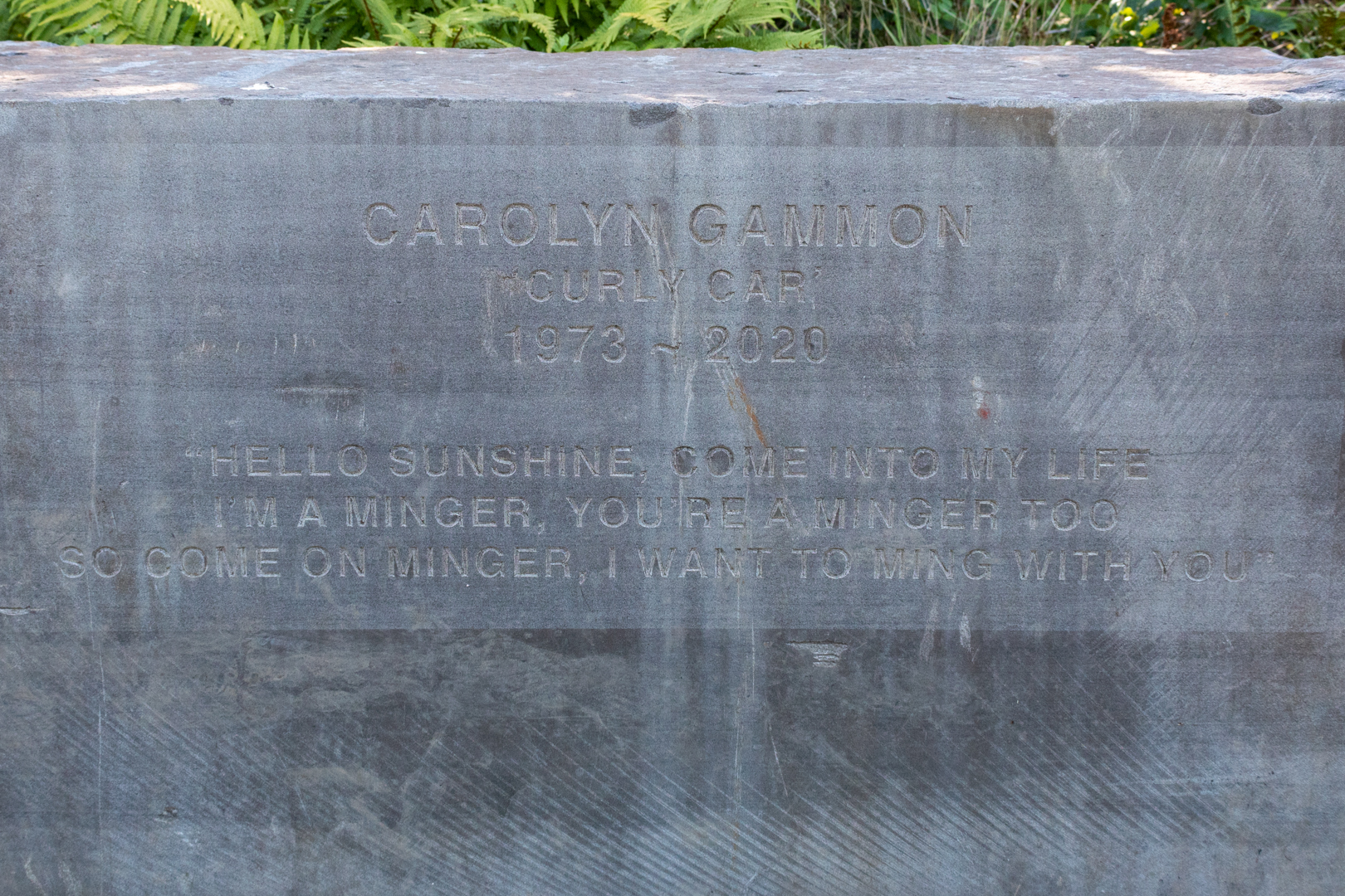
Along the pathway from the sculptures, there is another moving tribute to a lesser-known local heroine.


Carolyn Gammon Memorial


I have to say I didn't know anything about this until I returned home and did some research. This tribute is known as Carolyns Rock and is a memorial of a local woman, Carolyn Gammon known as Curly Car.
She was diagnosed with breast cancer during her pregnancy.
She raised lots of money for breast cancer charities.


Carolyn Gammon Memorial


It seems that Rachel Wigley arranged this beautiful memorial to Carolyn (following her EXACT instructions ).


Footer:
Visit Information: -

Google Reference: -
51.61895331276028, -3.749284085203686
Google Keyword: The Portrait Bench

What Three Words reference: -
///spooned.conspired.weeded

OS Details: -
SS 78990 92575 : Altitude:171 ft

Additional information.
This is an easy walk to get to through a forest park.
There is parking in the village (51.617043334820664, -3.7548627356550908) and from there there is a short walk to the bridge crossing the river which leads naturally to the path. Take a left after the bridge and you will pass the portrait bench approximately 500 metres further on.


Read More

Devil's Quoit. .


Devil's Quoit


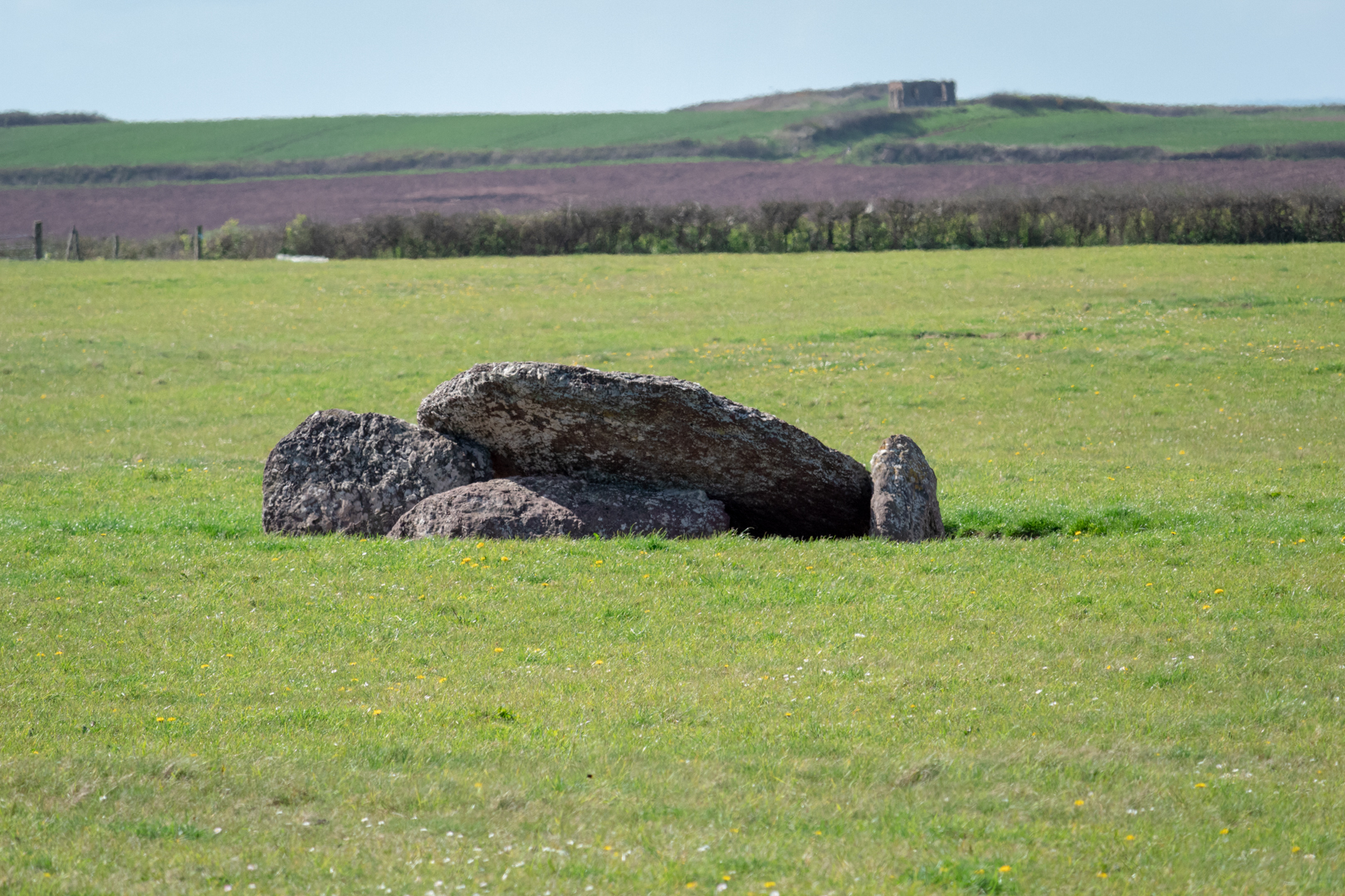
An ancient Neolithic burial chamber in the centre of a field, near the coast in Pembrokeshire, Wales.
Formed by a large wedge-shaped capstone which is supported on the east by two large side stones
and the west by a third side stone which now lies on the ground. 


Visit Date April 2022


Devil's Quoit, Angle, Pembrokeshire


In Wales, there are many of these types of burial sites and as in the rest of the UK, they can be referred to as Quoits, Dolmens or Chromlechs. In addition, the name "Devil's Quoit" is also commonly used for other sites and standing stones in the area.

The structures typically have three or more upright standing stones with a large capstone on top. Originally they would have been covered with earth.


Devil's Quoit, Angle, Pembrokeshire


In its current form, there is no mound to be seen but it was noted when investigated in 1810 that there was a large circular "Agger" or earthwork around the monument.

The pieces of the monument are of a reddish-brown conglomerate; the capstone measures 2.75m in length and is 2m wide. The uprights would be around 1.5 metres high.


Devil's Quoit, Angle, Pembrokeshire


There is little recorded about this site and the chamber is in the centre of a field on private land and is inaccessible due to the area being sealed off by an electrical fence. Despite this, The monument is of national importance and is a substantial relic of a prehistoric funerary and ritual landscape that may retain significant archaeological potential, with a strong probability of the presence of both intact burial or ritual remains, and  environmental and structural evidence, including a buried prehistoric land surface.

The mount is on a peninsular of land with the sea to either side.


Footer:
Visit Information: -

Google Reference: -
51.66650404534974, -5.05761344477118

What Three Words reference: -
///windpipe.pays.premiums

OS Details: -
SM 88652 00842 Altitude: 204 ft

Additional information.
This is an important historical site, however, as it is in a field and on private land, surrounded by an electrical fence therefore a close visit is not possible however, the site can be seen from the road and a small pull-in by the field gate is possible.


Read More

Hadleigh Castle

________________________________________________________________________________


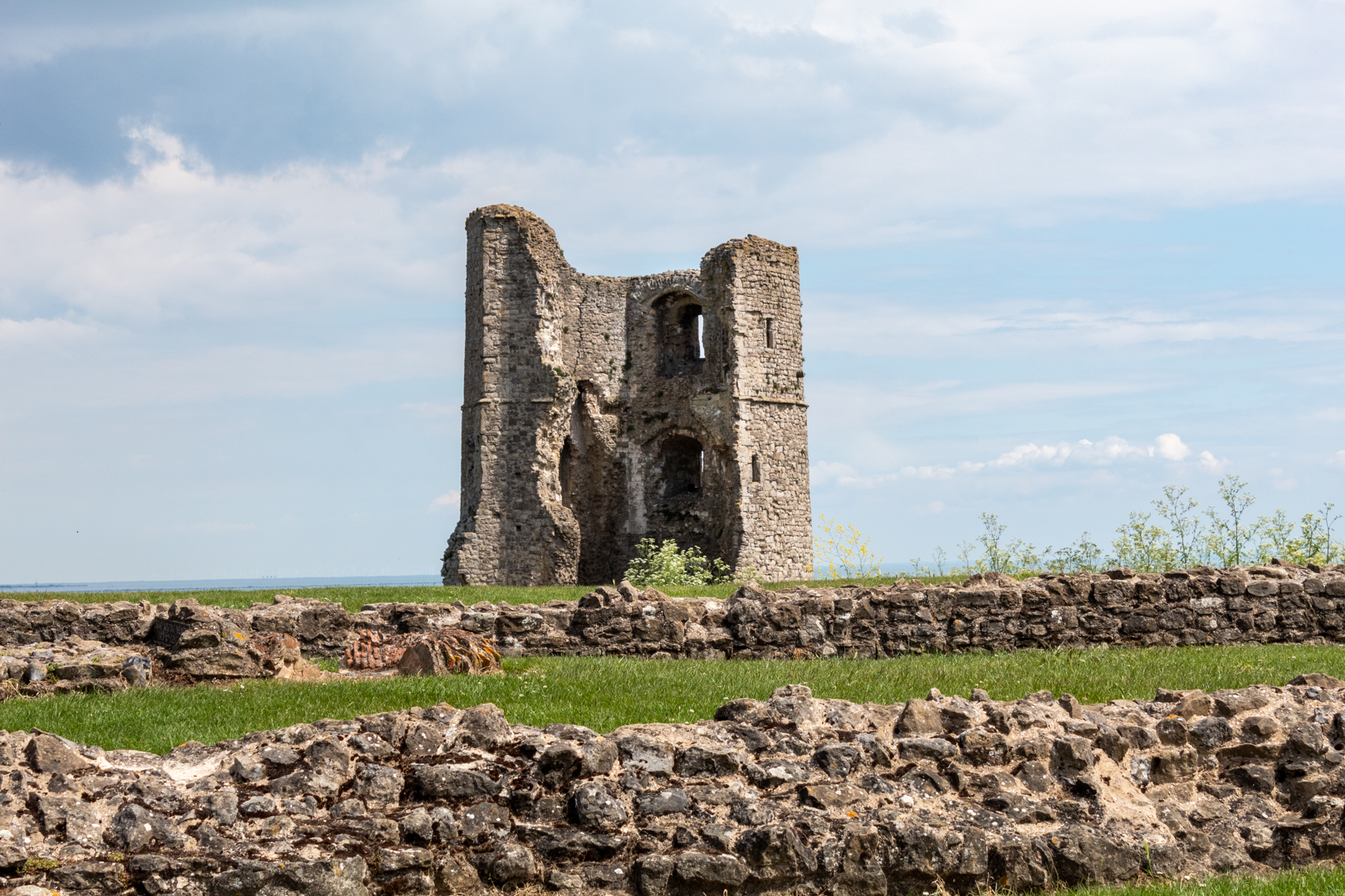
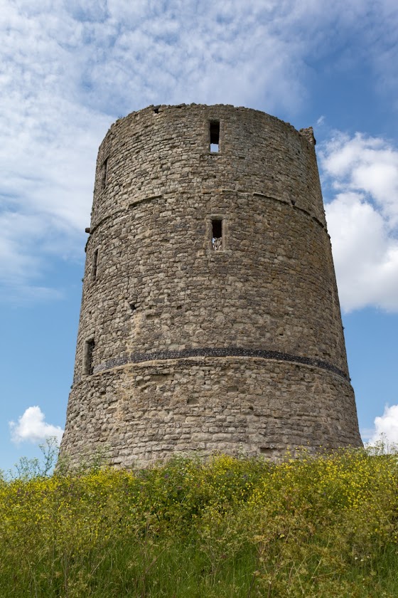
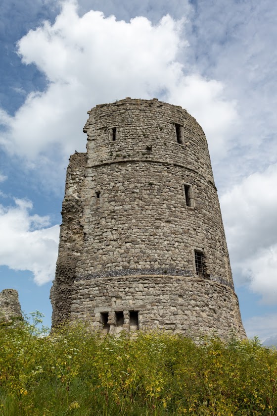
Hadleigh Castle


Hadleigh castle's history began in about 1215 when constructed by Hubert de Burgh, but its most important time was to come later when extensively refortified during the Hundred Years War, becoming a strategic defence overlooking the Thames estuary.


Visit Date June2022

________________________________________________________________________________


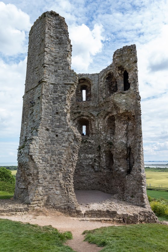
Hadleigh Castle


In 1215 King John bestowed many gifts to his chief minister Hubert de Burgh and the Manor of Hadleigh was just one of them.

Herbert was a loyal follower of King John and was to repay some of the king's kindness when he proved himself as a fine military man when he lead the successful defence of Dover castle during a fierce attempted siege in 1216.


Hadleigh Castle, Essex


During the young Henry III's childhood, Hubert was a very important influence on the young king and during this time he built this large turreted castle on the Manor of Hadleigh as a statement of his power. 

However the young king brought up by priests became devoted to church, art and learning, subsequently after quarrels with the king, Herbert's career and influence waned and he was forced to return his lands, including Hadleigh in 1239.


Hadleigh Castle


The castle remained in royal hands for many years however, it was not until almost 100 years later in the time of Edward II, that the castle was to be used as a royal residence.

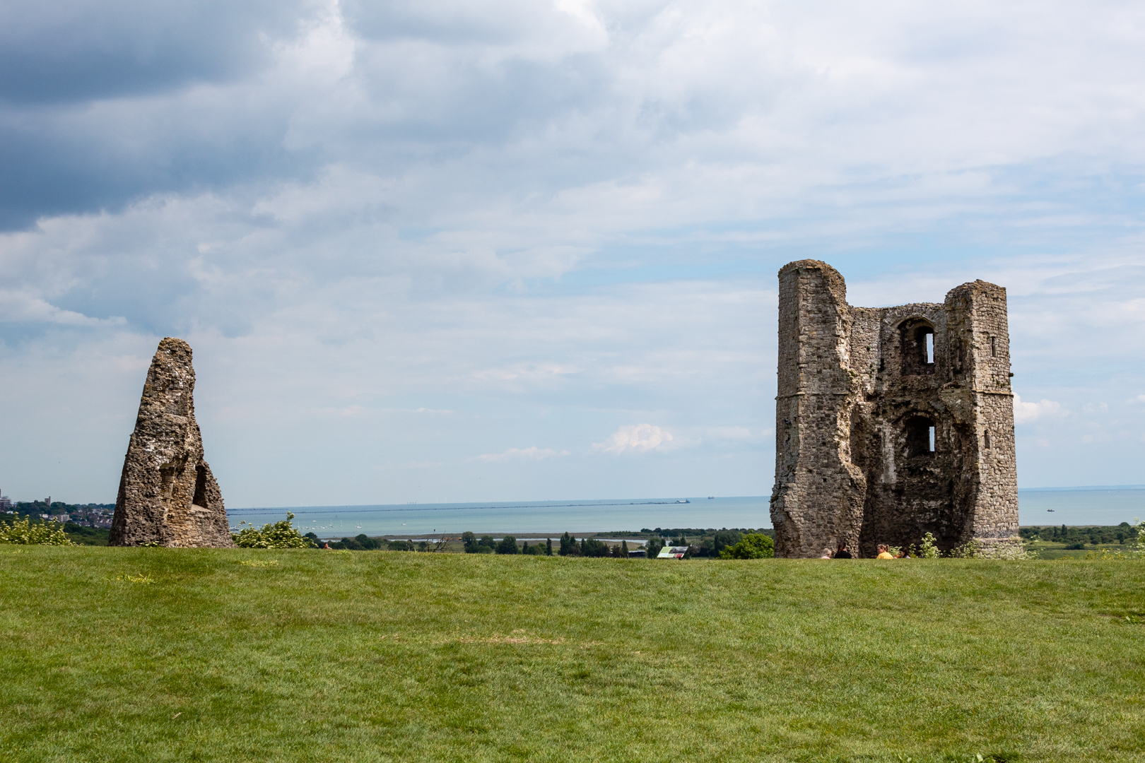
By the time Edward II son became King Edward III the castle was to become important in the defence of England. Edward III tried to claim the French throne which led to war with France. He immediately realised the importance of the castle as it was ideally situated as a base for defending the Thames estuary against French raids during the Hundred Years War.


Hadleigh Castle


The barbican and two striking drum towers – one later used by Georgian revenue men looking out for smugglers – are part of Edward's substantial building works during the 1360s.


Hadleigh Castle


Unfortunately for the history of the castle Edward III's subsequent successors took little interest in the castle as a residence and the importance of the castle began to recede. This resulted in the castle being leased to a succession of tenants.


Hadleigh Castle


The demise of the castle proper came about when it was eventually sold to Lord Riche in 1551, Riche had even less interest in the castle and this led to him eventually selling it off as building materials.


Hadleigh Castle


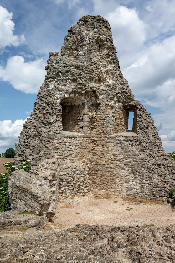
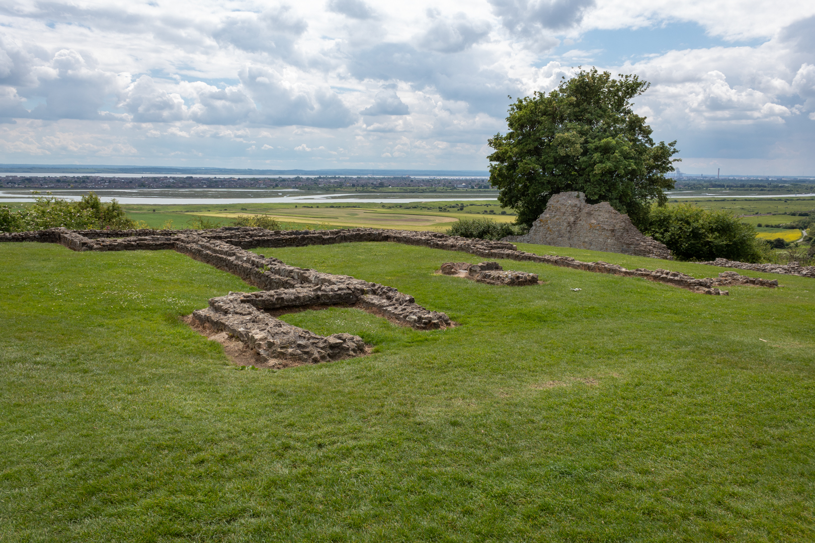
Today as you can see not much remains of the castle but the setting of the ruins adds to the enjoyment of a visit to this site of once historical importance.


Hadleigh Castle


During the demolition, a tiled hearth was built into the floor of the hall to melt down the valuable window leads.


Hadleigh Castle


Footer:
Visit Information: -

Google Reference: -
51.544610767349745, 0.6090745734243965

What Three Words reference: -
///mute.tile.gently

OS Details: -
TQ 81002 86071 Altitude: 158 ft

Additional information.
This is a fine ruin in a very beautiful setting. It gets busy with walker and is popular for picnics.
There is a good size car park at Hadleigh Farm (51.54785716762494, 0.6068869826787562) This is the site of a rare breeds farm and there is also tea rooms here.
The castle is a short well signposted 15 minute walk from here.


Read More

Talley Abbey.

________________________________________________________________________________


T A L L EY   A B B E Y


Talley was founded in the 1180s by Rhys ap Gruffydd (‘The Lord Rhys’, native ruler of the
south Wales kingdom of Deheubarth) for the monks of the Premonstratensian order.


Visit Date August 2022

________________________________________________________________________________


Talley Abbey


Originally Colonised by a small group of canons from the house of St John at Amiens in north-east France. Talley Abbey was the first and only abbey in Wales for the Premonstratensians, monks who were also known as the ‘White Canons’ from the colour of their habit. 


Talley Abbey


The Order was founded in 1120. In 1126, it received papal approbation by Pope Honorius II.

The Abbeys history is not a tranquil one but was something of an unholy struggle.

Abbot Peter of Whitland abbey, envious of the Talley estates launched a hostile takeover of the land and there was a legal battle between the White Canons and the rival Cistercians he supported.


Talley Abbey


The plans to construct a grand church at the heart of their new abbey were interrupted for nine years.

The White Canons did eventually win but the financial cost was great and with little help then coming from Lord Rhys' they were almost bankrupt, and it is unlikely the full church was ever completed.


Talley Abbey


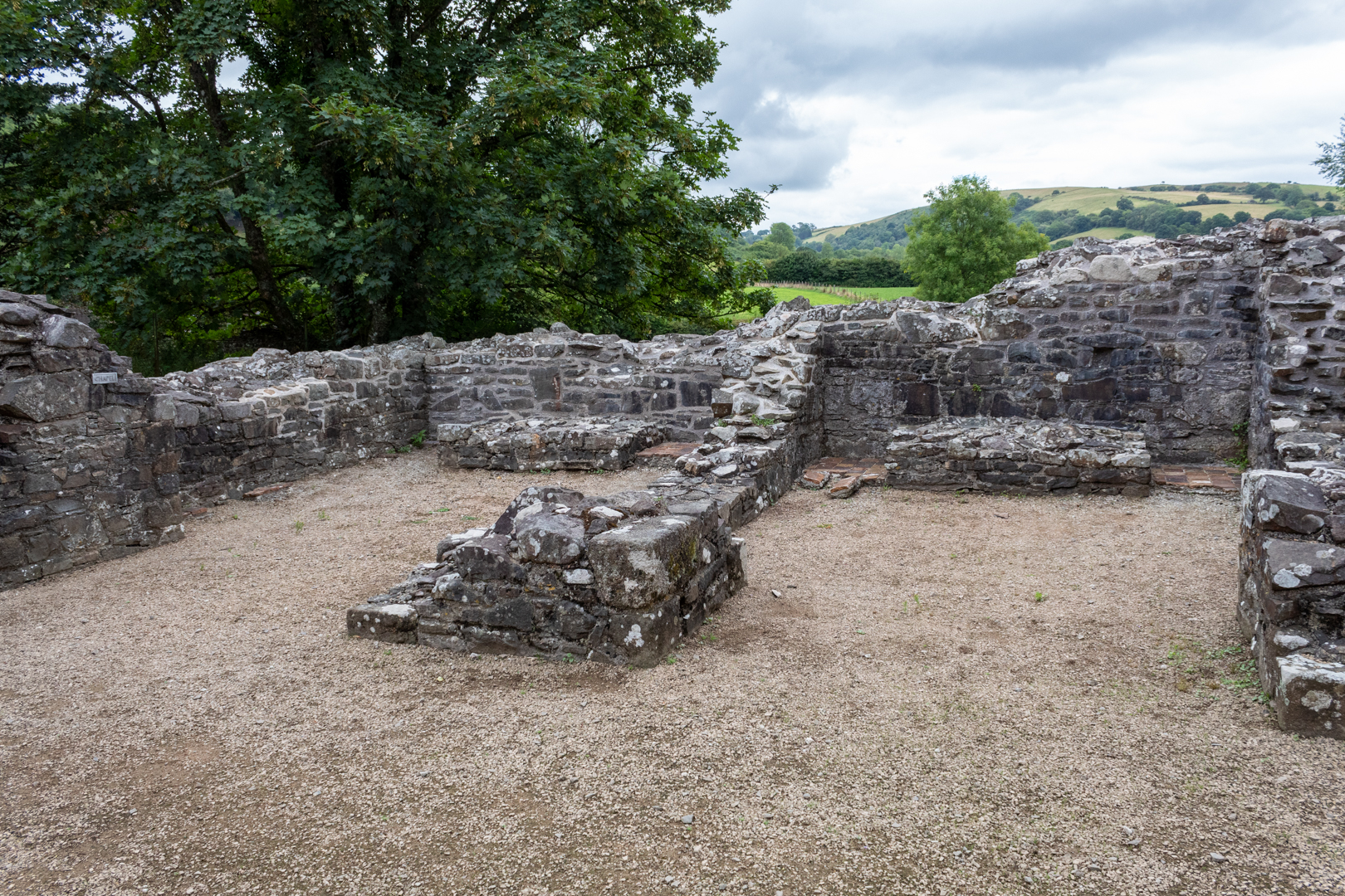
There were 4 individual chapels within the structure. The remains of two can be seen in the image above.


Talley Abbey


The first war of independence in 1277 won by Edward I ensured that the Premonstratensian lost their Welsh sponsorship and the remote Talley only just survived being sustained by income from the churches it served.


Talley Abbey


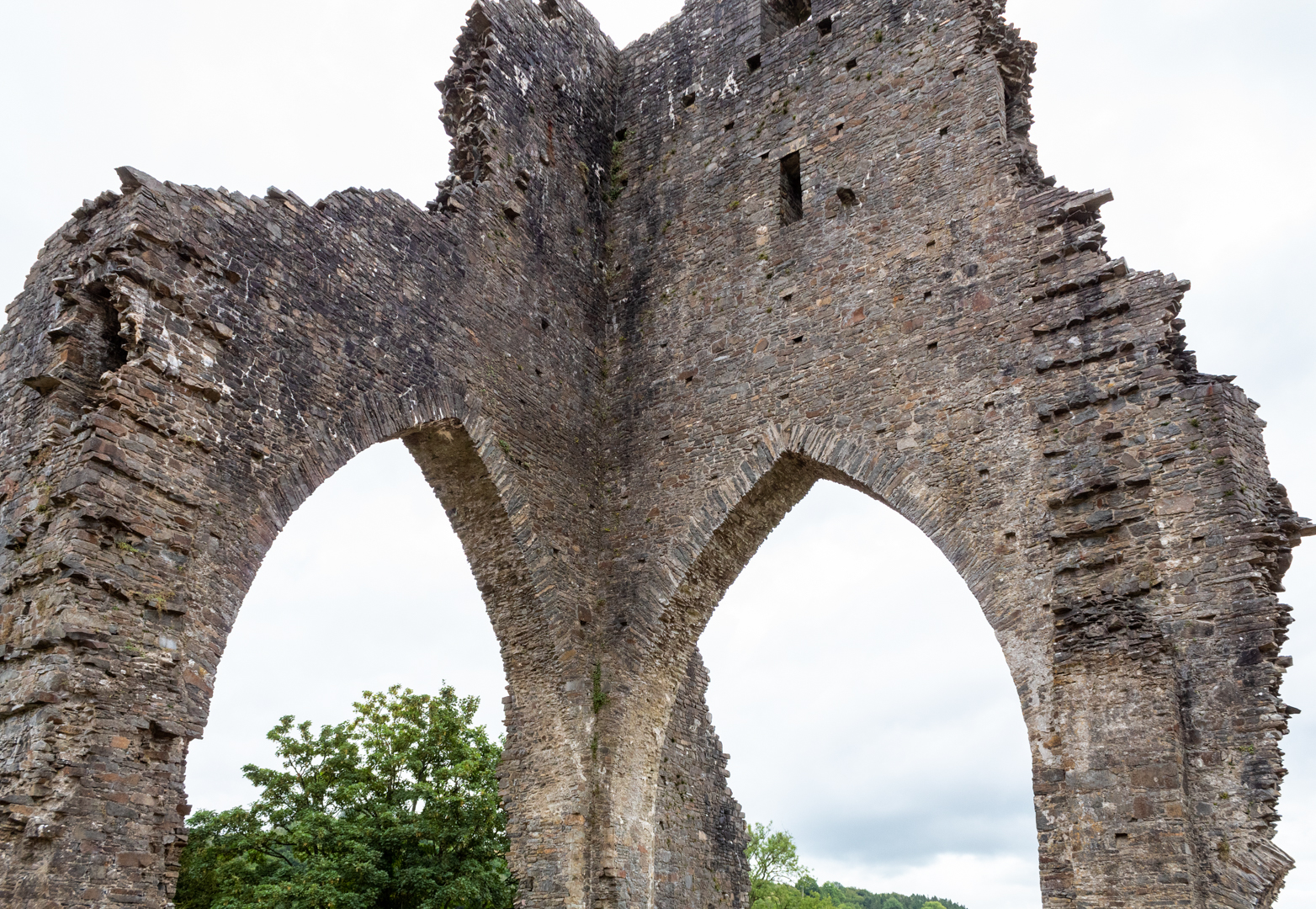
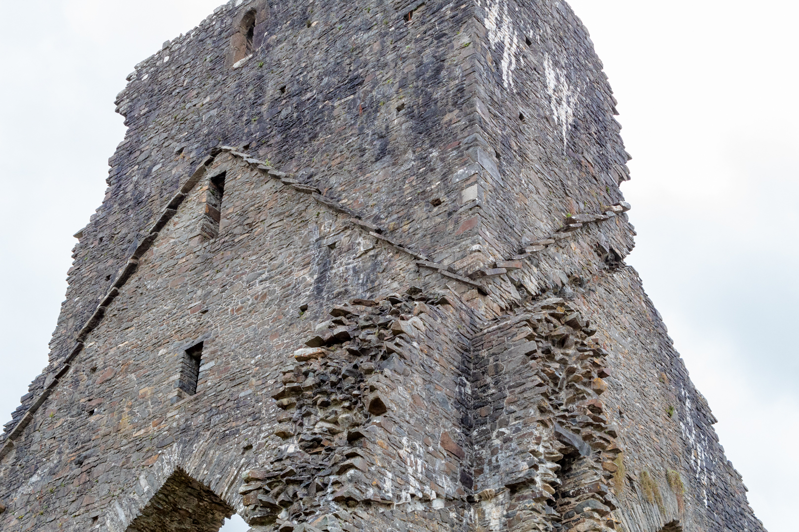
The abbey was dissolved by Henry VIII and the structure was mined by the villagers for stone to build much of the present village and the church next to the abbey. The Abbey as can be seen is now in a quite ruinous state, but the majesty of the tower can still be seen.


Eglwys y Plwyf Talyllychau (Talley Parish Church ).


The beautiful white church on the site now is Eglwys y Plwyf Talyllychau (Talley Parish Church).


Eglwys y Plwyf Talyllychau (Talley Parish Church ).


The Abbey was once claimed to be the site of the grave of the medieval Welsh poet Dafydd ap Gwilym.


Eglwys y Plwyf Talyllychau (Talley Parish Church ).


The two lakes near the abbey ruins, which were used for fish farming to support the community of monks run alongside the church and abbey and add to the natural beauty of the site.


Footer:Visit Information: -

Google Reference: -
51.97664362266242, -3.9918785275528212

What Three Words reference: -
///stance.decimal.cabinet

OS Details: -
SN 63273 32774 Altitude: 369 ft

Additional information.


This is a fine ruin in a beautiful small little village and is a must if in the area.
There is a small car park for 2 or 3 cars outside the abbey walls. It is a great area to explore and stroll and the terrain is very flat and easy. A visit to the church is also a must. There is a small community cafe and toilets alongside the site.


Read More

Captain Cat.

 ___________________________________________________________________________________


C a p t a i n   C a t 

A sculpture in Swansea


Here we see a sculpture which seems to encompass two elements of the Welsh history and culture of this area.
The statue erected in the heart of Swansea's maritime quarter is of a sailor looking out and ringing a bell.
The statue is named Captain Cat sculpted by theWelsh sculptor Robert Thomas .
Commissioned by Swansea City Council on 1st March 1990.


Visit Date August 2019


_____________________________________________________________________________________


Captain Cat . A statue in Swansea maritime quarter


The sculpture does at first glance seem just to refer back to the maritime past of Swansea, but the character here has more significance.

Captain Cat is one of the main characters from possibly the best-known piece of literature to come out of Wales, "Under Milk Wood" by Dylan Thomas. Under Milk Wood was written as a radio drama and was broadcast in 1954.

Subsequently, in the 1972, the story made it to the silver screen being made into a movie starring one of the all-time greatest actors to come out of Wales Richard Burton.

An additional version and then was remade in 2015.

Captain Cat although old and blind is one of the play's most important characters, He observes and comments on the goings-on in the village from his window as he can recognize the different characters by the sound of their footsteps.


CAPTAIN CAT

"The sleepers are rung out of sleep

with his loud get-out-of-bed bell"

from

Under Milk Wood

by

Dylan Thomas


Footer:
Visit Information: -

Google Reference: -
51.6164323229727, -3.935963108023244

What Three Words reference: -
///bliss.case.cans

OS Details: -
SS 66059 92618 Altitude: 8 ft

Additional information.


his statue is in the maritime quarter of Swansea. 
There is lots of parking and the closest is the marina car park (51.61679855131115, -3.936364737297523)which is just a 2 minute walk from the site.


Read More

Coetan Arthur


___________________________________________________________________________________


C o e t a n  A r t h u r


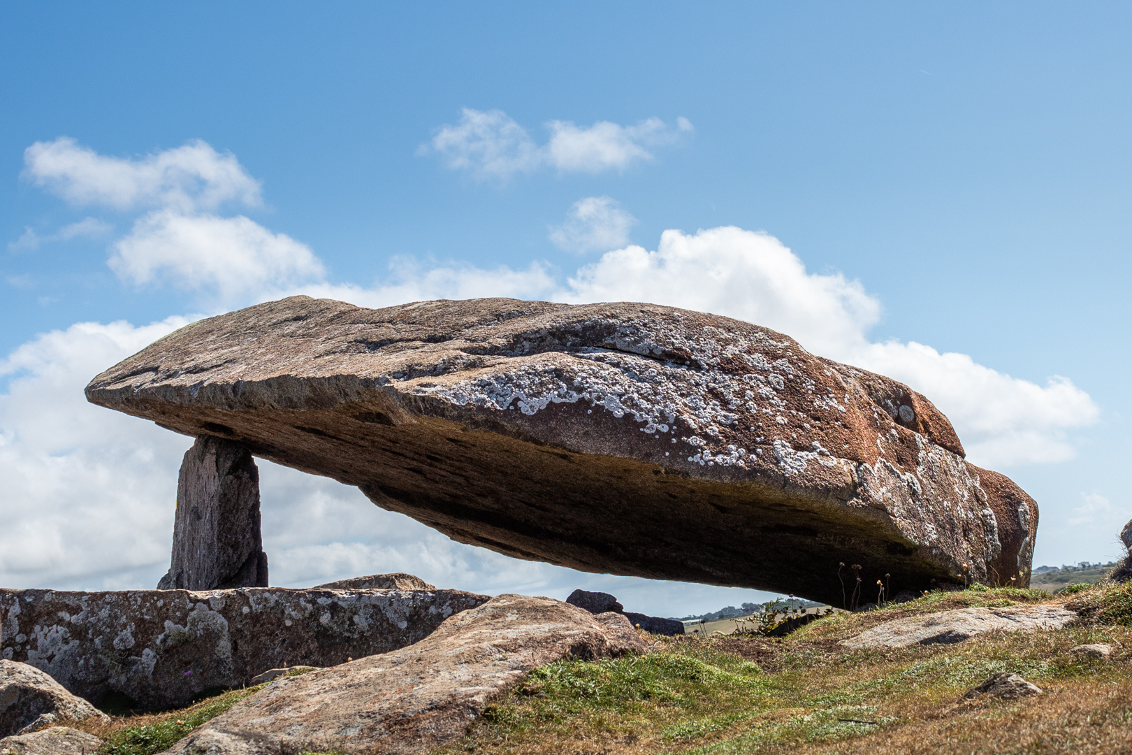
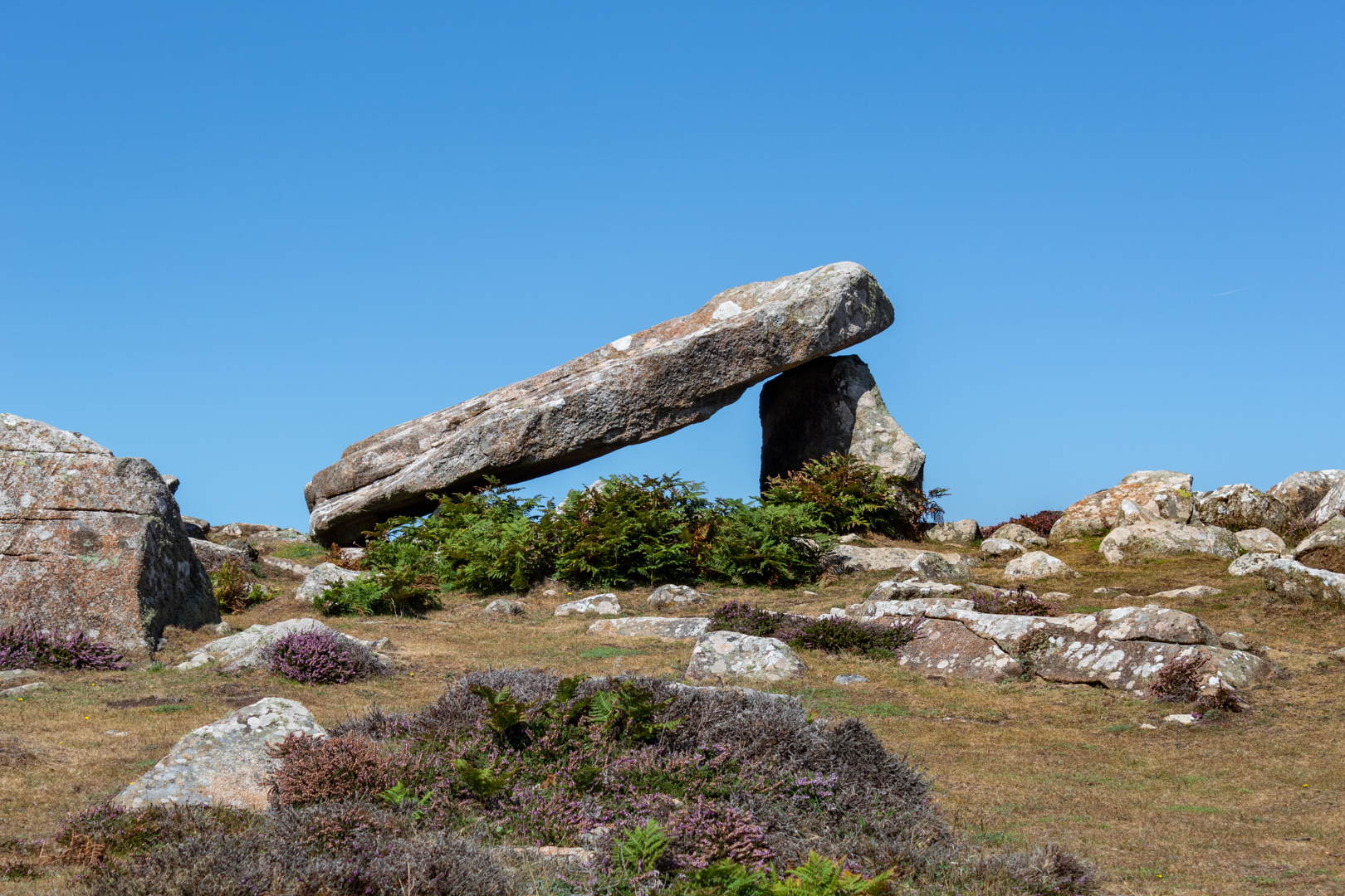
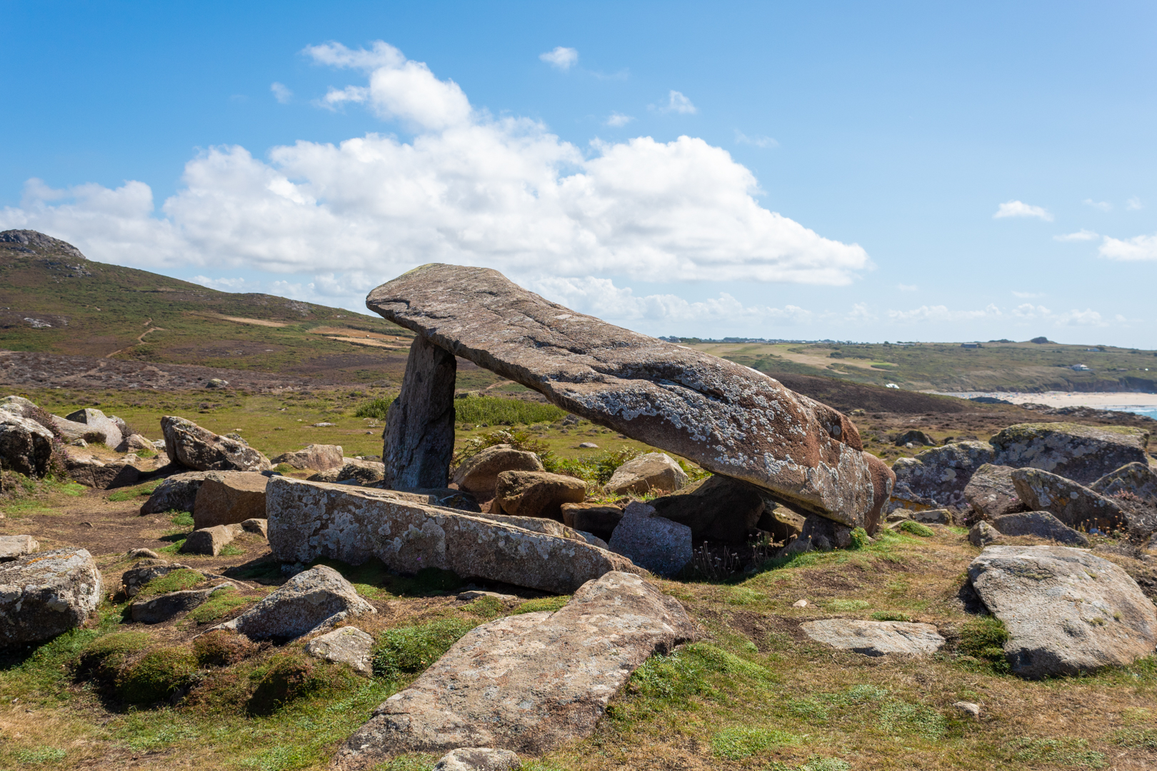
Coetan Arthur (also known as Arthurs Quoit).
 A dolmen on the southwest coast of Wales 
on the St. Davids's head peninsular, 
in county of Pembrokeshire, Wales.
This impressive megalithic tomb dates from 
between 4000 to 3000 BC.
The dolmen, which is formed by two vertical 
megaliths erected to support a flat capstone,
is partially collapsed, but still impressive nonetheless.


Visit Date August 2022


_____________________________________________________________________________________


Coetan Arthur, St Davids, Pembrokshire.


There are many ancient burial sites around the southwest of Wales
These burial sites are often marked with three or more uprights and a large capstone. Often this is all that is left of the site which would originally be covered with earth. This upright/capstone structure has been called a Dolmens or often also referred to here in Wales as a Cromlech, but my understanding is that Cromlech can also refer to a circular stone structure.


Coetan Arthur, St Davids, Pembrokshire.


This structure should not be confused with Carreg Coeten Arthur which is also in Pembroke, and which will be covered in another blog soon.


Coetan Arthur, St Davids, Pembrokshire.


The St Davids headland is full of ancient remains including signs of ancient field patterns, Neolithic enclosures, and defensive banks and ditches.


Coetan Arthur, St Davids, Pembrokshire.


Perhaps the most impressive part of the burial chamber is the massive capstone, which is roughly 6m long and 2.5m wide. The upright stone supporting it (known as an orthostat) is about 1.5m high.


Coetan Arthur, St Davids, Pembrokshire.


The site here overlooks Whitesands Bay at St. Davids and has a good view but is far enough from the main cliff not to be to battered by any storms that hit the coast.


Coetan Arthur, St Davids, Pembrokshire.


It has been reported many visitors to the site that they found the site hard to find. I suspect that if you were only casually walking the coast path that this could be true but I found that the site could be seen from quite a distance when walking east to west which seems to be the most natural direction to be walking.


These ancient sites often have a legend attached to them and this one is no exception. The legend for Coetan Arthur states King Arthur himself chucked the stones from nearby Carn Llidi.


Note: The terms Dolmen, Cromlech and Quoit are often used to describe this sort of neolithic site.


Footer:
Visit Information: -

Google Reference: -
51.90450867492426, -5.308083153876568

What Three Words reference: -
///snowstorm.finely.deck

OS Details: -
SM 72527 28056 Altitude: 162 ft

Additional information.
Visiting is easy, head to Whitesands bay car park (51.897174093111616, -5.2940221280185105) this is a caravan and camping park and is easy to get to.
There is good facilities for the park, there is a charge for parking.

The walk is around 1mile from the car park but is not flat it is undulating.
Before you descend to the path to Pothmelgan beach (there is a small crossing) you can see the site to the northwest. You can then either take the steep path directly to the site of take the coastal path around the head and then on to the site.


Read More

Port Eynon Salthouse


___________________________________________________________________________________


P o r t  E y n o n  S a l t h o u s e


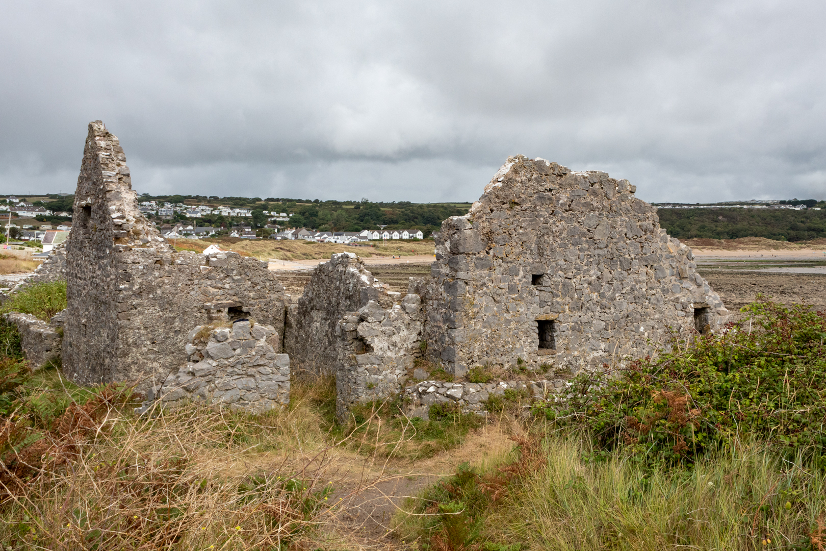
On Port Eynon Point, on the Gower peninsular, overlooking the bay are the surviving remains of the sixteenth-century Port Eynon Salt House.

Much of what survives today owes to the excavation and subsequent protection of the site.

As well as other valuable industries such as coal, iron, lime and fisheries salt is perhaps overlooked but the Salthouse at Porth Eynon is a reminder of this important and valuable commodities production.


Visit Date August 2022


_____________________________________________________________________________________


Port Eynon Salthouse


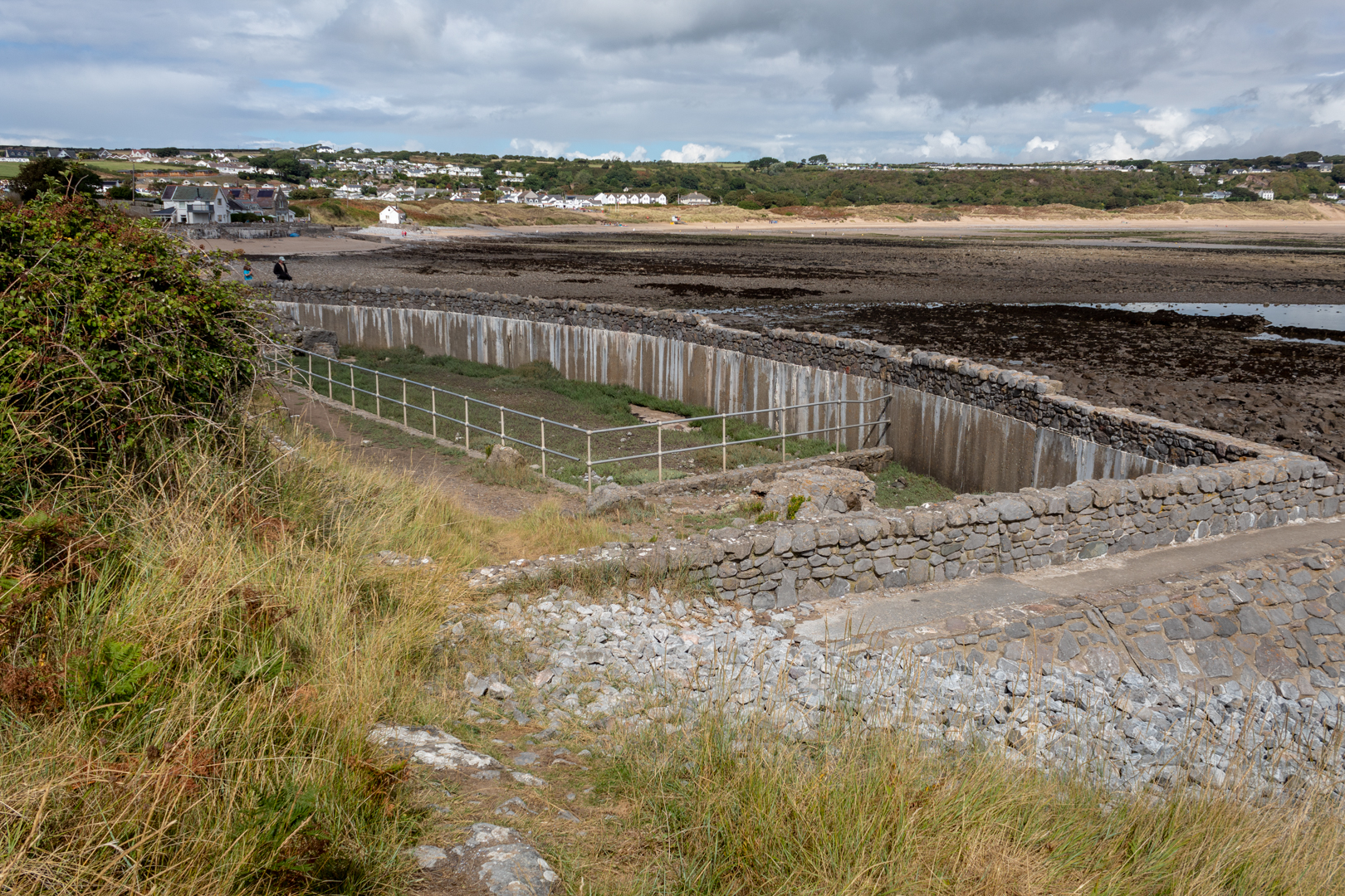
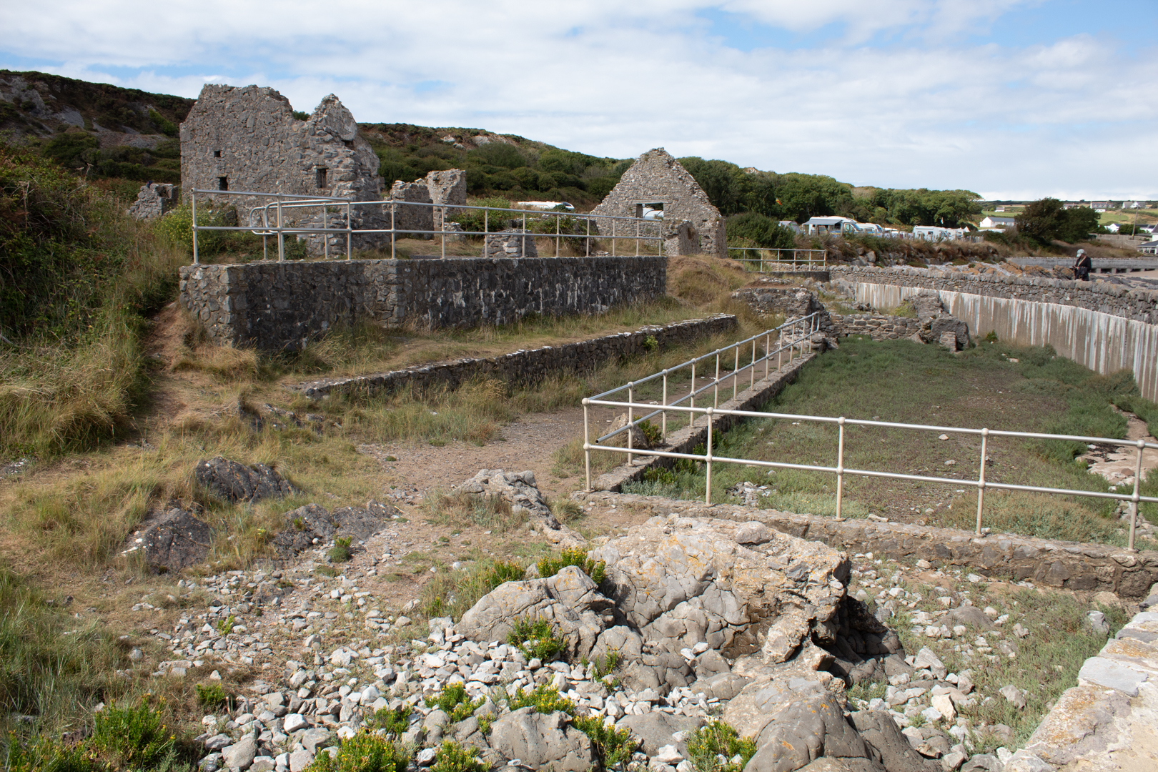
The complex is of three stone-lined chambers, with walls approximately one metre thick with stone-flagged floors set into the beach at the foot of a low cliff.

The main building still visible today was used for occupation and storage while the three large chambers closest to the beach were used for salt production.


Port Eynon Salthouse


At high tide, the seawater would enter the beach chambers where it would be stored in a holding tank.


Port Eynon Salthouse


The water would be pumped into the Panhouse where large iron pans would be heated by coal furnaces and the water would slowly evaporate. The forming salt would then be skimmed off for storage in the northern building to dry completely.


Port Eynon Salthouse


In the 1500s salt was a valuable commodity not least for the preservation of foodstuff. At this time the British Isles imported much of its salt from France, however, during the mid-1500 the English and French were often at war, so the supply was inconsistent, and the cost grew exponentially and so it became clear that salt produced at home was needed.

The first of the new salt works were set up in 1566 at Dover, Southampton, and on the Essex coast. In the same year, works were established at Blythe near Newcastle, and in the following year, similar concerns were set up in Suffolk and in another part of Essex.

Much of the records of the salt production largely ignored Welsh salt production, but there are records of the salt production that started in mid-west Wales near the Dyfi estuary.


Port Eynon Salthouse


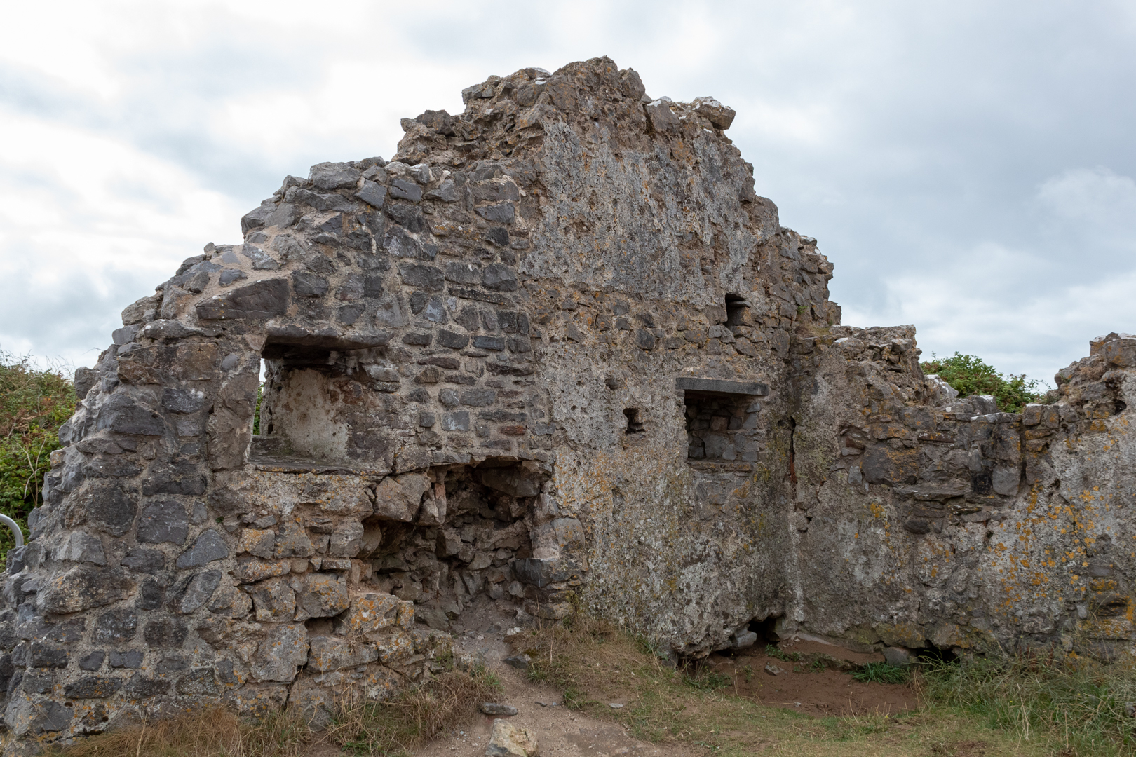
The first knowledge of a salt house at Port Eynon is also mentioned in a document of 1598. It would seem Welsh salt houses of the later 16th century were amongst the most advanced of their day. The value of the salt is perhaps shown by the fact that the site was fortified during the 17th century, with the inclusion of musket loops within the thick walls. It appears, however, salt production ceased around the mid-17th century.


Port Eynon Salthouse


Of course, this is Wales and therefore myths and legends always surround such buildings and this site is no exception.

This site has attracted some interesting stories about its history. The historical annotation of the Lucas family claimed the building was erected in the mid-16th century and fortified by John Lucas who apparently also fortified Culver Hole (previous blog here) connecting the two via an underground passage. From this stronghold, aided by a group of lawless men, he engaged in piracy, resisting all attempts by the authorities to dislodge him. It is also said that 7 generations later another John Lucas found a rich vein of paint mineral and exported it from his base at the Salt House but shortly after his death the building was ruined in a storm. Although interesting this history was later shown to be a fabricated family history written by the Rev. Dr. J. H. Spry during the 1830s in connection with a family lawsuit over the ownership of the property.


Port Eynon Salthouse


Later in the building's life, some of the buildings were demolished but occupation continued in the main house. The most recent was the use of the northern end as oystermen's cottages, which were finally abandoned circa 1880.


Port Eynon Salthouse


Footer:


Visit Information: -

Google Reference: -
51.53986210851509, -4.208391765954198

What Three Words reference: -
///expiring.bookmark.bright

OS Details: -
SS 46942 84634 Altitude: 13 ft

Additional information.
Visiting is really easy as in Port Eynon there is a large public car park (51.54431040120058, -4.2118757381346805) which is adjacent to a caravan and camping holiday site. There is also public toilets and a café, shop and take away.
The walk is around 600 metres from the car park and is easy and flat.
Just walk through the camping site and past the Youth Hostal.
Read More

Search This Blog

About Me

Bridgend, United Kingdom
A renewed interest in photography and local history.

Contact Me

Name

Email *

Message *

Followers