With a renewed enthusiasm for photography and local history, I set out this blog as a record of my experiences with images and narratives. It is my hope that you find something of interest on this site. Please feel free to contact me for more information on any of the posts. You can see a comprehensive list of my blogs at my website :- http://www.davidnurse.co.uk

Carreg Cennen Castle

Visit Date : August 2021


Carreg Cennen Castle

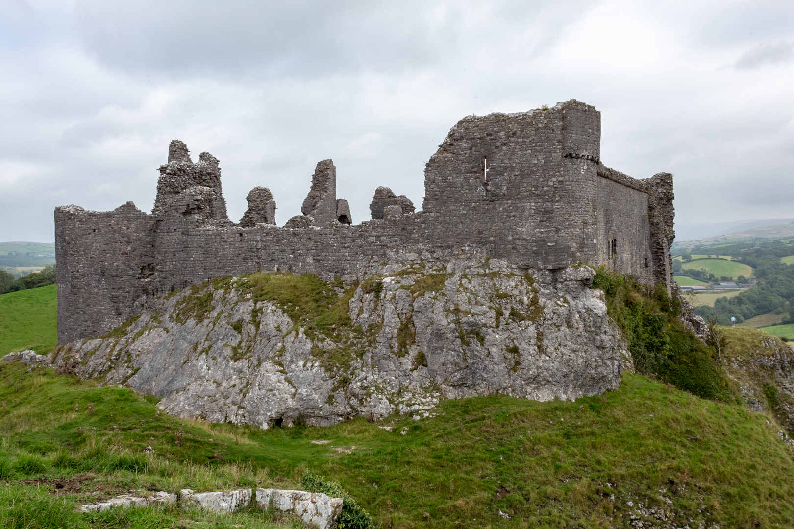
WELSH: Castell Carreg Cennen meaning castle (on the) rock (above the) Cennen) is well named as this fortress is well above the outlying land high upon a limestone cliff.

Castell Carreg Cennen


The site has a long history and may well have also been the site of an Iron Age hillfort.

There is also some Roman history as Roman coins have been found in the area, although it is unlikely the Romans occupied this site on a permanent basis.

Castell Carreg Cennen

Legends of the original fortress goes back to the Dark Ages, held by Urien Rheged, Lord of Iskennen, and his son Owain, knights during the reign of King Arthur.

Stories claim that there is a warrior (perhaps one of the knights, or Arthur himself?) asleep beneath the castle, awaiting a call from the Welsh.

Castell Carreg Cennen

As with many Welsh castles, they will have been built, rebuilt and altered through the ages.

The first "castle" on the site was probably built by the Welsh Lord Rhys, Prince of Deheubarth, in the late 12th century, but was taken in 1277 by King Edward I.
Castell Carreg Cennen

The castle we see today replaced the demolished previous structure in the late 13th century by John Giffard and his son.

Castell Carreg Cennen


It was involved in many battles and was besieged during the rebellion of Owain Glyndwr in about 1403 and was considerably damaged.

Around 1461, the castle was deemed too much of a threat to the monarchy and was destroyed the following spring and is basically in the same state today.

Castell Carreg Cennen

Despite being in a ruinous state in the 18th century it started to attract artists (Turner sketched the castle in 1798).

Castell Carreg Cennen

In the 1960s Carreg Cennen Castle was acquired by the Morris family of Castell Farm, when Lord Cawdor's legal team made a mistake in the wording of the deeds and included the castle as part of the farm.

Castell Carreg Cennen

Castell Carreg Cennen

Castell Carreg Cennen

Castell Carreg Cennen

Castell Carreg Cennen

Castell Carreg Cennen

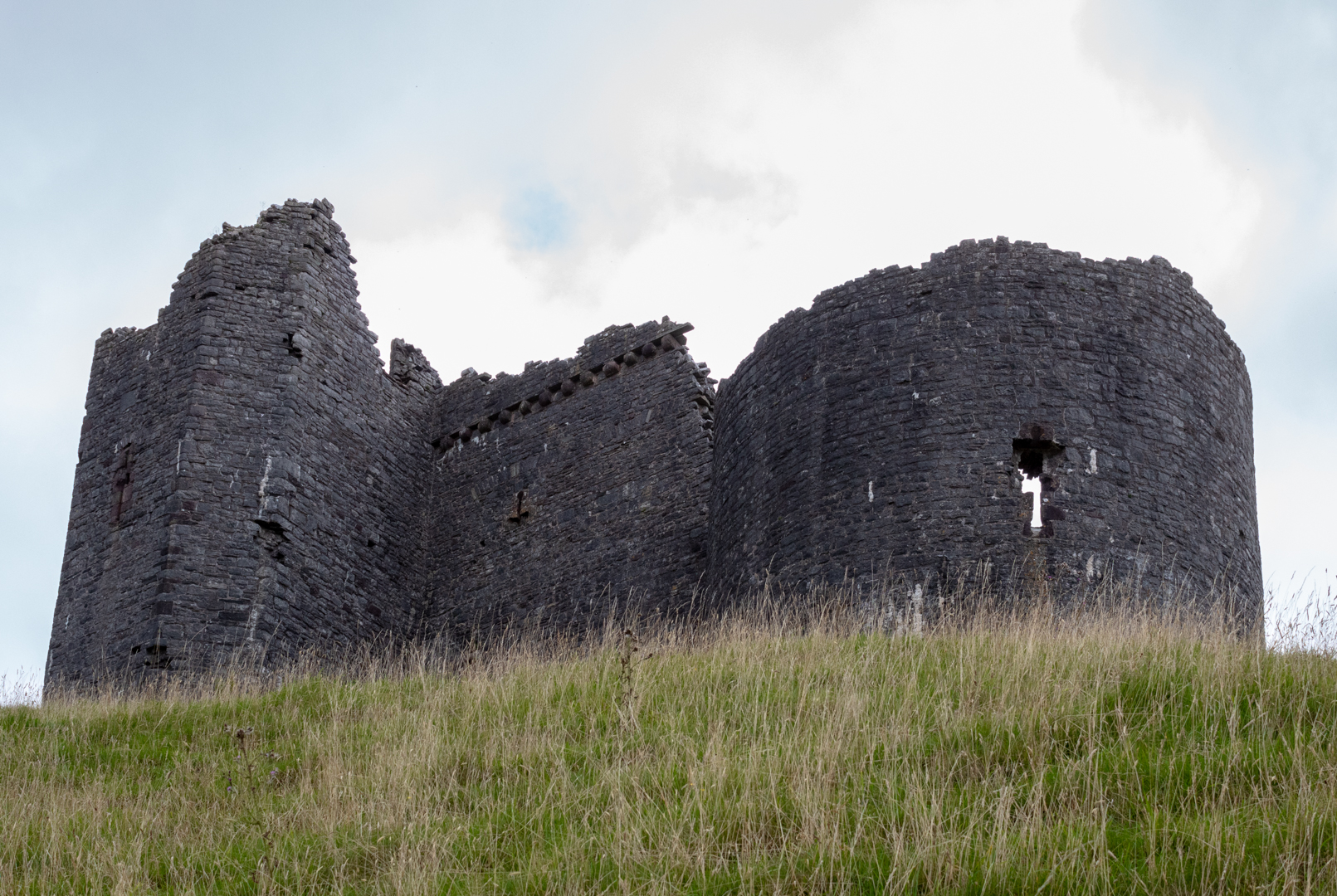
The image below is an interesting feature (at least to me) was this tower with the hole at the bottom. It was the outlet for the latrine.

Castell Carreg Cennen

Although today the Castle is maintained by CADW: (Welsh Historic Monuments) the castle is still privately owned and managed along with the farm and tea rooms by Margaret & Bernard Llewellyn and their Daughters.

Castell Carreg Cennen


Footer:

Visit Information:-

Google Reference 51.854408996393424, -3.935643592179748

Google Search reference: Carreg Cennen Castle

What Three Words reference : ///reason.winners.routs

The site is easy to find Leave north from Ammanford and turn left onto Ffordd Wern Ddu it is signposted from here.

The car park (51.85656999860168, -3.9376914809885473) is free with many spaces and overflow spaces. There are toilets and a "must visit" tea room and gift shop.




Read More

Maen Llia

Visit Date: December 2019


This is a post from a visit I made to this site in 2019.


Maen Llia Standing Stone on The Brecon Beacons


This standing stone is situated in Brecon.

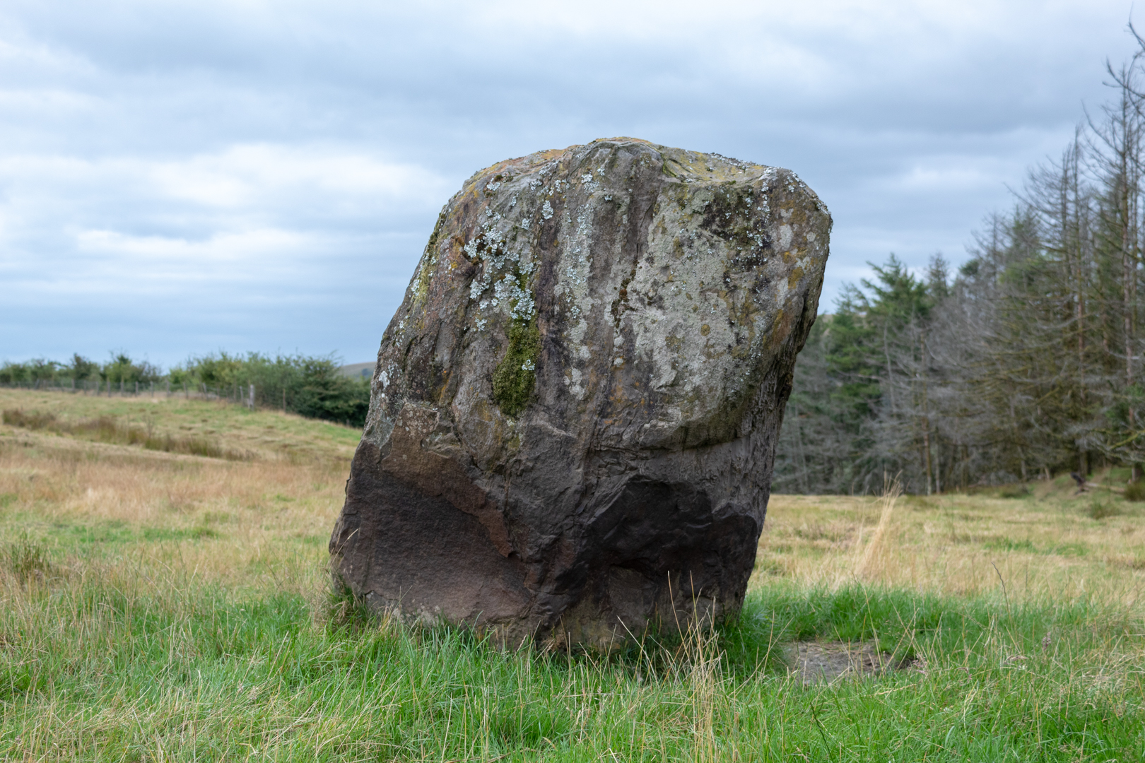
As you approach Maen Llia, the megalith is in a large area of scrub and does not look so large but gets more and more overwhelming as you get closer and close up is it very impressive. The stone is actually 12 foot high and 9ft wide.

The stone is made of Calcreate which is a form of old red sandstone which is found some distance away.

Maen Llia Standing Stone on The Brecon Beacons


The stone is likely to have been brought to this location by a glacier many thousands of years ago and then placed upright in its exact position during the Bronze Age.

The myth associated with this stone is that on mid-summers eve the Maen Llia walks to the river to drink.

It is said that this myth stems perhaps from the shadow getting longer as the sun goes down and stretches down to the river before sunset.

Maen Llia Standing Stone on The Brecon Beacons

Maen Llia Standing Stone on The Brecon Beacons


Footer:

Visit Information:-

Google Reference 51.860873062740495, -3.5636886724985617

Google Search reference: Maen Llia

What Three Words reference : ///compress.maple.display

The site is easy to find on Sarn Helen, in the Brecon Beacons.

Head north from Glynneath briefly on the A4019 and then the B4242 and Maen Llia is right next to the road, well marked and easily visible from the road.


Read More

CARN LLECHART RING CAIRN

Visit Date:- August 2021

Today my short outing was to visit the small stone circle called Carn Llechart.
This is within the Brecon Beacons National park and is high on the hills overlooking the village of Rhyd Y Fro.


Carn Llechart Ring Cairn
Click on images for larger view


The site comprises the remains of a burial cairn probably dating to the Bronze Age (c. 2300 - 800 BC).

CARN LLECHART RING CAIRN
Click on images for larger view


On observation, the ring is not really that impressive as other circles with the stones being not more than a few feet high and the ring not nearly as large as many others.

The reason for this is likely to be that the circle is not of the same sort of group ceremonial use that we see from the larger circle sites but is more likely that this circle is just the border of a burial site. But it does have significance in the history of this site.

CARN LLECHART RING CAIRN
Click on images for larger view

An important ring cairn, It measures 13 metres in internal diameter

with its unusual circle of contiguous slabs, about 25 in number, around a large rectangular cist (A cist is a small stone-built coffin-like box or ossuary used to hold the bodies of the dead. Examples can be found across Europe and in the Middle East),

This site is important as it has the distinction of being mentioned in one of Britain's earliest antiquarian books, William Camden's 'Britannia' (1695 edition).

CARN LLECHART RING CAIRN

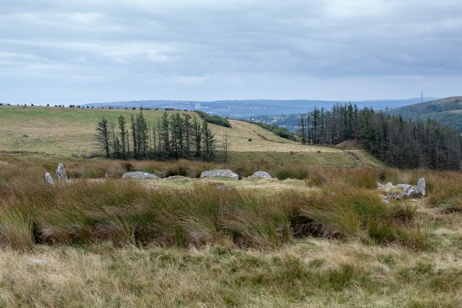
The twenty-five stone slabs leaning outwards slightly create a 'crown of thorns' effect. The circle is very slightly above the surrounding ground level. At the centre is the robbed-out rectangular cist measuring 2 metres by 1 metre Approx.

CARN LLECHART RING CAIRN


The cist was originally topped by a large stone slab, but this has been lost. Although I did read that it had been "moved" to a site 100 yards away.

I wish I had realised that the circle was so close to the ground as I would have taken a light ladder to get above the site to show it better, especially as the site was overgrown today at the height of summer, Maybe a return winter visit is on the cards?

CARN LLECHART RING CAIRN


There have been some interesting visit mentions for this site.

One of the visits was recorded by a couple who said "I have never seen anything like it. Claire was bodily thrown from the centre of the circle by some kind of force. I felt it too. It was like being punched in the stomach."

"Since our visit we suffered severe headaches, stomach problems, lethargy and general illness. It was almost as if our energy was completely sapped by whatever was in the centre of those stones."

By contrast, another reads:-

" I visit this place regularly and have found no ill effects when visiting, in fact, quite the contrary... I find the energy there is very warm and welcoming, not at all malicious, I leave with a renewed sense of wellbeing.

======================================================

In an adjoining farm field to the southwest of the circle, you will see another stone circle with much larger stones. A more impressive site this has often been in reports mistaken for the actual site. The stones are much larger and set out not in a proper circle so you have to be more open to the circle description.

CARN LLECHART RING CAIRN
Click on images for larger view


This is almost certainly more recent, however, it is likely that these large stones did mark something in the distant past but have been moved considerably.

CARN LLECHART RING CAIRN

One local resident stated that this was constructed by the gas board to stop the farmers cows from rubbing against the machinery that was stored there. This was going to be the use for the large flat stone. Although this may have been the recent use it is difficult to believe that these stones would have been brought here when the field with its dry-stone walls could have been secured more easily.

CARN LLECHART RING CAIRN

Another report was of a farmer building a stone circle in a field south of Carn Llechart ring cairn in 1985. Either way, I think these may have been of importance before being repurposed and the original position and purpose has now sadly long gone.

That said they are impressive to look at. Oh yes, the views are also great from up here but the light was very flat and not good for the long landscape shots.

--- Footer ---

Visit Information:-
Google Reference 51.73995923556227, -3.8880360662304243
Google Search reference: Carn Llechart Stone Circle & Cairn
What Three Words reference : ///fight.lucky.geek

To visit the site is quite easy, but it took me quite a time to find it but this should make it easier for you.

When entering the village of Rhyd Y Fro with the "Traveller's Well" pub on your right-hand side, take the turning left just past the pub. Go up the hill on the small farm track until you pass over a cattle grid. A little way after this is a sharp hairpin bend to the left, take this up the hill further.

Next, there is a right-hand hairpin turn with a larger tuning space. Here you can park or just a little way further up the hill there is an entrance to the hill with a yellow grit box on the right-hand side, you could park here also.

Take a walk through this entrance by the grit box with the wall on your left and then follow the wall 90 degrees around to the left. When you reach the second metal gate with the "walkway markings" and style stop.

You will see the false circle and stone in the field if you wish to visit but Carn Llechart is not in this direction.

With this gate at your back look opposite and slightly to the right and the Circle is just a few hundred yards away up the hill slightly. I visited in summer and could hardly see the stones of the circle from the gate as they were overgrown but in winter you may possibly see them.

The google map reference is very good and I found it from that.


Read More

The Wreck of the Altmark

Date of visit: April 2021

The Wreck of the Altmark


This is a wreck on my favourite local beach.

It is located along the coast heading west from Sker beach where the S.S Santampa was wrecked.


The Wreck of the Altmark


This part of the South Wales coast is very treacherous in stormy weather and there are quite a few wrecks here.


The Wreck of the Altmark


There is not much showing of the wreck today because the level of sand on the beach does vary during the year.


The Wreck of the Altmark


The Altmark was a fishing vessel that was travelling from Briton Ferry to Barry in June 1960 when it developed engine trouble and ran aground.
Luckily there was only one person on board and he was rescued safely.


The Wreck of the Altmark


Footer:

Visit Information:-

Google Reference
Footer:

Visit Information:-

Google Reference
51.528958947924274, -3.760627107183939


What Three Words reference : ///haunts.mule.disgraced

Additional information


Visiting:
Easy but quite a way from any parking.
You can park at the Kenfig Natural Nature Reserve (51.51590589843503, -3.72832430176402) there is now a fee that needs to be paid for parking and on last visit it was card only.
From the car park you need to follow the yellow signs to the beach and then turn left on the beach until you reach the wreck (2.5 Miles Approx).
There are facilities at the nature reserve, toilets and café and also visitor centre information.


Read More

The Keeper of the Woods (Bridgend Nature Keepers Project)

 Visit Date: April 2021


This is one of the ‘Nature Keepers’ oak sculptures.

The Nature Keepers project has been led by Bridgend County Borough Council, working together with local community groups.

They add interest to our beauty spots, and with the accompanying poetry, they capture the imagination of younger visitors by interweaving mythology into the sites.

Their aim is to spark an emotional connection to our green spaces, and so encourage people to visit as well as care more for them.

The Nature Keepers were carved out of Welsh oak by local sculptor Dai Edwards.

This will be a first of a series of posts on this topic


This keeper can be found in Tremains Wood Nature Reserve.

Brackla housing estate expanded greatly in the latter half of the last century and now accounts for nearly a quarter of the Bridgend town with a population of 11,749 at the 2011 Census.

Tremains Wood is a lowland mixed broadleaf woodland in the middle of the Brackla estate. It’s an easily accessible, leafy haven from town life and the meandering pathways through woodlands are a perfect place for children to explore. It is managed so the local community can access nature.

An area of ancient, semi-natural woodland, Tremains Wood is listed in the provisional ‘Glamorgan Inventory of Ancient Woodland’


THE KEEPER OF THE WOOD

I am a calendar, watch the seasons grow,

Warmed by summer sun, blanketed in snow.

I am a wardrobe full of things to wear,

Woven mossy blankets, woolly underwear.


I am a market full of tasty grub,

Caterpillar sandwiches, desiccated slug.

I am a mansion, fit for popstar folk,

Bunches of ash keys, wall to wall oak.


I am a classroom, open to the skies.

History surrounds me, imagination flies,

Woodland interface, nature’s open book,

Ancient hub of knowledge, welcome to the wood.”


Read More

Newcastle Castle (Bridgend)

Visit Date : July 2021

Newcastle Castle (Bridgend)


I visited another of the South Wales Castles, this time Newcastle. This should not be confused with the towns of Newcastle in the UK or the very famous northern city of Newcastle-Upton-Tyne.

This Newcastle now stands on Newcastle Hill overlooking the town of Bridgend and the river Ogmore that flows through the town.


Newcastle Castle (Bridgend)


The Norman castles throughout Wales were built hastily of wood with an earthen embankment but this castle like so many others was later reinforced by stone.

Above you can see the Southern wall incorporating the south tower that is the part of the castle that has survived the best. (In the background you can see St. Illtyds Church).


Newcastle Castle (Bridgend)
Click on any image to enlarge


The west tower would have stood here, sadly most of it has gone now but this would have looked onto the keep which is now completely destroyed and there is no visible remains of the keep.


Newcastle Castle (Bridgend)
Click on any image to enlarge


On the eastern side, the remains of domestic buildings can be seen.
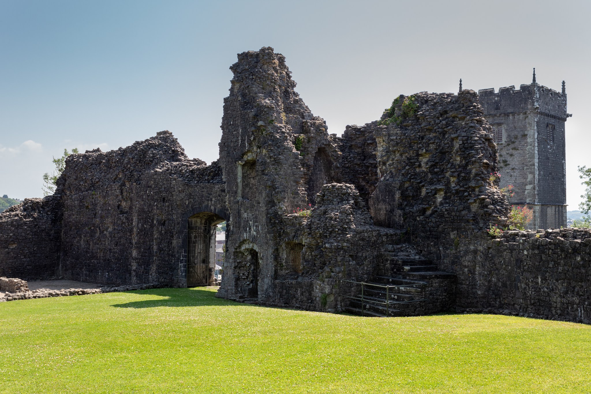
Although the castle overlooks the strategic River Ogmore which flows down past Ogmore Castle it is more likely that this Newcastle was more of a great residence than a defensive stronghold.


Newcastle Castle (Bridgend)
Click on any image to enlarge


After the invasion and conquest of England in 1066 by the Normans, a buffer was created between England and Wales along what is known as the Marchers or Welsh Marchers. The leaders at the time were given authority and were encouraged to take land from any Welsh rulers.

The invasion of South Wales was led by Robert Fitz Hamo and this led to the destruction of the Welsh Kingdom of Morgannwg and the Lordship of Glamorgan was born.

According to legend, The lord was accompanied by a dozen knights who would be later known as the "Twelve Knights" and much of the early castle building was done by The Twelve Knights".

Later in the Castles history, Lord Roberts grandson William died leaving a daughter but no male heir and that led to the Welsh tribes led by "Morgan ap Carradog" (Morgan son of Carradog) to rise up. This disorder was soon quelled and King Henry was forced to take over the rule of Glamorgan in around 1183 and it is likely that the decorated stone gateway was built at this time.


Newcastle Castle (Bridgend)
Click on any image to enlarge


Another of the Castles of South Wales which sadly is in ruin but is now protected by Cadw

(Cadw is the historic environment service of the Welsh Government and part of the Tourism and Culture group. Cadw works to protect the historic buildings and structures, the landscapes and heritage sites of Wales, so that the public can visit them, enjoy them and understand their significance. )


Footer:
Visit Information: -

Google Reference: -
51.50892482554663, -3.583186606287954


Google search:-
Newcastle Castle Bridgend

What Three Words reference: -
///latter.sweat.brings

OS Details: -
OS Grid Ref : SS 90221 80079 :Altitude:159 ft

Additional information.

Parking is not easy here as you will need to park on the street. There is a small lay by (51.50899382089056, -3.5836980556567433) There is plenty of parking in the town if you do not mind a 15 - 20 minute walk up to the castle.


A full list of blogs can be found at my website


Read More

Strumble Head Lighthouse


___________________________________________________________________________________


Strumble Head Lighthouse


Strumble head lighthouse is just one of the many lighthouses that surrounds the United Kingdom

The lighthouse station was built for the greater safety of sea traffic between Ireland and Fishguard Harbour and is located on cliffs and a breakwater three miles to the east. The light also formed a link with South Bishop light, 18 miles to the south-west.


Visit Date July 2021


___________________________________________________________________________________


Struble Head Lighthouse


This is one of my visits to the Pembrokshire Coast in South Wales.

The day started with bright and hot, however, as we got to this part of the coast the mist rolled in around the headland, the temperature dropped and the visibility got shorter illustrating why this lighthouse is needed here. When I left the lighthouse just a half a mile inland it was like another part of the country with bright hot summer sunshine.


Struble Head Lighthouse


Strumble Head Lighthouse stands on Ynys Meicel (St. Michael's Island), also known as Strumble Head, a rocky island at the northwest corner of Pencaer area, quite near the town of Fishguard, in Pembrokeshire, Wales.

This stretch of coast is very dangerous, and some 60 vessels are known to have been lost along it in the 19th Century alone.


Struble Head Lighthouse


The lighthouse replaced a light vessel previously moored in the south of Cardigan Bay.


The Lighthouse was reached by an iron bridge and is currently off-limits so you are unable to get to the lighthouse unless it is one of the open days or educational tours that happen infrequently.


A plaque in the lantern-room is inscribed with a verse from Psalm 127:
Except the Lord Build the house
They labour in vain that build it
Except the Lord keep the city
The Watchman waketh but in vain


Struble Head Lighthouse


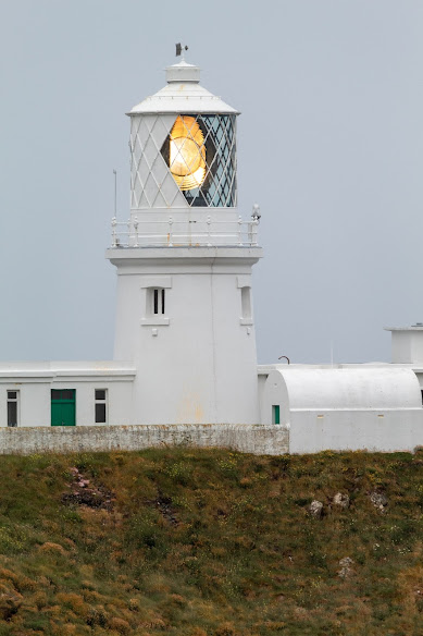
The circular stone tower is 55 ft high and still contains the original lantern complete with Fresnel lens.
Illumination was updated from paraffin to electricity in 1949. The Lighthouse was fully electrified in 1965 when the optical system was also replaced by more compact equipment.


The Lighthouse was fully automated in 1980 but monitored with regular visits made by an attendant from the Trinity House Operations Control Centre at Harwich.


Footer:

Visit Information:-

Google Reference:-
52.029738410495085, -5.073602151740549

What Three Words reference:-
///stumpy.regulator.showering

OS Details:-
SM 89239 41270

Additional information.
Visiting is easy but the roads to the lighthouse are quite narrow.
Take the A40 from Haverfordwest to Fishguard , then left on Quay Road and follow signs for Strumble Head
There are two parking areas. The first you will come to on the road is (52.02963342008546, -5.069457876611645) there is rooom for perhaps a dozen cars, however there is also a small car park a little further on but it is not obvious (52.028993841497254, -5.07054577404669)


Read More

Pennard Castle


Visit Date: July 2021

This week I took advantage of the great weather and went to the Gower coast in South Wales and visited the ruins of Pennard Castle.

Pennard Castle


Pennard Castle is a ruined castle on the Gower Peninsula near the village of Pennard in South Wales. Like many Norman castles built in the early 12th century, it started as an oval shaped timber ringwork and the walls were rebuilt in stone in the late 13th or early 14th century.

Pennard Castle


The only entrance was through the gatehouse on the east side, which consisted of an archway.


Pennard Castle

A small settlement grew up around the castle, and to its east, a solitary section of wall is all that is left of St. Mary's church which was the last element of the settlement to be abandoned in 1532. The Castle, village and church were all subsequently overwhelmed by sand.

Pennard Castle

The castle was listed in a survey in 1650 where it was described as being desolate, ruinous and surrounded by sand.

By the 1920's Penard Golf Club had acquired the site and a beautiful golf course had been developed with the castle ruins at the beachside of the course.

In 1923 funds were being raised to help preserve what was left of the castle but the cost was too high and only some remedial work being "patched" with concrete was carried out.

Pennard Castle


After the disaster of the remaining southern wall collapsing at the beginning of 1960 a public appeal launched by local newspapers and urgent masonry repairs were then carried out in 1963, paid for by a combination of the Ministry of Public Buildings and Works, the Gower Society, the golf club and the public appeal funds.

Pennard Castle

Thankfully now The ruins are protected under UK law as a grade II* listed building and a scheduled ancient monument.


Footer:
Visit Information:-
Google Reference
51.57650638581841, -4.102301944976939
Google Search reference: Penard Castle
What Three Words reference : ///existence.fluffed.verges


Additional information
Visiting is easy. Take the M4 motorway west Junc 42, Pass thought Swansea and take the Mumbles road . A 483 - A4067 and then B4436.
There is a national trust car park quite close (51.56692601910292, -4.087807245914044) and the charge is reasonable. There is also toilets and a cafĂ© and restaurant near the car park. The castle can then be reached either by walking the road back to the golf course which is passed getting to the car park and crossing the course. Or if you are fitter from the beach which is down from the car park and across Pobbles bay to Three Cliffs Bay and then up to the castle.

Read More

Search This Blog

About Me

Bridgend, United Kingdom
A renewed interest in photography and local history.

Contact Me

Name

Email *

Message *

Followers