With a renewed enthusiasm for photography and local history, I set out this blog as a record of my experiences with images and narratives. It is my hope that you find something of interest on this site. Please feel free to contact me for more information on any of the posts. You can see a comprehensive list of my blogs at my website :- http://www.davidnurse.co.uk

Showing posts with label Welsh history. Show all posts

TÅ· Newydd Burial Chamber.


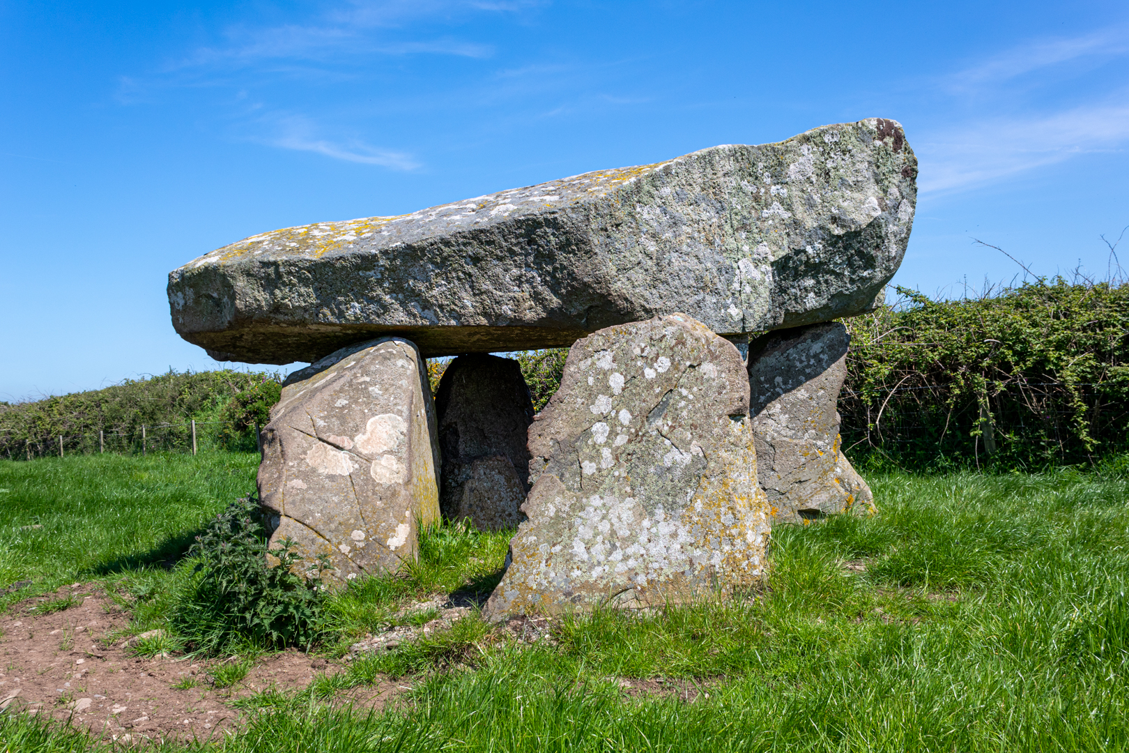
TÅ· Newydd burial chamber although ruined, is still a good example of a megalithic dolmen. 
Set on a natural outcrop it would originally have been covered with a mound or cairn 
now marked out by the small bollards that surround it.


Visit Date May 2023


Ty Newydd Burial Chamber (Dolmen)
Click on image for a larger version.


Ty-Newydd has a massive cracked capstone, about 4.0m by 1.8m and up to 1.2m thick, that rests on three of the four remaining uprights. The Capstone is likely to have originally been wider as part of the southern edge has broken off.


Ty Newydd Burial Chamber (Dolmen)


The chamber was originally part of a passage grave. One theory is that the tomb was originally similar to Bryn Celli Ddu (the subject of a later blog), with a second chamber joined to the first by a passage, and the entire tomb was covered by a large earth mound which was later removed.


Ty Newydd Burial Chamber (Dolmen)


Early reports claim that the second larger chamber existed close by, this has long since been broken up and carried away as has any surface evidence of a covering stone cairn so it is impossible to establish the original layout of the site although several small concrete markers around the chamber hint at the possible extent.
It is said to have once been enclosed by a circular wall about 32m in diameter and this may reflect the form of the cairn.


Ty Newydd Burial Chamber (Dolmen)


The huge tilted capstone is split and is now partly supported by brickwork and concrete. This does distract from the natural beauty of this site however one suspects that without this intervention the capstone would now be on the ground.
There is a photo in 'The Ancient Stones of Wales' by Barber and Williams, which purports to show Ty Newydd in 1900, with the capstone resting on 3 uprights, without all the modern brickwork.


Ty Newydd Burial Chamber (Dolmen)


The chamber was excavated in August 1935 by Charles Phillips.
There was a lot of charcoal, suggesting evidence of a large fire that formed this thick layer of charcoal as well as a quantity of quartz.


Ty Newydd Burial Chamber (Dolmen)


There were no human remains found at the site however the finds included five flint flakes, a burnt flint arrowhead, a small chip from a polished flint axe, and some small fragments of pottery. Phillips believed that the pottery fragments were from the Beaker culture, suggesting a Bronze Age reuse of this earlier Neolithic monument.


More recently, prehistoric artwork termed ‘cup marks’ have been detected on the capstone.


Footer:Visit Information: -

Google Reference: -
53.23592779682485, -4.482380635799995

Google search term:
I have had a few problems with google maps trying to locate the exact place by description so please use the google reference above.

What Three Words reference: -
///overgrown.broke.slings

OS Details: -
SH 34422 73862 Altitude:115 ft

Additional information.

Visiting is relatively easy.
There is a turn off to an unnamed road off the A4080
It traveling north the entrance to the field is on the right hand side and is has a ancient monument signpost and information board.
There is a small layby (53.23661829013594, -4.485084849839341).

There are no facilities here.


A full list of blogs can be found at my website


Read More

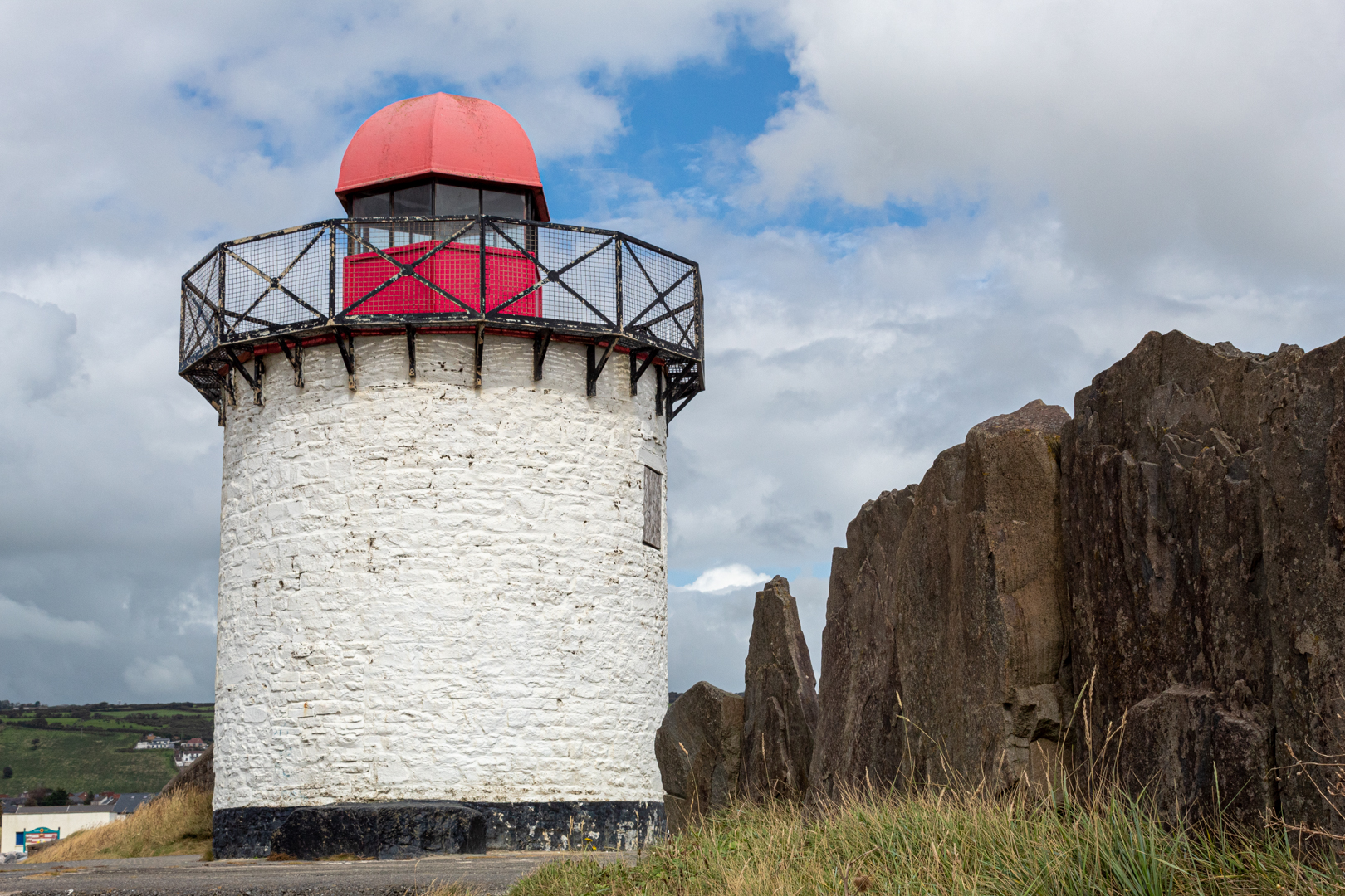
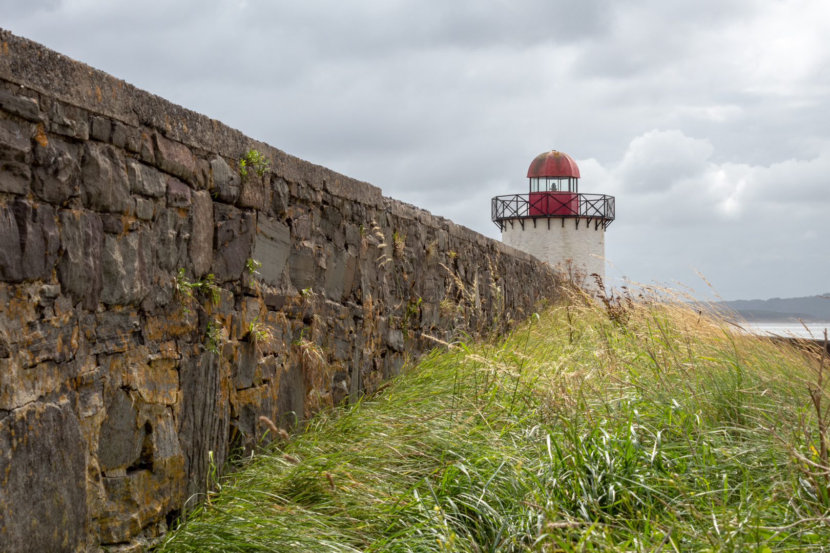
Burry Port Lighthouse


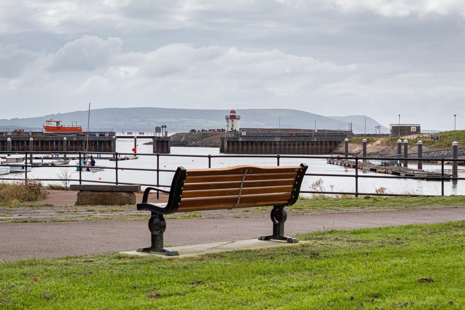
Burry Port is a small coastal town in the South of Wales.

The harbour was built in the early 1830s and was the main port for exporting coal from the surrounding areas.

The Harbour initially was named the Pembrey New Harbour and was a larger upgrade
 to the smaller harbour just along the coast.

The harbour's name was changed by an act of parliament in 1835 to Burry Port Harbour
 and thus gave the name to the Town of Burry Port.


Visit Date August 2020


Burry Port Lighthouse


Today the harbour has been developed into the local Marina and also houses the lifeboat station.


Burry Port Lighthouse


The lighthouse was built in 1842 and was restored in the mid 1990's by Llanelli Borough Training, with the support of the Burry Port Yacht Club with Trinity House*** supplying the lantern for the structure which was officially reopened on 9th February 1996 by the Mayor of Llanelli.


Burry Port Lighthouse


The lighthouse is quite small with its walls being just 24ft high with the gallery and lantern on top.


Burry Port Lighthouse


The lantern light is visible for 15 miles and is an important landmark for the marina.


Burry Port Lighthouse


***Trinity House is a charity dedicated to safeguarding shipping and seafarers, providing education, support and welfare to the seafaring community with a statutory duty as a General Lighthouse Authority to deliver a reliable, efficient and cost-effective aids to navigation service for the benefit and safety of all mariners.


Burry Port


Burry Port harbour was the landing place for the first crossing of the Atlantic by a woman please see my post:-


Footer:Visit Information: -

Google Reference: -
51.677500723894276, -4.2512000337731735


Google search term:
Burry Port Lighthouse

What Three Words reference: -
///kilt.origins.dynamics

OS Details: -
SN 44449 00034

Additional information.

Visiting Burry Port is very easy.
There is lots of parking here, with the closest being the harbour car park (51.680651095461656, -4.2513750336966005).


There are lots of shops toilets and other amenities close by.


A full list of blogs can be found at my website


Read More

Grove Colliery


In 1849, after the establishing iron furnaces at Kilgetty 
the Pembrokeshire Iron and Coal Company 
considered the possiblity of sinking a new pit at Grove
 to mine the Kilgetty anthracite vein and provide
 anthracite to the ironworks.


Visit Date October 2023


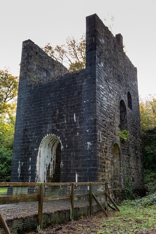
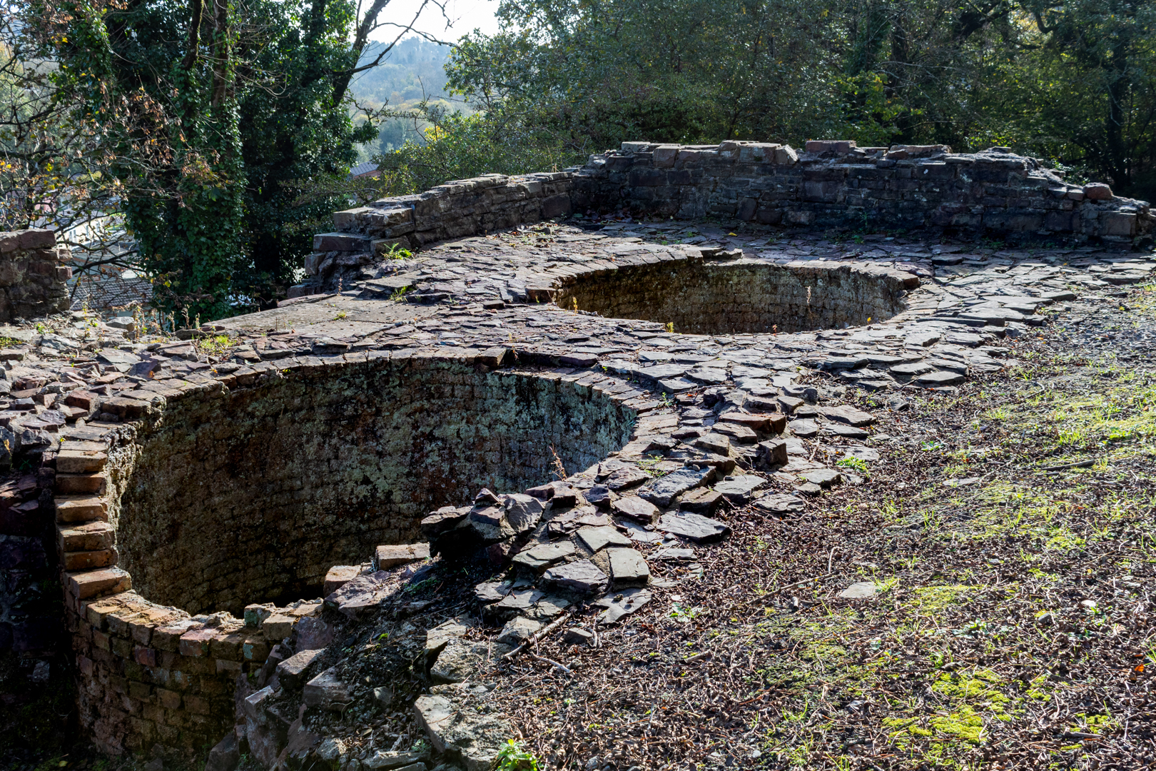
Grove Colliery Pithead
The Pithead and Shaft


The pit would have to be sunk to a depth of 182 metres to reach the vein.

The final decision was taken around 1852 and the new pit was started and opened some time later. When the pit finally started producing coal the Ironworks was in one of its production phases.


Grove Colliery Pithead
The Pithead and Shaft


The pit, being very close to the ironworks was to be linked underground to the workings of the older Kilgetty Colliery, which it drained. It had a tramway link directly to the Ironworks and was also connected to the Saundersfoot Railway.

The shaft was described in 1859 as the largest in Wales.

Coal from Grove was not exclusively used in the ironworks but was also taken by the Saundersfoot Railway to be sold for use elsewhere.


Grove Colliery Pithead
Inside view of Pithead


The Grove Colliery was later finally connected to Kilgetty Colliery via an underground tunnel.

Grove Colliery had its' own Smithy, Carpenters' shop and Stables which housed the pit ponies.


Grove Colliery Pithead


The associated ironworks finally ceased production in 1877 and a few years later coal extraction had ceased at Grove but the 274-horsepower Cornish Beam Pumping Engine was retained for pumping water until its' final abandonment in 1900."


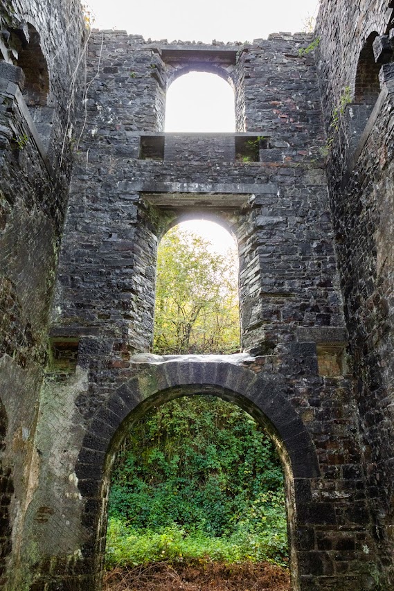
Grove Colliery Cornish engine house
The Cornish Engine House


It is reported that there remains a fully equipped stable at the foot of the shaft.


Footer:
Visit Information: -

Google Reference: -
51.731820524163666, -4.696051707193539

What Three Words reference: -
///jets.demanding.losing

OS Details: -
SN 13918 07112 WAltitude:58 m

Additional information.

There is parking here for a a dozen cars or so and the place is easy to visit.
The site is now alongside a Holiday Park

Off the A477 the turning marked for Stepaside, Wisemans bridge and Amroth. Then follow the brown heritage signs for the ironworks.
Then look for direction to the pit.

There are no facilities at the site.


A full list of blogs can be found at my website


Read More

Kilgetty Ironworks


Also known as Stepaside Ironworks, Saundersfoot, Pembrokeshire

Like many ironworks in Wales, the works at Kilgetty 

did not provide much iron during its 

intermittent operational years.


Visit Date October 2023


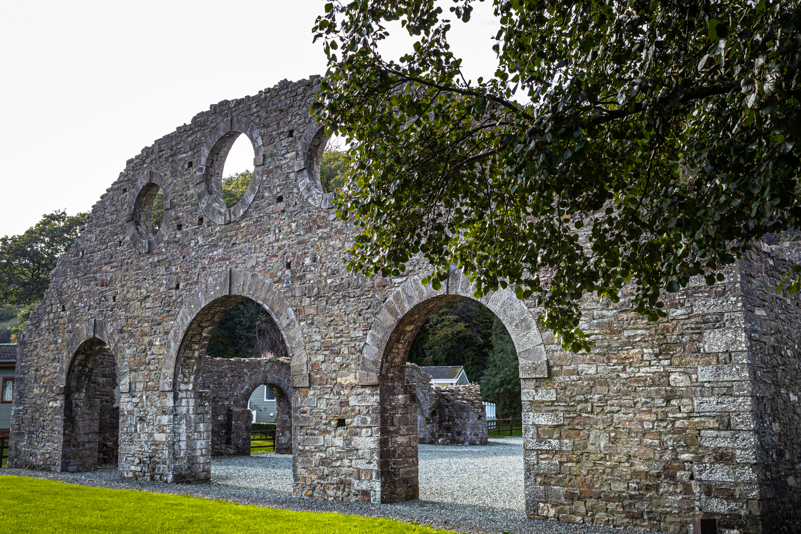
Kilgetty Ironworks
Iconic image of Kilgetty Ironworks


Following the successful introduction of anthracite smelting at Ynyscedwyn in 1836, Kilgetty Ironworks were established in 1848-49 by Charles Ranken Vickermann, a London solicitor, to exploit the local anthracite coal and haematite deposits.


The Cast House @ Kilgetty Ironworks
The Cast House.


The ore was obtained largely from levels driven in the cliffs between Saundersfoot and Amroth and transported by the branch line of the Saundersfoot Railway.


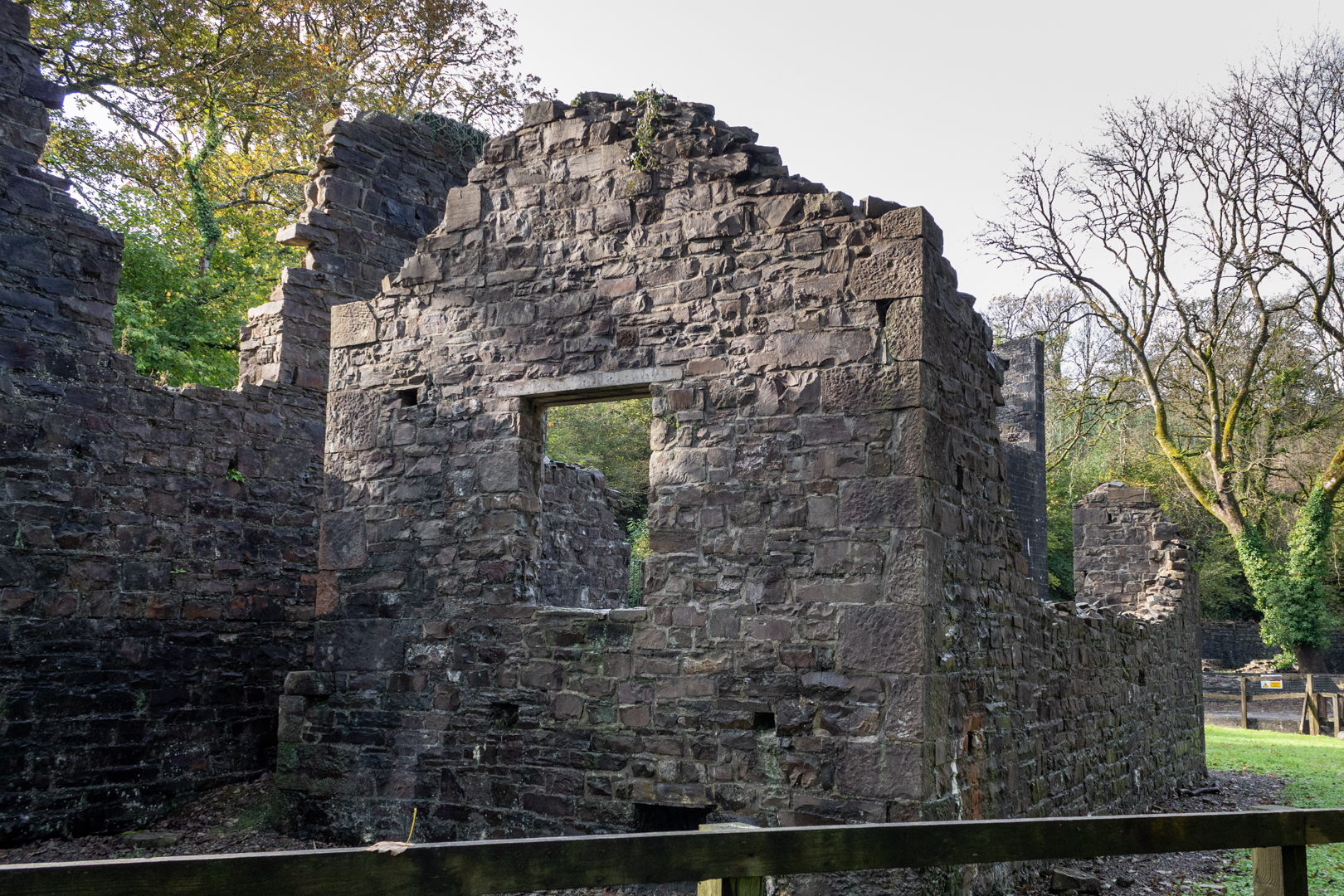
The Engine Houses @ Kilgetty Ironworks
The Blowing and winding engine houses


Known then by the name Pembrokeshire Iron and Coal Company by 1853 the works were at a standstill.


The Furnace Walls @ Kilgetty Ironworks
The Furnace Wall


In 1853 Grove Colliery was sunk just above the ironworks to provide fuel (This will be added in a further post), however production of both coal and iron was intermittent until 1859.


The Kilns @ Kilgetty Ironworks
Kilns


The site's fortunes continued to be bleak and by 1862 the works were again at a standstill.


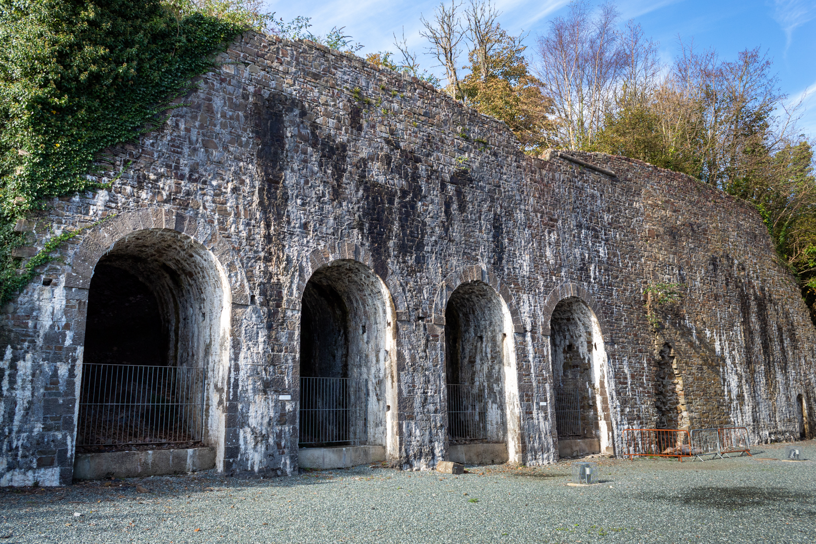
The Coke Ovens @ Kilgetty Ironworks
The Coke Ovens


Revived once again in 1863 five further years of poor production resulted in the complex being sold in 1873 to Bonville's Court Coal and Iron Company.


The Coke Ovens @ Kilgetty Ironworks
Internal detail of Coke Ovens


In its final stage, the Iron Works consisted of 2 blast furnaces, blowing engines, coke ovens, workshops and lime kilns, however, no pig iron was produced after 1874 and work ceased in 1877.


Kilgetty Ironworks
Calcining Kilns


The property and plant were auctioned in 1878. Vickermann was the successful (in fact the only) bidder.


Kilgetty Ironworks
Remains of the Smithy


The works were dismantled in 1887-89. The chimney stack above the furnaces was eventually demolished in 1909.


Additional information: Also known as Stepaside Ironworks. Stepaside is a small holiday village and Information signs at Stepaside state that Stepaside got its name when Oliver Cromwell and his army passed through on their way to Pembroke. Cromwell is reported to have asked people in his way to step aside.


Footer:
Visit Information: -

Google Reference: -
51.73398913017965, -4.693719186700272

Google Search term:
Kilgetty Ironworks

What Three Words reference: -
///broth.polka.verge

OS Details: -
SN 14087 07355 Altitude:14 m

Additional information.

There is parking here for a a dozen cars or so and the place is easy to visit.
The site is now alongside a Holiday Park

Off the A477 the turning marked for Stepaside, Wisemans bridge and Amroth. Then follow the brown heritage signs for the ironworks.

There are no facilities at the site.


A full list of blogs can be found at my website


Read More

St Bridget’s Church


St Bridget's Church, Skenfrith was consecrated in 1207 and is
one of the oldest churches in continuous use in Wales.


Visit Date August 2023


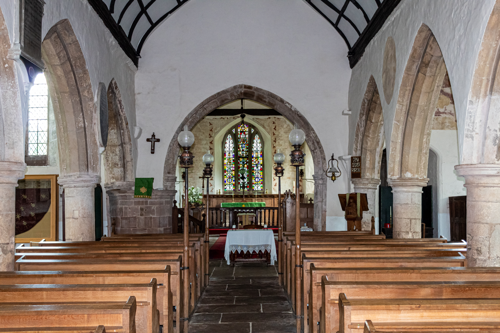
St Bridget’s Church


The exterior of the church is a delight, with a massively buttressed, squat square tower built of red sandstone.

The tower is topped by a dovecote belfry and a pyramidal roof.


St. Bridget's Church


It has been restored on at least two occasions the first in 1896 and then again in 1910


St. Bridget's Church


The church is medieval in origin, with the earliest parts believed to date from the reign of King John (1166–1216). It has been extended firstly in the fourteenth and once again in the sixteenth century.


Tomb of John Morgan St. Bridget's Church


The interior contains the chest tomb of John Morgan, who died in 1557, who was a Member of Parliament for the Monmouth Boroughs, Steward of the Duchy of Lancaster and last Governor of the Three Castles, of Skenfrith, Grosmont and White Castle.


The Font St. Bridget's Church


The font is inscribed on its east side with the date 1661 but this date is of the re-erection but is much older than this.
The font can be locked this was to prevent the common practice in days gone by of stealing the water and used in casting spells.


The Lectern. St. Bridget's Church


The lectern was commissioned in 1909 and is by the Arts and Crafts designer, George Jack, and incorporates a figure of St Bridget.


Footer:
Visit Information: -

Google Reference: -
51.87906878835942, -2.7913557263133586

Google Search term:

St Bridget's Church, Skenfrith
What Three Words reference: -
///parked.sporting.help

OS Details: -
SO 45606 20341 : Altitude:141 ft

Additional information.

There is parking here (51.87809680428079, -2.790591909573205) for a a dozen cars or so and the place is easy to visit.

Off the B4347 from Monmouth and on to the B4521 takes you to Skenfrith.

There are no facilities at the site.

The site is popular in the summer months with locals sunbathing and swimming in the river.


A full list of blogs can be found at my website


Read More

Skenfrith Castle


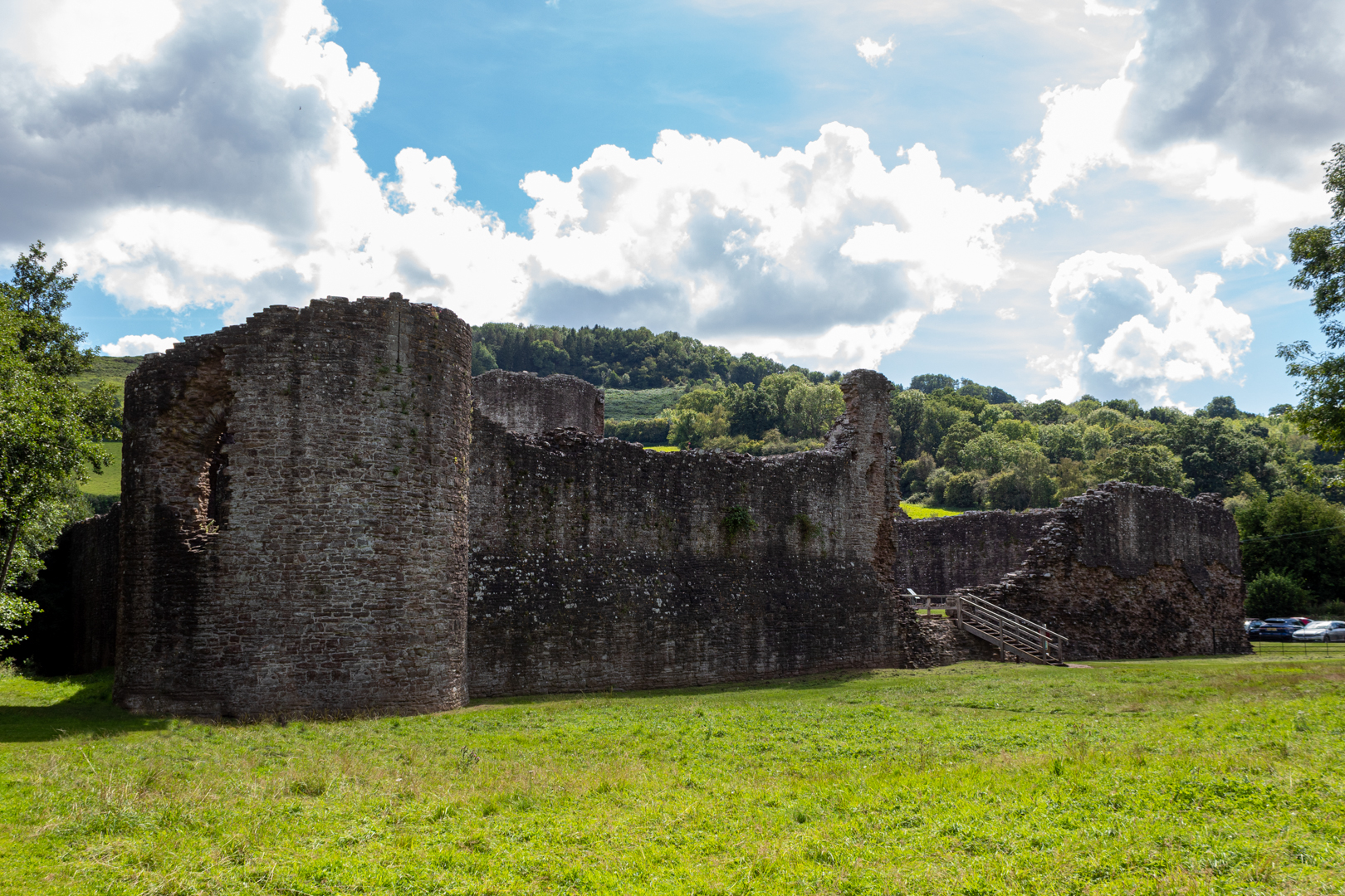
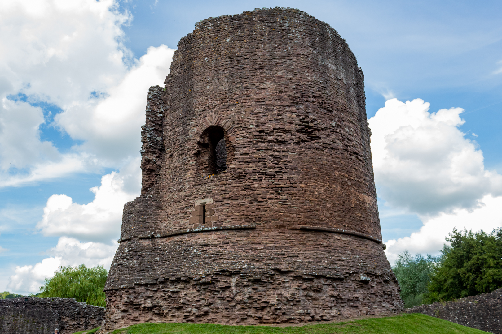
Skenfrith Castle (Welsh: Castell Ynysgynwraidd) is an 
ancient medieval fortress with a substantial central tower.


Visit Date August 2023


Skenfrith Castle


Commissioned by William Fitz Osbern, the Earl of Hereford, in the early 12th century the castle comprised earthworks with timber defences.

What is left of the remains is the later constructed fortress by Hubert de Burge in the 13th century.


Skenfrith Castle


Built on an earthen mound this structure was one of the ‘Three Castles of Gwent’ (along with Grosmont and White Castle)


Skenfrith Castle


Controlling a large area of Gwent the three castles guarded the border country between The river Wye and the Black Mountains with Skenfrith Castle overlooking one of the main routes between England and Wales on the banks of the river Monnow.


Skenfrith Castle


In 1135, a major Welsh revolt took place and in response, King Stephen brought together Skenfrith Castle and its sister fortifications of Grosmont and White Castle to form a lordship known as the "Three Castles", which continued to play a role in defending the region from Welsh attack for several centuries.


Skenfrith was rebuilt in stone. In 1201, King John gave the castle to a powerful royal official, Hubert de Burgh (Earl of Kent) who destroyed the old castle and rebuilt the rectangular outer walls with the round keep and towers we can see today.


Skenfrith Castle


Hubert fell from power in 1232 and was stripped of the castles, which were placed under the command of Walerund Teutonicus

Walerund built a new chapel at the castle in 1244 and repaired the keep's roof


Skenfrith Castle


In 1267 the Castle along with the other two castles were granted to Edmund, the Earl of Lancaster


Skenfrith Castle


King Edward I' (20 November 1272 – 7 July 1307). In his conquest of Wales in 1282 removed much of the castle's military utility and saw the demise of the importance of the castle and by 1538, it had fallen into disuse and ruin.

In 1825, the Three Castles were sold off to Henry Somerset, the Duke of Beaufort. Skenfrith was eventually acquired by the lawyer Harold Sands, who carried out some conservation of the site; he went on to give the castle to the National Trust. Skenfrith was placed into the care of the state in 1936,


Skenfrith Castle


Skenfirth Castle is managed by Cadw
(Cadw is the historic environment service of the Welsh Government and part of the Tourism and Culture group. Cadw works to protect historic buildings and structures, landscapes and heritage sites) 


A visit to the castle would be enhanced by seeking out a disused mill on the south-eastern side of the castle. Much later than the castle of course dated 1867 at the 1st-floor level of the SW side; the mill continued to function until 1990 although by that time the mill had been converted to electric power.


Skenfrith Corn Mill

Skenfrith Corn Mill


Footer:
Visit Information: -

Google Reference: -
51.878293893054106, -2.790379413287163

Google Search term:
Skenfrith Castle

What Three Words reference: -
///parked.sporting.help

OS Details: -
SO 45697 20264 : Altitude:141 ft

Additional information.

There is parking here (51.87809680428079, -2.790591909573205) for a a dozen cars or so and the place is easy to visit.

Off the B4347 from Monmouth and on to the B4521 takes you to Skenfrith.

There are no facilities at the site.

The site is popular in the summer months with locals sunbathing and swimming in the river.


A full list of blogs can be found at my website


Read More

Talley Abbey.

________________________________________________________________________________


T A L L EY   A B B E Y


Talley was founded in the 1180s by Rhys ap Gruffydd (‘The Lord Rhys’, native ruler of the
south Wales kingdom of Deheubarth) for the monks of the Premonstratensian order.


Visit Date August 2022

________________________________________________________________________________


Talley Abbey


Originally Colonised by a small group of canons from the house of St John at Amiens in north-east France. Talley Abbey was the first and only abbey in Wales for the Premonstratensians, monks who were also known as the ‘White Canons’ from the colour of their habit. 


Talley Abbey


The Order was founded in 1120. In 1126, it received papal approbation by Pope Honorius II.

The Abbeys history is not a tranquil one but was something of an unholy struggle.

Abbot Peter of Whitland abbey, envious of the Talley estates launched a hostile takeover of the land and there was a legal battle between the White Canons and the rival Cistercians he supported.


Talley Abbey


The plans to construct a grand church at the heart of their new abbey were interrupted for nine years.

The White Canons did eventually win but the financial cost was great and with little help then coming from Lord Rhys' they were almost bankrupt, and it is unlikely the full church was ever completed.


Talley Abbey


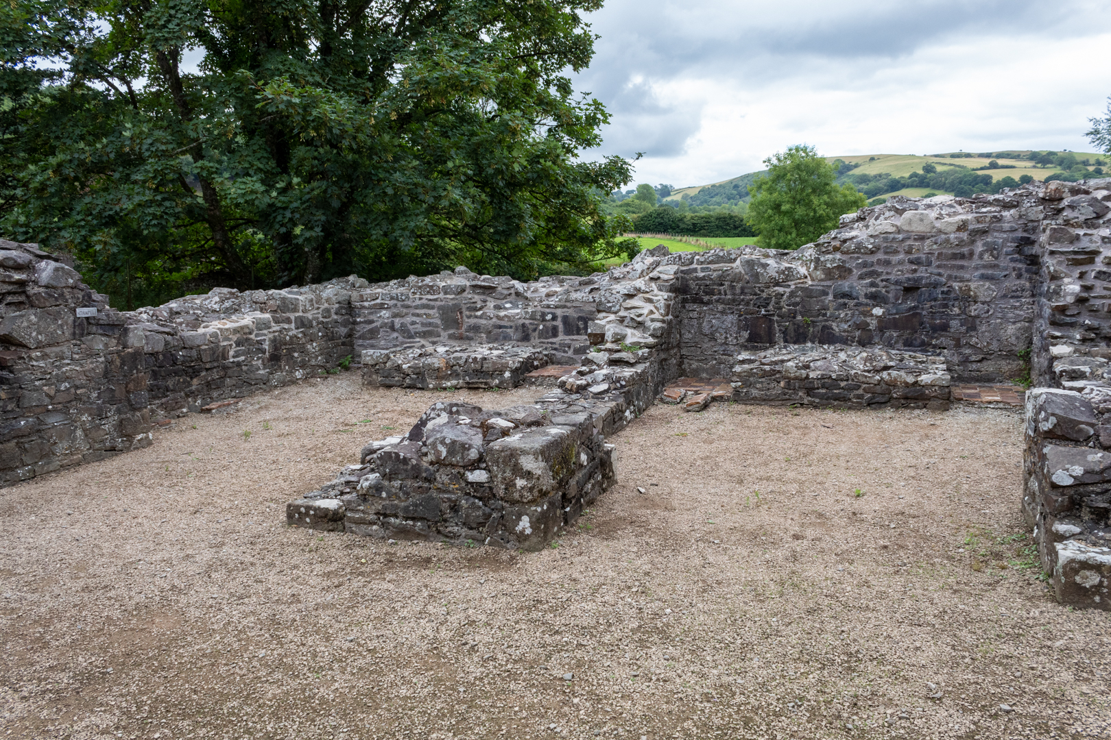
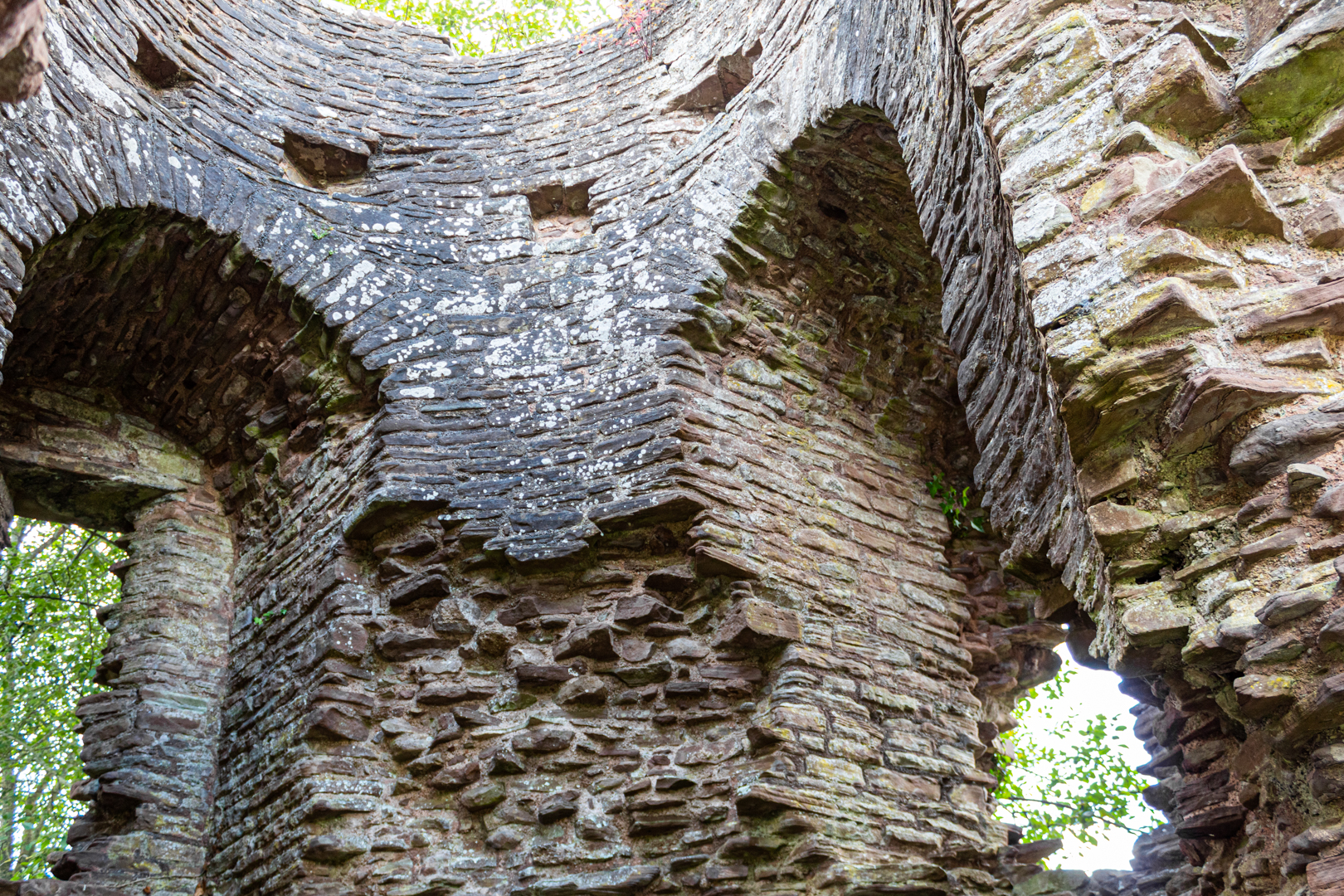
There were 4 individual chapels within the structure. The remains of two can be seen in the image above.


Talley Abbey


The first war of independence in 1277 won by Edward I ensured that the Premonstratensian lost their Welsh sponsorship and the remote Talley only just survived being sustained by income from the churches it served.


Talley Abbey


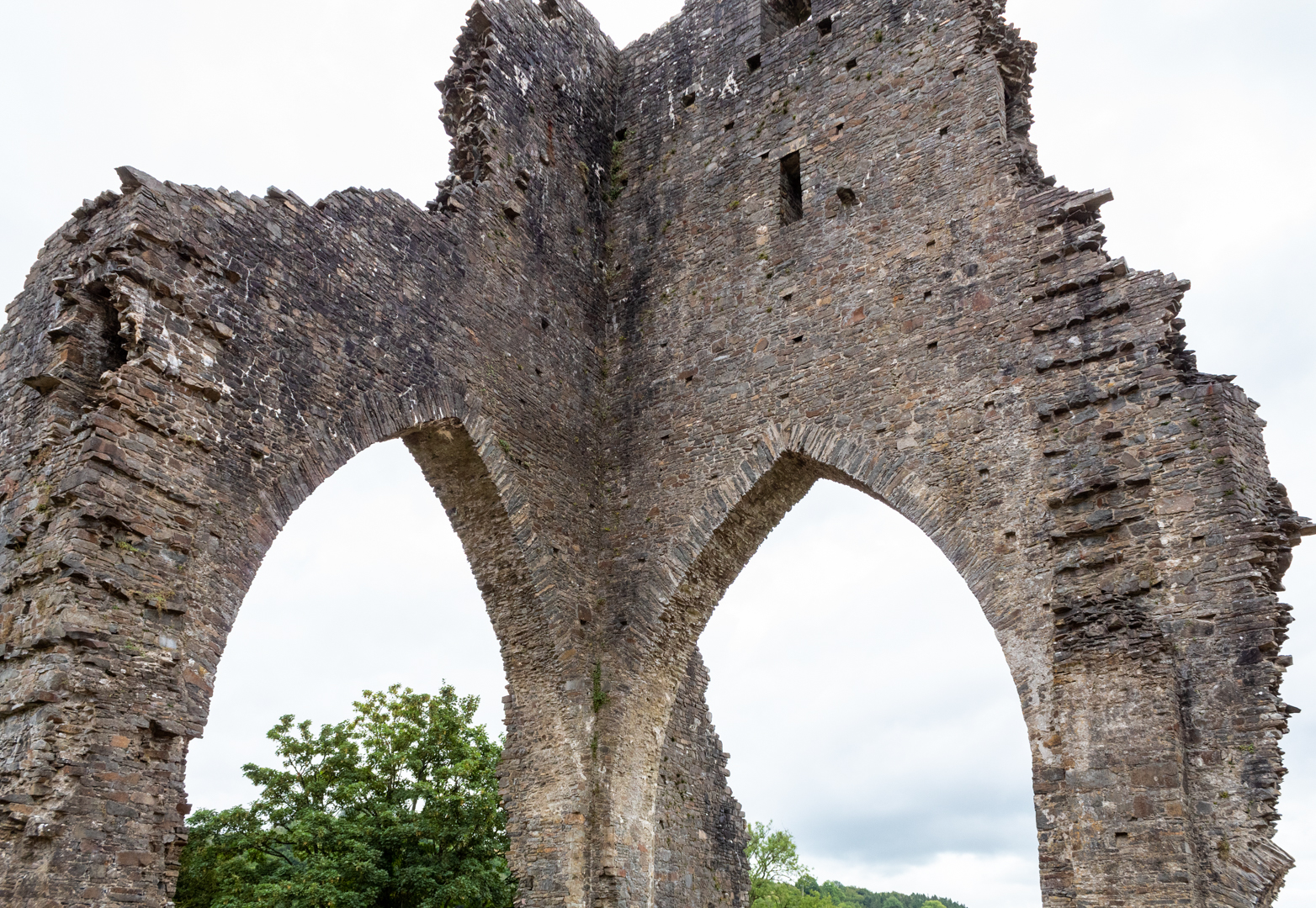
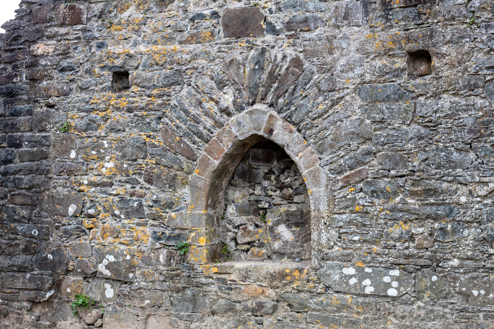
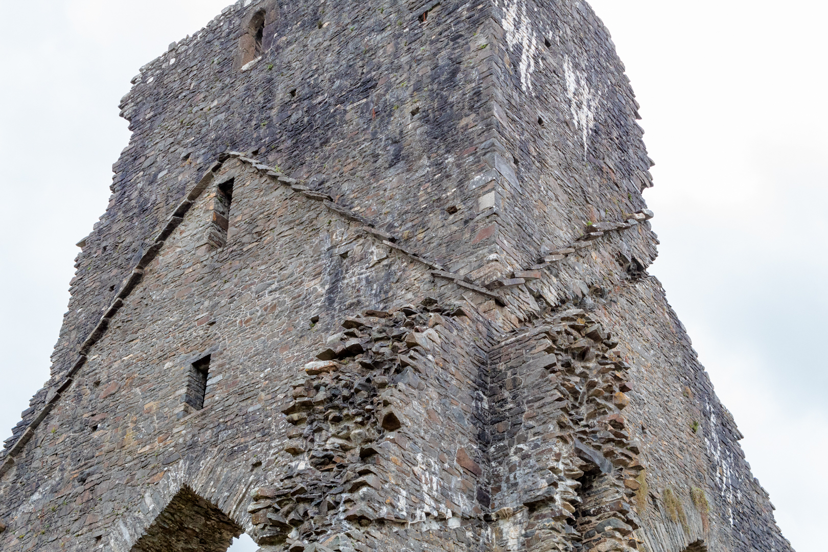
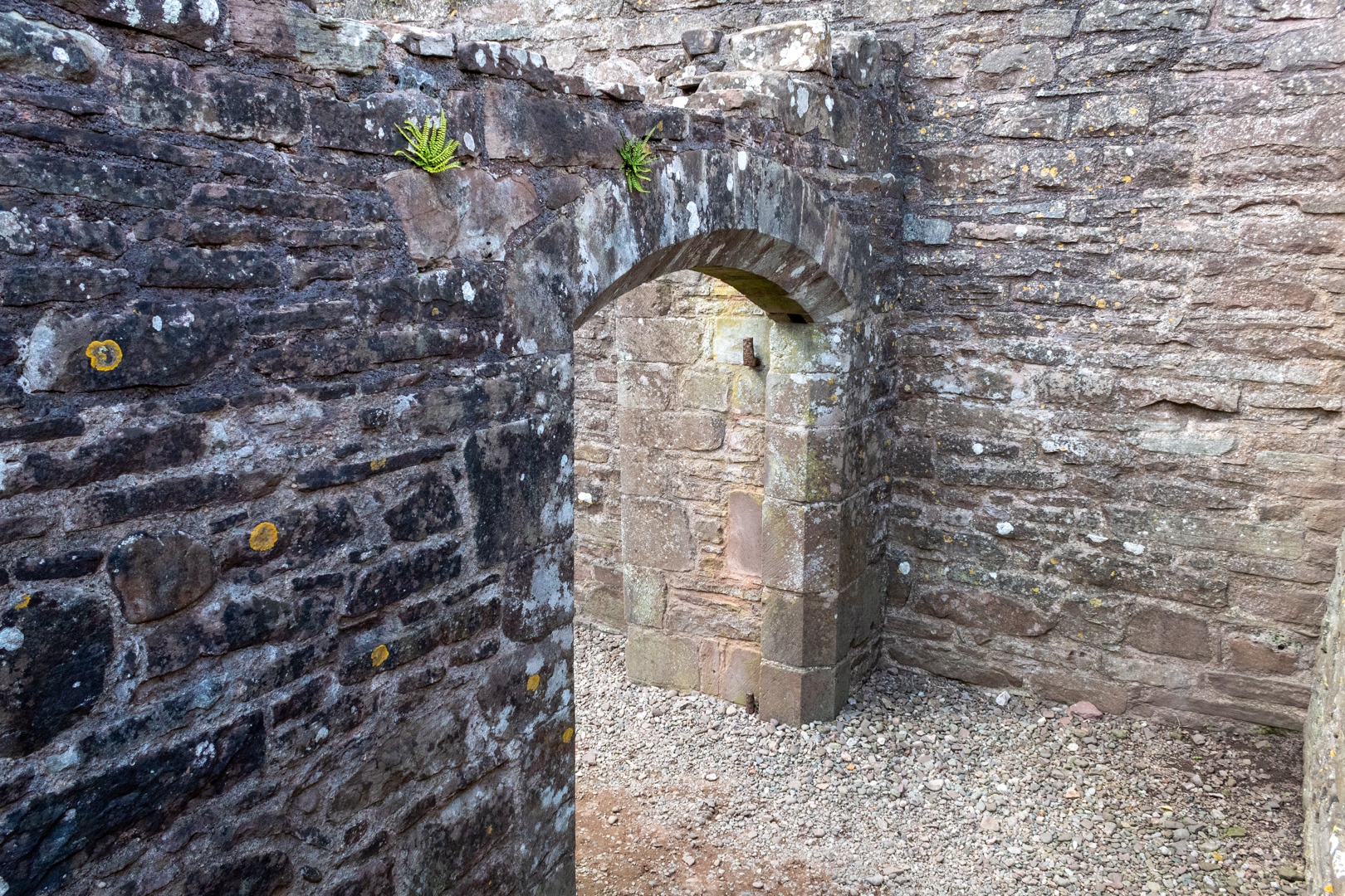
The abbey was dissolved by Henry VIII and the structure was mined by the villagers for stone to build much of the present village and the church next to the abbey. The Abbey as can be seen is now in a quite ruinous state, but the majesty of the tower can still be seen.


Eglwys y Plwyf Talyllychau (Talley Parish Church ).


The beautiful white church on the site now is Eglwys y Plwyf Talyllychau (Talley Parish Church).


Eglwys y Plwyf Talyllychau (Talley Parish Church ).


The Abbey was once claimed to be the site of the grave of the medieval Welsh poet Dafydd ap Gwilym.


Eglwys y Plwyf Talyllychau (Talley Parish Church ).


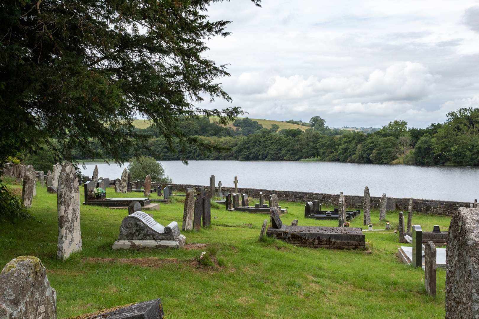
The two lakes near the abbey ruins, which were used for fish farming to support the community of monks run alongside the church and abbey and add to the natural beauty of the site.


Footer:Visit Information: -

Google Reference: -
51.97664362266242, -3.9918785275528212

What Three Words reference: -
///stance.decimal.cabinet

OS Details: -
SN 63273 32774 Altitude: 369 ft

Additional information.


This is a fine ruin in a beautiful small little village and is a must if in the area.
There is a small car park for 2 or 3 cars outside the abbey walls. It is a great area to explore and stroll and the terrain is very flat and easy. A visit to the church is also a must. There is a small community cafe and toilets alongside the site.


Read More

Search This Blog

About Me

Bridgend, United Kingdom
A renewed interest in photography and local history.

Contact Me

Name

Email *

Message *

Followers