With a renewed enthusiasm for photography and local history, I set out this blog as a record of my experiences with images and narratives. It is my hope that you find something of interest on this site. Please feel free to contact me for more information on any of the posts. You can see a comprehensive list of my blogs at my website :- http://www.davidnurse.co.uk

Showing posts with label Ancient Structures. Show all posts

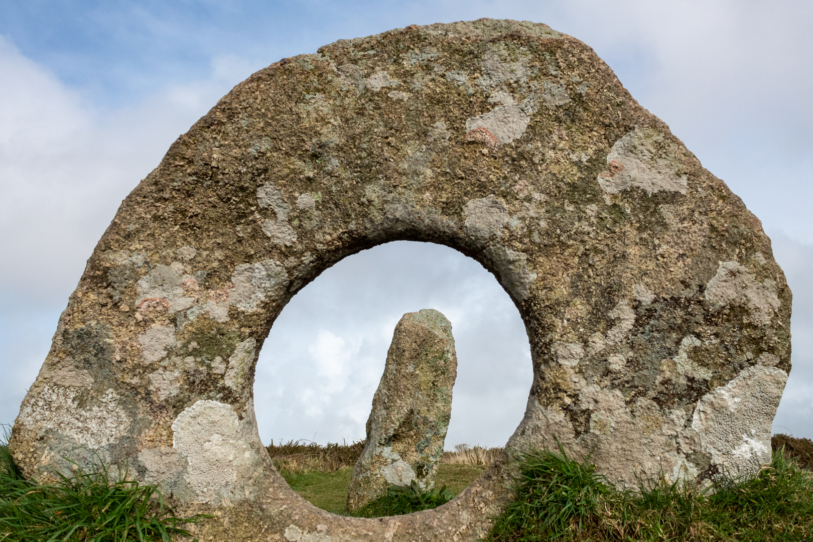
Men An Tol


An Ancient Cornish Treasure

The name Men an Toll (note the extra l) in
Cornish means "the stone of the hole",
Aptly named for this 3500-year-old bronze age structure.


Visit Date March 2023


Men An Tol Cornwall


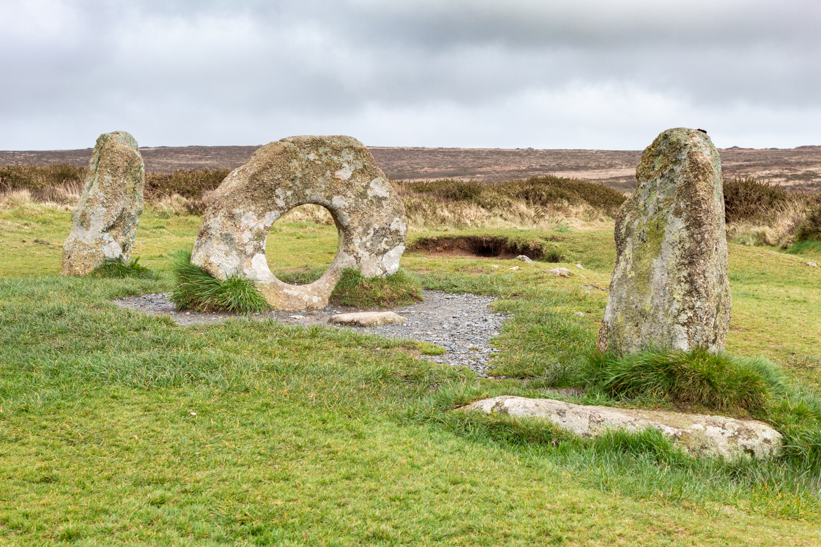
There are many "loose" stones around this site but the MĂŞn-an-Tol consists of three upright stones made from local granite, The two side uprights stand just over a metre high. The round stone is 1.3 metres wide and around 1.1 metres high.

There has been some discussion as to the structure being part of a stone circle but although there are outlying stones there does not seem to be any circle structure to them, of course, the site may have been changed since its "modern discovery".
Also, there have been theories that the holed stone was a capstone from a Dolmen but again I think this is unlikely.


Men An Tol


The first archaeological examination was carried out in 1749. The plan that was drawn seems to suggest that there had been some movement of the stones but in John Tomas Blights account "Ancient crosses and other antiquities in the west of Cornwall" published in 1858 the stones are set exactly as they are today.


Men An Tol Cornwall


It is difficult to know what the structure was used for but there are many stone structures close to this site. Its nearest neighbour is Menscifa (A standing stone with writing on its surface, that will be in a later post.) which is just a few hundred yards away and the Nine Maidens Stone Circle is about a quarter of a mile further over the moor. Also in the distance you can see the more recent structure of the Greenburrow engine house (1919 - 1936).


Men An Tol


As you would expect from a site this well known there is much folklore attributed to the structure.

It is said, If a brass pin was placed on the holed stone, questions could be answered by the movement of the pin.

In his 1932 report, Hugh O'Neil Hanchen was told by local farmers that pain in limbs or back would improve by passing through the hole. This is said to happen because a fairy or piskie (a cornish name for a pixie or elf) can make miraculous cures.
Although I guess the portly figures would not have this available to them given the size of the hole.


Men An Tol Cornwall


Another tells that some Evil piskies put a changling spell on a child which was reversed by the mother passing the infant through the hole breaking the spell.

A very well-known tale was the holed stone was said to cure rickets and children with rickets were passed naked through the hole in the middle stone from three to nine times to provide a cure.

The most popular local legend reports that a woman passing through the hole at a full moon will soon become pregnant.

Whatever the original reason for the structure we will never know but it has been put to many good uses down through the years.


Footer:
Visit Information: -

Google Reference: -
50.158569483211956, -5.604591983491583

What Three Words reference: -
///chitchat.flips.chatters

OS Details: -
SW 42645 34942 Altitude:638 ft

Additional information.
This is a fine site that is easily accessible on the moor.
The road is a turn south off the B3306
There is a parking for around 4 cars close to the path of this site (50.153595163384026, -5.6149119102692655) The pathway is marked and the walk is an easy 1.2KM (15 minutes) from here. Look for a sign on the path by a a stile to cross the field.

A full list of blogs can be found at my website
Read More

Devil's Quoit. .


Devil's Quoit


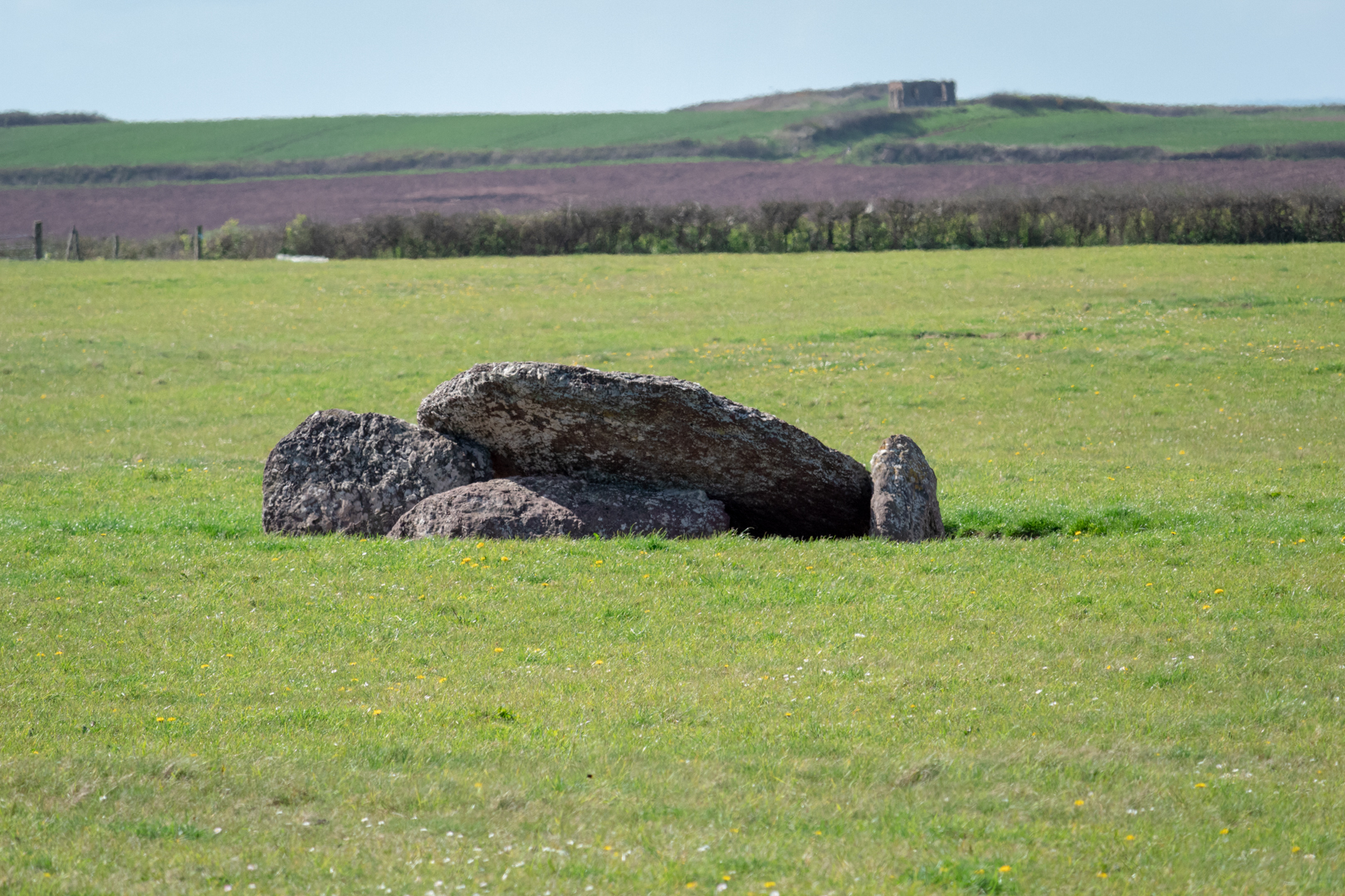
An ancient Neolithic burial chamber in the centre of a field, near the coast in Pembrokeshire, Wales.
Formed by a large wedge-shaped capstone which is supported on the east by two large side stones
and the west by a third side stone which now lies on the ground. 


Visit Date April 2022


Devil's Quoit, Angle, Pembrokeshire


In Wales, there are many of these types of burial sites and as in the rest of the UK, they can be referred to as Quoits, Dolmens or Chromlechs. In addition, the name "Devil's Quoit" is also commonly used for other sites and standing stones in the area.

The structures typically have three or more upright standing stones with a large capstone on top. Originally they would have been covered with earth.


Devil's Quoit, Angle, Pembrokeshire


In its current form, there is no mound to be seen but it was noted when investigated in 1810 that there was a large circular "Agger" or earthwork around the monument.

The pieces of the monument are of a reddish-brown conglomerate; the capstone measures 2.75m in length and is 2m wide. The uprights would be around 1.5 metres high.


Devil's Quoit, Angle, Pembrokeshire


There is little recorded about this site and the chamber is in the centre of a field on private land and is inaccessible due to the area being sealed off by an electrical fence. Despite this, The monument is of national importance and is a substantial relic of a prehistoric funerary and ritual landscape that may retain significant archaeological potential, with a strong probability of the presence of both intact burial or ritual remains, and  environmental and structural evidence, including a buried prehistoric land surface.

The mount is on a peninsular of land with the sea to either side.


Footer:
Visit Information: -

Google Reference: -
51.66650404534974, -5.05761344477118

What Three Words reference: -
///windpipe.pays.premiums

OS Details: -
SM 88652 00842 Altitude: 204 ft

Additional information.
This is an important historical site, however, as it is in a field and on private land, surrounded by an electrical fence therefore a close visit is not possible however, the site can be seen from the road and a small pull-in by the field gate is possible.


Read More

Talley Abbey.

________________________________________________________________________________


T A L L EY   A B B E Y


Talley was founded in the 1180s by Rhys ap Gruffydd (‘The Lord Rhys’, native ruler of the
south Wales kingdom of Deheubarth) for the monks of the Premonstratensian order.


Visit Date August 2022

________________________________________________________________________________


Talley Abbey


Originally Colonised by a small group of canons from the house of St John at Amiens in north-east France. Talley Abbey was the first and only abbey in Wales for the Premonstratensians, monks who were also known as the ‘White Canons’ from the colour of their habit. 


Talley Abbey


The Order was founded in 1120. In 1126, it received papal approbation by Pope Honorius II.

The Abbeys history is not a tranquil one but was something of an unholy struggle.

Abbot Peter of Whitland abbey, envious of the Talley estates launched a hostile takeover of the land and there was a legal battle between the White Canons and the rival Cistercians he supported.


Talley Abbey


The plans to construct a grand church at the heart of their new abbey were interrupted for nine years.

The White Canons did eventually win but the financial cost was great and with little help then coming from Lord Rhys' they were almost bankrupt, and it is unlikely the full church was ever completed.


Talley Abbey


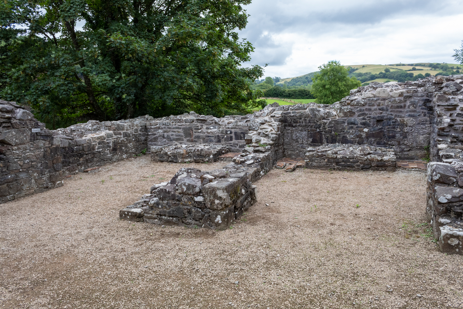
There were 4 individual chapels within the structure. The remains of two can be seen in the image above.


Talley Abbey


The first war of independence in 1277 won by Edward I ensured that the Premonstratensian lost their Welsh sponsorship and the remote Talley only just survived being sustained by income from the churches it served.


Talley Abbey


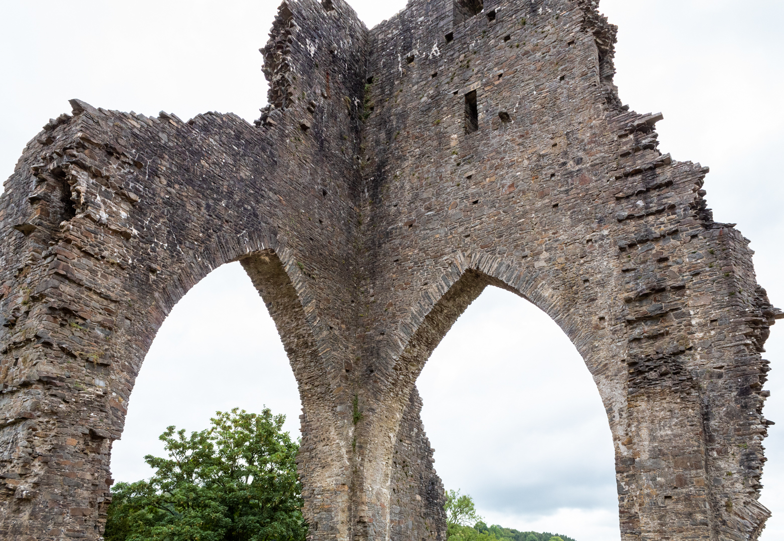
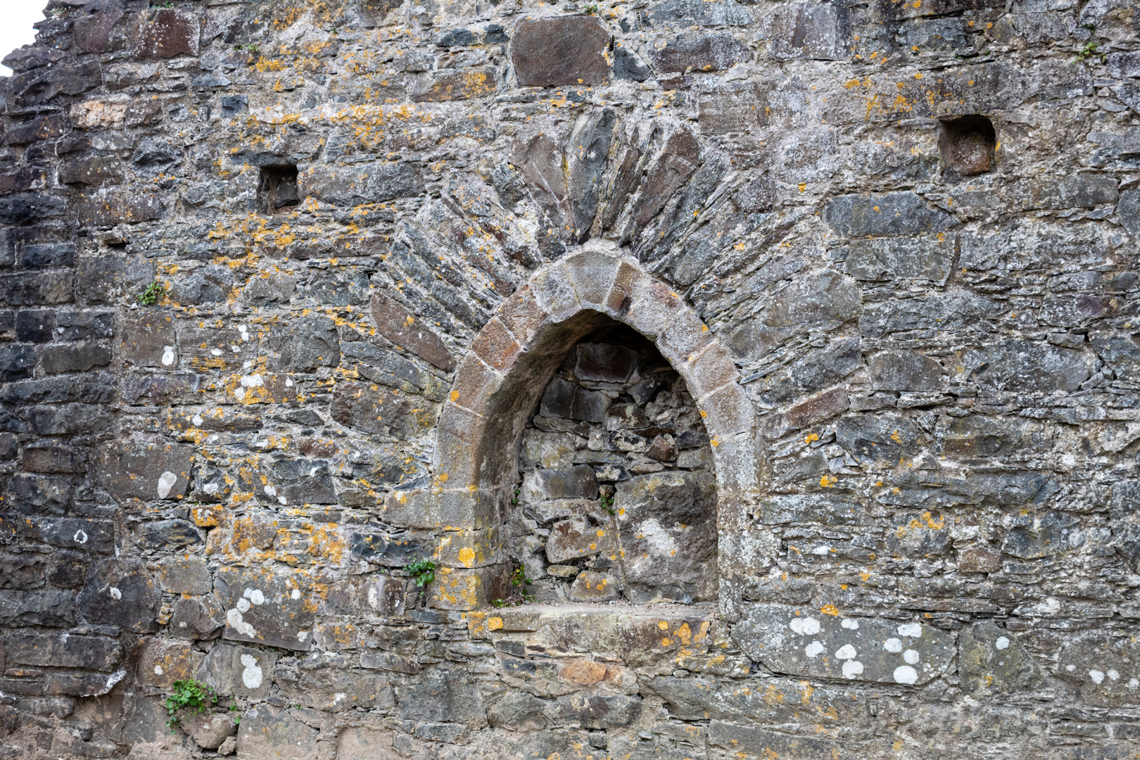
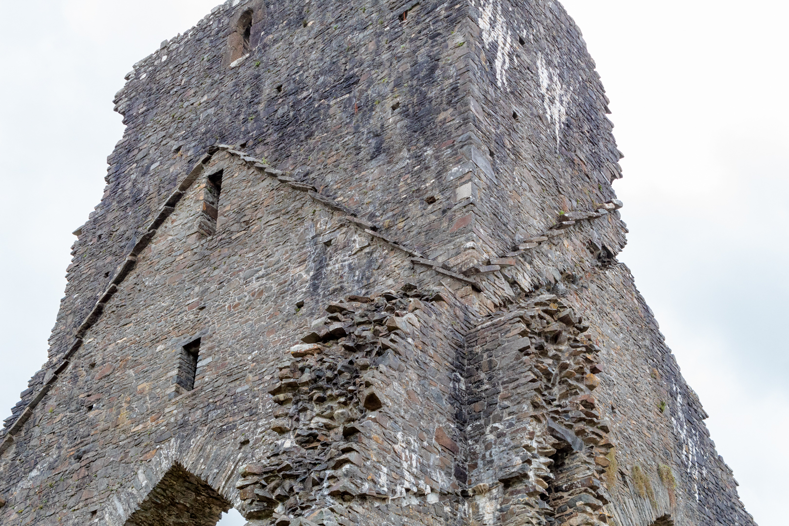
The abbey was dissolved by Henry VIII and the structure was mined by the villagers for stone to build much of the present village and the church next to the abbey. The Abbey as can be seen is now in a quite ruinous state, but the majesty of the tower can still be seen.


Eglwys y Plwyf Talyllychau (Talley Parish Church ).


The beautiful white church on the site now is Eglwys y Plwyf Talyllychau (Talley Parish Church).


Eglwys y Plwyf Talyllychau (Talley Parish Church ).


The Abbey was once claimed to be the site of the grave of the medieval Welsh poet Dafydd ap Gwilym.


Eglwys y Plwyf Talyllychau (Talley Parish Church ).


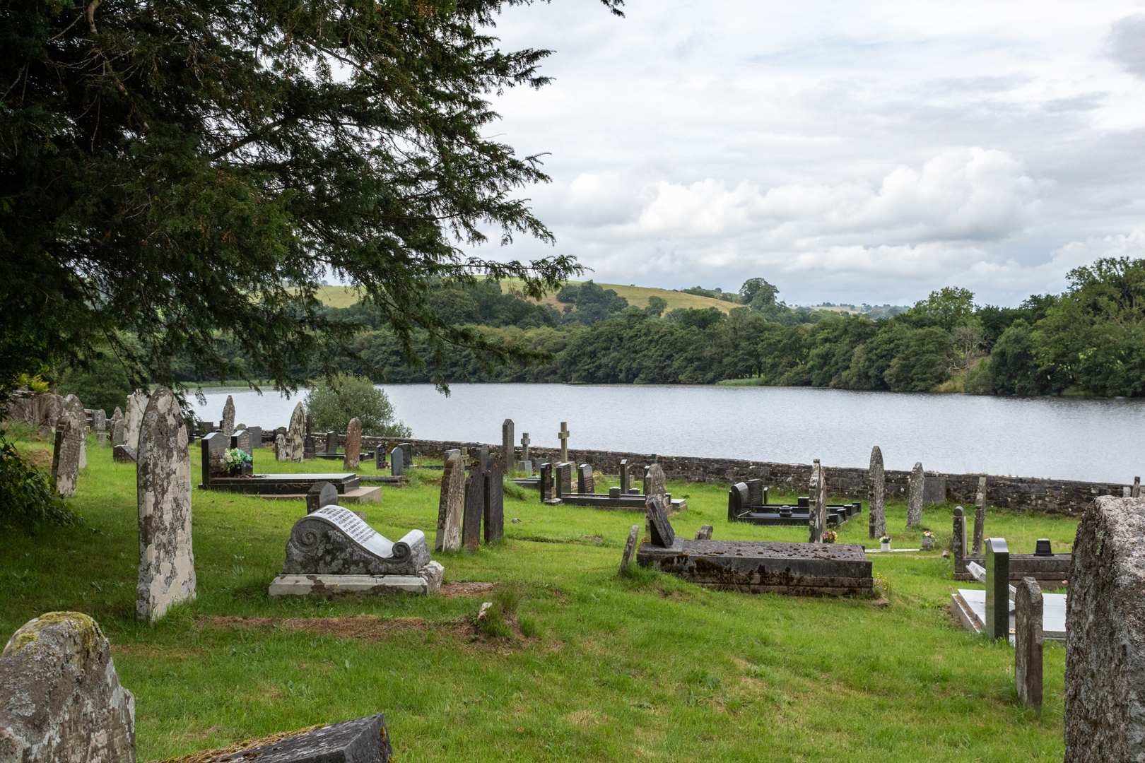
The two lakes near the abbey ruins, which were used for fish farming to support the community of monks run alongside the church and abbey and add to the natural beauty of the site.


Footer:Visit Information: -

Google Reference: -
51.97664362266242, -3.9918785275528212

What Three Words reference: -
///stance.decimal.cabinet

OS Details: -
SN 63273 32774 Altitude: 369 ft

Additional information.


This is a fine ruin in a beautiful small little village and is a must if in the area.
There is a small car park for 2 or 3 cars outside the abbey walls. It is a great area to explore and stroll and the terrain is very flat and easy. A visit to the church is also a must. There is a small community cafe and toilets alongside the site.


Read More

Coetan Arthur


___________________________________________________________________________________


C o e t a n  A r t h u r


Coetan Arthur (also known as Arthurs Quoit).
 A dolmen on the southwest coast of Wales 
on the St. Davids's head peninsular, 
in county of Pembrokeshire, Wales.
This impressive megalithic tomb dates from 
between 4000 to 3000 BC.
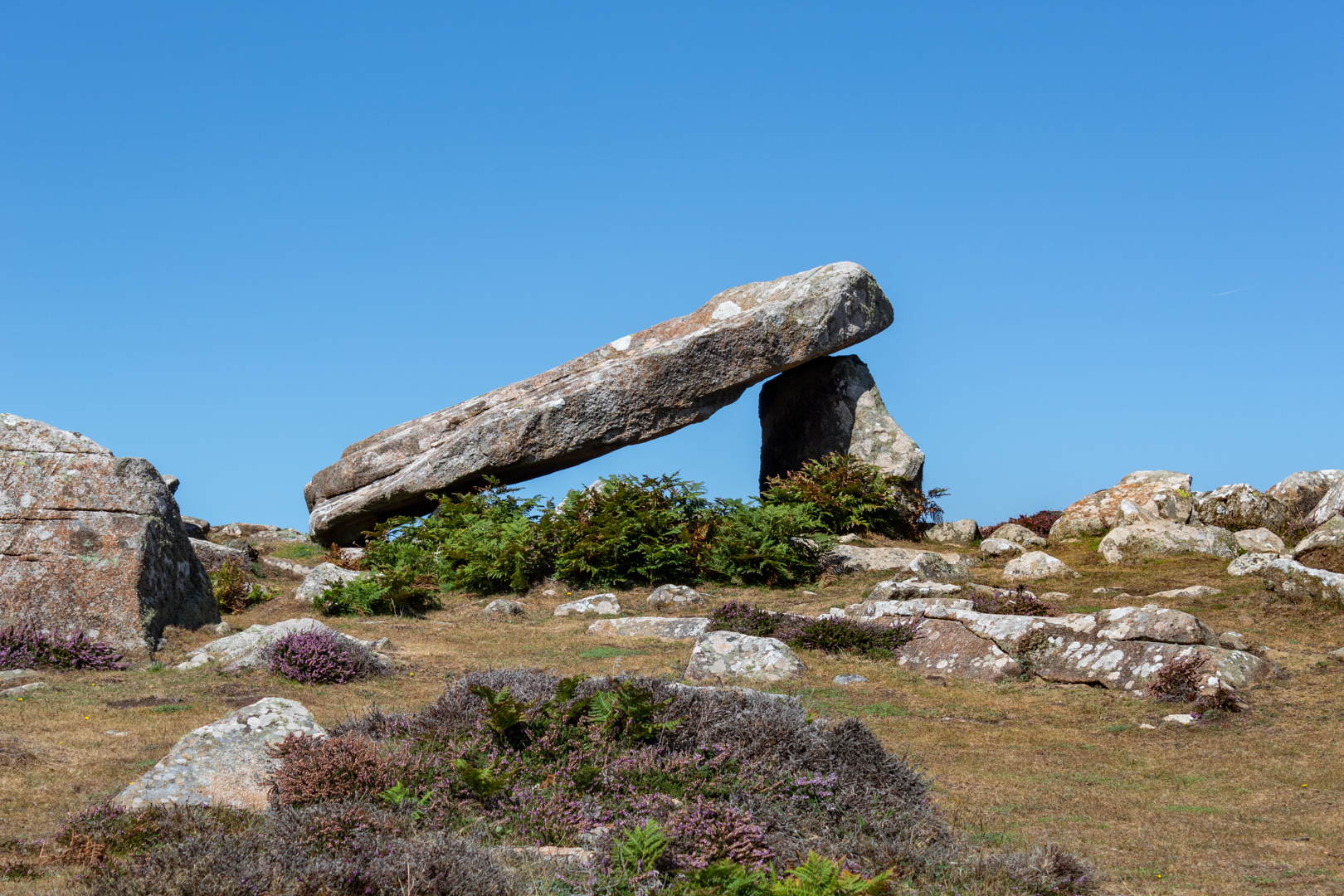
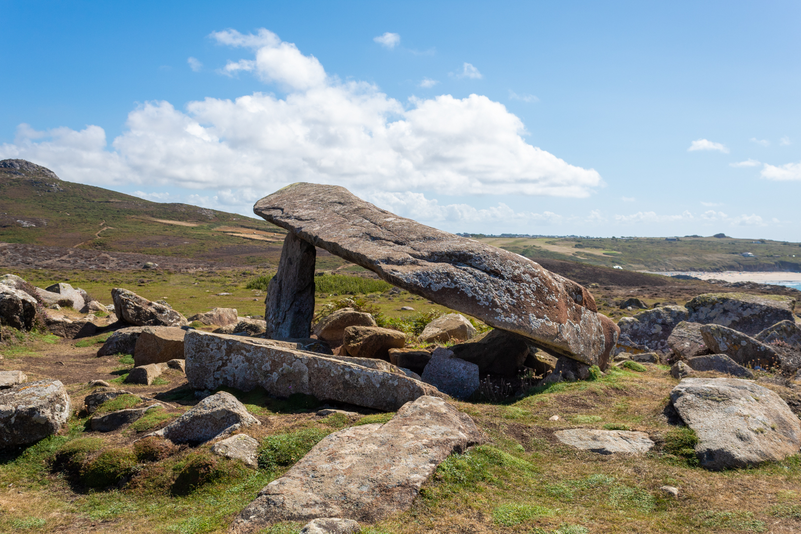
The dolmen, which is formed by two vertical 
megaliths erected to support a flat capstone,
is partially collapsed, but still impressive nonetheless.


Visit Date August 2022


_____________________________________________________________________________________


Coetan Arthur, St Davids, Pembrokshire.


There are many ancient burial sites around the southwest of Wales
These burial sites are often marked with three or more uprights and a large capstone. Often this is all that is left of the site which would originally be covered with earth. This upright/capstone structure has been called a Dolmens or often also referred to here in Wales as a Cromlech, but my understanding is that Cromlech can also refer to a circular stone structure.


Coetan Arthur, St Davids, Pembrokshire.


This structure should not be confused with Carreg Coeten Arthur which is also in Pembroke, and which will be covered in another blog soon.


Coetan Arthur, St Davids, Pembrokshire.


The St Davids headland is full of ancient remains including signs of ancient field patterns, Neolithic enclosures, and defensive banks and ditches.


Coetan Arthur, St Davids, Pembrokshire.


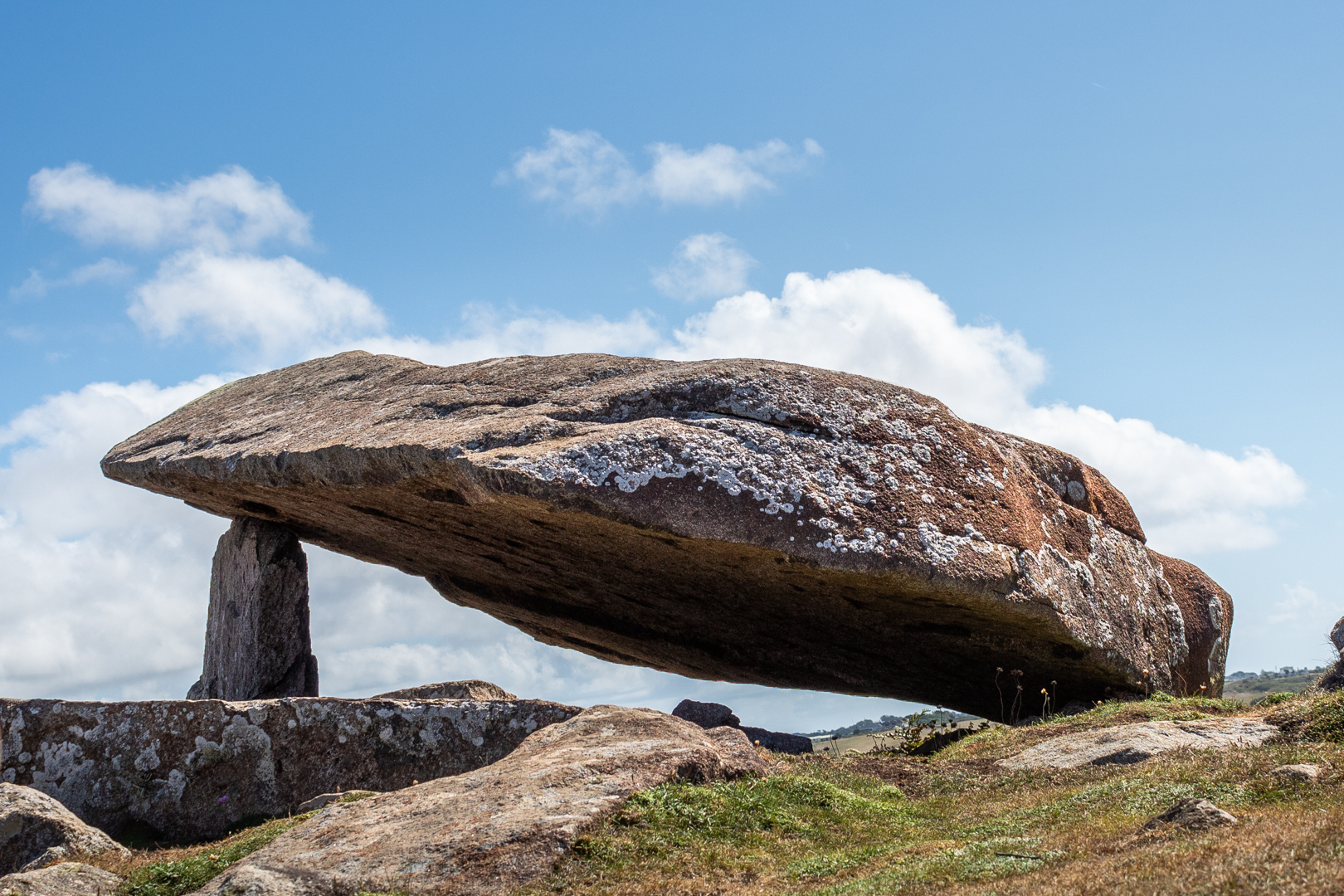
Perhaps the most impressive part of the burial chamber is the massive capstone, which is roughly 6m long and 2.5m wide. The upright stone supporting it (known as an orthostat) is about 1.5m high.


Coetan Arthur, St Davids, Pembrokshire.


The site here overlooks Whitesands Bay at St. Davids and has a good view but is far enough from the main cliff not to be to battered by any storms that hit the coast.


Coetan Arthur, St Davids, Pembrokshire.


It has been reported many visitors to the site that they found the site hard to find. I suspect that if you were only casually walking the coast path that this could be true but I found that the site could be seen from quite a distance when walking east to west which seems to be the most natural direction to be walking.


These ancient sites often have a legend attached to them and this one is no exception. The legend for Coetan Arthur states King Arthur himself chucked the stones from nearby Carn Llidi.


Note: The terms Dolmen, Cromlech and Quoit are often used to describe this sort of neolithic site.


Footer:
Visit Information: -

Google Reference: -
51.90450867492426, -5.308083153876568

What Three Words reference: -
///snowstorm.finely.deck

OS Details: -
SM 72527 28056 Altitude: 162 ft

Additional information.
Visiting is easy, head to Whitesands bay car park (51.897174093111616, -5.2940221280185105) this is a caravan and camping park and is easy to get to.
There is good facilities for the park, there is a charge for parking.

The walk is around 1mile from the car park but is not flat it is undulating.
Before you descend to the path to Pothmelgan beach (there is a small crossing) you can see the site to the northwest. You can then either take the steep path directly to the site of take the coastal path around the head and then on to the site.


Read More

Culver Hole


___________________________________________________________________________________


C u l v e r   H o l e

Legends and tales of smugglers and pirates.


The rugged coast of South Wales has seen many shipwrecks and is well was well known for its rough and dangerous coastlines. What better place than these unwelcoming bays to try and bring booty and contraband ashore away from the H. M Customs men? This well-hidden man-made structure is surrounded by the mystery and legends of ancient pirates and smugglers that came ashore on the South Wales coast.


Visit Date August 2022


___________________________________________________________________________________


Culver Hole


"Culver Hole" is well hidden and difficult to access so it is understandable that it is easy to pass by and not notice it from the cliffs above.

It is accessible by the low tide and it is quite a distance down the cliff to get to it. Or perhaps possible along the beach from the small port of "Port Eynon", easier, of course, if you are on a small boat.

Given its location, it is perhaps unsurprising that so many tales and legends of smugglers are related to it.
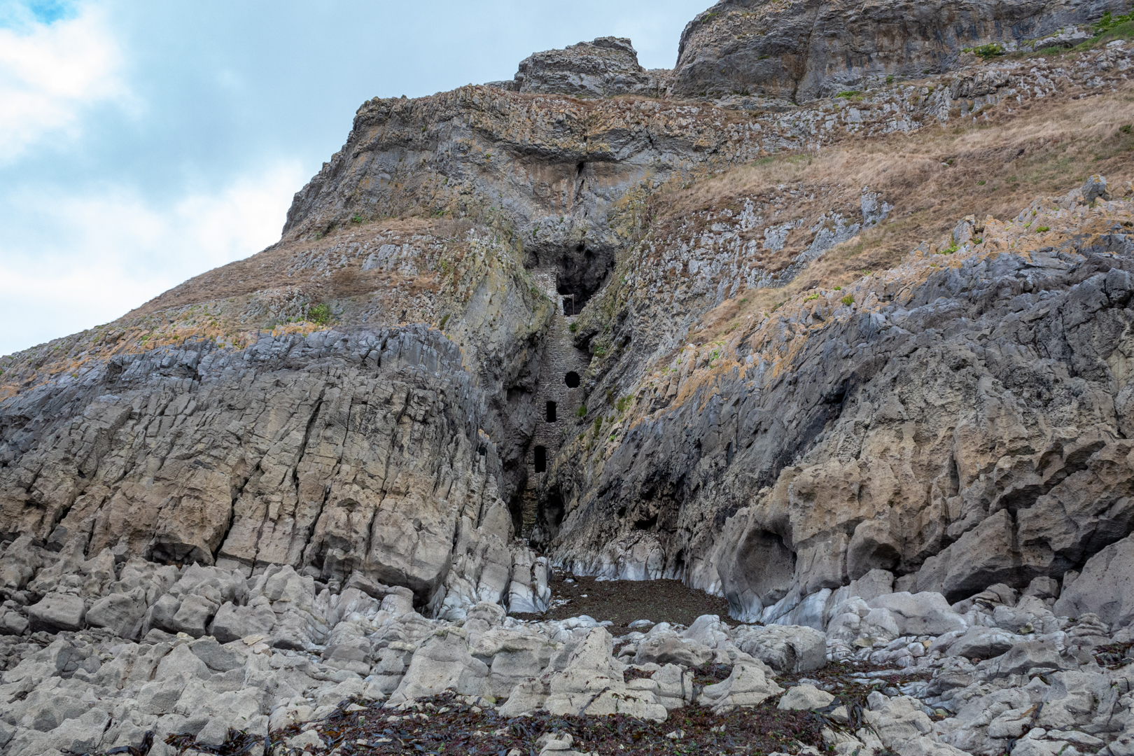


Culver Hole


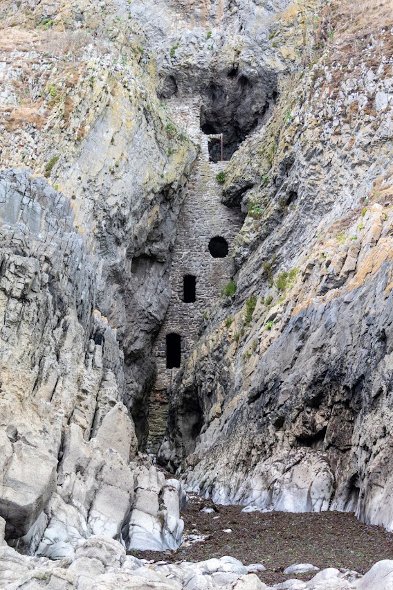
The structure of the site settled in its small cove which is only around 4 meters wide consists of a 16m high wall which is 3.6meters thick at the base.

One such legend states that it was used by a powerful local brigand, John Lucas who used it as a storehouse for his ill-gotten gains. There is also a tale that there was a tunnel, big enough to ride a horse through, for over a quarter of a mile to a local "Salthouse" (more on that in another blog).

While it might be true that "Culver Hole" was used in the 17th Century by these dangerous and ruthless men the original use of the structure is more mundane.
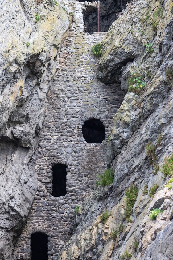


Culver Hole


The structure, built in the 13th or 14th century is listed as a Dovecot on Coflein (a catalogue of archaeology sites, buildings and monuments in Wales) and that is most likely what this structure is.

Internally it has around 30 tiers of nesting boxes cut into the walls and a narrow stairwell.

It might seem very strange for a dovecot to be placed here and so it is but in the times when this was built doves, pigeons, and their eggs were an important source of food.

The name also would support this as the name Culver derives from the old English word Culfre which means pigeon.

Even given all this, there are still some oddities about this structure. Firstly it seems strange that the holes are so big. Normally you would have a door on a dovecote but the windows are very large for a dovecote, also the location of a beach seems strange. 

There are some historical mentions of the site.

There is some thought that it may have been attached to a castle at some time and there are records of "The Castle of Port Eynon" being mentioned in a lawsuit in 1396.  but there is no evidence of a castle on this site. 
There is a minister's account dated 1429 of a dovecote in the clyve at Penard,
Also, the aforementioned John Lucas is found in a document that states he is said to have repaired a stronghold called Kulvered Hall.
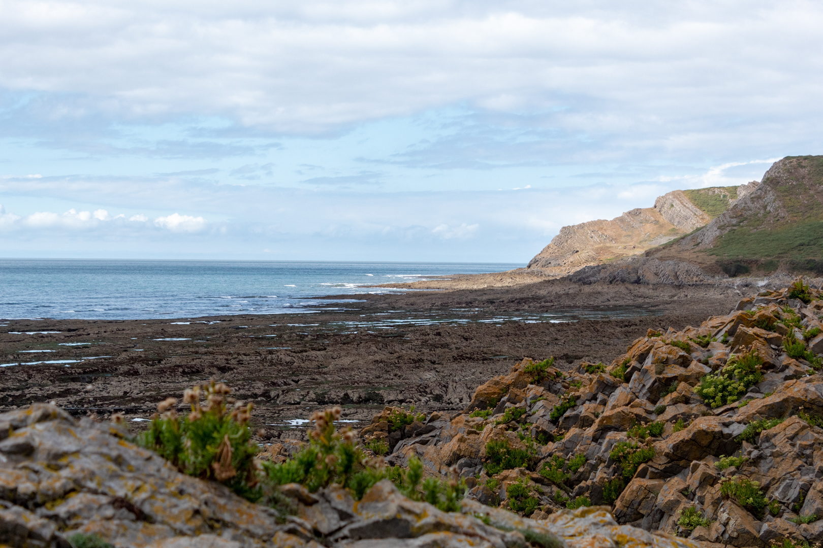

View of coast at Culver Hole


Whatever the uses of the "Culver Hole" it must have seemed a very bleak place in a winter storm, however, there can be no denying that its location on a good day is breathtaking.


View of coast at Culver Hole


Thank you for visiting this blog.


Footer:

Visit Information:-

Google Reference
51.5392344199753, -4.214123775586852

What Three Words reference : ///comments.youths.months


Culver Hole can be visited but must be done so with great care and at low tide.
About a quarter of a mile from here there is a large public car park (51.54431040120058, -4.2118757381346805) which is adjacent to a caravan and camping holiday site. There is also public toilets and a cafĂ©, shop and take away.
You can walk from the car park alongside the camp site until you reach the Youth Hostal. The path then takes you right and up the side of the hill but a better course is to walk on to the "Salt House". From here you can look up to the hill and see the marker stone in the last image. If you take the footpath up to this and then go along the cliff for a few hundred yards until you see a stone coast path marker. The path is just opposite this but is narrow and steep. The last few yards are difficult as you will be climbing down the rocks at the bottom. It is passable with care.


Read More

St Lythans Dolmen


St. Lythans Dolmen

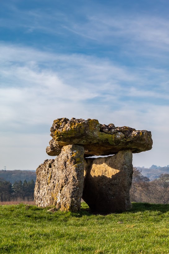
Built at around 4000bc the St. Lythans Dolmen is a large lonely structure near the Capital of Wales, Cardiff.


Originally covered by an earthen mound around 90ft/27m in length, only traces of this now remain.

Despite its Neolithic origins, the site’s name may derive from the Arthurian legend of Culhwch and Olwen, which appears in two 14th-century texts.

St. Lythans Dolmen is only 1.6km from another more extensive Tinkinswood burial chamber

The capstone, which slopes downwards, measures four metres (13 ft) long, three metres (10 ft) wide, and 0.7 metres (2 ft) thick.

Interestingly, this site is likely to be a lot older than the more expansive and more well known Stonehenge.

There are many of this type of structures, often also referred to as Cromlechs all over Europe.

These structures often have "local legends" attributed to them and the one I like the most is that each Midsummer's Eve, the capstone spins around three times and all the stones go to the nearby river to bathe, Now if I could only capture that with my camera!

St Lythans Dolmen

St Lythans Dolmen

St Lythans Dolmen

Footer:
Visit Information:-
Google Reference
51.442569197823424, -3.294977200482513

Google Search reference: MSt Lythans Dolmen
What Three Words reference : ///sparrows.paddle.cupboards


Additional information
Visiting is easy but there is no parking here and therefore you will have to park on the side of the road. The road is not too busy so for a short visit you should be fine.


The Dolmen is in a field and is signposted but please take care in the field.
Read More

Search This Blog

About Me

Bridgend, United Kingdom
A renewed interest in photography and local history.

Contact Me

Name

Email *

Message *

Followers