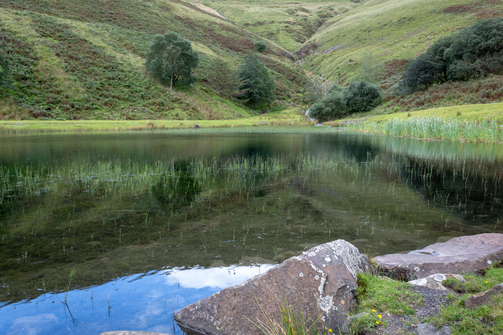
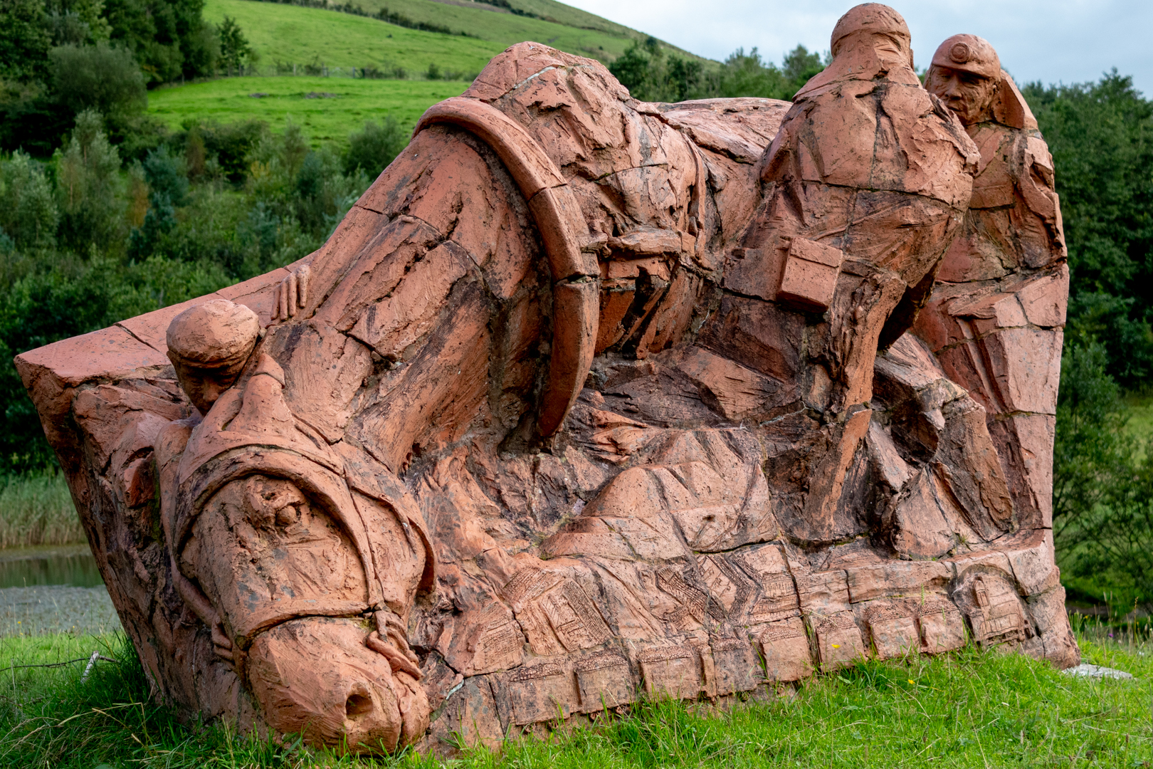
With a renewed enthusiasm for photography and local history, I set out this blog as a record of my experiences with images and narratives. It is my hope that you find something of interest on this site. Please feel free to contact me for more information on any of the posts. You can see a comprehensive list of my blogs at my website :- http://www.davidnurse.co.uk

Penmaen Burrows Burial Chamber - Dolmen.


Visit date 08-2022.  


Penmaen Burrows Dolmen
View showing entrance passage


There are many ancient burial sites around the southwest of Wales and I took a recent visit to Penmaen Burrows on the Gower peninsular to try and find one of the lesser known minor Neolithic burial sites.

These burial sites are often marked with three or more uprights and a large capstone. Often this is all that is left of the site which would originally be covered with earth. This upright/capstone structure has been called a Dolmens or often also referred to here in Wales as a Cromlech., but my understanding is that Cromlech can also refer to a circular stone structure.


Penmaen Burrows Dolmen
Close up of front of dolmen


It stands around 50 feet above the shoreline in a bowl near a sand dune. It consists of two rectangular chambers and a 2-metre leading passage.
The main chamber is about 4 metres long and around 2 metres wide.
There are a number of uprights possibly 6 or seven and a large capstone made of some sort of sandstone conglomerate.


Penmaen Burrows Dolmen
Side view of entrance


The capstone has been displaced somewhat with the passing of time and sits at an obtuse angle.

The chamber would have been more than 1 metre high.
The second chamber is almost buried again.
investigations were carried out in 1860 and 1881 and the remains were cleared in 1893 down to the original ground surface.
Most of what was uncovered has been reclaimed by the blowing sand from the coastline.


Penmaen Burrows Dolmen
View from rear showing capstone


At the site were found some bones and artefacts which consisted mainly of late debris in the filling of blown sand, including human jaw fragments, animal bones and a piece of a bone tool handle. Bones were found beneath two internal paving slabs that were left in place while `three small pieces of brown pottery lay on an early surface.


Penmaen Burrows Dolmen
View of conglomerate showing quartz content


Some of the conglomerate stones have a lot of quartz in them but are in tact. There have been many burial sites where the stones can be seen pitted where the quartz has been removed.

The burial site is around 1.5 km to the southwest of Penard Castle which is on the other side of the bay which I visited on an earlier trip and can be seen here.


Footer:

Visit Information:-

Google Reference
51.57278938446611, -4.120320919546553

What Three Words reference : ///reputable.dare.superbly


Although it is possible to walk here from The Cliffs Bay, the easiest route is from the west side of the burrows.
Here the site is easy to find just 20 minutes from the small car park which has parking for around a dozen cars (51.575623411575215, -4.1279809835289045) it does get busy with hikers and dog walkers. The pathway is well signposted from here and the path taken will pass a old stone building and then through a set of gates. A few hundred metres further there is an offset crossroads in the path. The first on the left goes to a secondary mound of stone but the second path on the right takes you through the hedge and into the clearing where the dolmen is found.
My visit was at the Hight of summer and the vegetation was perhaps at it's most vigorous. It might be easier to find in the winter.


Read More

Parc Slip Mining Memorial.

 Visit Date 03-2019. 


Parc Slip Memorial


Parc Slip in the village of Tondu was one of many small coal mines that scattered the south Wales valleys at the end of the last century.

This area was very poor in monetary terms was very rich in community and in these small villages people were very close.

At 8.20 am on Friday 26th August 1892 when 146 men and boys were working in the mine the unthinkable happened, there was an explosion in the mine.

Fathers, sons and brothers, 112 in all, lost their lives that day leaving sixty women widowed and 153 children without a father.

Many heroes came to light that day helping the community, one such man was a local doctor Frederick Twist who managed to reach the men below ground and, despite a high risk of further collapse and at great risk to himself he tended the injured and stayed with them until they were all brought out.

Mr Granville a local historian tells "Everybody was eventually brought to the surface," "Fifteen of the horses that died underground were also brought out - there was only one which was too difficult to reach. That's how carefully they went about it."


Parc Slip Memorial


The mine was closed in 1904 and this memorial stands in a local nature reserve which is now on the original site of the mine.


Parc Slip Memorial


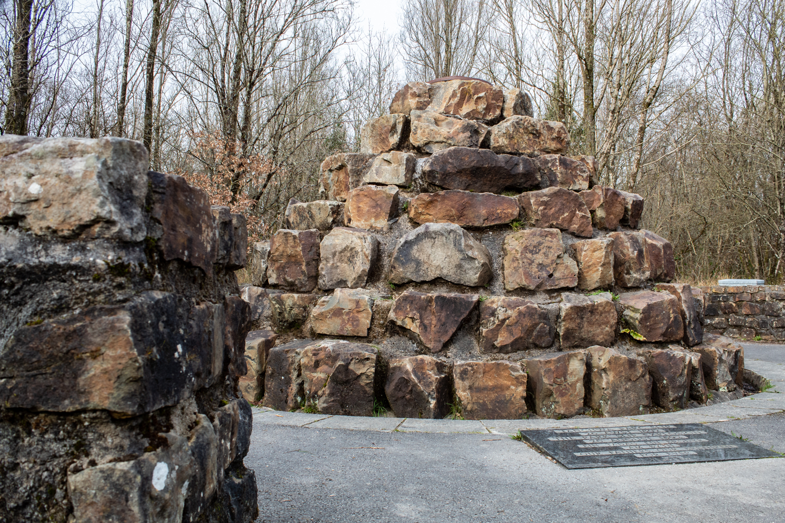
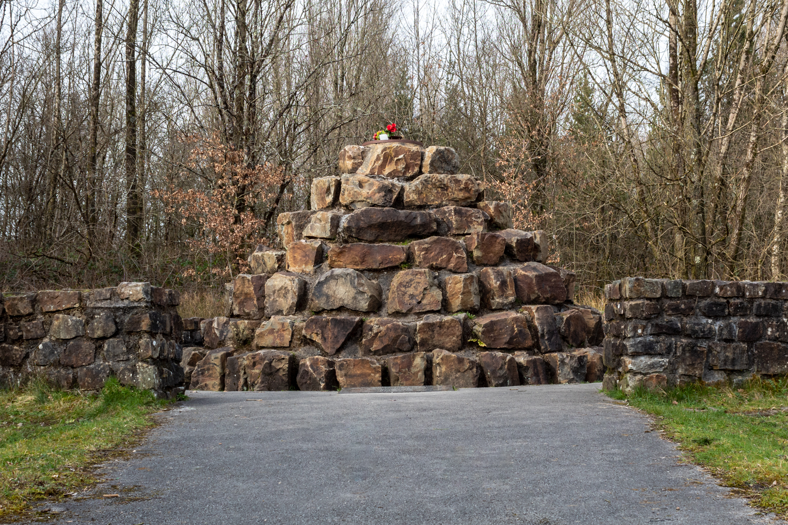
The stone memorial fountain is made up of 112 stones – one for every person who lost their life.


Parc Slip Memorial


An annual memorial service is now held on the anniversary of the disaster to remember all who were affected by the event.


I have two additional references for this place the first is a newer memorial that has been placed on the site since this visit.
this can be found on my blog here


And the second is a reference to another sculpture of s miner and son close to the site and that blog is  here


Footer:

Visit Information:-

Google Reference
51.539548735113236, -3.618187109403901

Google Search reference: Parc Slip Memorial

What Three Words reference : ///ranks.fixed.rally

The site is easy to find just 15 minutes from M4 motorway at junction 46

The car park //////joystick.plod.painting
Google Maps (51.54538490015156, -3.6143532913911733) is free and there are toilets and a café nearby.


Read More

The Black Mountain Lime Kilns (Herbert's Quarry)

Visit Date: April 2021.

The Black Mountain Quarry


Today's post is based on an area that, despite being only an hour away, I did not know even existed until a few weeks before my visit.


My visit was inside the Brecon Beacons National park, an area preserved and rightly praised for its outstanding natural beauty.


However, I was happy to learn that the relics of the heavy industries in the area are also prized and one of these is the Black Mountain quarries and lime kilns, also known as Herbert's Quarry.


The Black Mountain Quarry


Wales is known more for its coal mining, however, along with the great forests that created the coal, we can see along the western edge of the Brecon Beacons the exposed crags of carboniferous limestone that were of course at the bottom of the sea at one point in history but due to the powerful earth crust movements now lie at an angle along these mountain ranges. 2.6 Million years ago the great glaciers of the area carved out the geology that exposed the rich seams of both coal and limestone.


Lime has many uses but 200 years ago it was in great demand in Wales for use as a soil improver. Farmers would have to travel what would have been long distances to obtain this great resource.
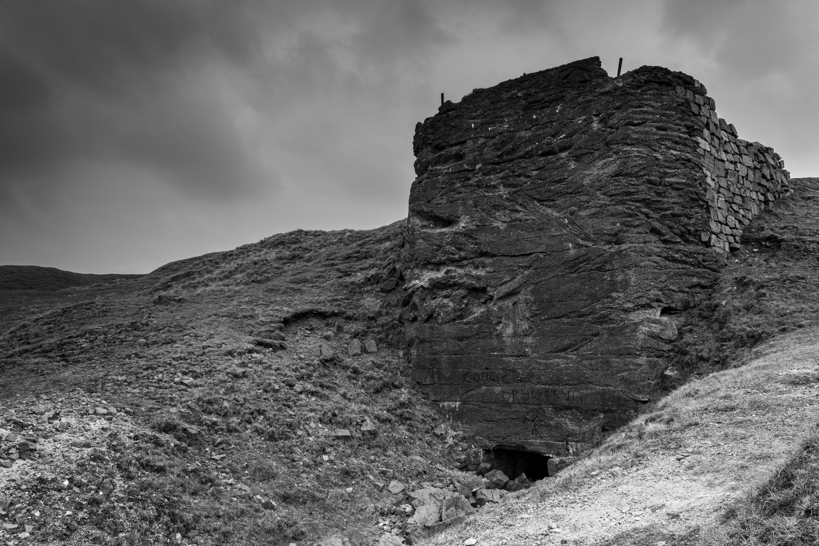


The Black Mountain Quarry


In order for the limestone to be made into a useful lime product, it would have to be worked.


Making "quicklime" was hot and hard work. Once the limestone was removed from the quarry it would have been smashed into quite small pieces by hand with sledgehammers to be loaded into the kiln with coal. The temperature would have to be raised to 900 degrees. it was a skilful process to adjust the airflow and fuel to keep the kiln burning correctly at these high temperatures.


The lime would then be removed from the lower chamber and in the image below, you can see the rails, now just leading to mid-air, that would have been part of this drawing process.
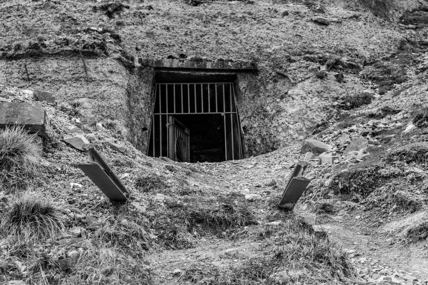


The Black Mountain Quarry - Kiln


Typically at this time in the 19th century, it would have taken two tons of limestone and one ton of coal to produce one ton of quicklime.


The process would take a day to load the kiln, three days to burn, two days to cool and a final day to unload. A kiln would produce 10 to 15 tons of lime at a time.


This whole process was a dangerous one and it cost many lives newspapers would to often carry stories like this:-

On Thursday week a young man named Thomas Griffith, son of John Rees Griffith, mason, Gwinfe, was engaged in blasting rock in the Black Mountain lime quarries. He bored the rock, and put into it about 20lbs of powder which he filled and returned to a convenient distance to allow the charge to explode. Not finding it to go off in the usual time he approached the place to ascertain the cause, when the powder fired with a tremendous explosion, driving of the pieces of rock quite through the unfortunate young man’s head. Death was consequently instantaneous.


The Black Mountain Quarry - Kiln


Lime was treasured in the area and farmers needed it to spread on the land to fertilise and improve the land. They would often travel many miles with horse and cart to collect the lime. This quicklime of course was dangerous and would burn if on exposed skin so it was to be transported with much care and best efforts to keep it dry and safe.


Many farmers, of course, would have to travel many miles by horse and cart to collect the lime, sometimes return journeys of 100 miles would be needed and it was common to see processions of laden carts filled with the product on the road.


The roads at first would have been nothing more than tracks but as the industry expanded better roads were needed. In 1779 "Turnpike Trusts" were founded to build these new roads and the work was financed by tolls.


Tollgates sprung up everywhere.


As the roads needed to be maintained in good order more tollgates were added, eventually, 41 miles of road had 13 tollgates.


The tollgates were run as private enterprises and sold each year to the highest bidders who after paying the rent (presumably for the road upkeep) were allowed to keep the extra toll money they collected.


The Black Mountain Quarry - Kiln Top


The Rebecca Riots.

At first lime carts were exempt from the tolls, but this soon changed and after a series of poor harvests farmers were struggling to pay the tolls. By 1840 the cost of the tolls cost as much as the lime. Farmers were facing dire poverty and they stood against the greed of the "Turnpike trusts".


This led to riots at the tollgates.


For a reason that has got lost in time there were masses of farmers who dressed themselves up in their wives clothes and blackened their face before setting out on these raids. They would burn down the tollhouses and tear down the gates.


The rioters became known as "Rebbeca and her daughters"


The following was from the time.

THE SLAVE DRIVERS

You say the toll man wiped his eye,
But this is all a bubble
For he shall never cease to cry
While Becca is in trouble.

In vain you strive to save a gate,
By threatening blood and slaughter;
Your swords shall ne’er intimidate
Rebecca and her daughters.

The cheating toll trusts may complain,
The Mayor may roar his ‘riot’,
‘Till Becca do her rights obtain
She never will be quiet.

Then if you wish to hear no more
Of what Rebecca’s doing,
BE HONEST, and her rights restore,
Or she will prove your ruin.

She’ll Burn your Houses to the ground,
She’ll set your fields on fire,
She’ll make you pay for every pound
Your toll-men may require.

Then bid these wars and tumults cease,
You robbing vile aggressor!
She’ll gladly wave the flag of peace,
If you no more oppress her.

Reduce your farms to half the price -
More than this they can’t afford;
Down with the toll, take my advice,
Then sweet peace shall be restored.
The Welshman, 28/07/1843


The riots got so bad that a reporter from the London Times was sent to investigate and wrote:-

“Pentarlleche gate between Llangadock and the Black Mountains, was destroyed on Tuesday night by a party of Rebbeccaites, who came from the direction of Llandilo. It appears that they had sent threatening letters before, and two constables were employed to guard the house and gate, but they were compelled to go home for tools and made to assist in the work of destruction. In about a quarter of an hour, both gate and house were level with the ground.”
04/08/1843

and later.

FOUR MORE GATES DESTROYED – Last Wednesday night a party of mounted Rebeccaites, about 300 in number, visited 3 turnpike gates in the neighbourhood of Llangadock and completely destroyed them. Two of them had been before down and re-erected. The names of the gates are Wainstredverys, Pontarlucoe and Carig(?)-Southey.”
15/09/1843


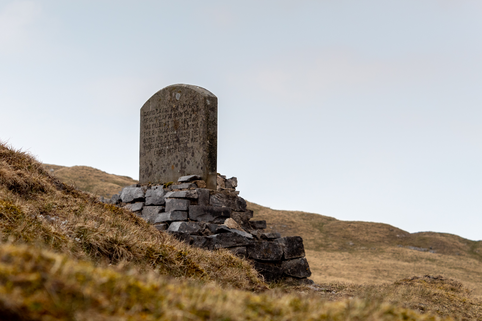
The David Davies Memorial


The David Davies Memorial


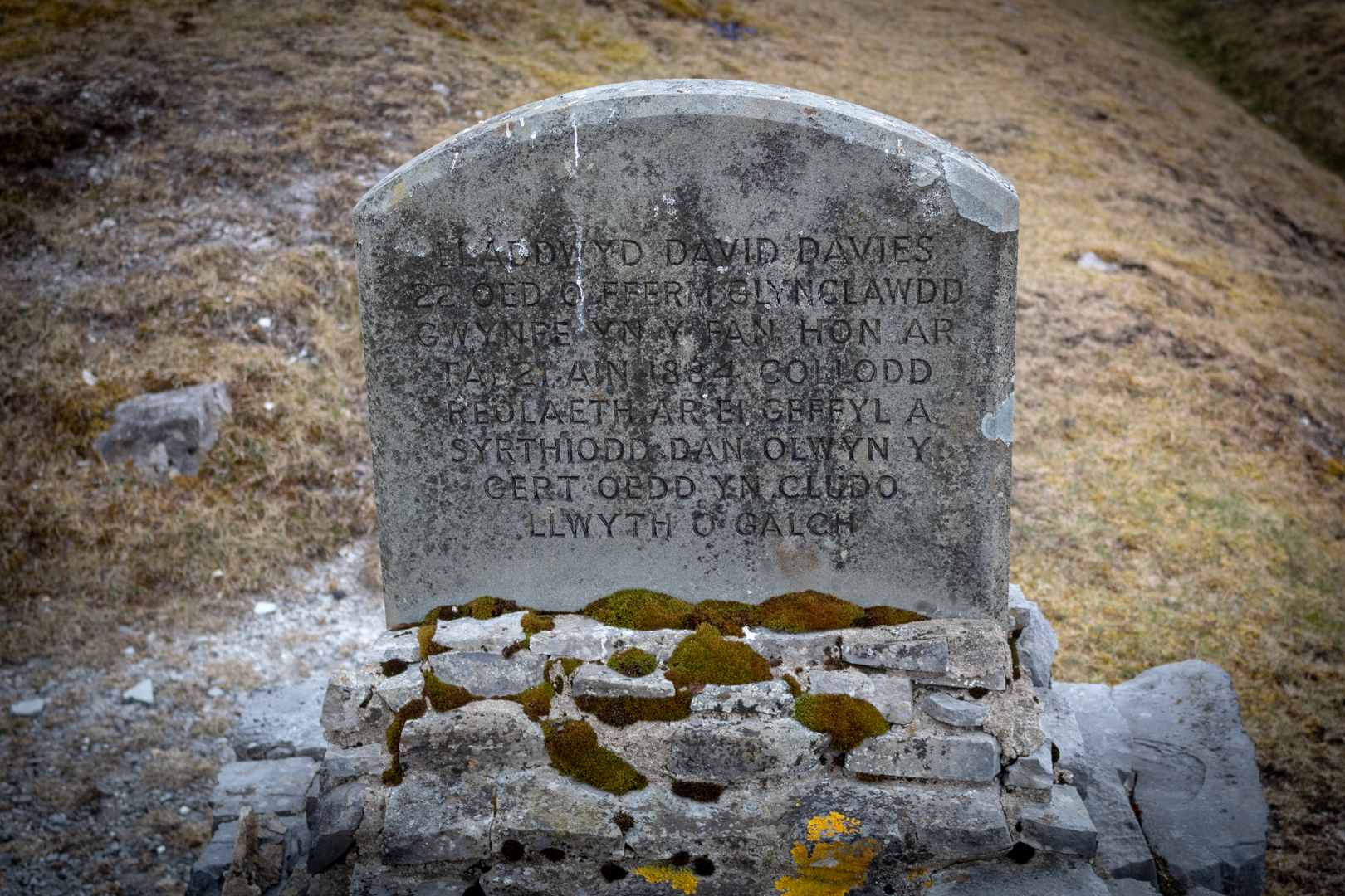
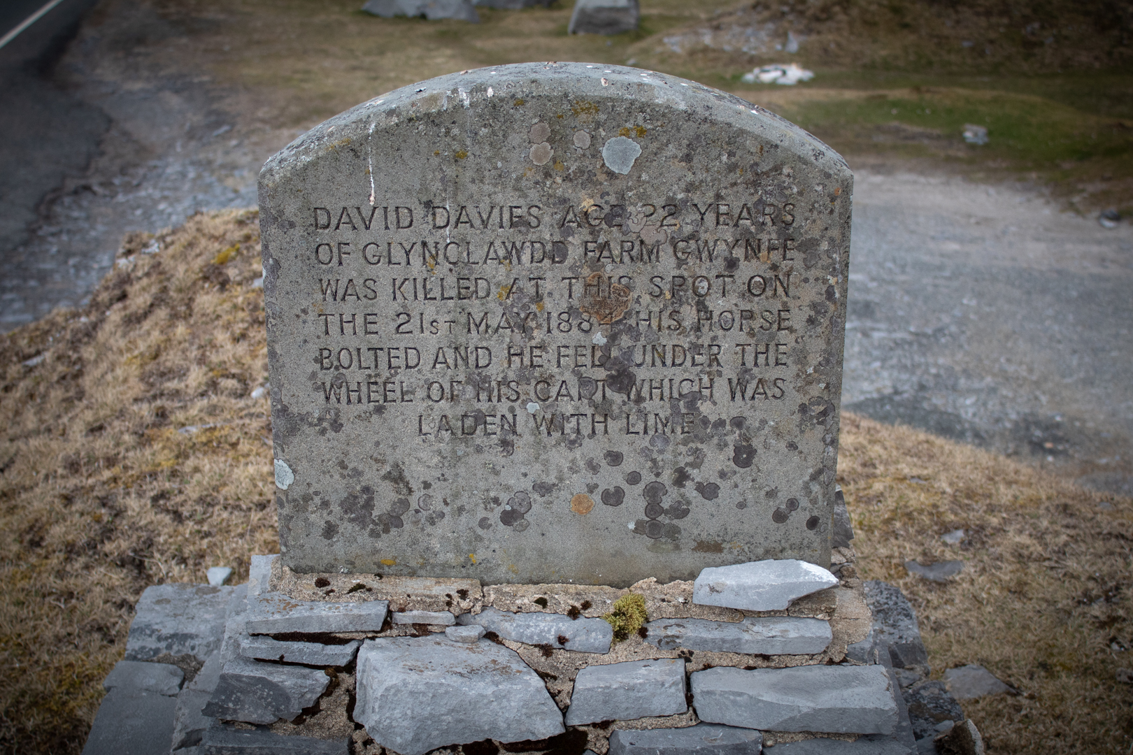
To illustrate further how dangerous it was on the road with these lime filled carts, I would like also to relay two more reported stories. The first of which is remembered by this memorial at the side of the road. The memorial is in welsh on one side and English on the other. It tells the tale of a young man of 22 and was reported:-

Fatal accident – As Mr D Davies, Junior, of Glynclawdd Gwynfe, was driving an empty gambo on the Black Mountain on Wednesday afternoon, the horses became startled and dashed off. The unfortunate young man was thrown out, and though assistance was at once forthcoming he expired without a word. Much sympathy is felt for the family of the deceased, who is generally respected in the neighbourhood.
The Welshman 23/05/1884


The David Davies - Memorial in Welsh


The Memorial in Welsh


The David Davies - Memorial in English


The Memorial in English


and finally

RHANDIR MWYN – Dreadful death – On Thursday, 5th inst., as Mr William Rees, a boy aged between 14 and 15, was returning with his master’s wagon with a load of lime from the Black Mountain, between the above place and Llangadog, the unfortunate boy fell under the wheels of the wagon and he was killed on the spot.
D. Thomas Baner ac Amserau Cymru 11/09/1861:


"TUFA"


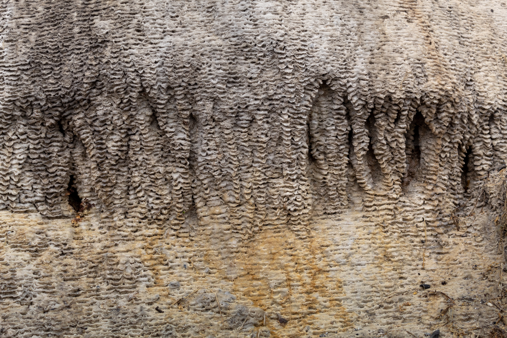
As a result of the lime industry, an unusual geological formation called "TUFA" has formed in places in the highly alkaline waters that flow here.


TUFA


The Black Mountain Quarry - TUFA

The Black Mountain Quarry - TUFA


Footer:

Visit Information:-

Google Reference:-
51.854527678567166, -3.8366992465994323

What Three Words reference:-
///rainfall.cackling.fees

OS Details:-
SN 73599 18921 Altitude:1623 ft

Additional information.
Visiting is easy as it is alongside the A4069 out of Brynamman which is one of the main roads through the Brecon Beacons.
There is a good size car park alongside the site ( 51.853047576738284, -3.8412540293511537 )
and an additional car park at the mountain view site ( 51.857233737767956, -3.844516511221795 ).
The David Davies Memorial is also alongside the road ( 51.85544051525515, -3.8432358117353203 ) -
WTW ( ///storming.saying.soap )


Read More

The Porthcawl Ukulele Bandits

 Visit Date: July 2019

The Porthcawl Ukulele Bandits


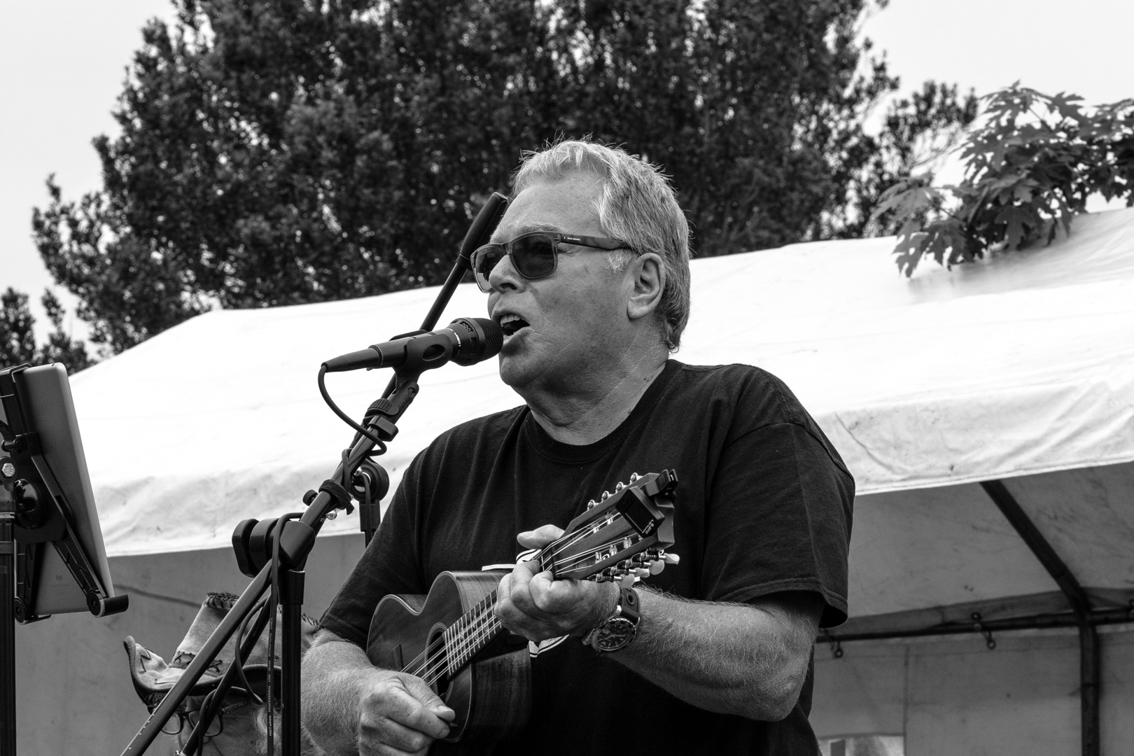
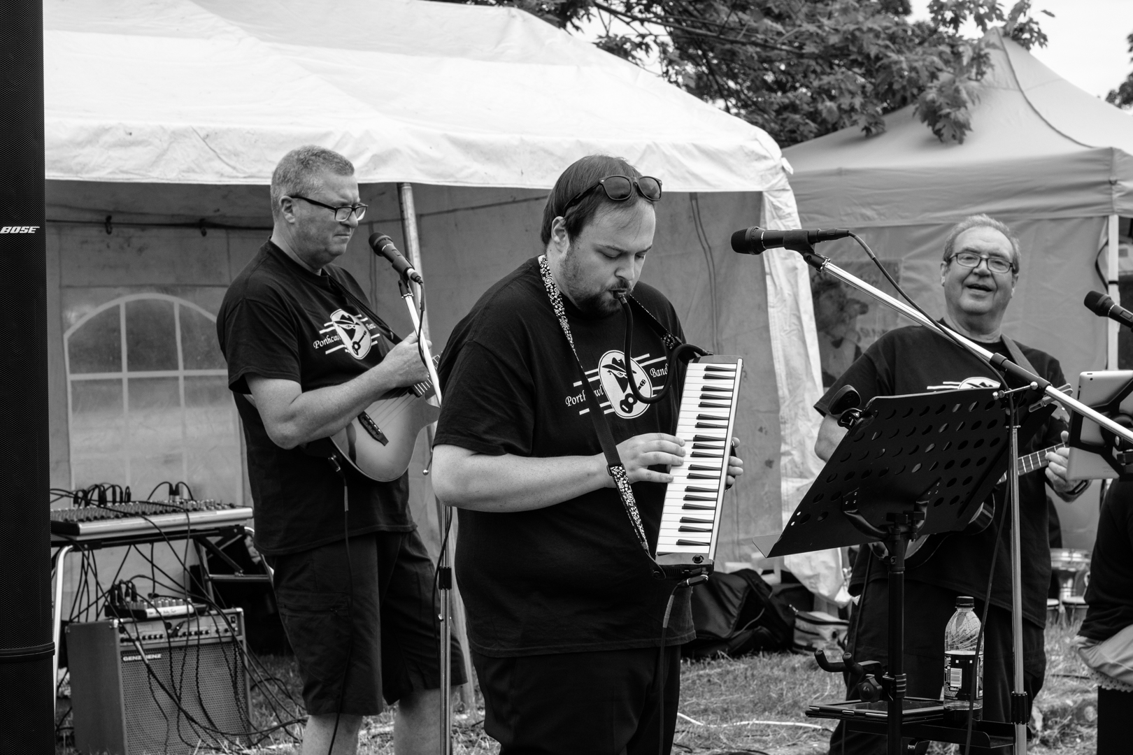
The "Players here are the "The Porthcawl Ukulele Bandits"

"The Porthcawl Ukulele Bandits is a tight 6-piece performing band which features harmony, backing vocals and additional instruments like bass, cajon percussion, melodica, accordion, mouth organ and mandolin (Taken from their publication)

They certainly have a most unique sound with unusual renditions of well-known songs.

The Porthcawl Ukulele Bandits

The Porthcawl Ukulele Bandits

The Porthcawl Ukulele Bandits


Read More

Memories, a photowalk into the past.

 Visit Date August 2020: .


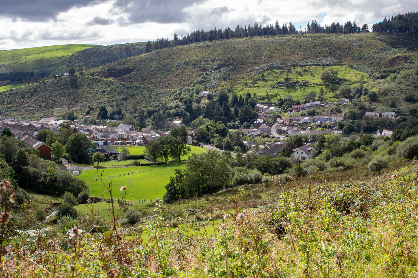
View of the Garw Valley


Almost 20 years ago I moved away from the small mining village where I spent most of my life growing up and raising my family. For some time now I have been wanting to go back and revisit some of the places I remember. A few weeks ago I decided that the time had come and I would like to go on a walk that I did many times while growing up to see what had changed in the 25 years + since I walked this track.


From the main "Garw Valley" there are many smaller valleys leading off and the one I took was from the lower village of Pontycymer.

I walked a familiar course to this scene.


View of the Garw Valley


What you can see here is very different from the scene I remember as this small waterfall would have been part of a feeder reservoir which was one of the main water supplies to the colliery.

In my youth, the area was completely surrounded by an 18ft high fence and was inaccessible to all but the very daring.

Unfortunately, it does not have good memories for me as when I was a teenager a youth just a year or two older than I was drowned here.


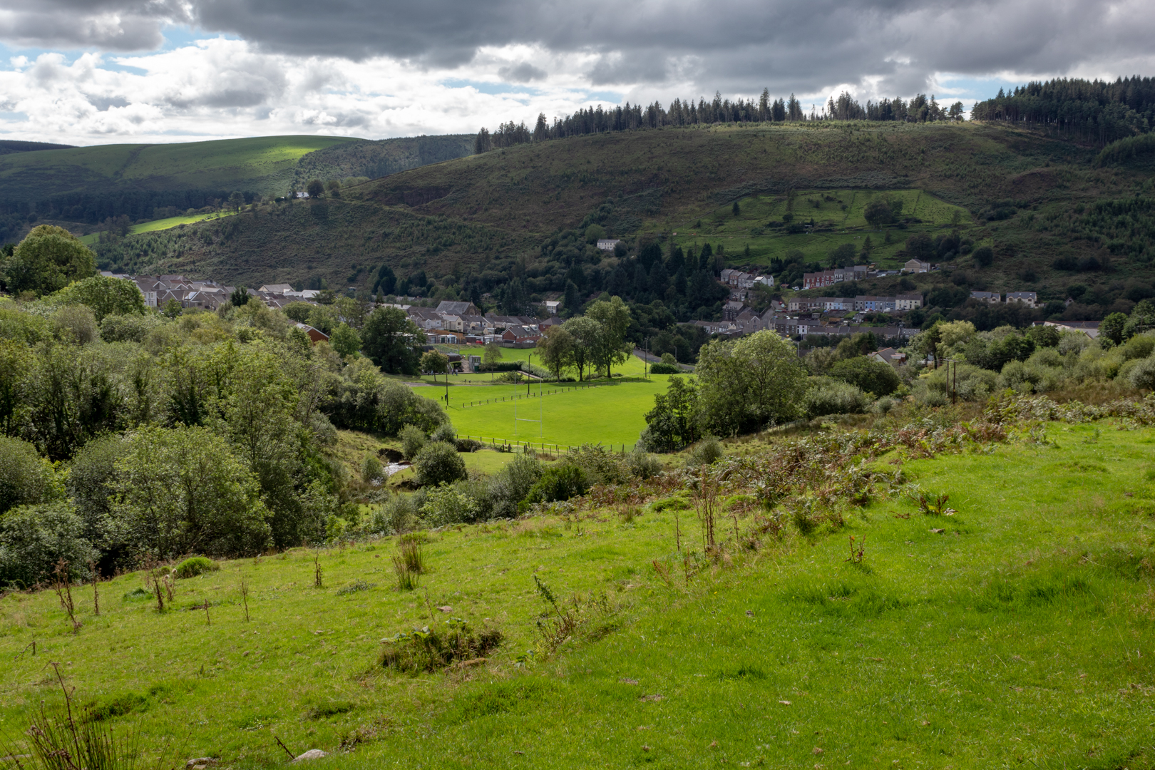
Climbing up from the small river floor I could look back on the village that I know so well.


View of the Garw Valley
 

This scene is very beautiful now and is as I remember however The small green patch at the bottom of the image, now a rugby field which also occasionally plays hosts to fetes and is enjoyed by all, I can remember being built. It was built on the local refuse tip and when I moved to Ponycymmer as a young boy I had many adventures here playing on the tip and sharing the experience not only with my friends but also the large population of rats that lived off the refuse that was tipped there.
As I moved up this valley I could see the clean river which we often dammed with stones and pieces of turf so that we were able to swim in the river during the summer months. I recall that however hot the air temperature got the river was always freezing cold.

Generally speaking, the water here was clean unlike the "Garw River" that flowed down the main valley. This was known as "The Black River" as it appeared black due to all the coal particles that would have been carried in it from the colliery washery further up the valley a by-product of the coal being washed.

I remember if you put your had in the water it would come out dark and speckled in this fine coal dust as the dust did not seem to get dissolved in the water.

The pool that we build was clean and fresh except for a couple of times a year when the river would have been dammed further up the valley by the local farmer who would have "Dipped" his large flock of hill sheep in it. Luckily for us, no nasty chemicals were used to dip sheep back then.


During the walk there were a number of distinctive things came to mind that I used to come across during my walks here.


One of the main things I was keen to see on this walk was an old boiler tank I believe was from some sort of steam engine that I remember being cast aside and left alongside the river.
After taking a small detour from the main path I could bearly see the path that I and many of my friends regularly took. It was really well overgrown now and I could bearly make it out. I guess with the advent of video games and mobile phones not so many venture up here anymore if indeed anybody does.


View of the Garw Valley

I did manage to find the pathway and also the boilers. Or should I say boiler? I could only find one but I am sure the other one is here somewhere in the undergrowth.


View of the Garw Valley


The second of the milestones that I wanted to see I know was not going to be well hidden and I know the path from the boilers to it, as it was just up the stream.


View of the Garw Valley


It was this waterfall. It is not very big but looked very nice in the summer sun.


Moving further up the valley I then got onto the path that I know would take me on my next part of this journey.

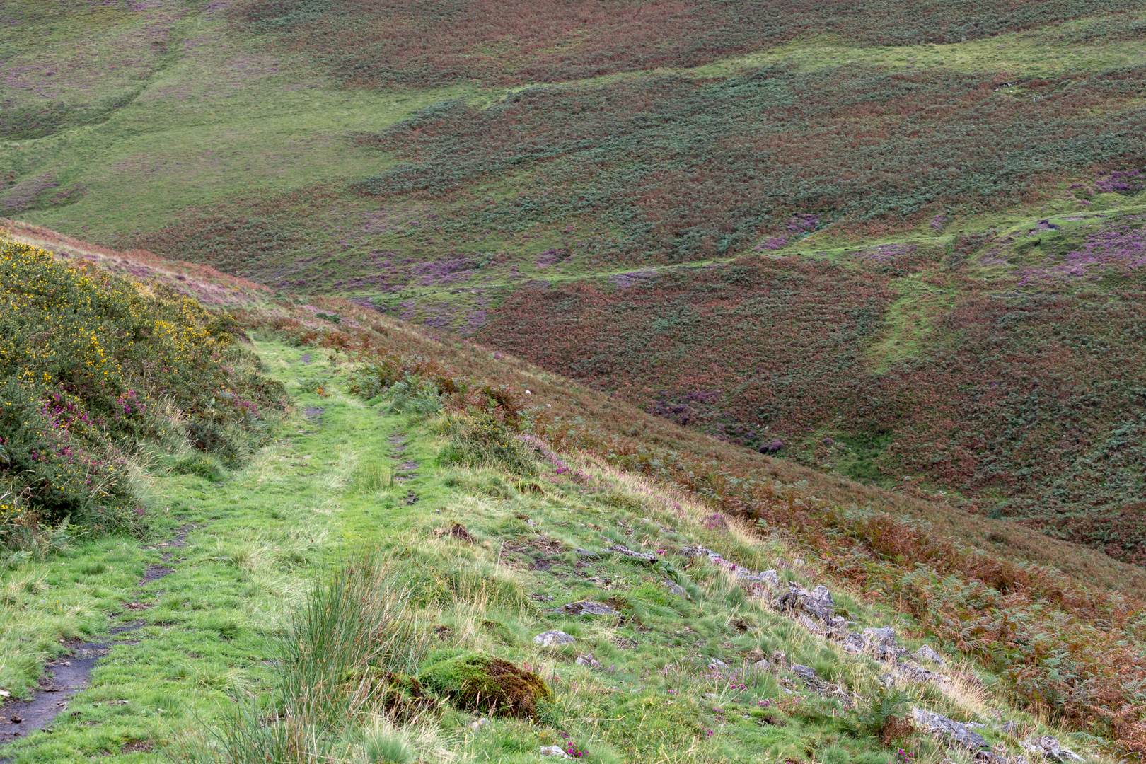
The path we called "The Dram Road".


View of the Garw Valley


The Dram Road is a path cut into the hillside and was used to carry coal from the mine out of the valley before the main railway line was installed. This would have been a small gauge line and it's path I was told was across one side of the river to the other. The path can be seen between the heather and orange bracken on the other side and came onto the path I was on.


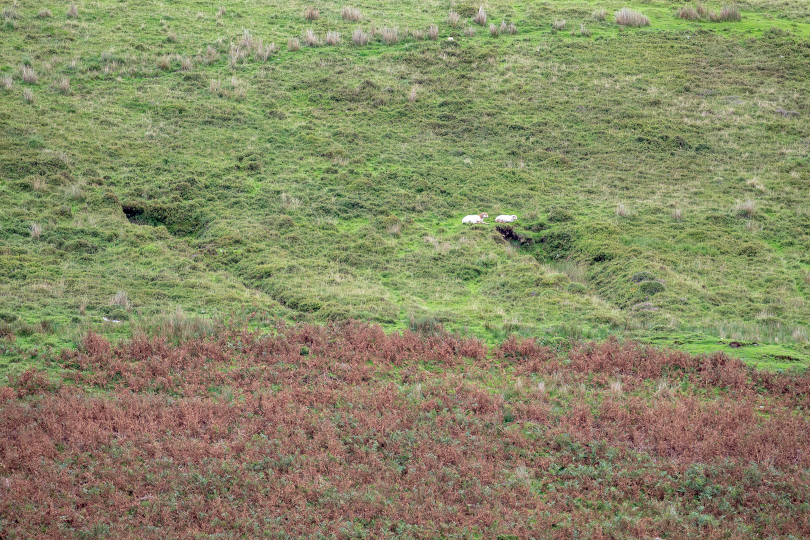
On the other side of the river, there are small outcrops that the sheep use now for some cover.


View of the Garw Valley


An old man told me that these were where local colliers came to dig out coal for their own use during the hard times of the 1926 general strike.


During my walk along "The Dram Road" it dawned on my that I had never seen evidence, other than the boilers, of the rails of the track along this pathway, so today I paid a lot of attention to try and find any.


View of the Garw Valley


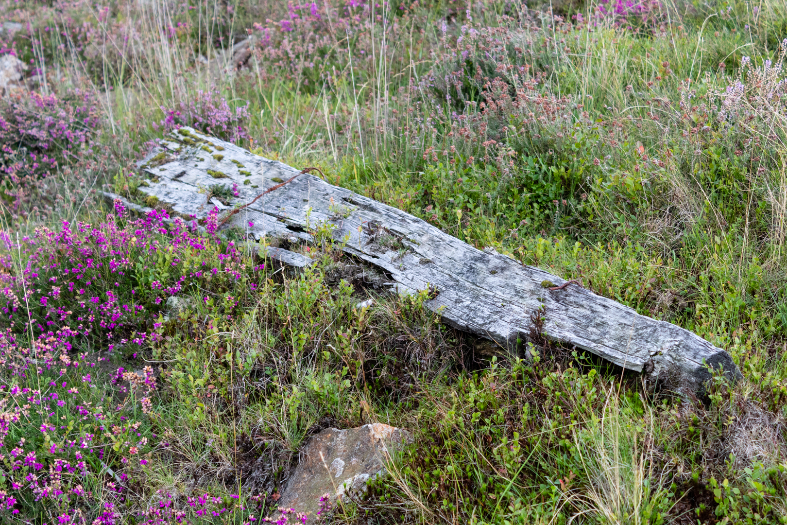
I was almost at the end of the track before finally, I found buried in the pathway an old piece of rail and also a sleeper which was lying in the undergrowth.

View of the Garw Valley

Not very much evidence now still visible along this track.


Moving on I looked back to Pontycymmer I could see many familiar landmarks.


View of the Garw Valley


One of which is the cemetery to the right-hand side of this image. It reminded me of a movie that was shot here called "Very Annie Mary" as some of the scenes in the movie were shot here.


Of course, the farming of the valley goes back even further than the mining.

I remember well that two of the local farmers could often be seen rounding up their sheep on horseback in the early 70's just like the cowboys in the western movies, but somehow a flock of sheep, however large, did not have the same impact as a heard of cows.

Even the old-time farmers have now left the valley hills and mountains.

I remember in the early days of satellite TV being asked to visit one of these farms as the farmer intermittently lost his picture. When I got to the farmhouse I could not see any dish on the wall. When I enquired about this I was told "Gary put it over there". Looking "over there" I could see the dish mounted on a large tree. It turned out that in Autumn winter and spring when the tree was quite bare the picture was fine but of course in the summer the tree was full of leaves and then his signal disappeared. It still makes my chuckle today. But I digress.


The farmer's life was also a hard one and quite a few years ago, one of the farmers, possibly that last of the old-time farmers, a bachelor, did not have any offspring to pass on his farm to and sold it. The later days of this historic moment was documented in a BBC 6 part series called "The Last Days At Fforchwen""


Some of it should still be available on youtube here. It is a moving tale, sometimes very funny and often sad of a man who only knew farming having to face retirement and moving from the only home he ever knew.


It was time to move on and head north towards the head of the valley.


View of the Garw Valley


Turning around the side of the hill The village of Blaengarw comes into view. This village was at the top of the valley and while Pontycymmer had the Ffaldau colliery, Blaengarw had the Ocean Colliery.


View of the Garw Valley

All remnants of the colliery have now gone and the land has been redeveloped with a small lake and good pathways for the peoples leisure time.

View of the Garw Valley


It is a very peaceful place but the tranquillity hides the Blood sweat and toil that was mining in the first part of the last century.


View of the Garw Valley


I remember the Ffaldau colliery and the Ocean colliery being combined and then closed.

It was a bitter blow to the valley because even in the 1970s and 1980s the work was hard labour.

I did not work in the colliery but many of the schoolmates when they left school did.

I remember vividly being in the local workingmen's clubs midweek and there would be just a handful of us there until the colliery afternoon shift came to an end. Within an hour the bar would be full of these work hardened men their eyes dark with coal dust that the showers could not remove and the blue scars that they had from cuts underground being engrained in coal.

Despite doing a dangerous job in a dangerous place I only remember them as happy go lucky people.


There is a sculpture on the site of the old mine.


View of the Garw Valley, Memorial


It is a moving scene of a fallen Pit Pony being attended to by a young man while to miners carry on working.


Despite the work still being hard, by the time the colliery closed for good in 1983 the miners were at least earning a decent living from their work so it was a great blow to the area when the end finally came.


View of the Garw Valley, Memorial


There were many hard-working loyal face-workers who would never earn such good wages again and the valley people would have to adapt to a new future.


This post now ends here. This was a blog that I had previously made as a stand-alone blog, now however I see it as the first part of a three-piece blog with the second and third parts taking place later this year, (hopefully). Exploring the other side of the valley and the forest and mountain paths.


I have made a short video photowalk which can be found here:-


Additional Information:

YOU CAN CLICK ON ANY OF THE IMAGES TO GET A LARGER VIEW!

Google references to point along the way (Note these are approximate)
The First Waterfall: 51.61355120428729, -3.5787354313861806
The boilers: 51.616333902482864, -3.571497376234325
The second Waterfall: 51.616582503969425, -3.571079630305689
Route Start: 51.61333664429233, -3.5793740249838346
Route End: 51.62602694887964, -3.583753079861704
Miners sculpture: 51.62646191192561, -3.5817175713442486


Note a Comprehensive list of my blogs can be found on my website HERE


Read More

Search This Blog

About Me

Bridgend, United Kingdom
A renewed interest in photography and local history.

Contact Me

Name

Email *

Message *

Followers